| |
| Stretch: |
Fleming Meadows trailhead to Happy Valley Road |
| Difficulty: |
Class IV+ with strenuous portages |
| Distance: |
10.1 miles, 1 long day |
| Flows: |
kayaks 200 - 400 cfs
|
| Gauge: |
flow as measured near Somerset
(USGS site)
|
| Gradient: |
113 fpm average, steeper near the end |
| Put-in: |
End of trail from Fleming Meadows, 3120' |
| Take-out: |
Happy Valley Road bridge, 1880' |
| Shuttle: |
20 miles (30 minutes) one-way, plus 1.7 mile hike down |
| Maps: |
Delorme N California, AAA Lake Tahoe Region,
Topo
|
| Season: |
Late winter or early spring, from snowmelt |
| Agency: |
USFS, private |
| Notes: |
© 2003 Bill Tuthill,
CreeksYahoo |
This run has a reputation of being one of the best class IV runs in California,
but with a very short or sometimes nonexistent flow window.
However its reputation has been tarnished in recent years by the presence
of new wooden features in the streambed: in 2003 at least 12 portages around
trees were required, in addition to 4-6 other portages required by rocks.
One of the required portages seems very long and difficult for a class IV run!
Not to mention the hike down to put-in.
Until a flood or saw-bearing human removes some downed trees,
and/or somebody figures out a strategy to simplify the long portage,
this run might not make the top 20 list.
Nonetheless it's worth doing at least once.
It is possible to put in upstream on a road and avoid the hike-in altogether,
but Camp Creek is steep in the approximately 6 miles to the standard put-in,
and probably contains many logjams.
If you have boated or hiked this section, please contact me.
The road-based put-in would be south on Capps Crossing Road,
after crossing Stonebreaker Creek.
The adventure begins in the trailhead parking lot near Fleming Meadows,
south of Jenkinson Reservoir on Sly Park Creek.
Your 1.7 mile downhill hike starts on a gated dirt road
that slants left from the beginning of the parking lot.
Check the trailhead map for details, despite its imprecise mileages,
before carrying your boat down the gated dirt road.
Where the road forks after .3 mile, go straight.
In another .4 mile and after the forest thickens,
where the dirt road goes slightly uphill, a trail marked 8B forks to the right.
That is the only path from that point to the Camp Creek, 1 mile downhill.
This old road is overgrown but offers plenty of clearance for your kayak.
-
mile
- 0
- This section of creek, starting where a gauging station is marked
on the topo map, although we did not see it, alternates between
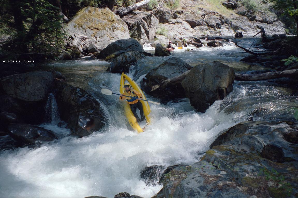
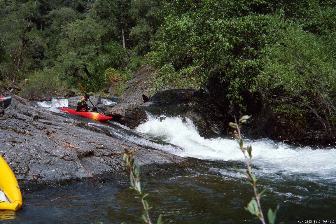
gently flowing pools and steep drops. Many of the drops contain
lumber, and trees sometimes span the creek in pools between.
- .7
- Creek that the hike-down trail followed enters on the right.
Pace of rapids gradually increases, with many class IV drops.
-
- 1.5
- Small creek enters on the right.
- 4.4
- Sly Park Creek enters very obviously on the right, below a spot
where Camp Creek splits around an island. There were about 12 tree
portages above Sly Park Creek confluence, but far fewer below (2003).
Despite the addition of water, flow did not seem to increase much.
-
- 6.0
- Diversion dam with bad backwash, portage or possibly run on the left.
A tunnel exits from the right side of the dam, but does not appear
to be diverting any water nowadays.
- 6.7
- Dirt road approaches creek on the right bank, possible emergency
take-out across private land, hopefully with permission.
- 6.8
- House along river. Residents were friendly on our 2003 trip
and did not seem surprised to see us. Good rapids continue and
intensify. One or two may require portaging at certain levels.
- 7.1
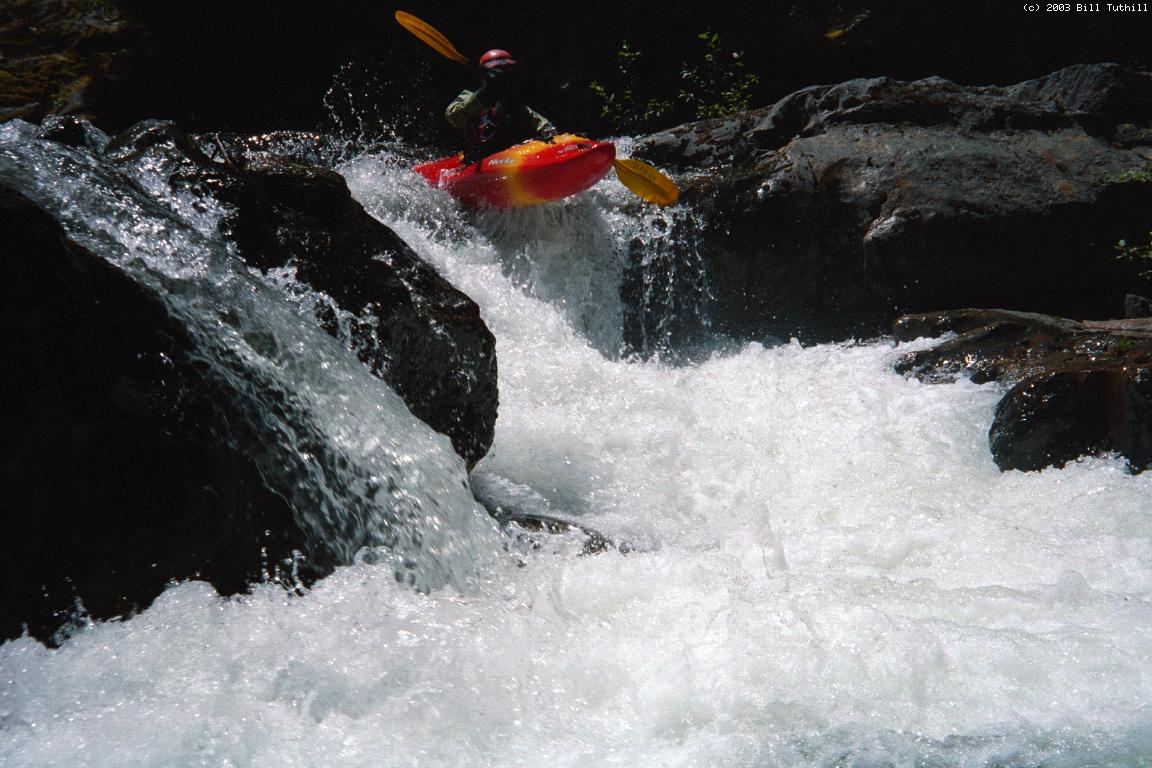
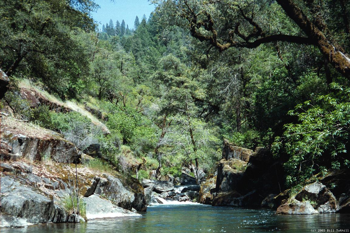
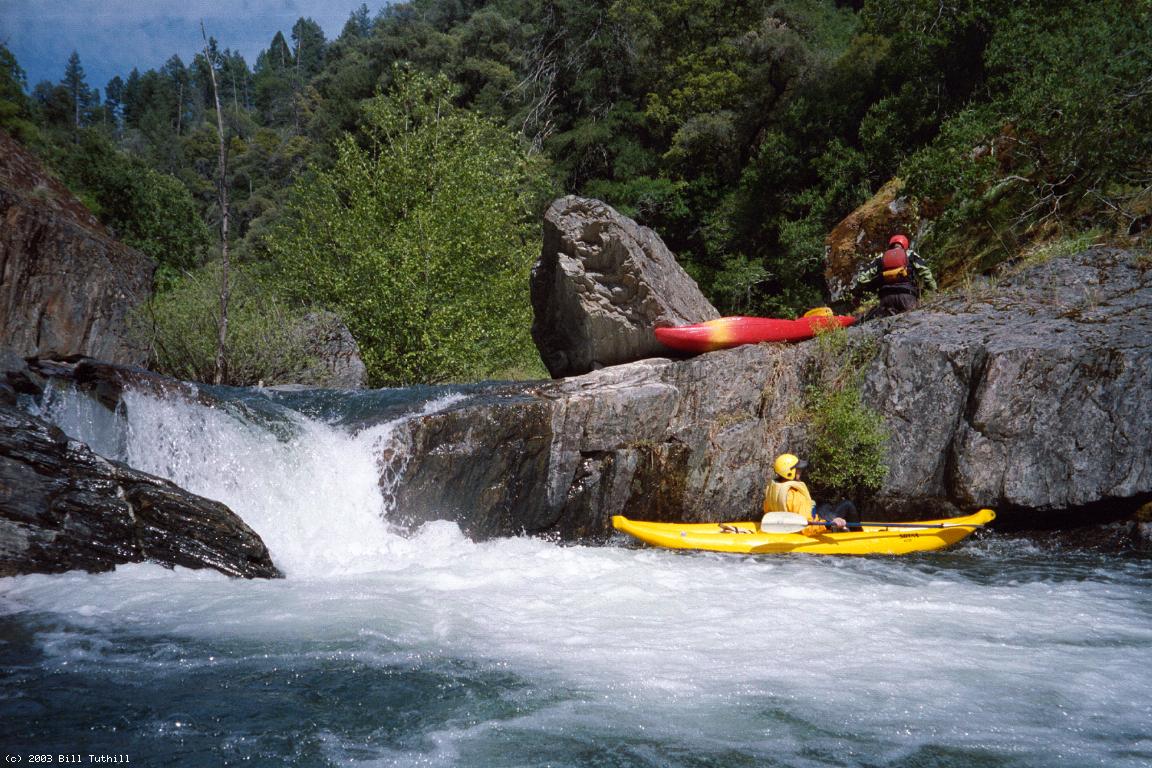
- A nice section with few logs and fun bedrock drops.
-
- 8.9
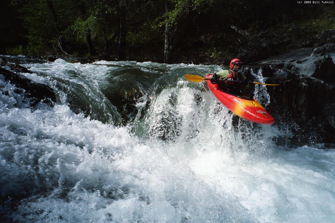
- Portage! Seemingly impassible boulder-laced bedrock rapid can be
portaged most easily on the right. Below the worst section,
a poison-oak laced trail descends to a precarious put-in.
Due to a rocky waterfall at the end of the next visible section,
some kayakers end up portaging again thru poison oak on the left
bank, although the waterfall might be runnable at certain flows.
- 9.4
- Siphon pipe of North Fork Extension Ditch descends the left bank
and, more obviously, ascends the right bank. After this point
the streambed steepens and becomes a portage-fest of sorts.
-
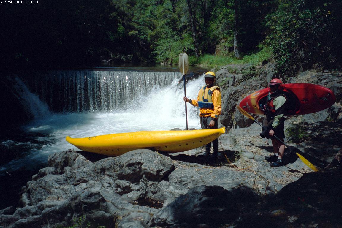
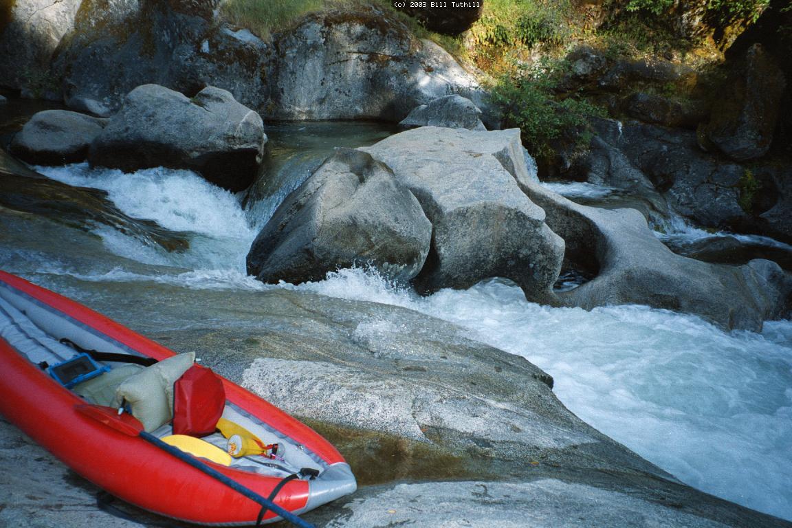
- 9.7
- Local Hangout Falls, with natural granite arch, seemed unrunnable
at low flows. Easy portage on the right. From here it's easiest
to continue portaging on the access trail used by locals.
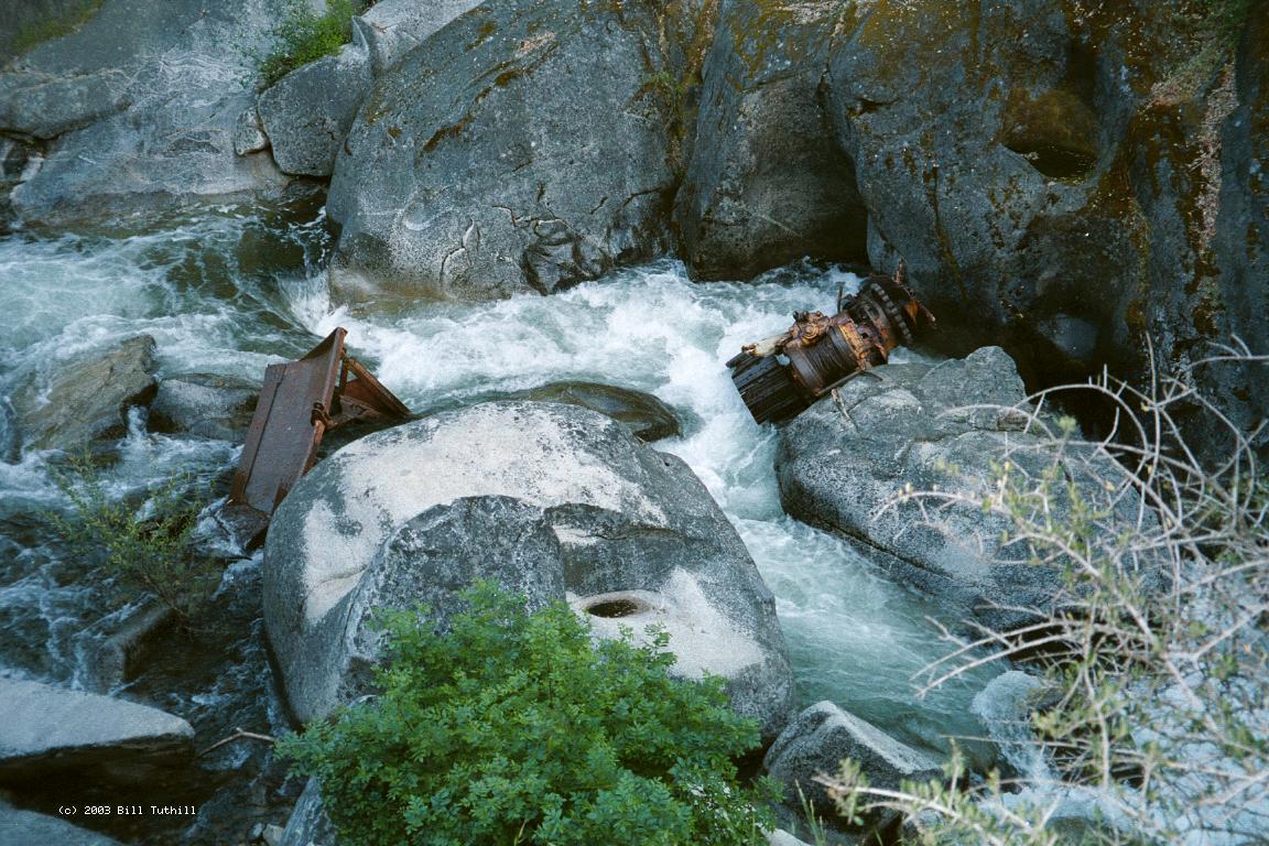
- 9.8
- Bulldozer Falls, with unnatural rusted metal accouterments,
looks very dangerous, maybe even without the eponymous bulldozer.
A side trail descends to a good launch spot below the falls.
-
- 10.1
- Happy Valley road bridge high overhead. You might miss it if you
are wearing a visor and fail to look up. Similar rocky drops
continue to the confluence with the North Fork Cosumnes, which
then flattens out to the Mount Aukum Road bridge.
To reach take-out, drive highway 50 to the Missouri Flat exit,
proceed south, turn left at the T onto Pleasant Valley Road,
and continue past Bucks Bar Road (stop sign) to the town of Pleasant Valley.
Coming from the east on highway 50, there are various shortcuts to this point.
Turn right onto Mount Aukum Road, at the Holiday Market,
and drive about 2 miles downhill.
Make a sharp left turn onto Happy Valley Cut-off Road,
and descend to a narrow bridge across Camp Creek.
To reach put-in from there, return to Mount Aukum Road,
turn right, and drive back uphill.
Where you turned at Pleasant Valley, take a right onto Sly Park Road.
Continue about 5 miles east until you see Jenkinson Reservoir,
turn right only Mormon-Emigrant Trail, and cross the dam.
You might want to check flows of spill into Sly Park Creek.
On the far side of the reservoir,
turn onto the first obvious road to the right,
which leads to the Fleming Meadow trailhead.
Its green-bar gate may be locked; if open it will save some hiking.
|
|
Creeks Navigation
Home
Recommended Runs
Map of Rivers
Alphabetic Index
Alphabetic Table
Text Search
Sponsored Links
|