|
Eel River below Middle Fork confluence |
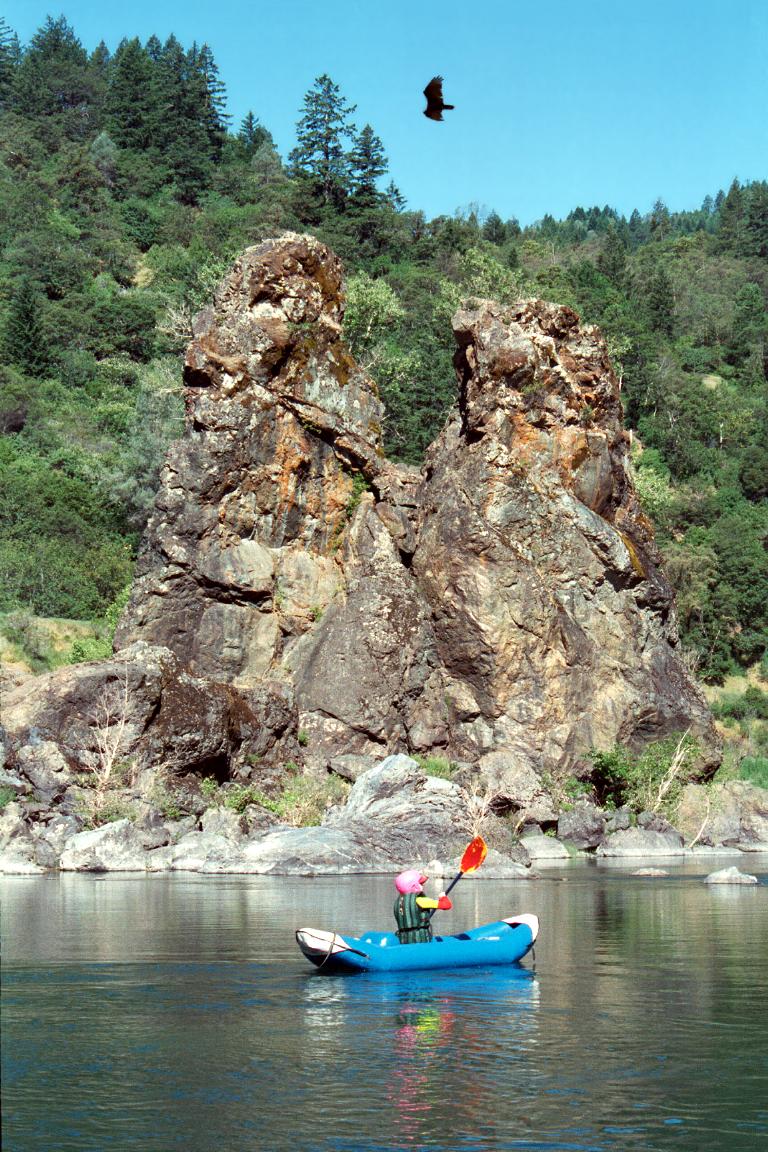
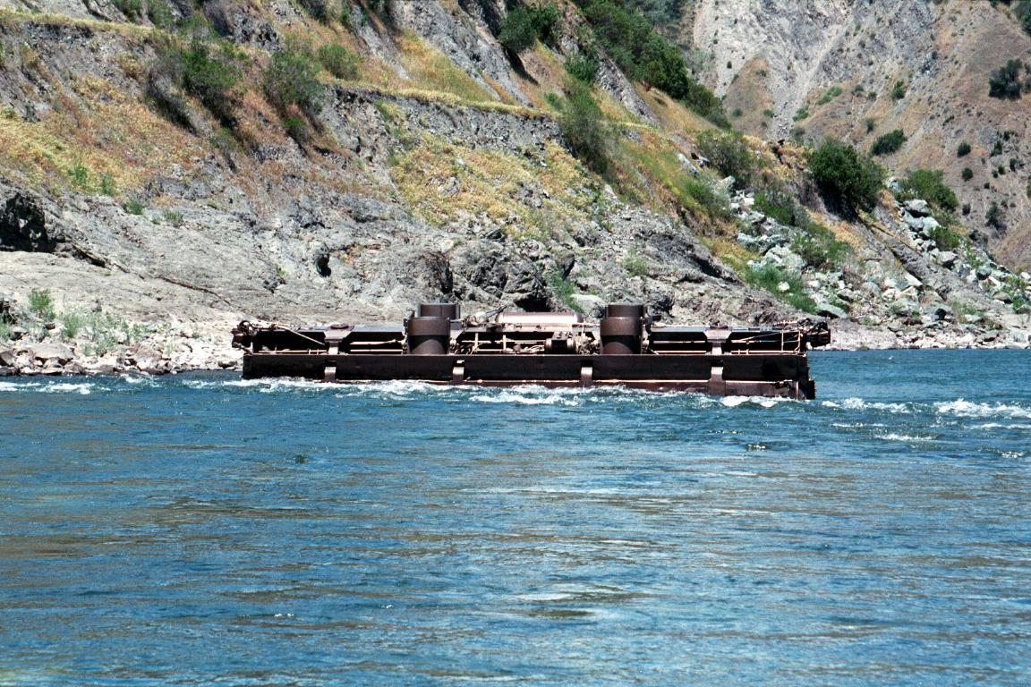
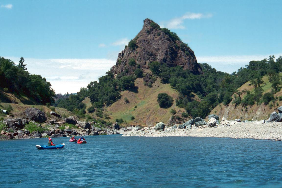
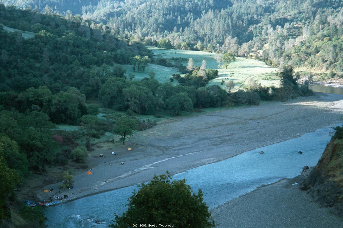
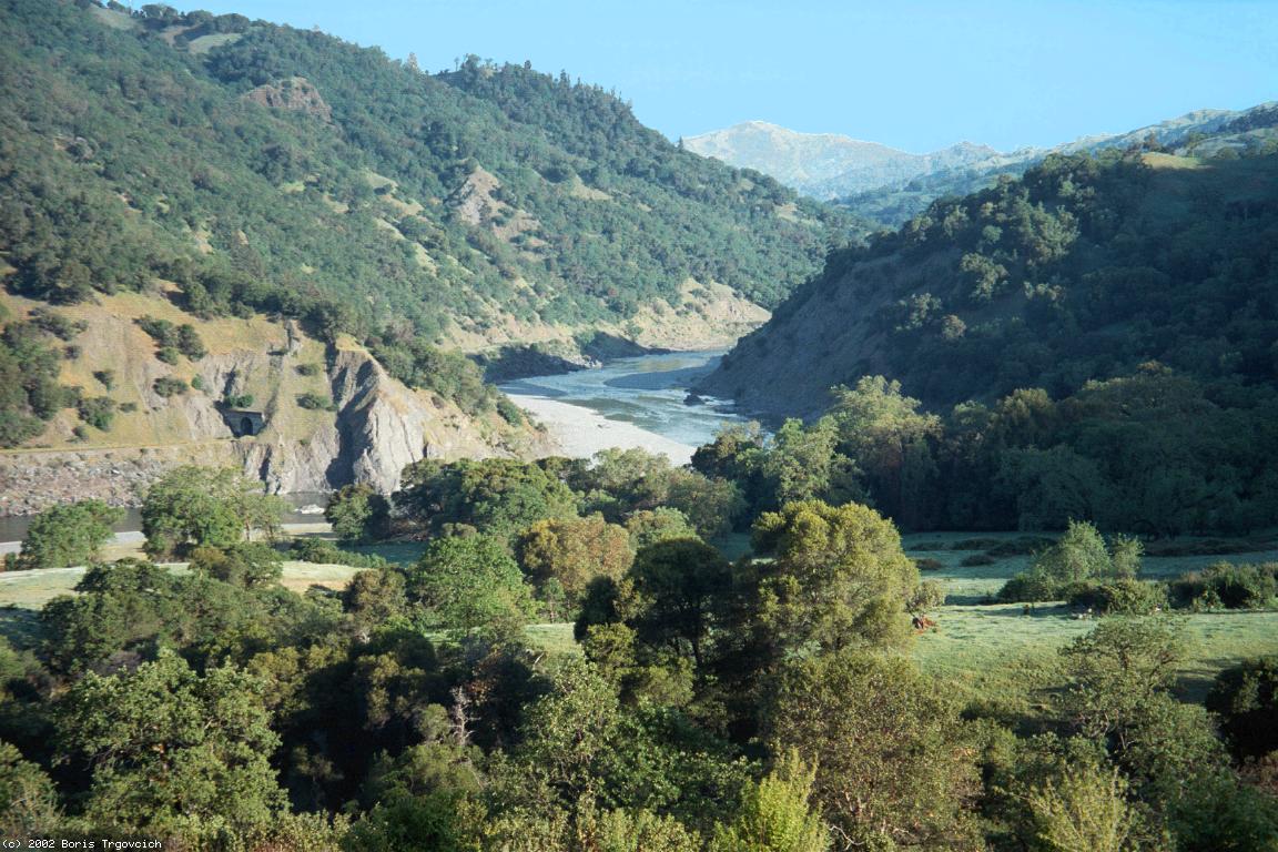
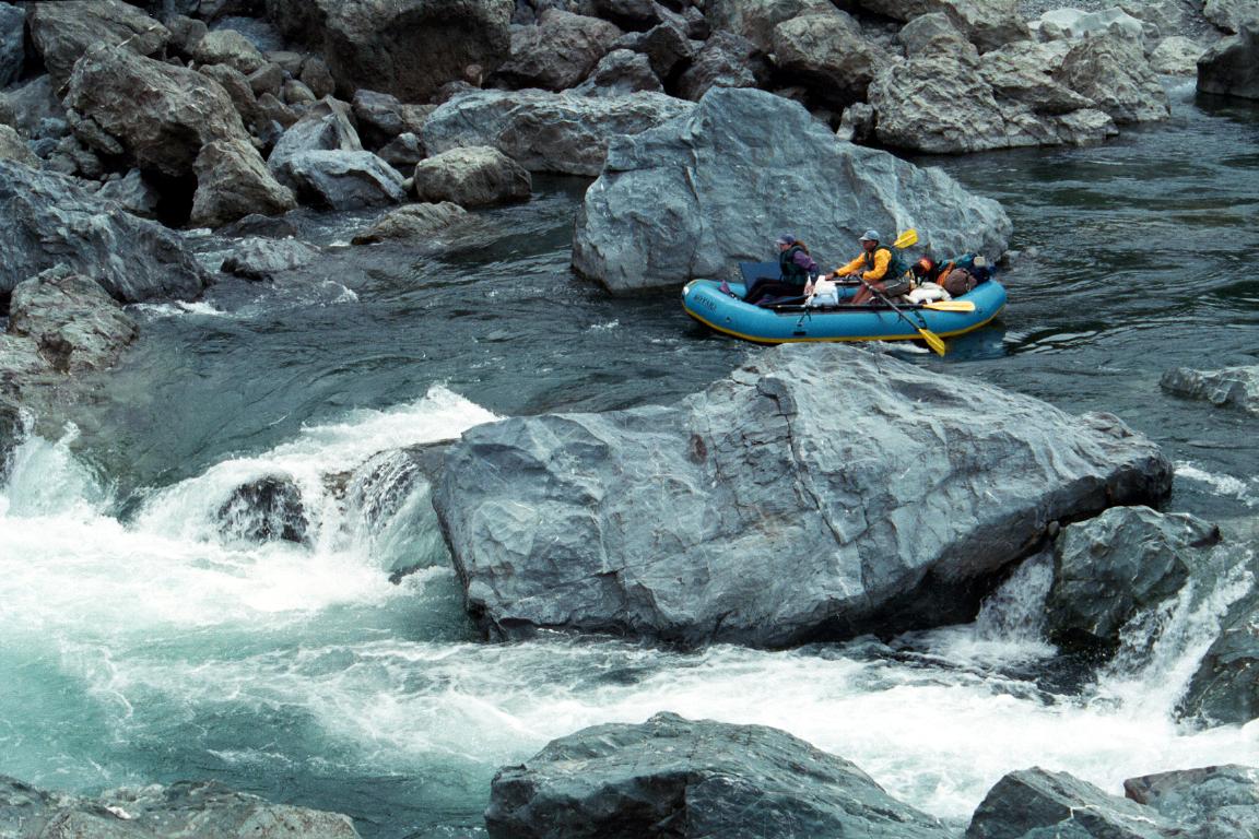
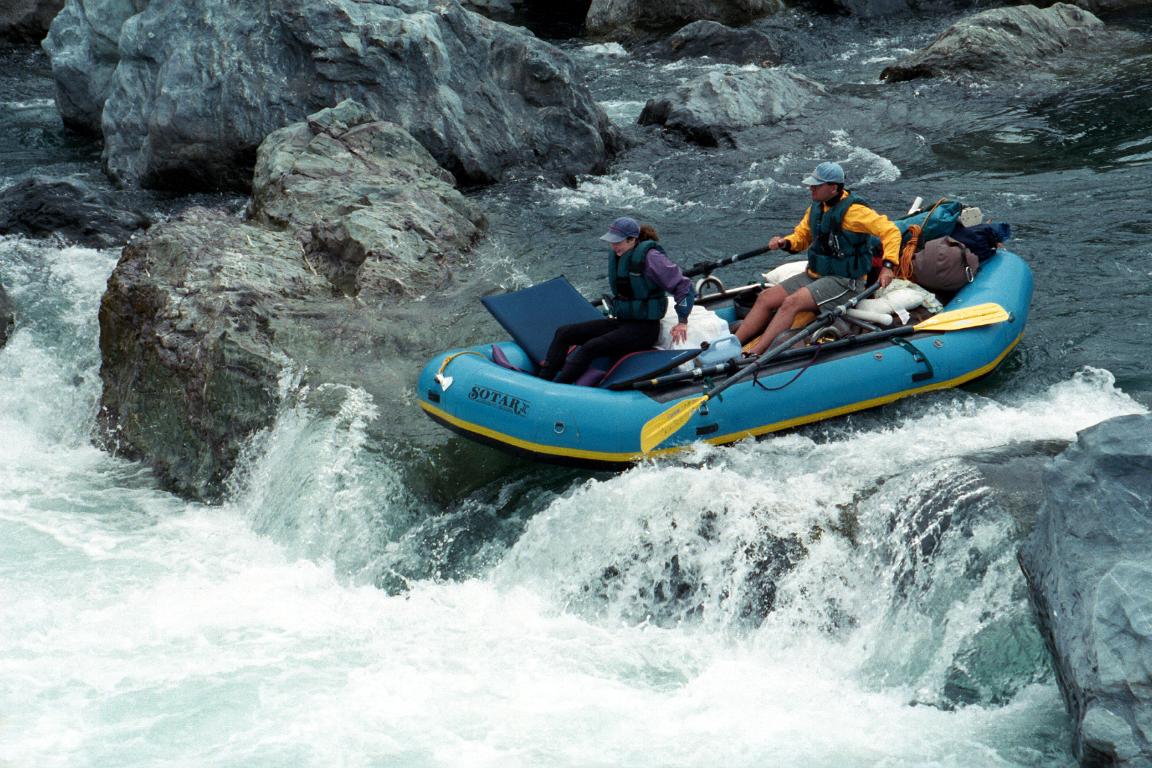
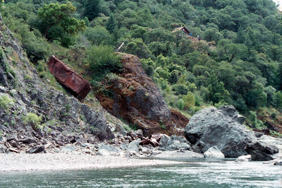
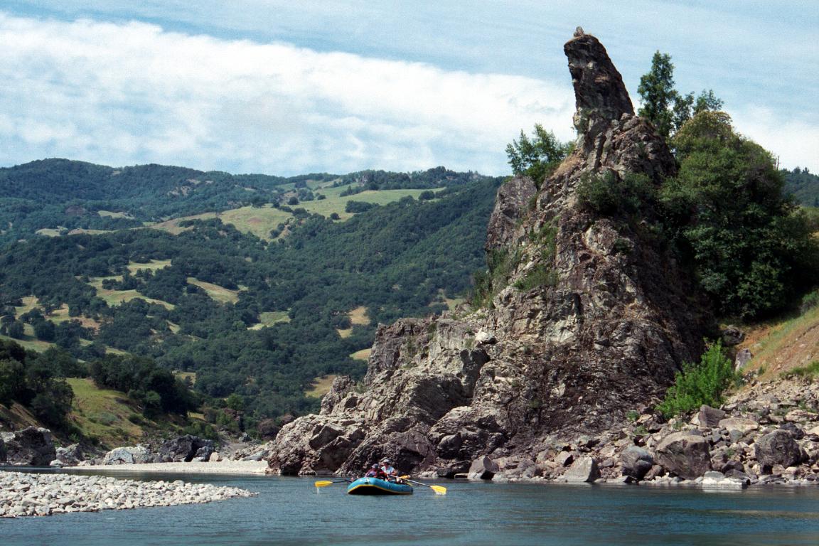
Springtime of a cold snowy year is an ideal time to run the main Eel. Although flows might be low, Memorial Day offers a good long weekend. As long as the middle fork Eel contributes moderate flows from snowmelt, this stretch remains runnable in canoes or kayaks, sometimes well into June. The water is greener and swimming better at low flows, but float times are longer. A train track follows the river, but was shut down (permanently?) in 1998. Railroad debris in the channel often detracts from the scenery, but could be considered historic. Rapids on the Eel can change radically from year to year. For example, at low flows in May 2000, we encountered several class III rapids in the so-called easy section before Spyrock. In his 1974 guidebook West Coast River Touring, Dick Schwind alludes to a rapid that moved 300 yards downstream between 1967 and 1969! Probably the description on this page is already outdated. Old guidebooks claim that the Eel became class IV at higher flows. The Holbek/Stanley book pegs the dividing line at 3000 cfs, but that is no longer true and perhaps never was. Even the 3rd edition of the Cassady/Calhoun book recommends 10000 cfs as the maximum flow, but because of the wide streambed, safe trips are possible well above that level. (See Trip Report below.) It is true that several rapids become class IV at high flows, but which rapids and at what flow may vary from year to year. Camping and scenery are good, as advertised, with plenty of sandy beaches that make for fine camping in dry weather. The Eel offers plenty of excellent hikes up side canyons, an often ignored aspect of this trip. Streams on the left bank are cooler and better for purification. The infamous afternoon headwinds sometimes do not occur, although they can be bad when they do occur. Check weather forecasts for troublesome “windy” or “breezy” predictions. At flows under 1500 cfs the water is clear and deliciously warm. Over 2000 cfs, the water turns light green from whitish silt, with clarity to a depth of a meter. The river turns brown at high flows. Overall, this is a run worth doing at least once if you are a rafter, and more times if you are a canoeist or self-supported kayaker. Low-water runs offer incomparable warm-water swimming and great camping. I'm often amazed that Californians drive long distances to float rivers in Utah or Colorado, when this one is right in their backyard.
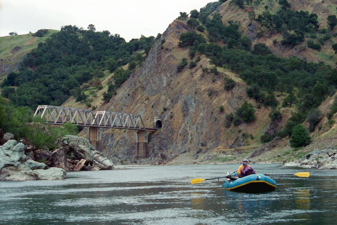
Below, the river continues class I-II for 18 miles to Eel Rock. As you go downstream, scenery gets better, with deeper forests and fewer grass-covered hills. Below Eel Rock there are roads (not just railroad) along the river. Going all the way to the south fork confluence in Dyerville would greatly simplify your shuttle. Rocky Contos paddled all the way to Fernbridge, and made these remarks: Below Eel Rock are another 60-80 miles of class 0-I+ water. It's very scenic along the way. I really enjoyed it. It would be boatable all year long. Years ago vandalism of vehicles had been reported at Alderpoint, but less so in recent years. The take-out there (river left above the bridge) might involve a long walk across a gravel bar, wading across an inlet, then climbing a steep dirt trail. Instead of Alderpoint, it is possible to take out at Fort Seward. That take-out might be easier, but it makes the run 6 miles longer. Formerly you could drive down to the gravel beach on river left upstream of the bridge, but 2014 flooding cut the bank, so the take-out on river right below the bridge is reportedly easier. Fort Seward Road from highway 101 might be gated seasonally. Alderpoint Road is open all year and, although 5 miles longer, takes the same amount of time (26 minutes past Alderpoint). For shuttle drivers, try contacting Donna at 707-672-9647. Quoted prices for the 2022 season were $300 for the first vehicle and $150 each additional vehicle. These are prices with a pick-up at the Dos Rios put-in and drop-off of vehicle(s) on the takeout day. Shuttled vehicles are safely kept in a field within view of her house. Dos Rios has no shuttle drivers of whom we are aware, but the nearby towns of Willits and Covelo might. To find nearby food and lodging, type Willits into the box and click Search. 
Custom Search
Trip Report by Randy HodgesApril 29th - May 1st, 2010 The Dos Rios to Fort Seward run on the Eel River is recommended for rafts at flows up to 10K cfs by most sources. We had planned a run for this Spring and had been watching the flows. They were at 4K a week before our trip and it was looking like we would have a run at optimal flows when a new rainstorm hit. The flows shot up to almost 30K. We watched as our launch date approached and the flows inched down below 25K. A call to Clavey Paddlesports gave us a response that a 20K flow was do-able with an experienced group of rafters. We went to the put-in at Dos Rios and saw a big but relatively civil river flowing at 22K. We decided to make the attempt so we launched. There were four 14-16 foot rafts, a 14 foot cataraft, and two IKs. We launched late in the day and went nine miles to find a great camp on river right. Our first challenging rapids came a bit below Spy Rock. Both pairs of IK paddlers ended up swimming that one. We recovered them and encountered several other moderate rapids between there and the North Fork Confluence. The rapid just above the confluence was the biggest we had seen and the IKers were swimming again. An executive decision was made to pull the IKs. No one argued. There was another set of challenging rapids below the North Fork. The railroad car in the river in this section was nowhere to be seen as the river completely covered it. There were many class II-III rapids between here and Island Mountain Falls . We pulled out on river left and sent half of our group up to the tracks to film us going through, for safety, and also to lighten our boats. Our scout boat with an observer ran first and radioed back a blow by blow description of the run. All three channels were available at the main drop. The rocks dividing the channels were holes. The left run was probably the best choice as there was a huge hole extending from river right across half the river below the drop. Most of us took the route on the right and ferried to the left around the hole. It was easy enough but you would not want to miss a stroke or have the wrong ferry angle. The other boats followed and only the cat had a problem as it hit the hole and emerged at an extreme angle, fortunately landing upright. It turned out that the group walking around had quite an adventure trying to follow the tracks as they were washed completely out in several places. The Poison Oak was epic. Both an unnamed rapid and Kekawaka Falls had huge river wide holes at their main drop. They could be barely skirted on the right. Several rafts and the Cat went through one of the holes with out a problem. We camped near Kekawaka Creek after covering 30 miles that day. We let our Rookies row us out the 15 miles to the Fort Seward take out. We were there by noon and eating sandwiches in Garberville by 2:30. Great Trip.
Light At The End Of The TunnelThis amusing story first appeared in the Paddle Tales section of Paddler magazine's February 1994 issue. © 1994, 2003 Frost Saufley Full of adventure, but short on insight, we were planning to paddle the main stem of Northern California's Eel River in a 13-foot aluminum canoe with a one-inch keel. Hardly the boat of choice for a 47-mile, three-day run through Class III whitewater flowing at a respectable 3500 cfs. Plus, Craig sat in front, though he outweighed me by 40 pounds. Between us, in dry bags, sat steaks, a box of wine, a handgun (for shooting wild pigs) and other necessities. Our four inches of freeboard looked mighty precarious.
|
Creeks NavigationHomeRecommended Runs Map of Rivers Alphabetic Index Alphabetic Table Text Search
Sponsored Links
|