| |
| Stretch: |
Highway 89 to Nelson Point campground |
| Difficulty: |
class II-III (one IV-) not floatable when too low |
| Distance: |
10.5 and 8.5 miles, 1 or 2 days |
| Flows: |
rafts and kayaks 600 - 2400 cfs
|
| Gauge: |
reliable estimate on Dreamflows
(below Sloat) |
| Gradient: |
upper run 20 fpm, lower run 31 fpm |
| Put-in: |
highway 89 bridge (4320') or near the town of Sloat (4140') |
| Take-out: |
Nelson Point campground on Quincy-LaPorte Road, 3880' |
| Shuttle: |
20 miles (30 minutes) one-way |
| Maps: |
USFS Plumas NF, AAA Feather and Yuba Region
Topo 1
Topo 2
|
| Season: |
spring, from rain and snowmelt |
| Agency: |
private, USFS |
| Notes: |
© 1998, 2019 Bill Tuthill,
CreeksYahoo |
This is a good run (or two) that did not appear in any guidebook
until Ann Dwyer's Easy Waters of California in 2000.
In 1998 when I wrote up the lower part of this run based on hearsay,
I noted that Charles Martin overlooked it in his 1974 guidebook,
though it seemed like something he would have enjoyed.
I speculated that it was too easy for Holbek/Stanley,
who instead ran the multiday class IV-V run that starts at this take-out.
Dwyer divides this run into two parts:
9.5 miles from Mohawk to Sloat, and 8.5 miles from Sloat to Nelson Point,
put-in for the Middle Fork Feather Devil Canyon run.
Sloat to Nelson is also called the English Bar run, and was better known of the two.
Dwyer also documents a 6 mile run from Clio (rhymes with I/O) to Mohawk,
and other runs above that.
Clio is where several sidestreams come together, improving navigability.
During the heavy snowpack year of 2019,
Jerry Meral organized a kayak float of the class II (one III) stretch
of the North Fork Feather from the Greenville Y to Virgilia.
Greenville Y is the highway junction where Indian Creek and Spanish Creek meet
to form the North Fork Feather.
Jerry planned to boat the English Bar run on the following day.
Having long daylight, some of us wanted to add the Mohawk run for 18 miles total.
We noticed that the highway 89 bridge involved a shorter carry to the river
than the Mohawk bridge, so we put in a mile upstream for 19 miles total, on good flow.
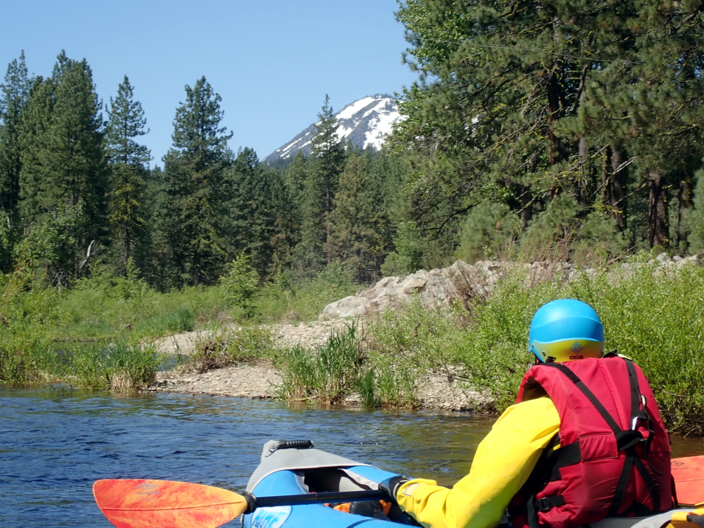
We liked the upper run a lot. It is easier than the lower run.
Scenery is similar to the Truckee river below the town of Truckee.
The Clio to Mohawk run seems good in the Dwyer guidebook,
and looks good on satellite images, but we didn't run it.
Satellite shows many class II rapids, and two rapids that might be class III-.
For an easy shuttle, and to avoid a class IV- on the lower English Bar run,
you could put in at Clio and take out at Sloat, for 15.5 total miles.
If flow is high enough at Mohawk, it should be high enough at Clio.
- -5
- If you want to start at Clio, put in where a bridge crosses north
across the river from highway 89 into town. Good put-in with parking.
The river soon turns north to northwest and enters a forested area.
After Frazier Creek enters on the left in a big alluvial fan at mile 2,
the river borders Graeagle golf course on the left,
then after a bridge also on the right.
Dwyer says watch out for flying golf balls.
- -1
- So called Green Bridge on A19, the Graeagle-Blairsden road.
Dwyer says this makes an excellent put-in with more parking than at highway 89.
- 0
- Easy put-in and some parking on the upstream south side of the highway 89 bridge.
Below, the river alternates between pools and narrow channels.
- 1
- Bridge on Mohawk highway, state route 14. Access is possible with a short carry.
After a bend, the river flows quietly thru Plumas National Forest,
then past houses of Plumas Pines and golf course on the left.
-
- Along the golf course the current splits around an island.
We went left (2019) but the right channel might be good.
- 3.5
- After the golf course is a section of national forest with good camping
on a right bend away from the railroad.
- 4.4
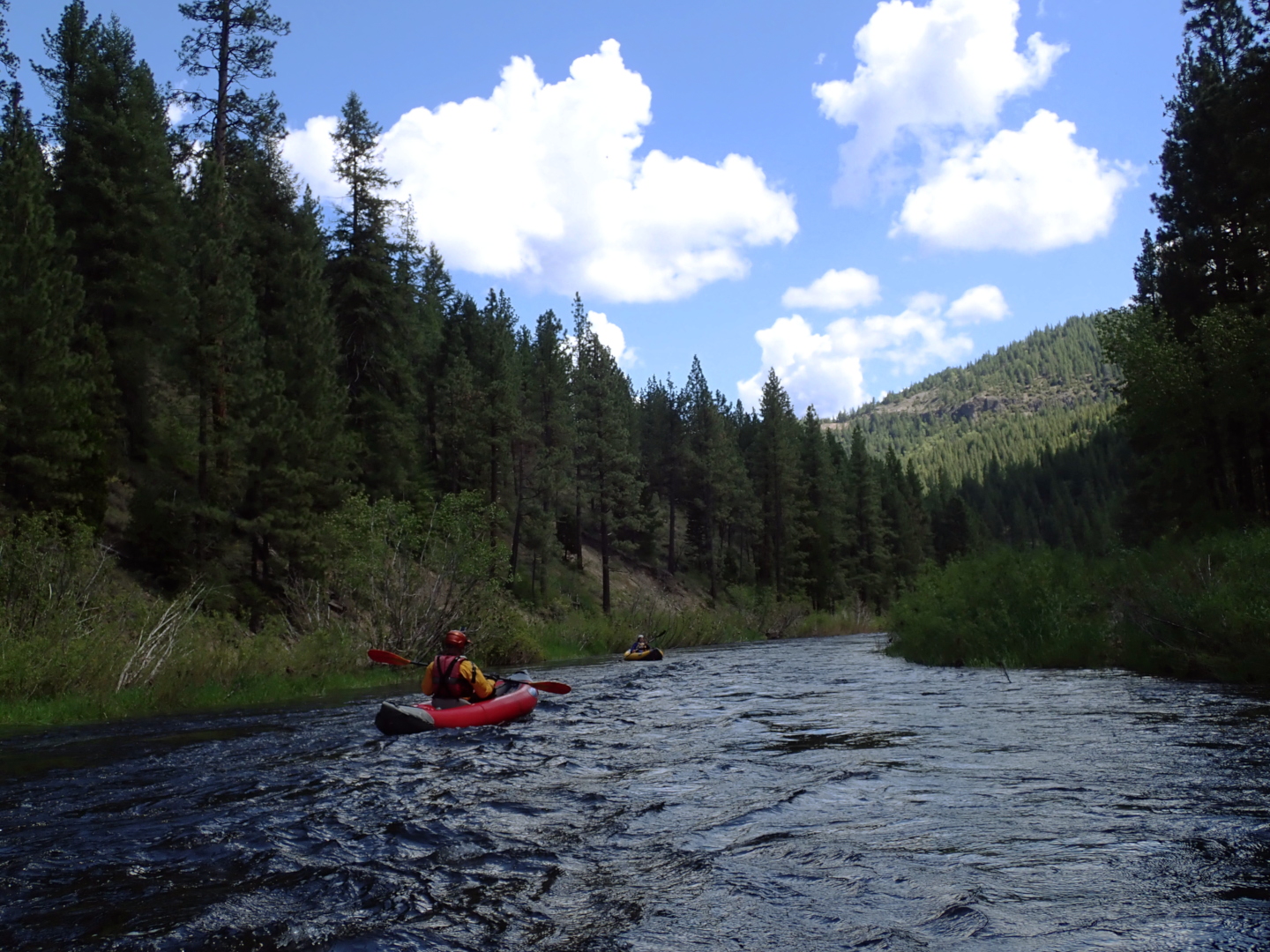
- Significant rapids begin at a left bend, then at a right bend,
with a short respite in between. One seemed class III-.
-
- An island splits the flow. Another rapid at a sharp left bend.
This whole series adds up to class III-.
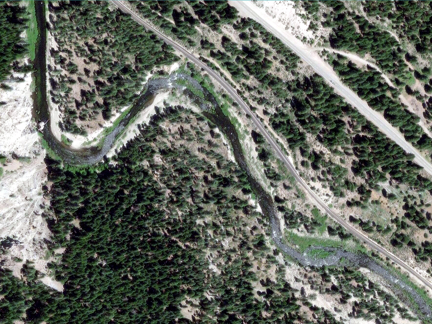
After a right bend, a big midstream boulder was decorated with logs.
You can see a log in the satellite image, where the river moves
from lower right to upper left.
- 5.2
- End of rapids, as the river curves right along a bare cliff.
Good campsites on river right away from the railroad.
-
- 5.6
- Jamison Creek enters on he left, contributing to the flow.
About .1 mile downstream is the Two Rivers bridge.
Good scenery continues, with moderate rapids.
- 6.5
- Camp Layman bridge. On the left upstream is a cliff on river left.
Before and underneath the bridge is a class III- rapid.
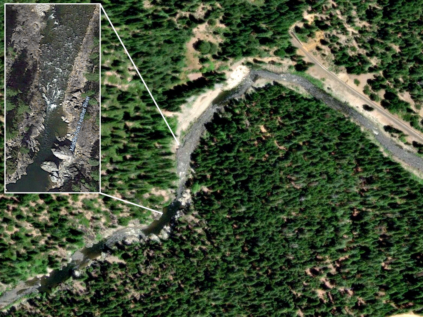
- 8.4
- Cogswell Creek enters on the right, as you pass the town of Cromberg
(no bridge). Then the river bends sharply left, then gradually right,
past a gravel pit on the right.
- 10
- After another gravel pit on the right, you encounter
a class III- rapid near the bottom of a high-water island.
Structures appear on the right, one saying Sloat (railroad stop).
- 10.5
- 0
- Bridge at Sloat, with access on river left.
The take-out and/or put-in is about 500' upstream of the bridge.
A dirt road turns east before the first house and leads to the river.
- .7
- The river turns sharp left and heads west along the railroad.
The canyon closes in, but rapids continue similar to those above.
About halfway you pass a collection of structures on the right,
labeled Bell Bar and Carmack Mine on maps.
- 3
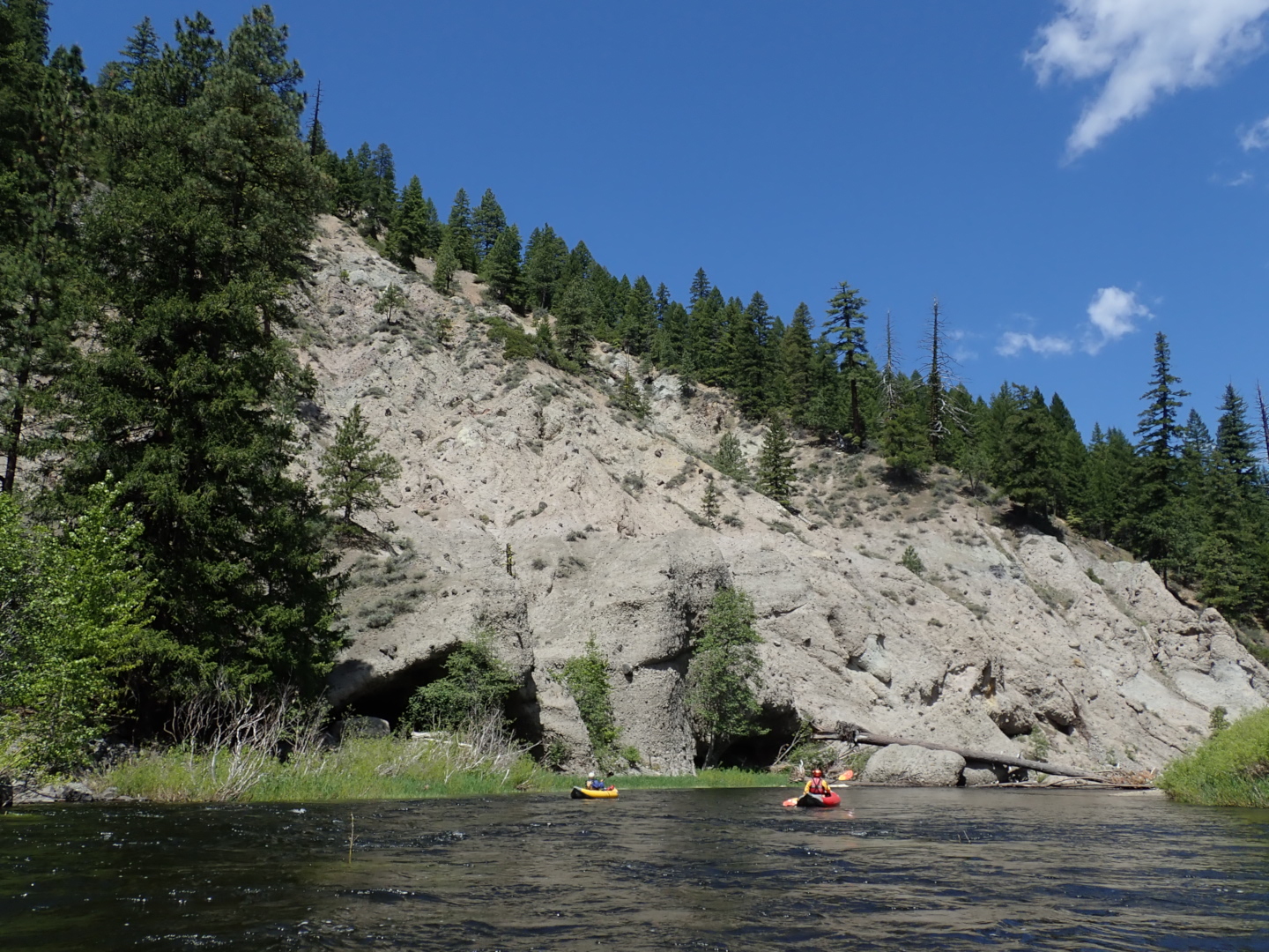
- On river right, the railroad leaves the river and enters a tunnel.
An odd sand and gravel bar slopes upward going downstream,
making you wonder if it's the railroad, but apparently it is
alluvial deposits from very high flows.
- 3.2
- Hazard! Class 3E rapid, meaning technically easy but dangerous.
Whitewater urges you left, but then you must paddle hard right
to avoid an undercut cliff jutting out on the left.
In April 1986, hardshell kayaker Al McManus pinned and died
in this rapid, or maybe the IV- a mile downstream.
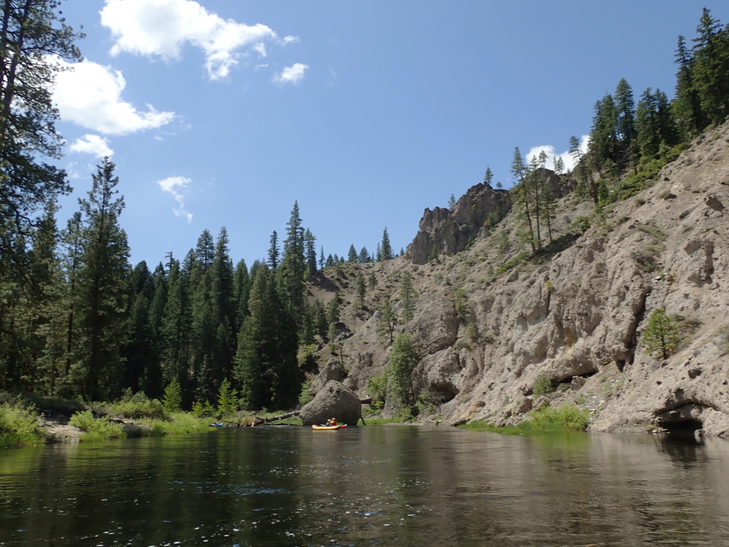
-
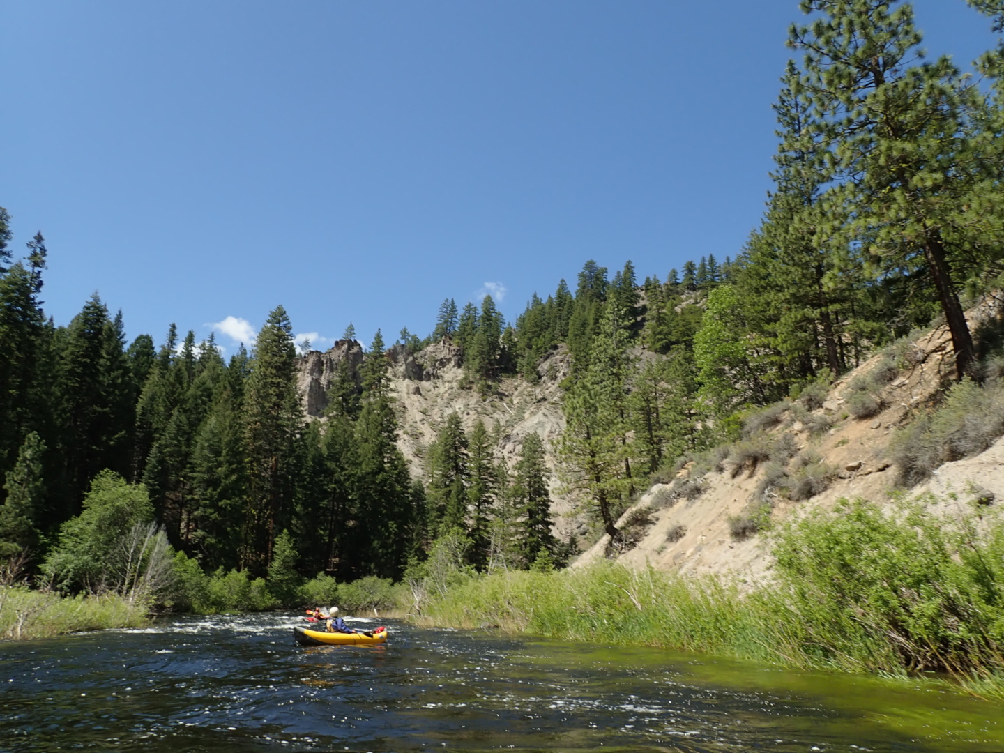
- An easier rapid follows in a beautiful canyon,
then several more as the canyon opens up.
- 4
- Buckhorn Mine, visible as metal roofs and collapsing structures
on river left. The canyon is deep, with no roads shown on maps.
How these structures were built is a mystery.
- 4.3
- Class IV- rapid. After the river curves right,
you encounter the most difficult rapid on this run.
At moderate and high flows, you can take a sneak channel on right,
after inspecting the entrance for wood or rock debris.
In her guidebook, Dwyer says “go right and stay right.”
She also writes it “stretches the definition of a class II run.”
We took the wider left channel because it looked fun.
When the far right sneak route is available,
current piles up into a large boulder at the entrance (2019),
so much so that it deserves a scout and possibly a short portage.
At low flows, you will have to brave the boulder-strewn drop
at the bottom of the left channel. Stay right along the island,
because the drop gets very manky on the left towards the bottom.
- Shortly below is another significant rapid thru boulders.
Difficulty of rapids diminishes after this.
- 6
- English Bar on river left. This would make a wonderful campsite,
or many campsites, if you are willing to carry camping gear down the river.
It looks a lot like some of the best Middle Fork Salmon camps
such as Hospital Bar, though without hot spring.
It's hard to say where English Bar begins and ends,
but it seems about a mile long. Across the river near the end,
Fells Flat is accessible by 4WD vehicles.
- 7
- The river bends left and flows through some gravel bar rapids.
Then the canyon deepens, and you encounter many minor rapids.
- 8.5
- Take out shortly past the Nelson Point bridge on river right
at a beautiful beach with vault toilet and primitive camping.
Shuttle Directions
To reach take-out, follow highway 70 to near Quincy (about 5 miles east),
and turn south on Quincy-LaPorte road.
Continue 6 or 7 miles to where the road crosses the Middle Fork Feather.
Park on the north side of the bridge, or down a dirt road at the picnic area.
Nelson Point campground is on the south side of the river.
To reach the lower put-in from there, return to highway 70,
and drive southeast about 10 miles to one of two roads leading to Sloat.
Cross the bridge on Sloat - Poplar Valley road,
and soon turn left on road 23N08 (Hartwig Way).
Proceed about .2 mile upstream and put in just before 23N08
turns sharp right away from the river.
To reach the highway 89 bridge, put-in for the upper run,
continue on highway 70 to the 89 junction near Blairsden,
turn right, cross the river on a good bridge, and park immediately.
|
|
Creeks Navigation
Home
Recommended Runs
Map of Rivers
Alphabetic Index
Alphabetic Table
Text Search
Sponsored Links
|