| |
| Stretch: |
Cresta Dam to Poe Reservoir |
| Difficulty: |
class IV then II (IV), harder at higher flows |
| Distance: |
5 miles |
| Flows: |
rafts and kayaks 800 - 1600 cfs, possibly 4000
|
| Gauge: |
flow approximates scheduled dam release |
| Gradient: |
48 fpm average, steeper at beginning |
| Put-in: |
below Cresta Dam, 1630' |
| Take-out: |
just above Poe Reservoir, 1390' |
| Shuttle: |
5 miles (10 minutes) |
| Maps: |
USFS Plumas NF, AAA Feather and Yuba Region |
| Season: |
monthly June to October, depends on PG&E releases |
| Agency: |
USFS, private |
| Notes: |
© 2003 Paul Quiroga, photos courtesy Martin Wong
at raft.org |
Due to the hard work of AWA volunteers on FERC relicensing,
two sections of the North Fork Feather now have dependable flows
once a weekend every month June thru October.
Saturday flows on the class IV Cresta section will start
at about 1600 cfs in June, dropping down 200 cfs every subsequent month
until 1000 cfs is reached in September and October.
In dry years we might only see 800 - 1000 cfs released on this section.
Below Cresta Dam, Grizzly Creek adds between 30 - 75 cfs to the flow.
Please note that above 1600 cfs it has been said that many advanced boaters
were portaging County Line Rapid during the first release in June 2002.
The 3rd edition Holbek/Stanley guidebook describe County Line as a
“killer” hole; the left side might very well be above 1600 cfs.
Most of the rapids on this run can be scouted from the road,
which runs along this entire run.
For this year's flow schedule,
see the North Fork Feather page.
Highway 70 follows this section of river, so traffic problems
may occur during the scheduled releases.
A good approach is to rig your boats,
drop them off at the turn-out right before Elephant Butte tunnel,
then return to parking at take-out.
You can use the AWA shuttle service (only $5 for unlimited use)
to get back to put-in.
Once at the put-in you must carry your boats and gear
down a narrow path alongside a steep drop-off.
Be careful because you need to single-file anything larger than a kayak.
The trail is unstable and rocky.
Once you get your boat and gear to an opening,
you must rappel them down a granite dome (rope and pitons provided).
The granite dome ends with a 30' high drop into sharp rocks and thorn bushes.
Underneath the cliff is a cave about 60' deep.
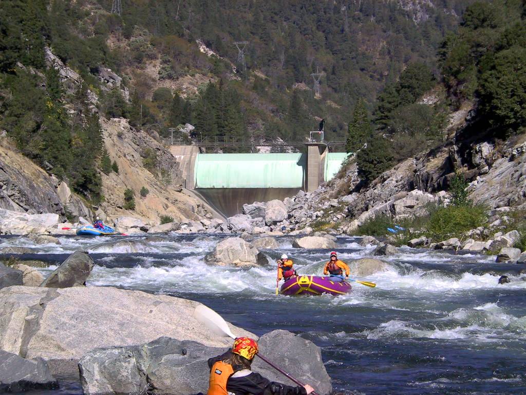
- mile -0.3
- The put-in trail to the upper run is supposedly even more difficult
than the one mentioned above. Easy water just below the spillway.
- -0.1
- Unnamed Class V-, scout left from high above the put-in
-
|
Entry to this rapid is marked by rocky shallows extending
almost all the way to river right. Kayaks might fare better
and could find entry points from river center out to river right.
Rafts need to work their way to river right against the bank
before entering the rapid. The last drop is best run left of center
for rafts, although kayaks could run it right of center.
Below 1000 cfs, rafts might have a hard time negotiating
the rocky shallows atop the rapid.
Unnamed class V- viewed from road
|
- mile 0
- Standard 2003 put-in. Slow moving water permits warm-up.
- .5
- Class II+ or III- boulder field, boat scout
Relatively easy but best run right or left of center.
Watch out for barely submerged rocks.
-
- .7
- Grizzly Creek, Class III-, boat scout
This rapid occurs immediately after the Grizzly Dome Tunnel
and is a straight shot down the tongue into an angled lateral
with a decent sized hydraulic that might send you against
the left bank if you don't square up to the lateral.
Grizzly Creek enters on the left about 100' past the drop.
You can paddle up the creek, which runs under the highway.
- .9
- The river splits around a shallow island with most water and
the cleanest route against the left bank, so stay left.
A few submerged boulders must be avoided.
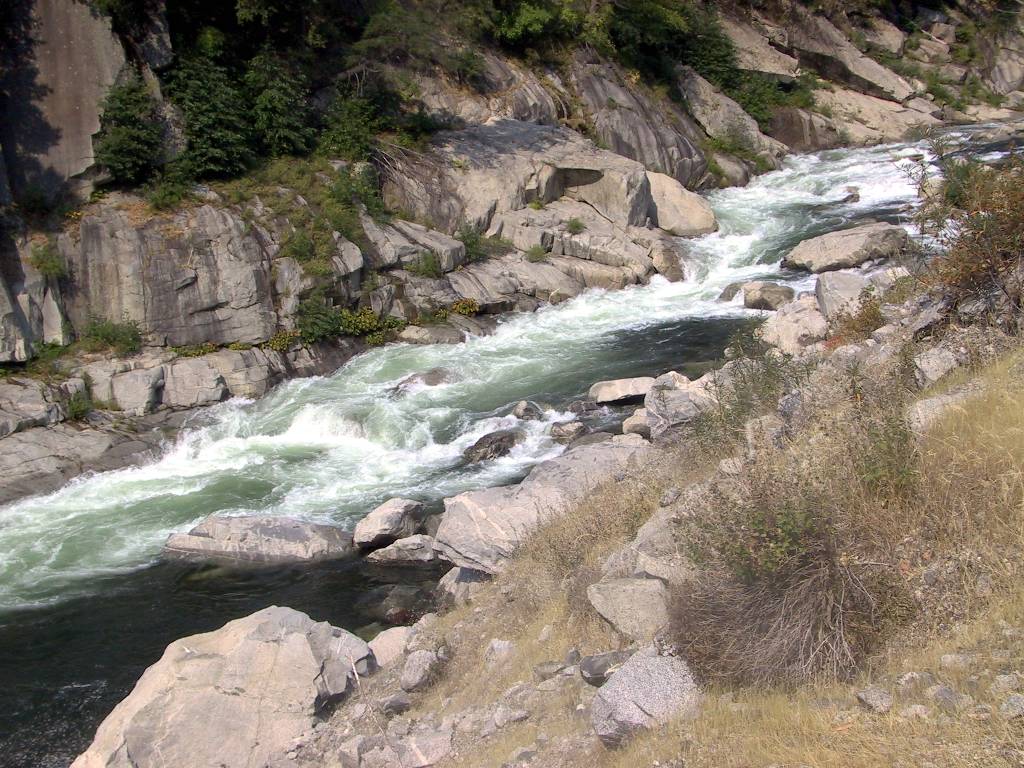
- 1.3
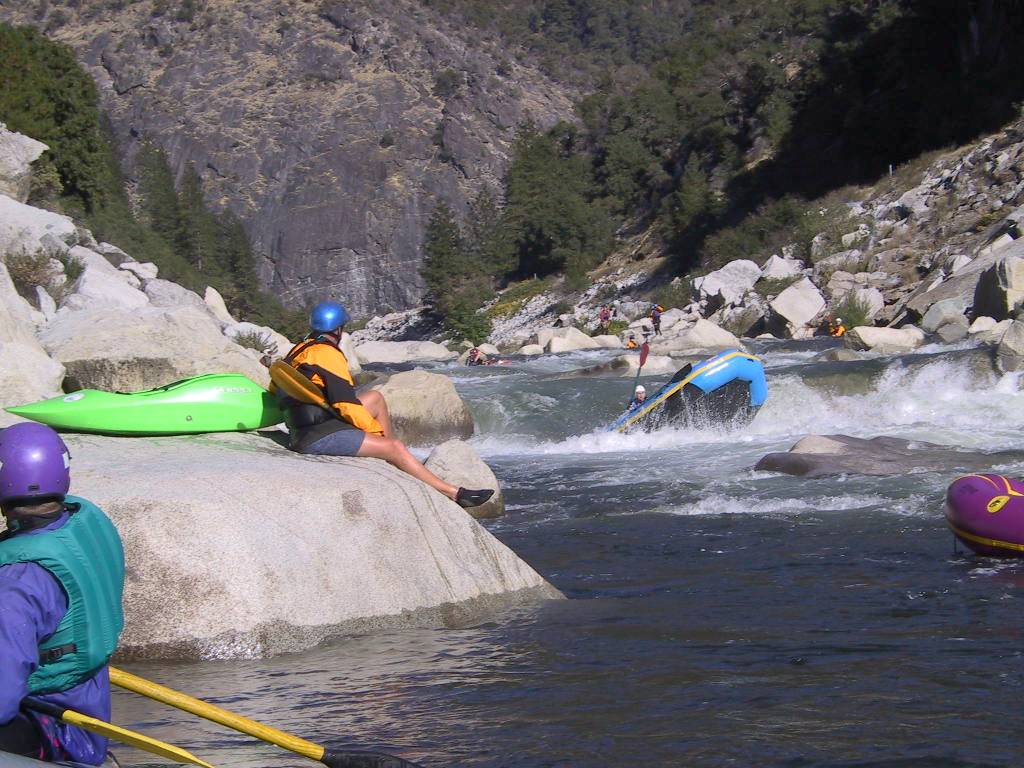
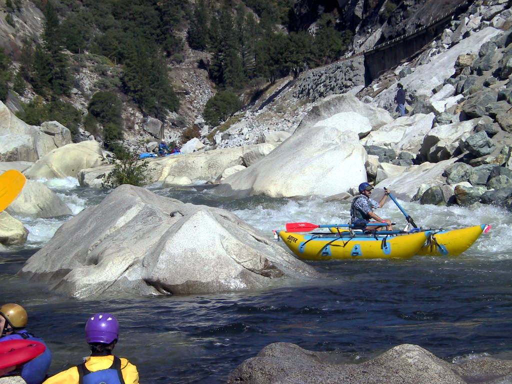
- County Line Falls, Class IV (verges on V- at high flows),
scout left above entrance
Other than the Unnamed Class V- above the normal put-in,
County Line is the largest rapid on this run. It is marked
by two county-line road signs along highway 70, hence the name.
Once you see the Plumas and Butte County road signs, eddy out
on river left to scout the entrance before the big drop.
This drop is best run right of center where a nice tongue
takes you into a frothy maelstrom of whitewater. You can use
the eddy behind the table rock to help set up for the drop.
Another possible route is on far left (see photos).
-
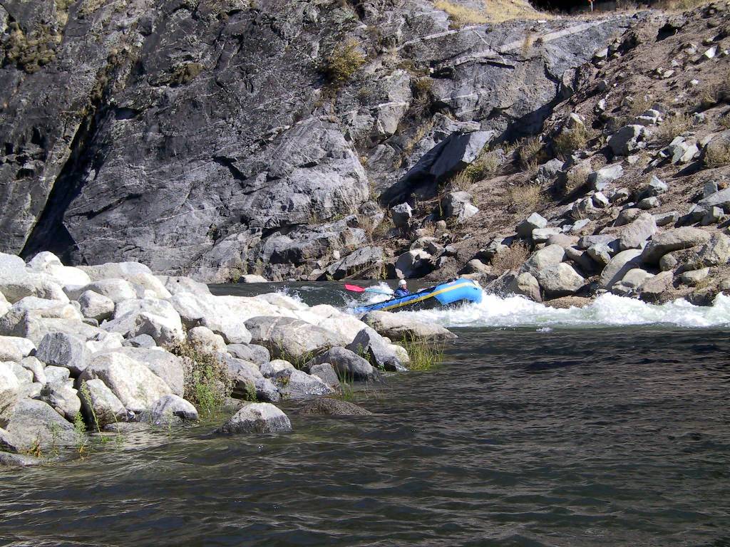
- 1.5
-
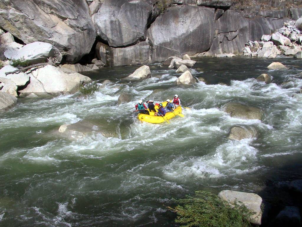
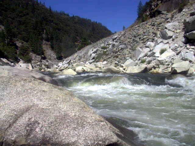
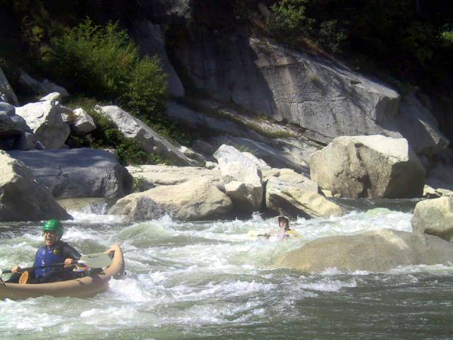
The Wave, Class IV, road scout or from either bank
Most swims on this run tend to occur in this one. You can enter
the rapid from either right or left of the mid-stream boulder.
The left slot has an angled wave (hence the name) which you must
square-up to and ride out before a midstream boulder forces you
to backferry towards river left. The run out is clean.
The right slot is clean and easy, but the required backferry
to the left-exit slot is extremely difficult. If you go right,
don't take the very far right chute against the bank, which is
shallow and rocky. The correct chute (see second photo below)
is obvious once you are in there.
-
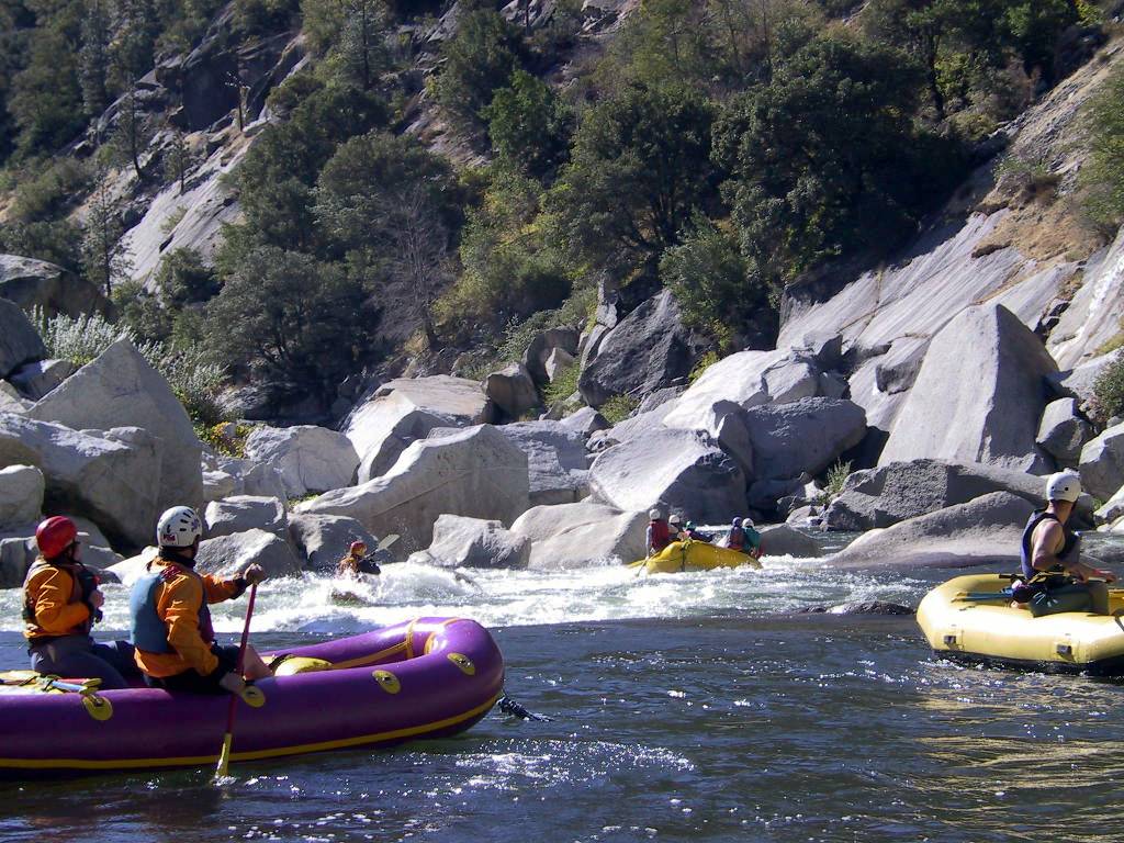
- 1.7
- Boxed-in Hole on right, run to river left
This next rapid is run by moving from river right to river left.
There is a runnable-looking drop against the right bank, but the
hole is boxed-in and has recirculated swimmers for over a minute,
so please do not run it (see picture below Rock Garden).
- 2.0
- Cave Rapid, class 4E, scout either side and set safety
Class IV technical difficulty with class V consequences.
A fatality occurred on this rapid in September 2003 when a raft
overturned and a swimmer was swept into the lethal 30' deep
undercut cave on river left, visible in the second picture.
-
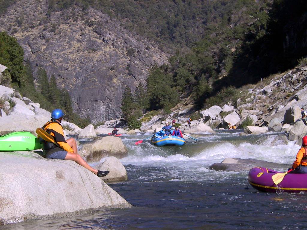
- 2.2
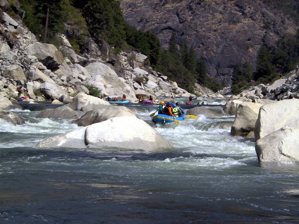
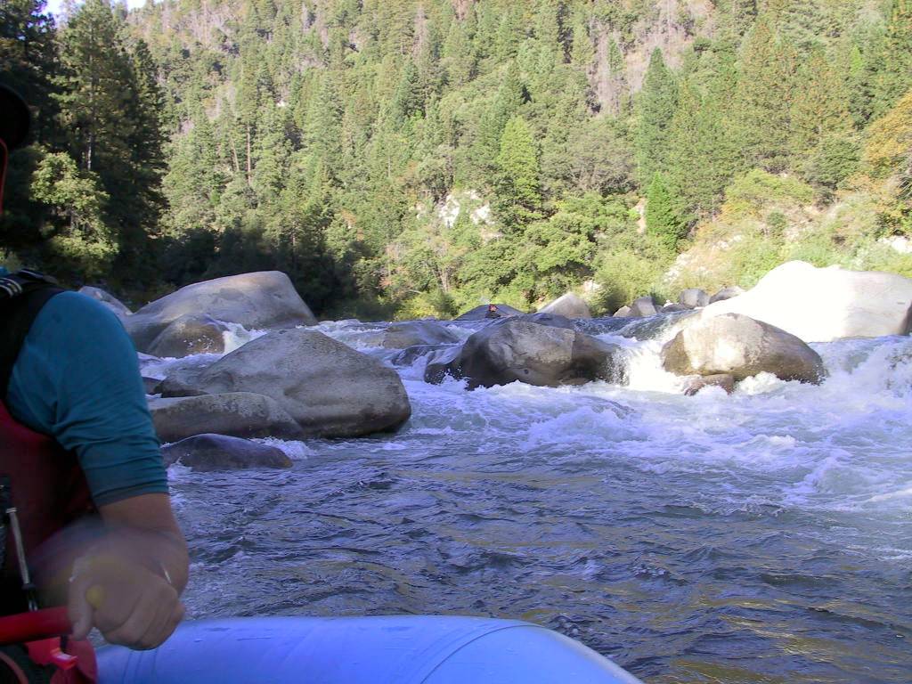
- Rock Garden, Class IV-, scout from either bank
This rapid is marked by a fairly long rock garden. Enter center
then work right. There are a few rocks to avoid, but moves are
easy enough to make. Moves are tighter at the bottom, where you
can run it right or center between two tight boulders, then exit
on river left. Recovery pool below. This rapid marks the end
of the Cresta class IV upper section.
-
- 3.5
- Shady Rest Take-Out on left bank
It is easier to take boats up the bank 500 yards above this,
than at Shady Rest Area itself. Novice boaters can put in here
for the more-remote class II-III section of this run. Somewhere
not too far downstream is a great surfing play-hole on river left.
This pour-over hydraulic is easy to spot and lots of fun to play in,
but please share the spot with other boaters! This section of river
meanders away from the road and gives an impression of solitude.
- 5.0
- Rock 'n' Wrap, Class IV, scout on river left
Class II-III boaters should take out before entering the boulder
garden above this rapid. This constricted boulder pile is very tight
for 14' rafts under 1100 cfs, and has caused many wraps due to lack
of scouting. There are at best two narrow slots to get you thru.
The safest is on river right were rafts must execute a lowside
(to the boat's left) and work from river right to left once past
the tight entry slot. The middle slot requires an immediate
right-to-left to avoid the wrap rocks lurking below the drop.
Moving pool below this rapid, so pick up any swimmers immediately.
-
- 5.1
- Take out on river left, where you can drag boats up a concrete apron.
For the most comprehensive photo journal of this run, see
Raft.org's North Feather
gallery.
|
|
Creeks Navigation
Home
Recommended Runs
Map of Rivers
Alphabetic Index
Alphabetic Table
Text Search
Sponsored Links
|