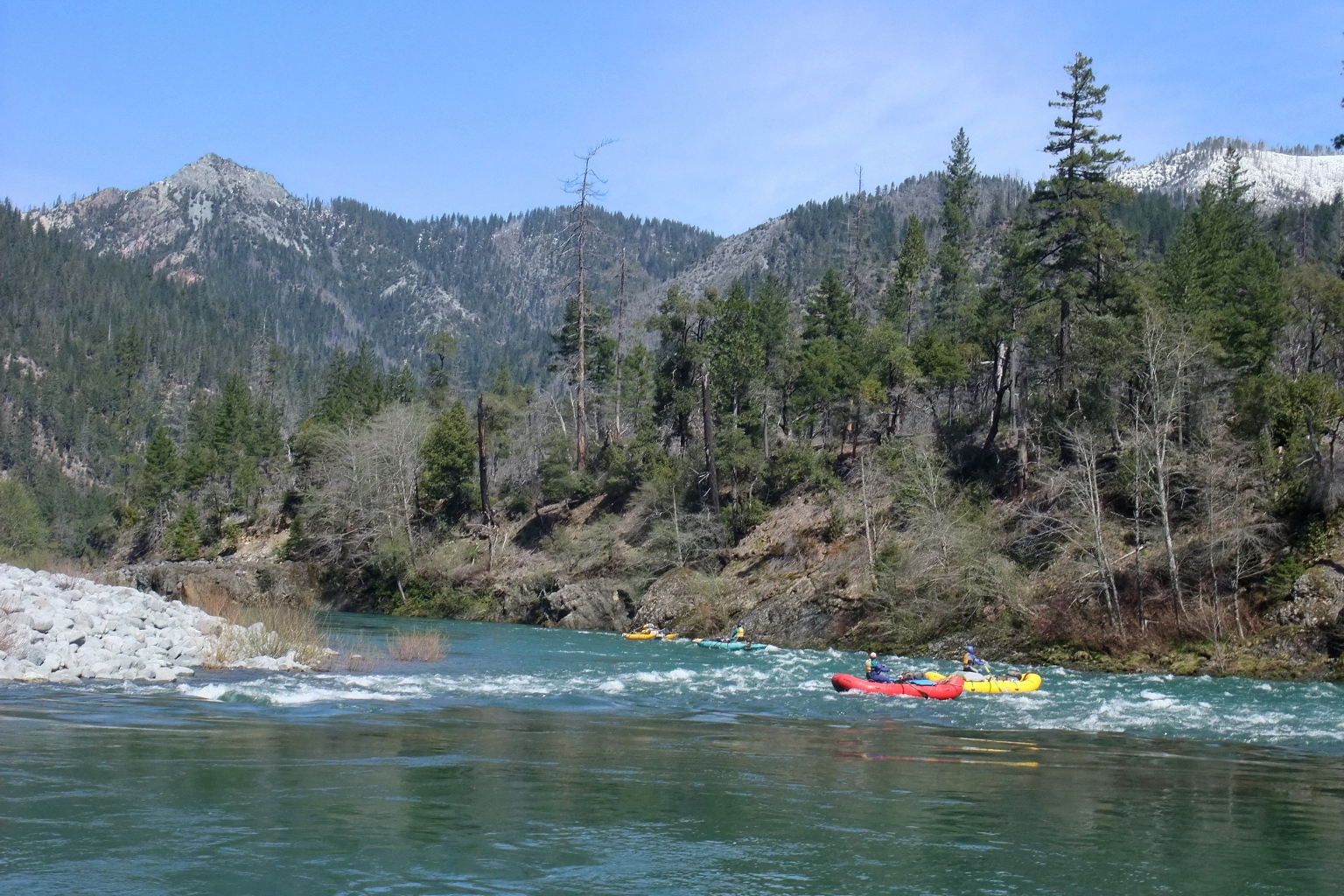
| |
| Stretch: |
Miami Bar to Oak Flat near Rogue confluence |
| Difficulty: |
Class IV, one class V, no portages |
| Distance: |
32 miles, 2 to 4 days |
| Flows: |
rafts and kayaks 800 - 3500, IK minimum 400 cfs |
| Gauge: |
measured above put-in at Kerby
(USGS site) |
| Gradient: |
24 fpm average, steeper in the middle |
| Put-in: |
gravel beach at Miami Bar, 870' |
| Take-out: |
shortly upstream of Rogue confluence at Oak Flat, 115' |
| Shuttle: |
155 or 95 miles (3.5 or 3 hours) one-way; shuttle service is easy to hire |
| Maps: |
USFS Siskyou NF, AAA Southern Oregon,
Topo
|
| Season: |
Winter and spring, from recent rain, rarely snowmelt |
| Agency: |
USFS, BLM, permit possible,
guided Whitewater Rafting |
| Notes: |
© 2008 Bill Tuthill
CreeksYahoo
Photos © Brian Vogt, Mike Holstrom, Andy Coit, Shaun Riedinger & Mike Howell |
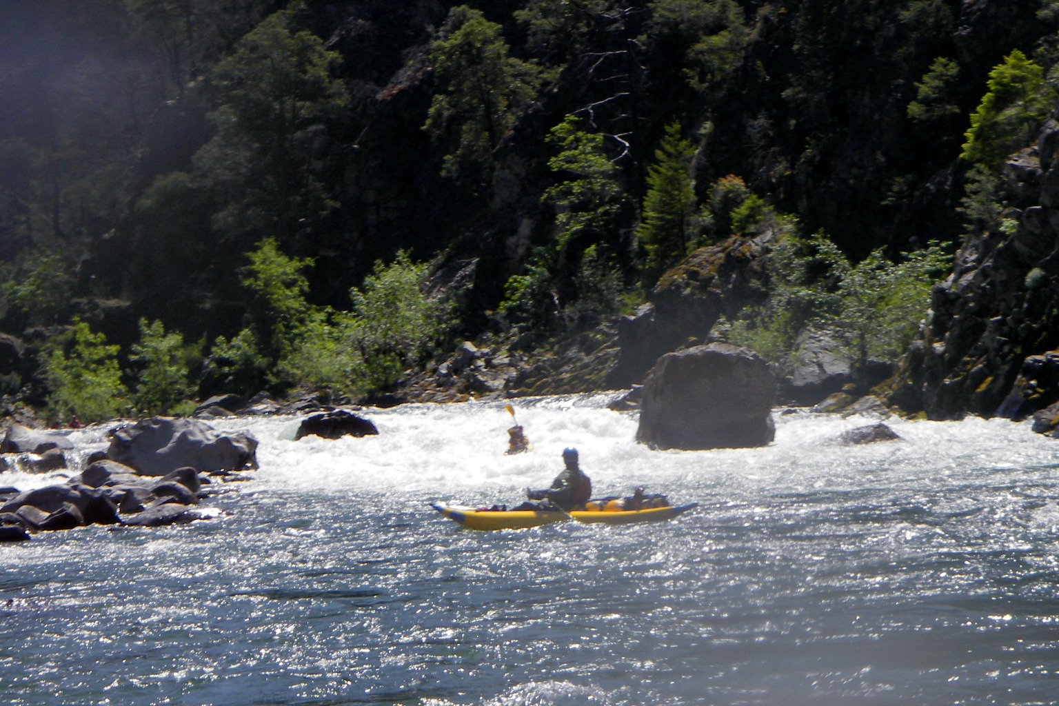
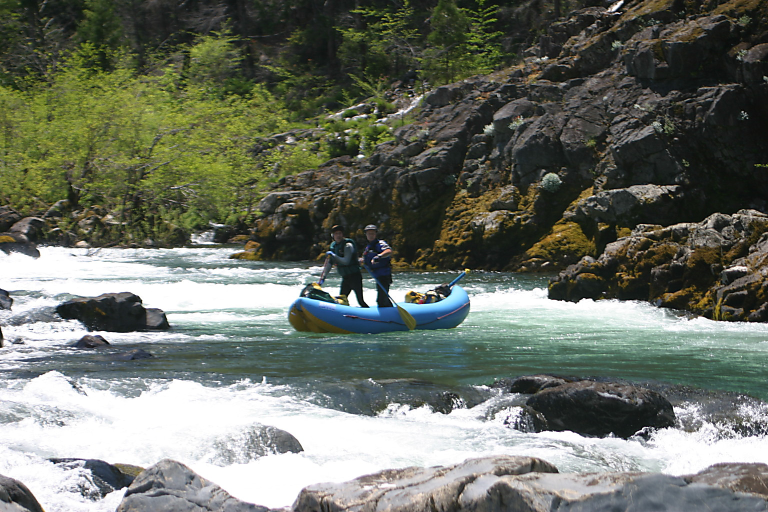
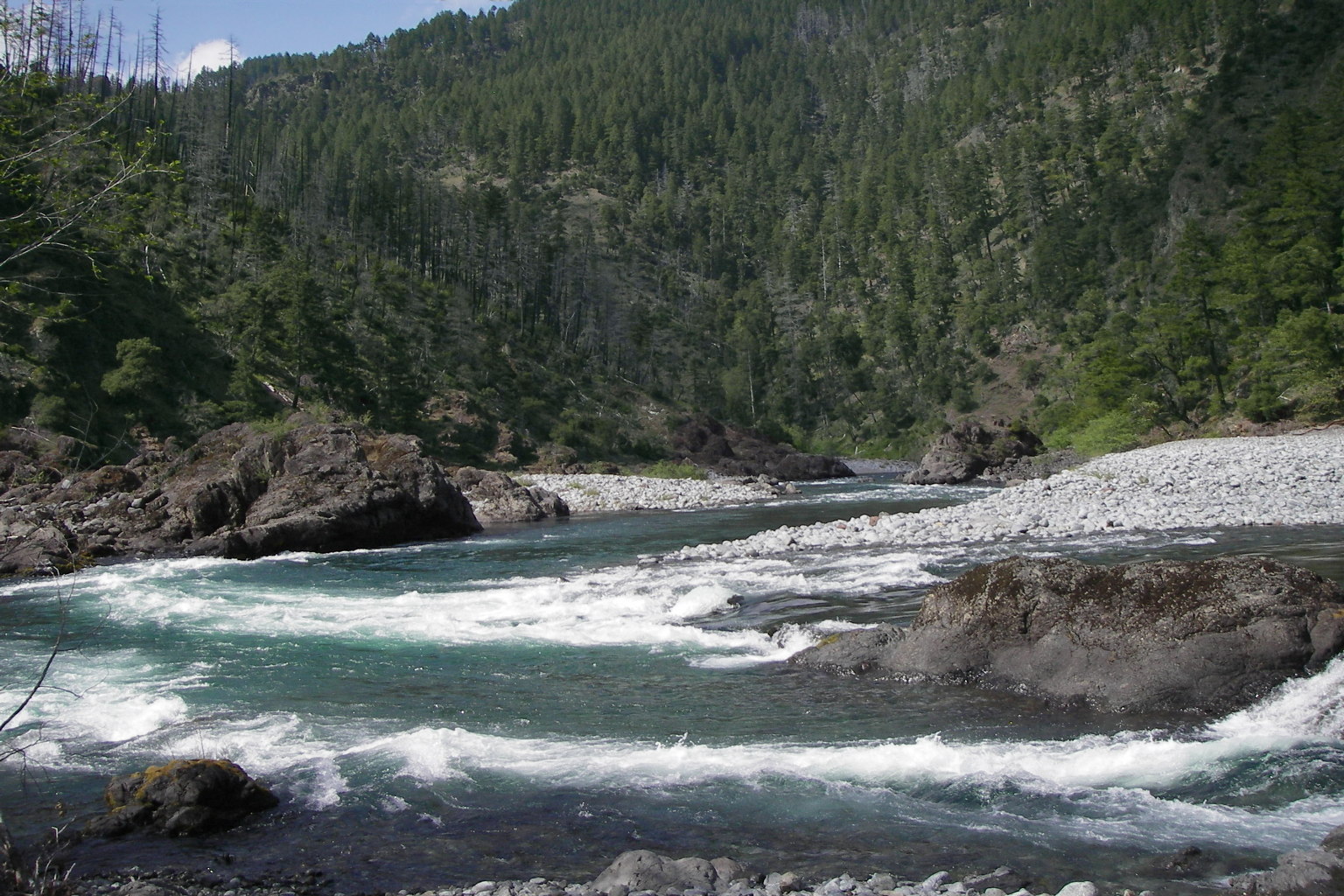
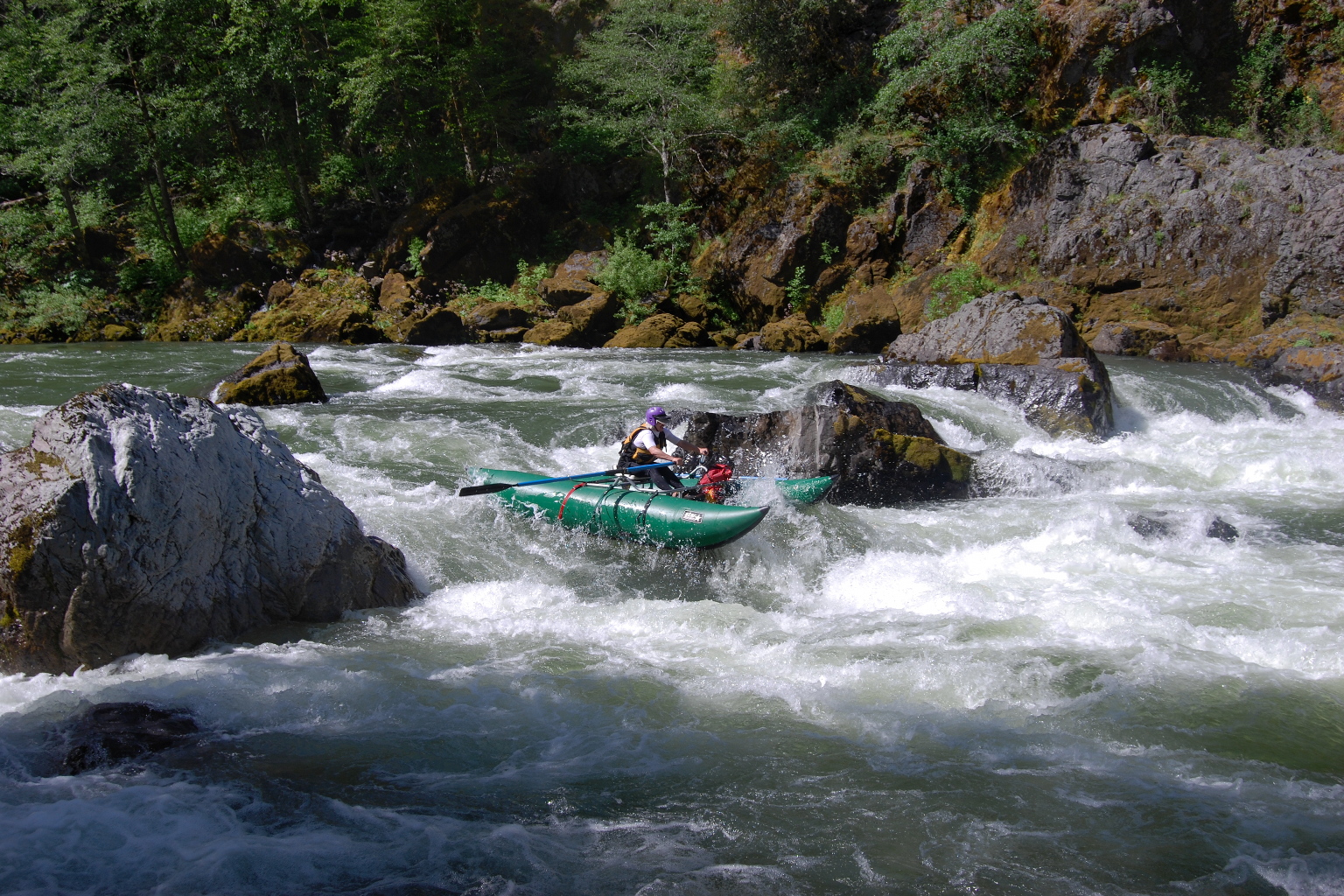
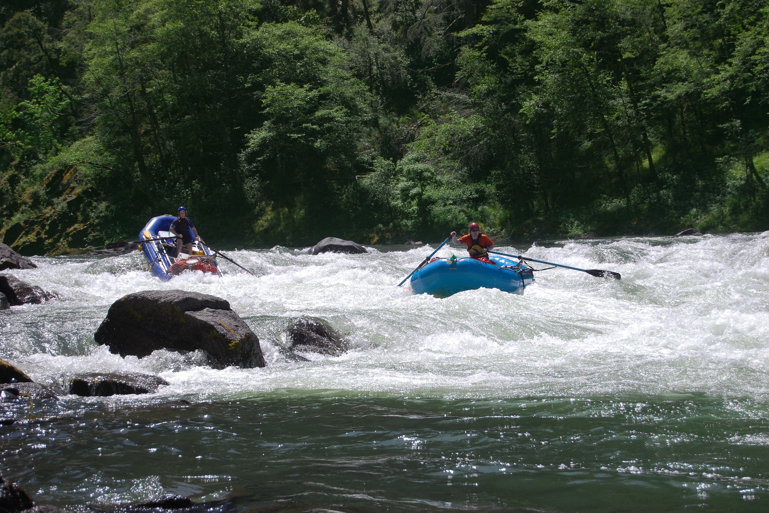
The Illinois is a total classic.
You have to be a good boater to run it, but at optimum flows
this must be one of the best river trips anywhere on earth.
Despite the name, it is located in southwest Oregon,
largely in the Kalmiopsis Wilderness.
Wilderness designation is no joke – some sections of this river
are not accessible even by hiking trail.
Scenery is good, though somewhat marred by the 2002 Biscuit Fire.
Camping and whitewater are phenomenal, especially in the middle.
The Kerby gauge is 15 miles upstream,
so the flow you get is always more than the gauge reading.
Flow at take-out is usually 2-3 times higher than at put-in.
This is because (cough) sidestreams add considerably to the flow.
Do not start your trip when significant rain is in the forecast.
The Illinois has a large drainage and can rise quickly overnight,
leaving you stranded, or a possible rescue victim.
Plan your trip using these weather links:
You can put in further upstream at several points.
Class VI Illinois Falls makes it inadvisable to start your trip at Kerby.
The most popular alternate put-in is McCaleb Ranch,
about 4 miles upstream of Miami Bar, and shortly downstream of Illinois Falls.
- mile
0
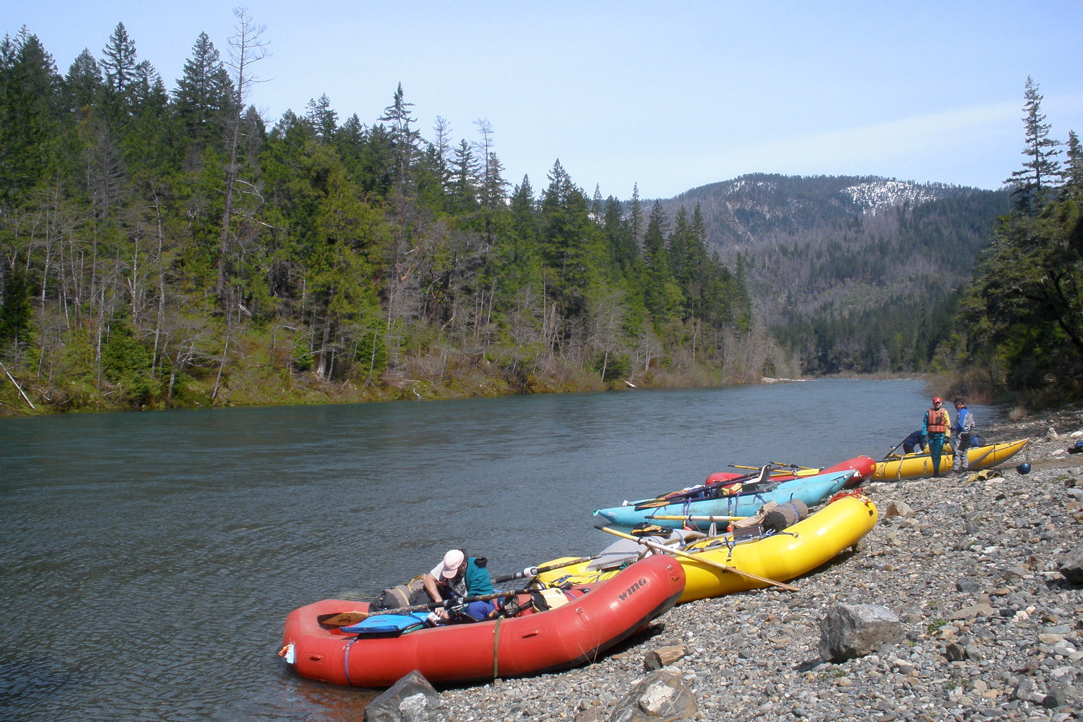
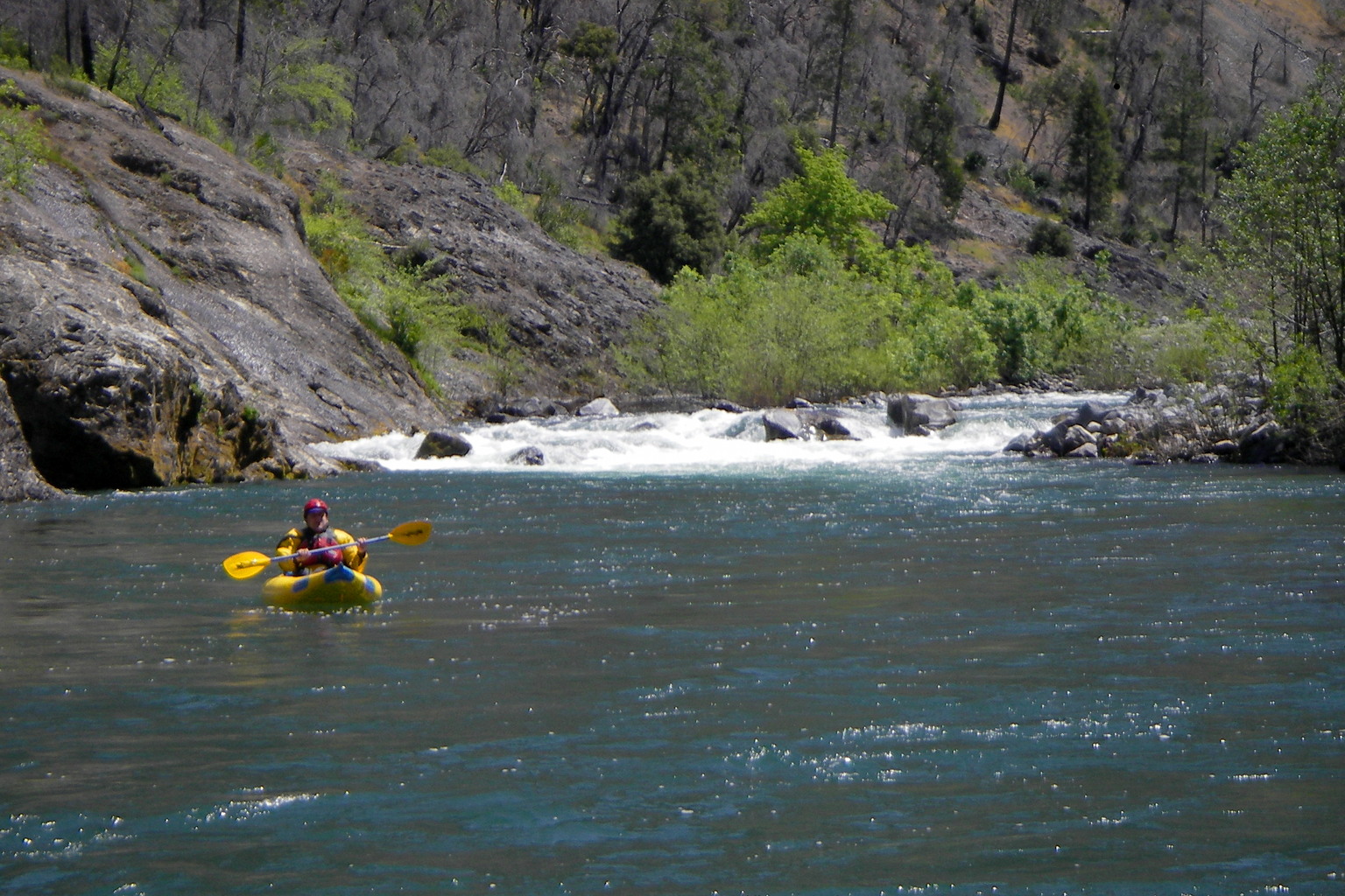
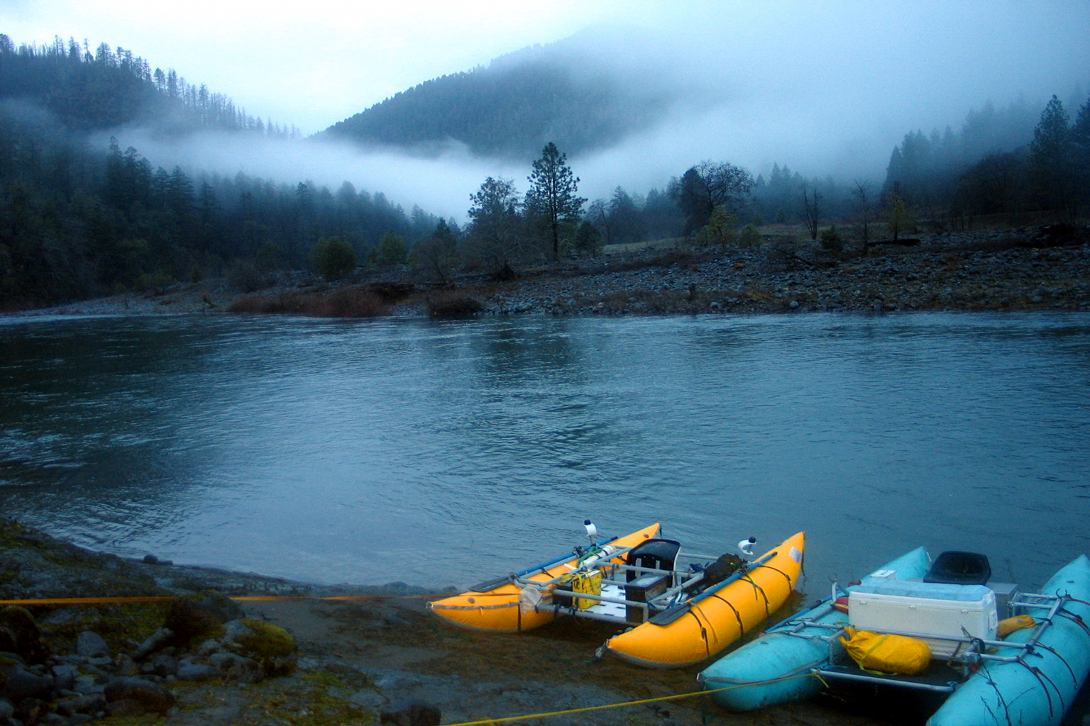
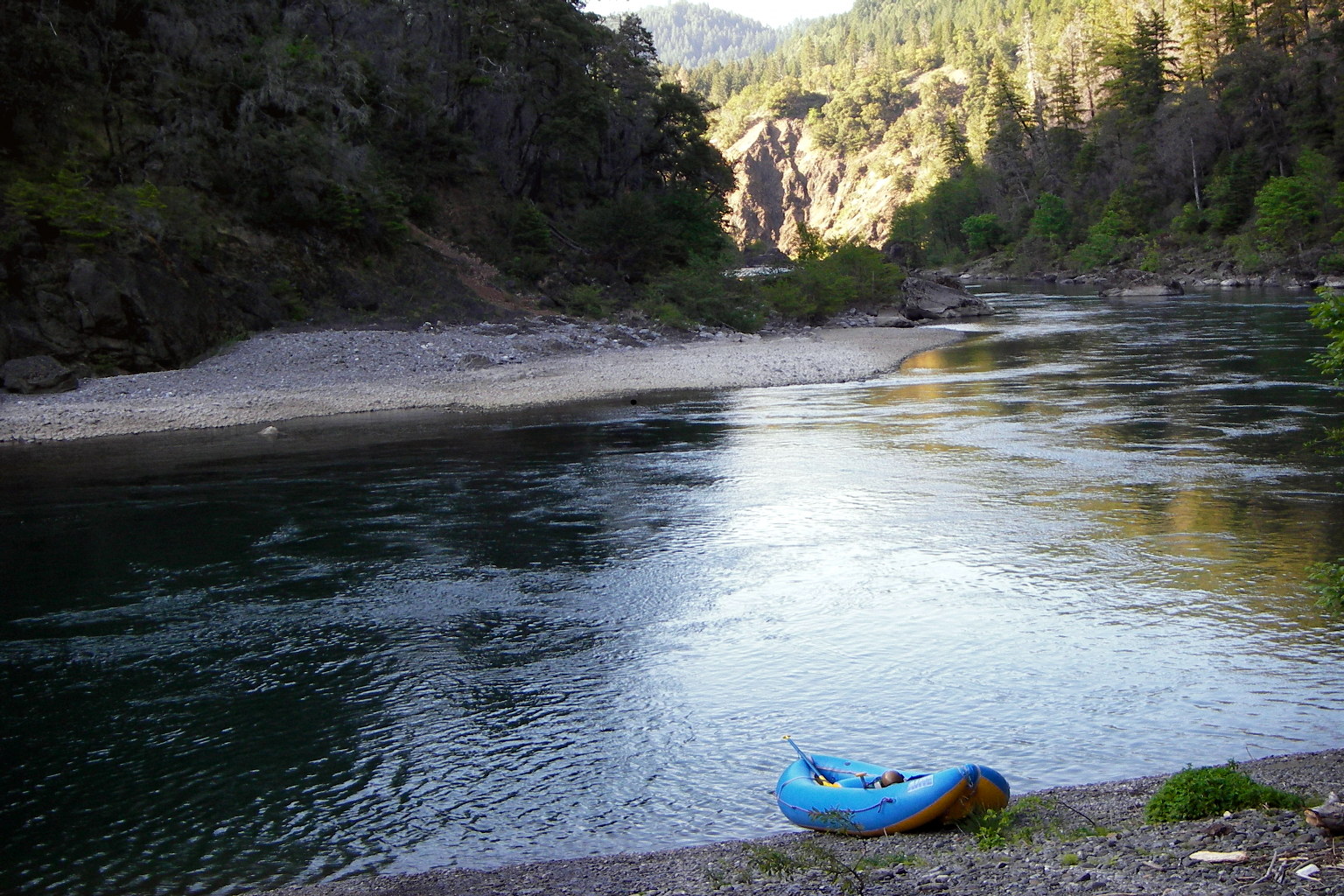
- Put in at Miami Bar, where a side-road slants down to a gravel beach.
No running water, but an outhouse is situated above the high-water mark.
Boaters are allowed to camp on the beach, or on a wooded promontory
about half a mile downstream.
- .5
- Class II rapid near the mouth of Baker Creek on the left. Choppy
water continues for a distance, followed by a stretch of flatwater.
- .9
- Waterfall from a cliff on the right, with houses of Oak Flat
sometimes visible above.
- 1.5
- Last residences you see along the river, although the road continues.
More flatwater. Around a bend, dead trees from the 2002 Biscuit Fire
become visible, and remain so for the entire trip.
- 2.5
- The biggest rapid so far, though perhaps not quite class III.
Briggs Creek, a major tributary, comes in on the right.
Road ends, but a trail follows the river on the right side
all the way to Pine Flat. Another stretch of flatwater.
-
- 2.9
- Panther Creek enters from the right, about 50 meters before
a relatively long and technical class II+ rapid.
This announces the beginning of a series of significant,
closely spaced rapids. Start counting, with this as the 10th rapid.
- 3.0
- Number 11, class II+, go right of a boulder field on left.
- 3.1
- Number 12, class III, avoid camel humps in the center.
- 3.2
- Number 13, class III, midstream boulder at a left bend.
- 3.3
- Labrador Creek, class III
Labrador Creek enters on left, before a long straight-away rapid.
Kalmiopsis Wilderness begins just downstream, unmarked.
- 3.7
- Nome Creek, class III
Nome Creek enters on left, above a drop with rock wall on the left.
This rapid, number 15, has .3 mile of calm water above and below.
- 4.0
- Number 16, class III, a boulder-bar shelf at the top and bottom.
- 4.1
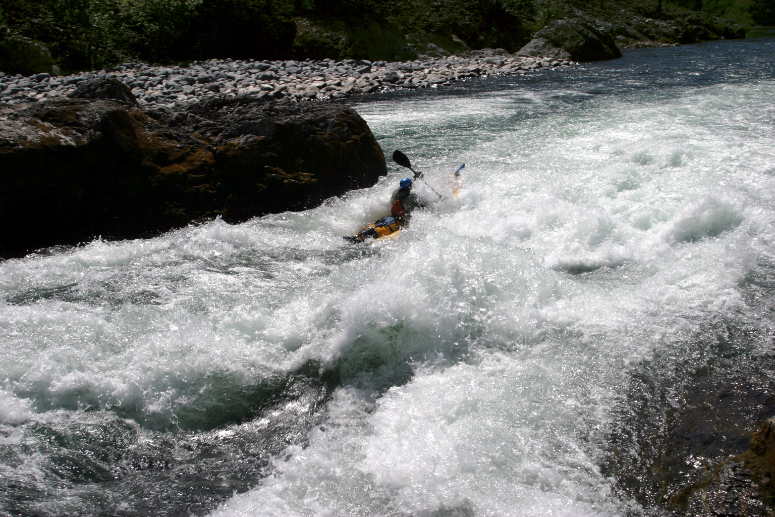
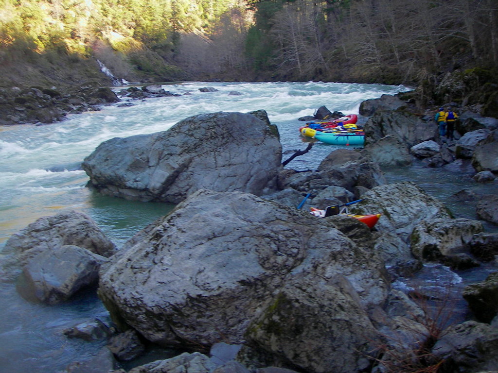
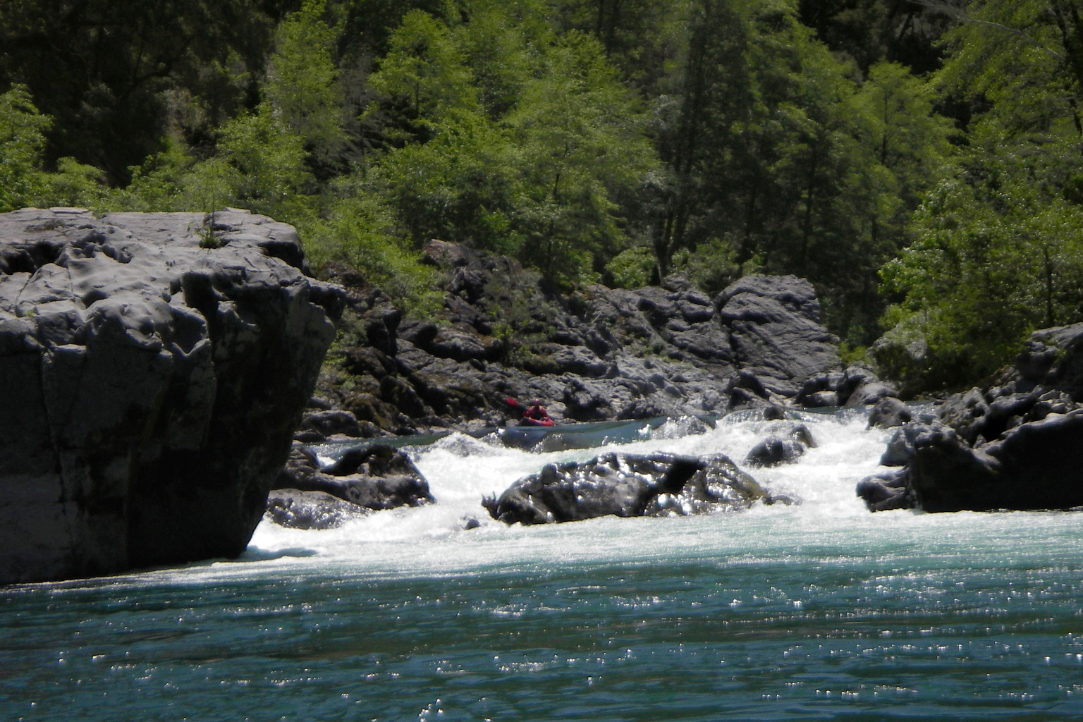
- Number 17, AKA Rocky Top, class IV
This rapid seems to cause more trouble for first-timers than any other.
If you forgot to count rapids, you can recognize this drop
by a big boulder sticking up above the horizon line on the left side.
At most flows you must enter left of center lined up with the boulder,
wait to clear some guard rocks, then work quickly right.
Low water is difficult because the passable channel is narrow.
Medium water is more difficult because entering too far right
can push you leftward into the boulder. Many rafts flip here.
High flows offer a possible sneak route to the far right.
This is called Number 18 in the Quinn Quinn & King book.
- 4.2
- False York Creek, class III
This looks a little like York Creek Rapid half a mile below,
but follows Number 17 very closely and is not as difficult.
Go right of a boulder bar and be ready for a drop at the bottom.
This is one of three rapids that get boney at low flows (below 800),
the others being the boulder fence near the top of Green Wall,
and the bottom left exit slot at Submarine Hole.
Two class II rapids follow False York, evenly spaced.
- 4.8
- York Creek Rapid, class IV
So named because York Creek enters on the right above the rapid.
You can scout this from above by standing on rocks near the left bank.
At lower flows you could get good photos by landing on a rock island
halfway down. Although there are many interesting choices here,
the easiest route is to enter left of center, somehow drop into the
deep-water channel against the left wall, perhaps over a fence drop
at low flows, and avoid or run the big holes halfway down and
on the left side at the bottom. Big pool below.
-
-
-
At high flows much of the water filters over the boulder bar, so holes
in the left channel do not enlarge as much as you would think.
-
- 5.3
- Mossy Left Bank, class III+
Big holes left and center, where the current pushes you into the wall.
-
- 5.5
- Clear Creek, class IV
Guidebooks say to scout left, but it is possible to scout right.
Long class II-III lead-in with the business end at the bottom.
At low flows and high flows, stay slightly left of center,
enter the lower section in the center, and exit either mid-channel
or near the left bank. At flows in the mid 2000s, the right side
is perhaps the best route. At most flows kayaks can choose
routes on the far right, if those routes look safe after scouting.
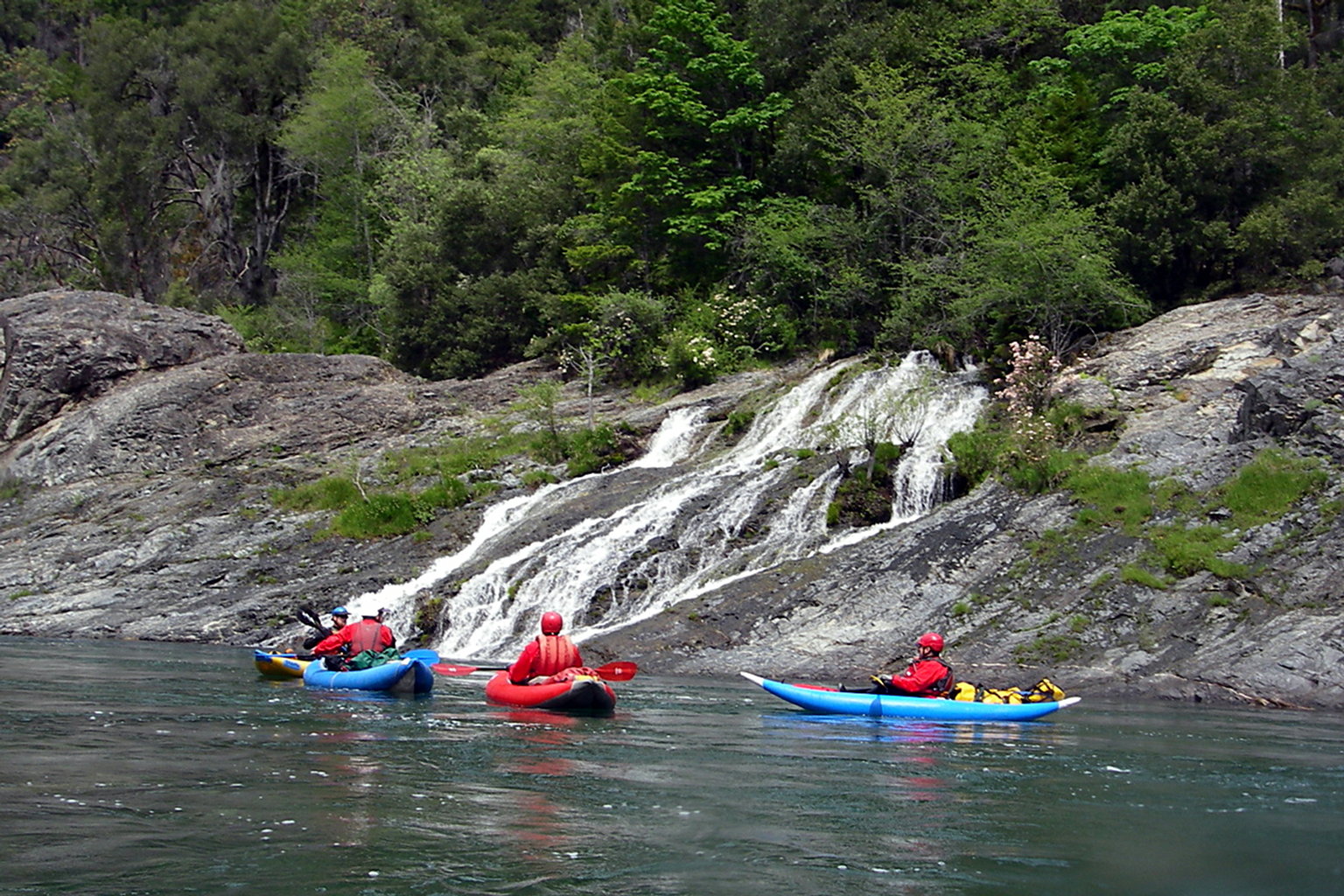
Clear Creek enters in a beautiful waterfall shortly below the rapid,
and the river becomes mellow for a distance.
-
- 6.1
- Finally, a sequence of unnamed rapids spaced about .1 mile apart:
class II, class II, class III, class III, class II.
- 6.9
- After about .4 mile comes another class III, into the left wall
where a creek enters. A mile of relatively placid water follows,
as the canyon opens up into Pine Flat.
- 7.9
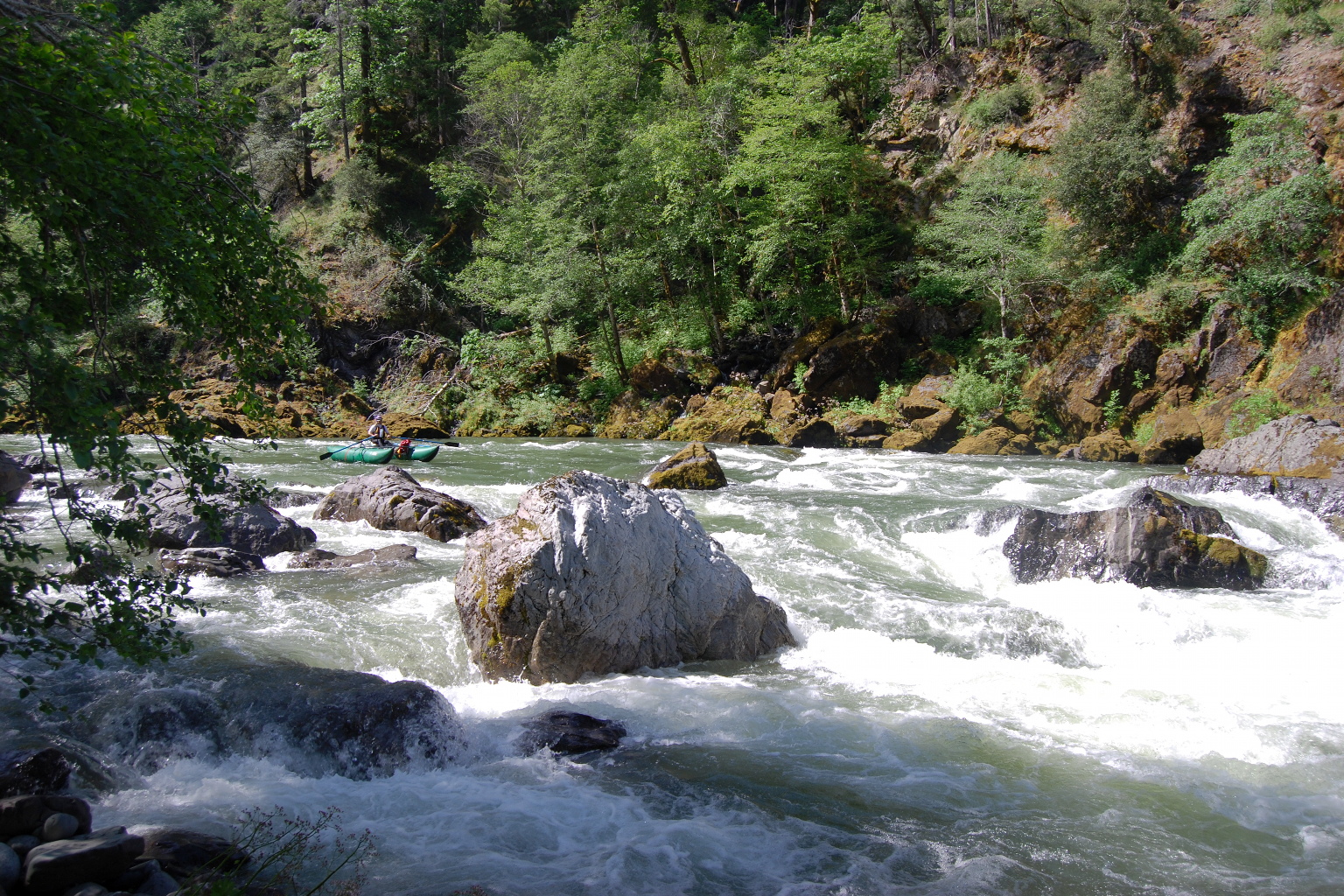
- Pine Creek Rapid, with Boat-Eater, class IV or II+
Pine Creek enters on the right, where backpackers sometimes camp.
You should decide your approach early, because the rapid begins
with a shallow boulder bar, making it difficult to change course.
The left side of a big boulder is relatively easy and low-risk.
The famed Boat-Eater is on the right side of the big boulder.
You can scout from the right bank if you elect to run Boat-Eater.
At some flows it is difficult to run the center hole without flipping,
although sneak routes circumvent the hole on left and right.
-
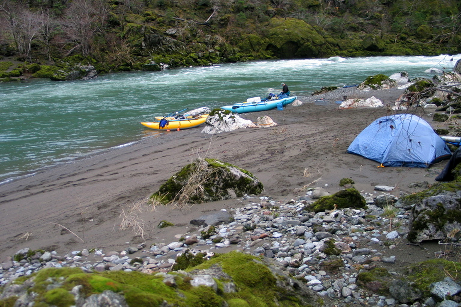
- 8.0
- Beautiful camp under pine trees on the left bank.
If a large amount of rain falls unexpectedly while you camp there,
consider crossing to the right, tying up your boats, and walking out.
If the flow hasn't come up yet, but you predict it will, start early
and get below Collier Creek (mile 21.7) before dark.
- 8.2
- Flat on the left bank ends, but not on the right bank,
where historic Weaver Ranch is located, well back from the river.
Occasional minor rapids in this section. If the aforementioned
pine-tree camp is full, several camps are available on the right.
-
- 8.9
- Florence Creek enters on the right, marking the end of Pine Flat.
- 9.1
- Boulder-bar class II rapid with deepest channel on the far left.
Landslide below with red soil and red chert boulders.
Only a few small rapids in the next .8 mile.
- 10.0
- Klondike Creek rapid, class III
Klondike Creek enters on the left just as the rapid begins.
This medium-size campsite is a challenge to reach at high flows.
Klondike Creek rapid intensifies at a sharp right turn.
More rapids appear, minor at first, for half a mile.
- 11.0
- After half a mile of calm water and a minor rapid,
a small stream enters on the right.
Shortly below, a stream cascades from the right bank,
followed by right-curving rapid with big rock on the top left.
- 11.4
- Series of three rapids after a creek enters on the left bank:
easy, easier, and harder. Below the harder third one, a class III,
a waterfall appears on the left.
- 11.7
- Mike's Nemesis, class IV
Recognition: at a right bend you see a cliff with white striations.
The steep cliff makes scouting difficult. Several midstream boulders
obstruct the flow and the river drops about 8 feet. Especially at
high water, it is easy to flip here. The best route is to enter center,
avoiding guard rocks on the right, and work right to avoid major holes.
This is called Number 51 in the Quinn Quinn & King book.
- 11.9
- Frequent minor rapids for over a mile.
In this section Sulphur Creek enters on the right.
- 12.5
- Deadman's Bar begins on the right and continues for .4 mile.
Excellent large camp, but high above the river.
Watch for poison oak on the uphill trails.
A small stream at the lower end provides drinking water.
- 12.9
- Rapids intensify, with a class II-III drop every .1 mile or so.
Many small creeks enter in this section, as the river bends left
(southwest) around South Bend Mountain.
- 15.8
- Lull in the rapids after a creek comes in on the left.
- 17.1
- A small creek enters on the left, where the river bends right
after its detour around South Bend Mountain. Tin Cabin Pass up higher.
Gravel-beach campsite (Red Rock Bar) on the right just after the bend.
- 17.6
- Pre-Prelude, class III
After a long slow stretch, you see rock slides on both sides,
and fallen boulders in the river on the right side.
- 17.8
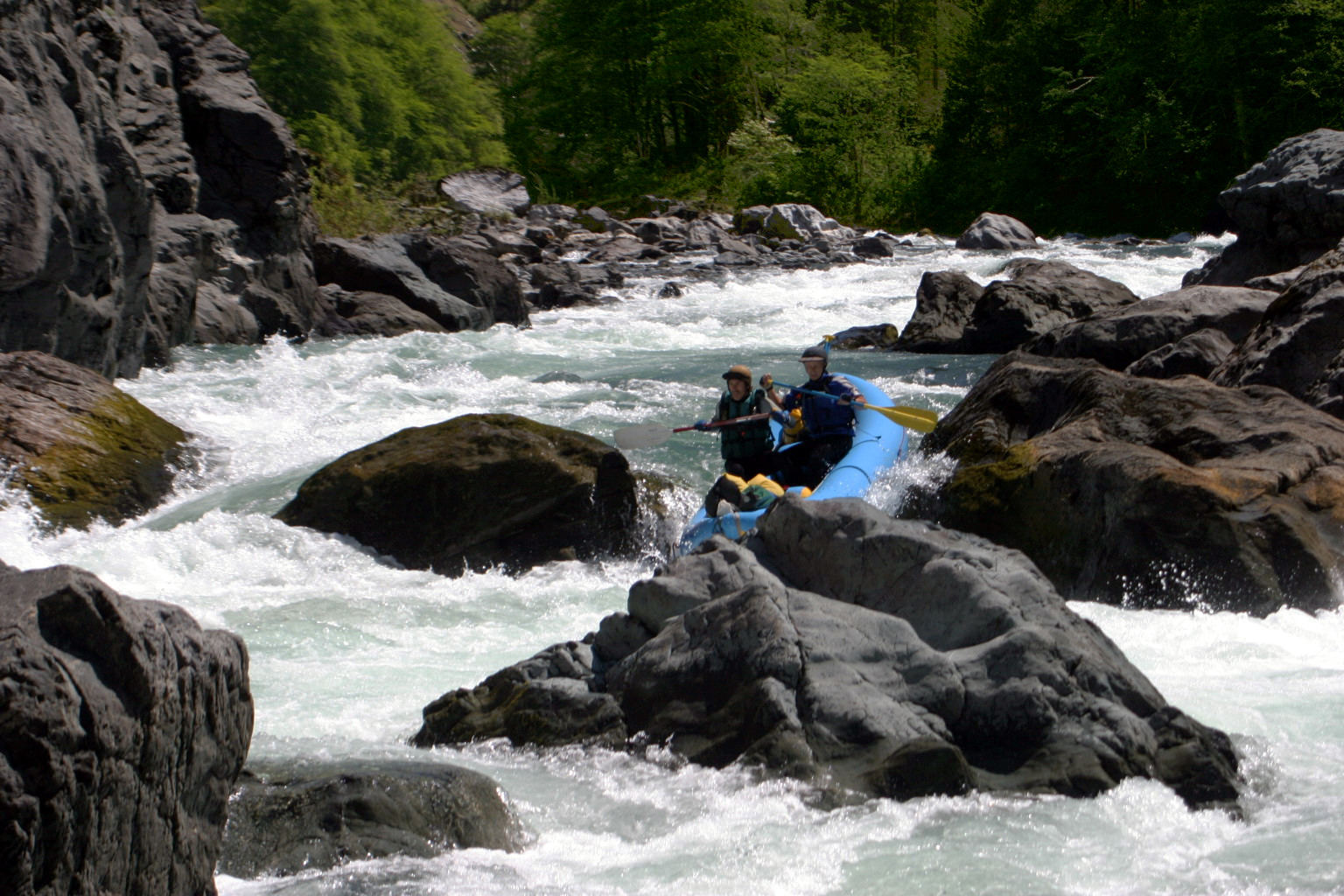
- Prelude, AKA Fawn Falls, class IV
A long boulder-bar rapid leads to a sharp final drop. Start left.
If you want to scout the falls, pull into the eddy where a small stream
enters on the left. If you want to scout the so-called sneak route,
stop well upstream and walk down the right bank. At the bottom,
the far left channel is a falls. Other slots in the final rock fence
might be considered sneak routes, although the oft-recommended slot
on the far right has changed in recent years, and might be one of
the hardest routes at certain levels. See the pictures below.
Green Wall, the crux of this Illinois trip, is .2 mile downstream.
-
- 18.1
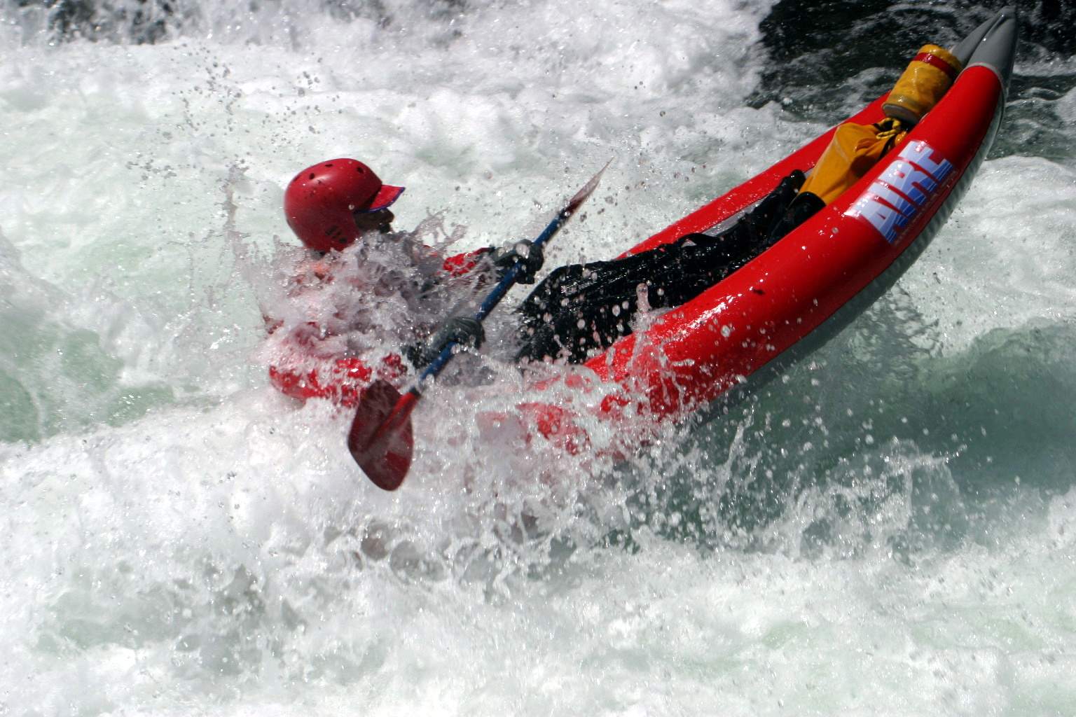
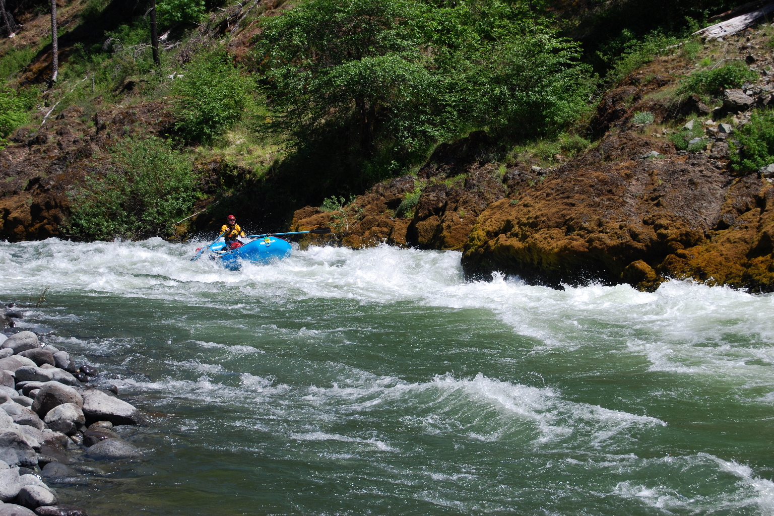
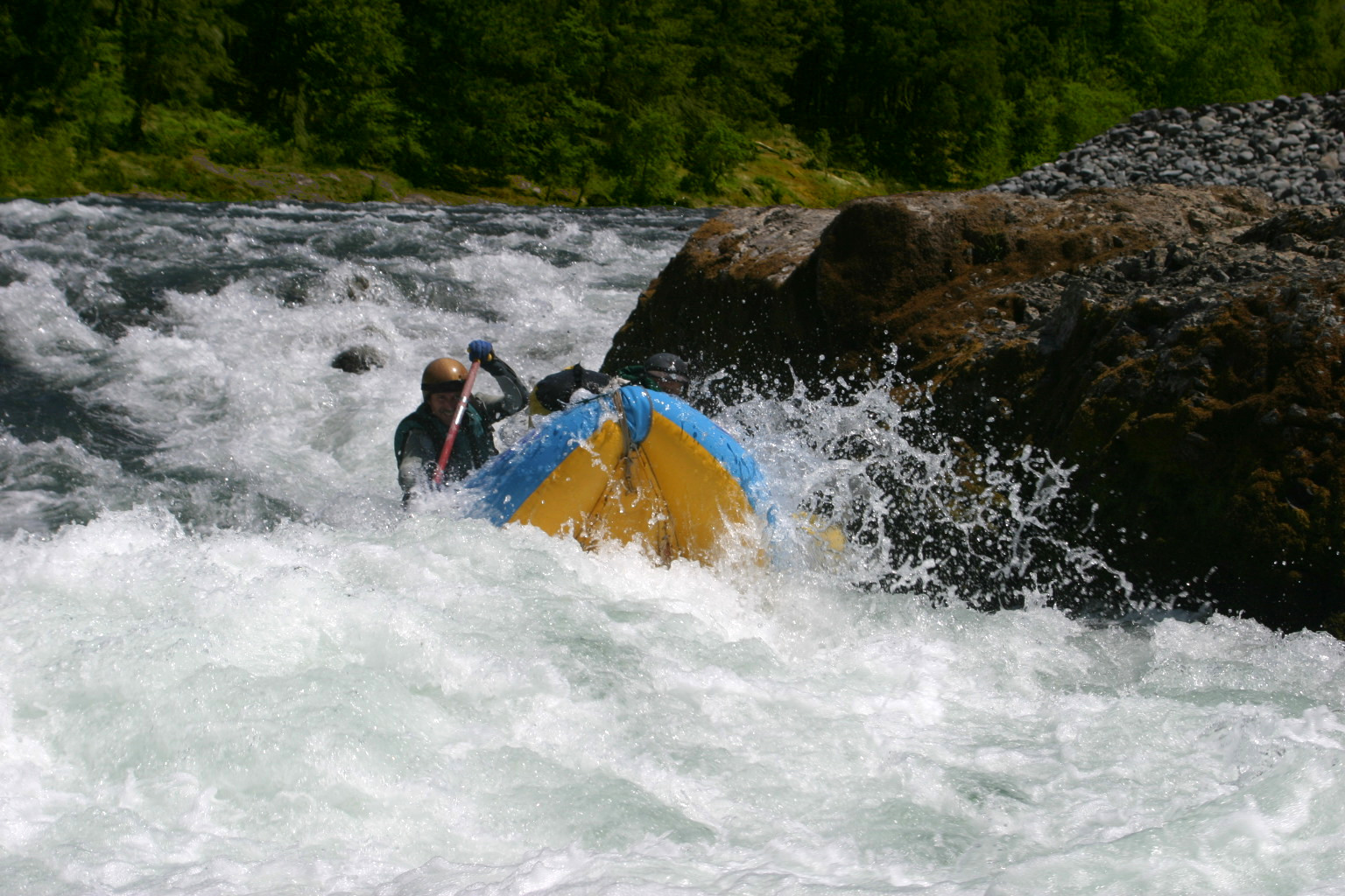
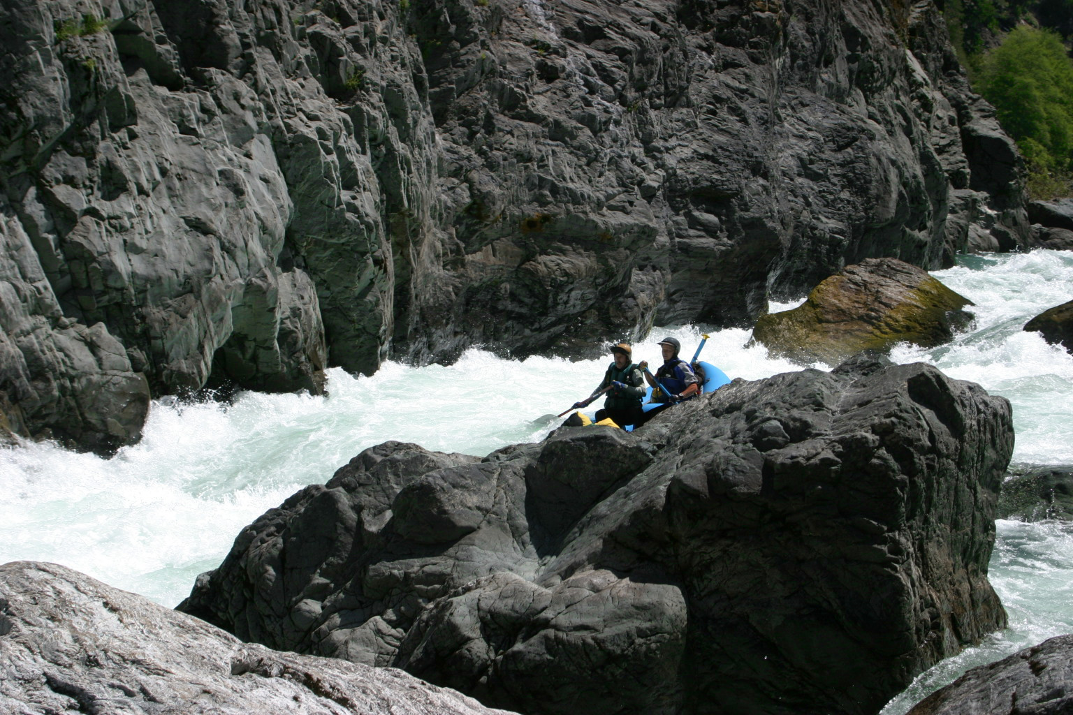
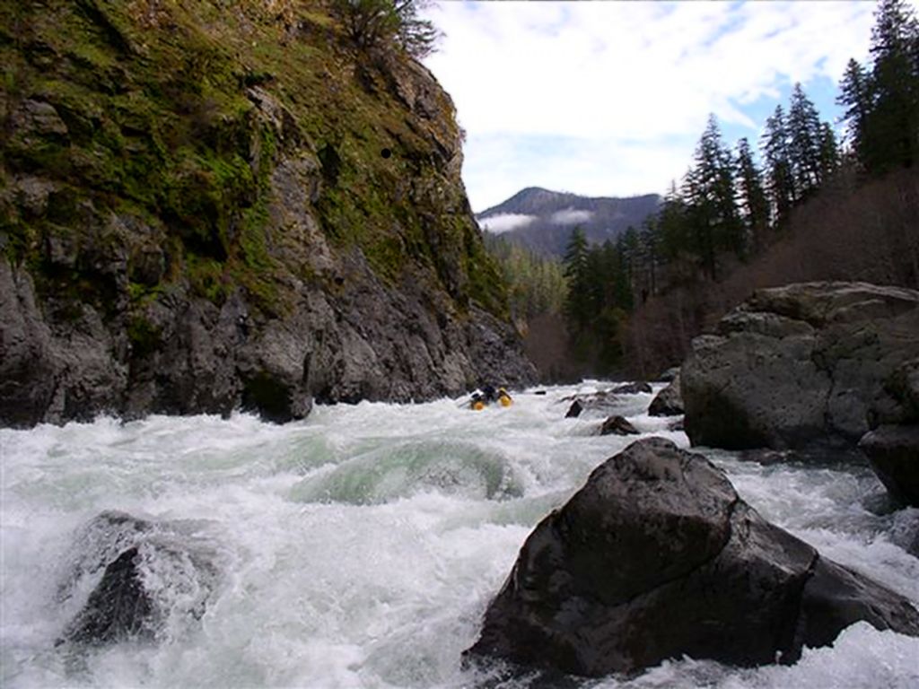
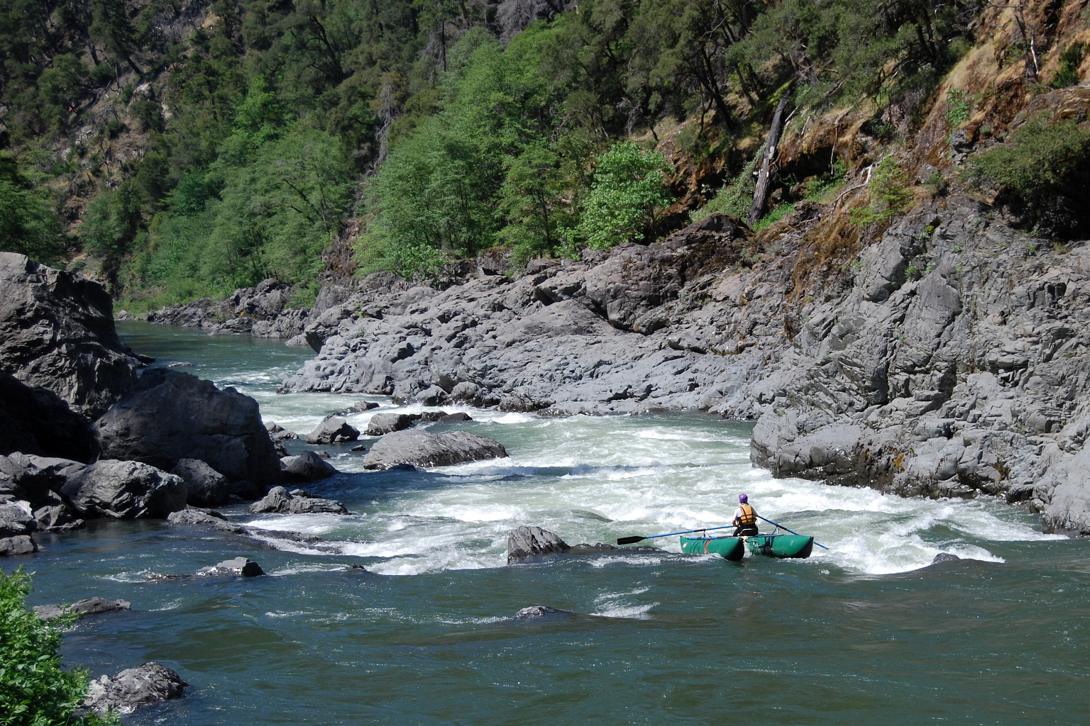
- Green Wall, class V, scout left
A long right-curving class III begins this very long rapid.
At low and moderate flows most people scout from a small eddy
on the left, between the class III and following class V section.
First-timers might want to stop above the class III to scout,
and perhaps set safety to help them attain the eddy.
At high flows, everybody might want to take this approach.
Preferred routes change according to flow and rock movement,
so scouting at least the bottom section is virtually mandatory.
The most dangerous features are the huge hole at the top right,
and a rock cluster or hole near the bottom, called Harvey.
At most flows the safest route starts on the left
to avoid the first hole, and moves right (almost against the wall)
to miss the rock cluster or hole, and finally away from the wall.
Many other routes are possible especially at high flows.
At flows below 800-900 (Kerby gauge) only small rafts can pass
thru the 3rd slot from the wall where the biggest hole develops,
and this is a gating factor for rafting, although at these flows
you could probably run the 2nd slot without major problems.
Portaging on the left side is possible but difficult.
-
-
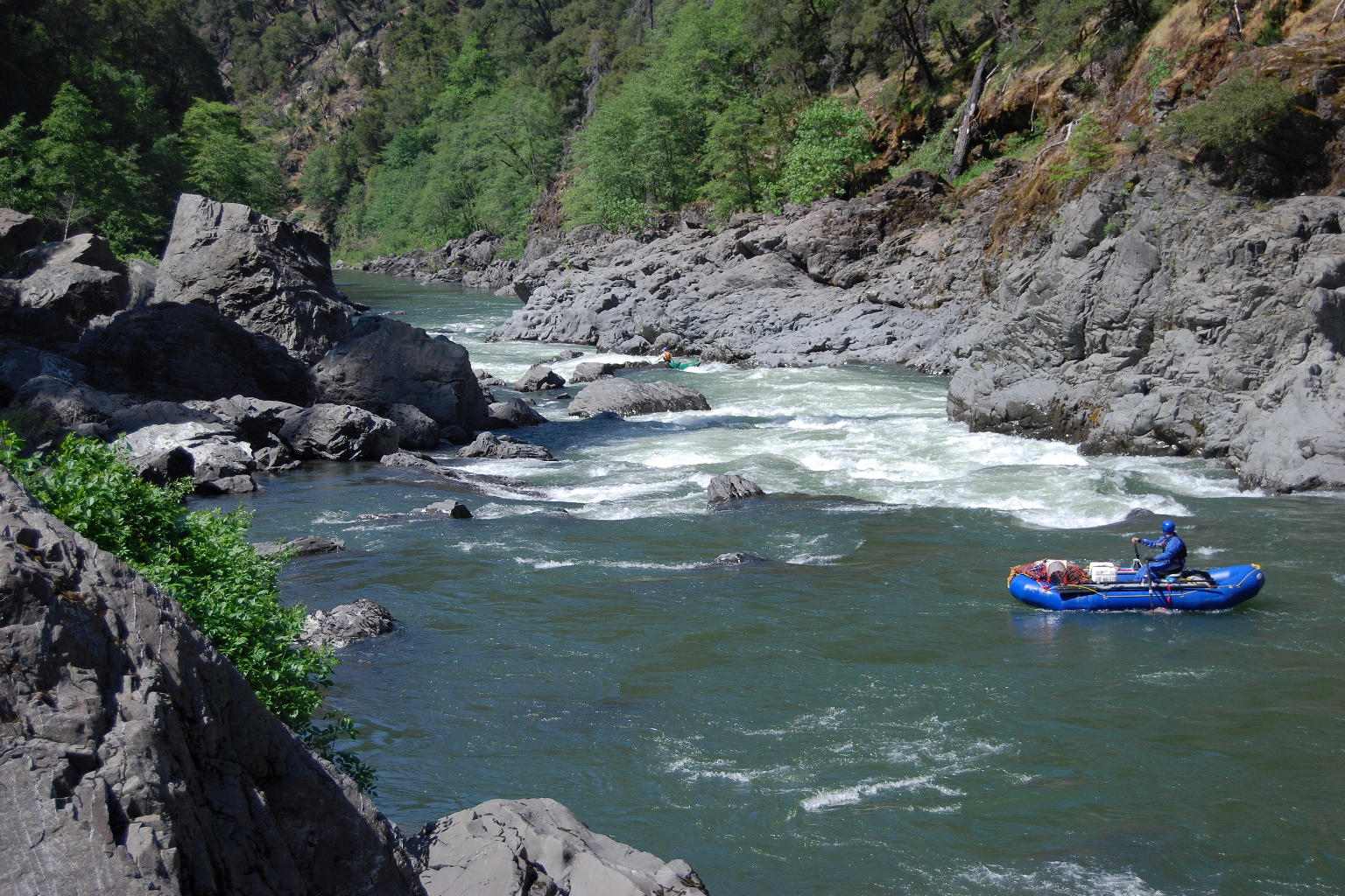
- At moderately high flows, most boats start on the left and run the 4th slot.
Working back to the right is quite difficult because of the guard rocks
you see here, especially after gaining momentum dropping thru the slot.
This fact sometimes encourages large boats to risk running the 3rd slot.
These pictures were taken with the Kerby gauge reading around 2500 cfs.
-
- At high flows, entering on the left to run the 4th slot becomes more mandatory,
as the 3rd slot is likely to flip boats and the 2nd slot becomes a deathtrap.
However working back to the right becomes a bit easier as the guard rocks
are covered over and resulting hydraulics help slow you down. Going far left
over the rock cluster at the bottom (Harvey) is possible but not recommended.
These pictures were taken with the Kerby gauge reading around 3000 cfs.
-
- 18.3
- There is a short pool at the bottom of Green Wall, unfortunately
not large enough for unassisted recovery. Throwbags are advisable
for the first boat. Two class II rapids follow, then a short lull.
- 18.8
- Little Green Wall, class IV, possibly scout left
A large rockslide from the left has dammed up the river.
The route is hard to describe so the description would make sense
when you are confronted with the rapid. Other routes are possible,
however the standard route is left of a large midstream boulder,
quickly left of another large midstream boulder, between two
midstream boulders, right of the next large boulder cluster,
and quickly left to avoid another boulder.
-
- 19.0
- Whitewater Primer, constant class II-III
Closely-spaced rapids appear one after another for about 20 minutes.
John Garren's guidebook charts them as follows:
class II, III, III, III, III, II, lull, III, lull.
- 19.5
- Catatonic, class IV at high flows, 2 class III+ rapids at low flows
Run the first section starting left and moving center.
Run the second section starting center and moving slightly left.
At high flows, catarafts can flip if they go right at the bottom.
- 20.1
- False Submarine A, class III+
Enter left of center between two large boulders, and work far right.
Distinguishable because of a pine tree on the right (2008).
- 20.4
- False Submarine B, class III+
Enter left of center between two small boulders, and stay left.
Distinguishable because of alder trees on both banks.
- 20.7
- Pre Submarine, class III, starting with a cabin-size boulder midstream.
- 21.0
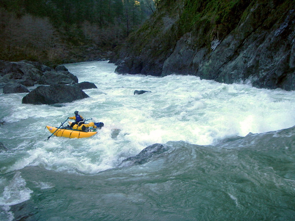
- Submarine Hole, class IV+, possibly scout left
Although this is a very steep, rocky rapid, the main difficulty
is a large plug rock at the bottom. At low flows
the passage between the left wall and plug rock is very narrow.
Below 800 cfs, rafts might need to deflate tubes to pass thru.
At high flows, the plug rock creates a monster reversal.
At low flows the best route is to enter far right, work left,
pass a big boulder on the right, and work extreme left.
At moderate and high flows, it is possible to enter in the center,
clear the big boulder, then ferry left.
Keep your boat straight in the narrows!
-
- 21.2
- Several rapids remain before Collier Creek.
The second is significant, class III-IV with three distinct drops.
At high flows it has a huge hole against the right wall that can
easily flip the largest rafts. Oregon boaters often call this one
Submarine Hole, because the real Submarine Hole gets easier at high flows.
- 21.7
- Collier Creek comes in on the left.
Excellent camp on the left bank shortly below,
but with steep access on bare rock.
Sandy beaches past this point.
Scenery becomes reminiscent of the Rogue river.
Most rapids are boulder-bar drops with big waves but easy routes.
- 25.2
- Three Waterfalls, scenery alert!
- 25.4
- Silver Creek enters on the right, with hiking bridge visible.
You could camp here on a high bench, but there is no kitchen area
near water level. A trail follows the right bank for two miles
downstream, but does not lead to take-out, instead going eastward.
- 26.1
- Class III rapid at a left bend, with nice Sandy Beach camp below
on the left. Gather firewood in advance.
-
- 28.4
- Indigo Creek enters on the right.
About .5 mile downstream, rock cliffs on both sides mark the site of
proposed Buzzard's Roost Dam, which would have flooded this entire run,
but was stopped by Wild & Scenic protection in 1984.
- 29.5
- Horsesign Creek, class III+
Above the rapid is a good campsite.
At some flows, this rapid contains the largest hole that you must run.
Below the rapid, Horsesign Creek comes in on the left.
-
- 31.3
- Class III rapid with midstream, above a large sandbar marked Lynch Bar
on the topo map. Good camp at the downstream end of the bar, with access
up a small unnamed creek to a large flat area. Gather firewood in advance.
Ethels Creek is shortly below.
- 31.6
- Dunbar Riffle, class II, below Nancy Creek.
This is the only rapid between Ethels Creek and take-out.
- 32.3
- Oak Flat, the take-out. Rest rooms behind a row of trees.
A dirt roads leads uphill to the paved road leading to Agness.
- 34.6
- Confluence with the Rogue river. No real rapids in this section.
Shuttle Directions
Shuttles can be arranged with Affordable Shuttles, 541-479-1042,
informational website.
You can also arrange shuttles with Galice Resort and other providers.
Prices vary according to which shuttle roads are snowbound.
Rates seem reasonable, especially if you consolidate vehicles.
To avoid snafus, be sure to have an extra key for the shuttle driver!
To reach put-in,
follow highway 199 south from Grants Pass 23 miles,
or north from Crescent City, to the small town of Selma, Oregon.
Just across the highway from the Selma grocery store,
drive west on Illinois River road, USFS 3504.
The pavement ends after a few miles.
About 7 miles from Selma, bear left and downhill.
It is about 9 more miles to Miami Bar.
To reach take-out (if you decide against hiring shuttle drivers)
reverse one of the directions below, depending on snow conditions.
If you arranged shuttle and find your vehicle at take-out,
drive uphill out of the Oak Flat parking area
and proceed downstream on a paved road to the Rogue confluence.
In early season when snow covers roads at low elevation,
turn left and follow signs to Gold Beach,
where you find highway 101.
Return to Grants Pass by driving south towards Crescent City,
taking the highway 197 shortcut (North Bank road) near Fort Dick,
and turning inland on highway 199 north.
The mostly-paved shuttle road south of the Rogue, used in summer,
is usually snowbound during Illinois season.
However in late season when snow has melted at low elevation,
you might be able to take the route north of the Rogue river.
This is how residents get to Marial (Rogue River Ranch) in winter.
Much of the way is dirt road,
but shorter distance makes the trip faster than 101 to 199.
Turn upstream (right) at the Rogue confluence, and proceed past Illahe.
Take USFS 33 north towards Powers.
Turn right on USFS 321, which becomes 32-8-31.
Pass 32-9-14.2 towards Marial.
Where 32-7-19.3 forks left to Glendale, bear right on 34-8-1,
which descends to the Grave Creek bridge before reaching Galice.
From there, drive east to Merlin and I-5.
To find nearby food and lodging, type Medford Oregon into the box and click Search.
|
|
Creeks Navigation
Home
Recommended Runs
Map of Rivers
Alphabetic Index
Alphabetic Table
Text Search
Sponsored Links
|