| |
| Stretch: |
Murphy near Nevada line to Bruneau Idaho |
| Difficulty: |
Class IV with one portage |
| Distance: |
almost 70 miles, 3 to 5 days |
| Flows: |
rafts and kayaks 800 - 2400 cfs, IK minimum 600 |
| Gauge: |
measured near take-out at Hot Springs
(USGS
site) |
| Gradient: |
continuous, 45 fpm on the Jarbidge, 27 fpm on the Bruneau |
| Put-in: |
confluence east and west forks of the Jarbidge, 4980' |
| Take-out: |
above diversion dams near Bruneau Idaho, 2580' |
| Shuttle: |
75 miles (2 hours) one-way |
| Maps: |
BLM Jarbidge Bruneau, AAA Idaho |
| Season: |
April into July, from snowmelt |
| Agency: |
BLM, USAF, private |
| Notes: |
© 1998 Bill Tuthill,
CreeksYahoo |
With fantastic basalt canyons often rising vertically out of the river,
excellent class III-IV whitewater at the beginning and end, compensatory
scenery in the middle, and wilderness hiking and camping at its best,
the Jarbidge-Bruneau offers one of the finest whitewater trips anywhere.
It is well worth the overnight drive across Nevada into southern Idaho.
Most kayakers and rafters stay off this river below 800 or 1000 cfs,
so if you visit in late June or early July,
when the 50-year average flow drops below 800,
you will have the river virtually to yourself.
Pack light (there is a portage) but prepare for emergencies,
because help is a long way off,
and the canyon walls are impenetrable in most places.
Jarbidge is a Shoshone Indian word for monster: they must have been
referring to class V+ Jarbidge Falls. Bruneau is French for brown water,
probably indicating the river color after rainstorms. Fortunately clarity
remains good during snowmelt season, but it is nonetheless advisable to
attach a prefilter to your water purifier (lots of cattle grazing upstream).
BLM regulations now mandate use of a port-a-potty.
These Idaho Snowpack
reports can be helpful in predicting duration of boatable flows.
- mile
- 0
- About two miles downstream from the town of Murphy there is a small
BLM campground with pit toilet just before a bridge over the river
Jarbidge. Put in below the confluence of east and west forks.
The water is green except after heavy rains.
-
- The narrow river is swift and continuous, but no rapids require
scouting until Sevy Falls at mile 16.5. Fallen trees, overhanging
juniper branches, and log jams are the principal hazards, requiring
a class IV frame of mind. A rudimentary trail follows the right
bank for several miles, providing an exit route in case of trouble.
- 3.3
- Columbet Creek enters on the left, although you might not notice
it until you have rounded the bend of its terminal moraine. The
gradient eases somewhat, but rapids are not perceptibly different.
- 8.5
- Dorsey Creek enters thru a canyon on the left. Just downstream is
a steep class III drop. Soon the tan basalt canyon walls steepen,
offering fantastic views of spires, cliffs, and hoodoos (topheavy
spires). It is hard to measure your progress because few definitive
landmarks exist in this section, and campsites are rare.
-
- 16.5
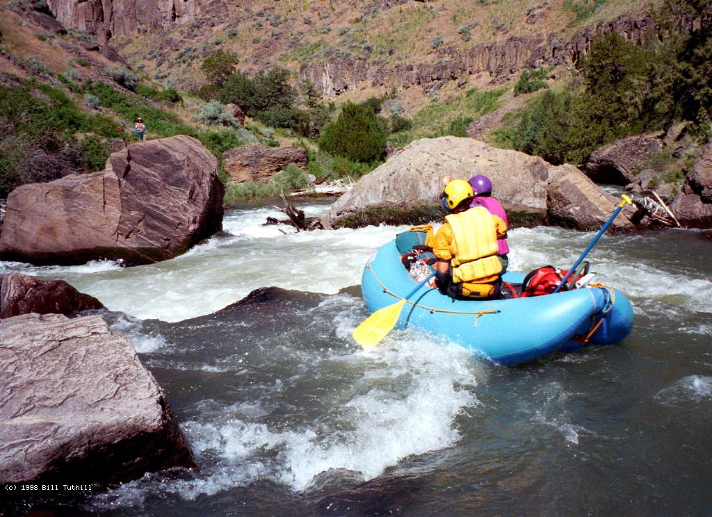
- Sevy Falls, class IV, scout right
A log jam (1998) forces most of the current right, where it drops
steeply into a lateral channel upstream of a big undercut rock,
flows across to the left bank, and turns downstream heading into
smaller rocks. At low flows, rafts have difficulty exiting.
Before running, check all channels to ensure they are log-free.
- 17
- Hazard! In spring 2009, a new rapid formed about half a mile
downstream of Sevy Falls. It was quite difficult that season,
and still changing. Photos © 2009 Doug Soule, at 600 cfs.
-
- 18
- Cougar Creek enters on the left. Excellent large campsite beyond
the mouth of the creek. Arch Canyon, with caves and natural bridge,
is a 3 mile hike up the creek.
-
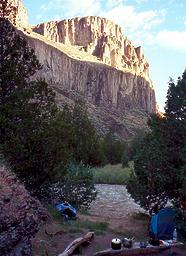 Evening sun on the mountain below Cougar Creek
- 19.2
- Poison Creek enters on the right. Fair campsite below the creek.
The poison ivy zone begins here, perhaps because the canyon walls
recede, allowing more sunlight to enter.
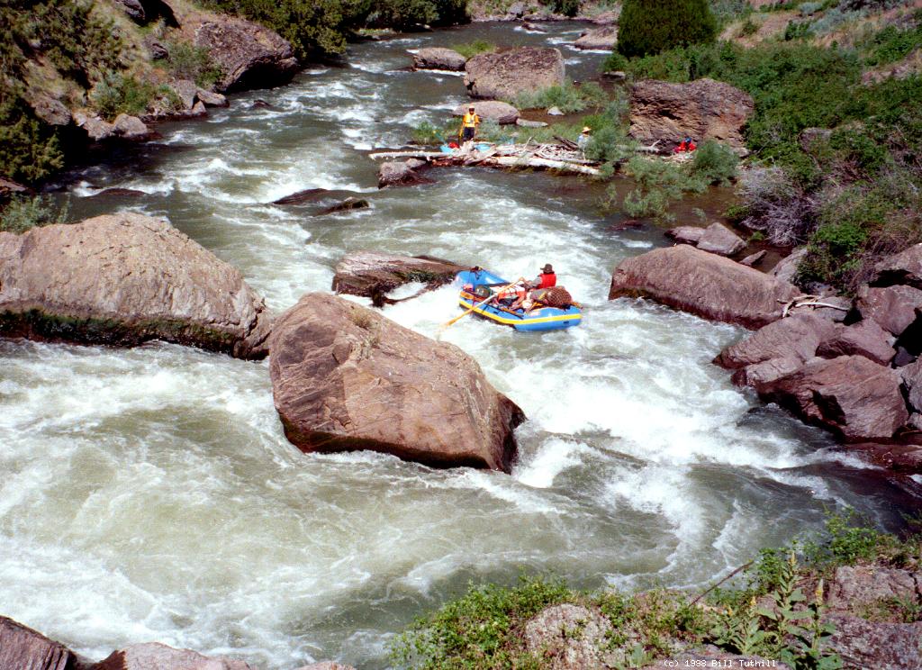
- 20.8
- Wally's World, class IV, scout right, possible left portage
Large boulders block your view of the river, emanating from slides
on both banks. The crux move is several drops down from the top,
involving a sharp falls and slalom around a large boulder to avoid
a tree-plugged chute (1998-2003). It would be wise to set rescue
here, because swift water continues below.
-
-
- Class III rapids, some containing large boulders, continue for
another 5 miles.
- 25.5
- Hazard! Jarbidge Falls, class V+, portage left
Watch for a large rock slide on the right bank and a house size
boulder in midstream. Do not boat beyond the boulder! Eddy out
on the right and send one boat at a time into the small eddy on
the left, where a good portage trail begins. The upper and lower
sections of Jarbidge Falls are runnable, but a drop about a third
of the way down is clogged with logs (1998). You needn't portage
the entire distance, because the runout is class IV, and partially
sneakable to the left of an island, except at ultra low flows.
-
- 26.5
- The gradient eases, the canyon opens up, and good small campsites
start to appear.
- 28.5
- Almost imperceptibly, the west fork Bruneau enters from the left,
ending your trip on the Jarbidge, which should be called the east
fork Bruneau. At recommended flow levels the west fork Bruneau
is rather clear, but it carries more silt than the Jarbidge, so
from this point the water becomes increasingly brown as it picks
up sediment deposited when the west fork contributes more water.
Juniper trees give way to willows and then cedars.
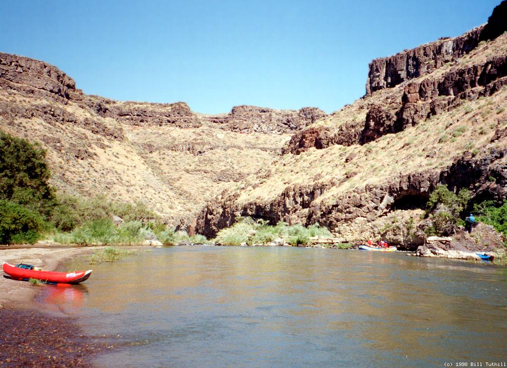
- 29.2
- A large gravel bar on the left with steam rising from waterfalls
streaming from the hillside marks Indian Hot Springs. The gravel bar
provides a huge campsite but lacks shade trees. On the other side
of a hot creek there is a white plastic spa tub with too-hot water,
and an old rock cabin, the former stagecoach station, further up
the hill. Just around the corner there is a rickety bridge and
a 4WD road leading up to the canyon rim towards your shuttle road.
The 4WD road on your side eventually leads to Rowland Nevada.
- 30.1
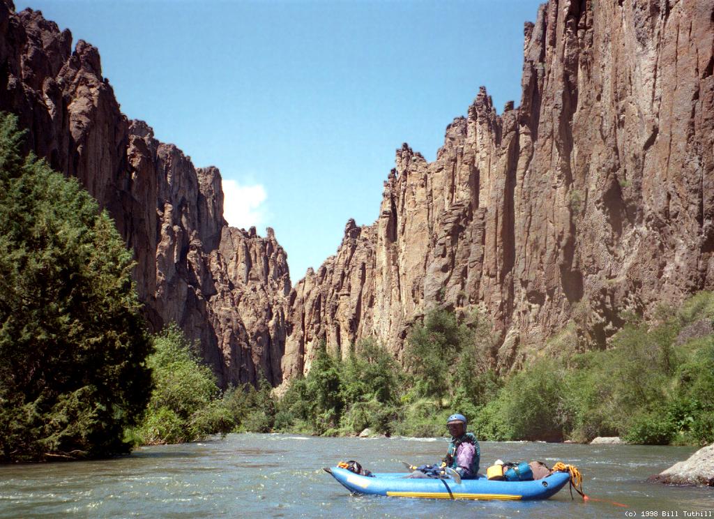
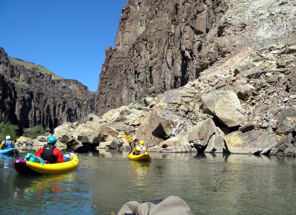
- The canyon walls close in and scenery improves markedly. High on
the right bank you can see an odd-looking building. Although it
seems impossible, the Bruneau canyons are even more beautiful than
the Jarbidge canyons, perhaps owing to reddish basalt. For the
next 36 miles, vertical walled canyons, often coming straight down
into the water, alternate with more open areas. However there are
some long stretches without any good campsites.
-
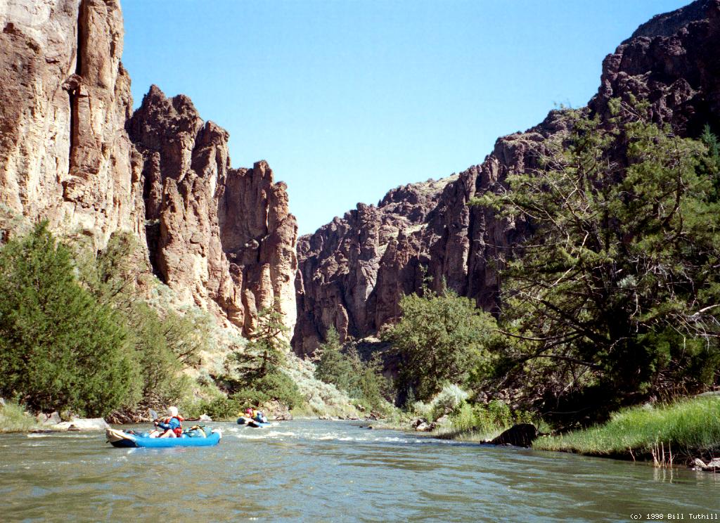
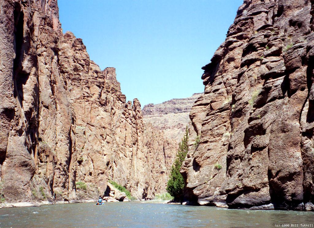
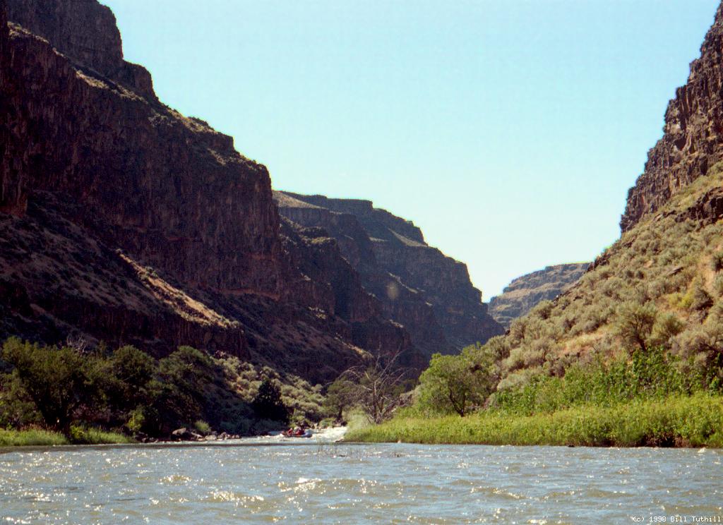
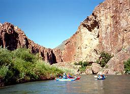 Near the top of Bruneau Canyon
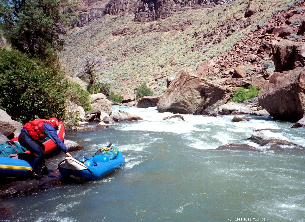
- 30.5
- Cave Rapid, class III+
The right channel drops straight down into a badly undercut cliff
with a large rock and logjam making the exit more difficult. The
avoidance maneuver is not difficult if you paddle hard. At higher
flows a chute against the left wall provides a sneak route (1998).
-
- 36
- Finally, a small but excellent campsite on the left bank.
- 36.5
- Cave Draw, a vertical walled side canyon, enters on the left.
What seems like a good small campsite is larger than it looks,
with many tent sites uphill.
-
- 41.8
- Sheep Creek enters from the left, apparently carrying as much
water as certain forks of the Bruneau, further destroying your
confidence in Idaho geographers. One half mile up Sheep Creek,
a steep trail climbs to the canyon rim. Large but virtually
treeless camp on the right bank across from the creek.
- 50.3
- Clover Creek, AKA the east fork Bruneau, enters on the right.
Fair campsite and interesting hiking up the canyon. Kayakers
have run this creek on occasion, taking out at Roberson Trail
to avoid running Five Mile Rapids at high water.
- 52
- Austin Trail on the left supposedly climbs steeply to the canyon
rim, although it is difficult to spot.
- 53?
- Excellent campsite with sandy beach on the right, just below the
entrance into a steep-walled canyon.
-
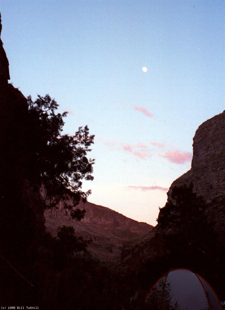
 Nearly full moon at sunset above dome tent
- 55
- A corner of the US Air Force bombing range overlaps the Bruneau,
so deafening overflights are possible here.
- 56.3
- Miller Water, a keyhole canyon opening narrowly onto river left,
makes a good side hike.
- 57.5
- Side canyon on the left, mostly dry, where the Roberson Trail
supposedly climbs to the west out of the canyon.
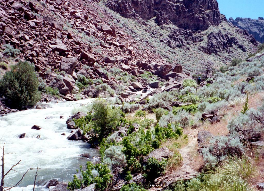
- 58
- Boulder-strewn side canyon on the right, mostly dry, where the
Roberson Trail climbs several miles to a dirt road intersecting
your shuttle route. Last chance to avoid whitewater, because
the gradient increases to 70 fpm for the next few miles. Kayaker
Kathleen Anderson, a lawyer for Esprit Corporation, died in May 1998
after taking a swim in this section.
- 58.5
- Five Mile Rapids, class IV
Immediately after a left bend, the gradient picks up and rocks
(holes at higher water) fill the riverbed. Five Mile is composed
of many class III-IV rapids with calm sections of varying length
in between. The Boneyard is a steep rock slalom. The Gates has
a boulder fence with narrow passages near the bottom. The Holes
contains two large hydraulics after a big drop. The Right Turn
is a long rock slalom at a right bend. The S Turn offers a route
all the way to the left and back again. The Left Turn is a long
and steep boulder slalom with a left turn near the end; it verges
on class IV even at low flows.
-
- 61?
- Although you are still technically in Five Mile Rapids, it no longer
seems like it. Class II and III rapids alternate with moving water
for the remainder of the trip, and there does not seem to be any
definitive end to the 5 miles. Cedar trees give way to cottonwood
and hackberry trees.
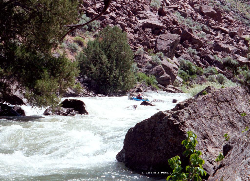
- 65.7
- Wild Burro, a long class III-IV rapid, starts innocuously as the
river splits around a low island. The route used to be on the left,
but now (2003) starts on the right and is quite rocky, so you might
want to scout on the right. Nice campsite on the right bank
just below this rapid, the last good camp before cattle country.
-
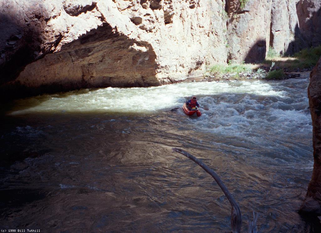
 Scouting and running the right entrance
- 68
- A canyon enters on the left. Over the next half mile, several
hot springs trickle from rock cliffs into the river. Partway down
there is a grotto with bathtub, marked by an eroded embankment
where you can park your boats on a tiny island.
- 68.7
- A take-out on BLM land where a dirt road approaches the river.
- 69.5
- A more convenient right bank take-out on private land, with gravel
beach and grassy boat ramp. Shuttle drivers prefer this take-out.
- 69.7
- Hazard! First of two diversion dams. In his guidebook
Utah Whitewater, John Nichols says the first is often run,
the second is not. Both look like drowning machines to me.
Before departure, call Jumbo's Auto Service in Bruneau Idaho,
208-845-2150, to arrange for a shuttle driver.
The fee in 2005 was reportedly $130 per vehicle.
To reach take-out, drive north from Elko Nevada on highway 225, which
changes to highway 51 at the Idaho border. Eventually highway 51 crosses
the Bruneau river below take-out, but above a reservoir, and reaches Jumbo's
Auto Repair (and Sinclair gas station) near the town of Bruneau. The dirt
road to put-in is just across the highway. Several miles up this road,
past the ranches of Hot Springs, another dirt road descends to the grassy
take-out described above.
To reach put-in, continue south on the original dirt road as it crosses
the USAF bombing range, intersects with several roads to the east rim of
the canyon, crosses Clover Creek, and finally reaches a paved road from
highway 93. Turn right at the T and descend to the river, past the town
of Murphy to the BLM campground at a bridge across the east fork.
|
|
Creeks Navigation
Home
Recommended Runs
Map of Rivers
Alphabetic Index
Alphabetic Table
Text Search
Sponsored Links
|
 Evening sun on the mountain below Cougar Creek
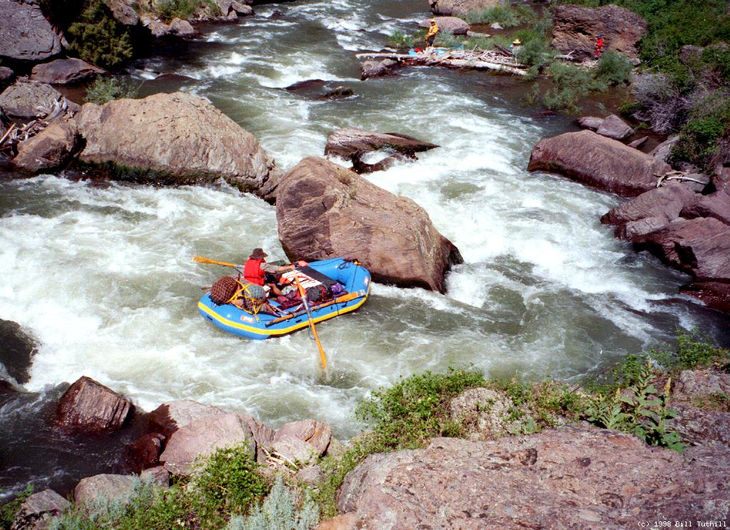

 Near the top of Bruneau Canyon
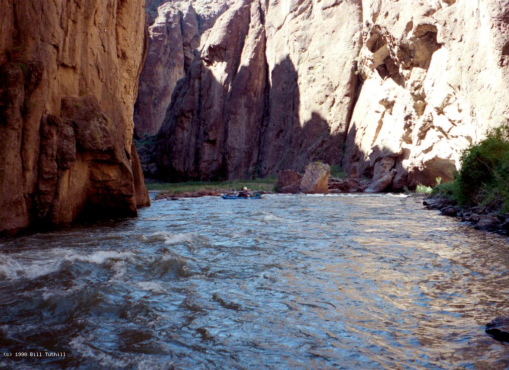
 Nearly full moon at sunset above dome tent
 Scouting and running the right entrance