| |
| Stretch: |
Iron Gate Dam to Happy Camp |
| Difficulty: |
Class II with some class III (harder above 5000 cfs) |
| Distance: |
84 miles, many days and sections |
| Flows: |
rafts 1500 - 15000 cfs, kayaks 1000 - 5000 then harder, IK minimum 600 |
| Gauge: |
flow measured at Seiad Valley
(KSV)
measured at mile 58 |
| Gradient: |
13 fpm average, steeper near Fort Goff |
| Put-in: |
boat access at Iron Gate Fish Hatchery, 2140' |
| Take-out: |
Curley Jack campground near Happy Camp, 1060' |
| Shuttle: |
80 miles (1.5 hours) one-way |
| Maps: |
USFS Klamath NF, AAA Northern California
(Topo)
|
| Season: |
Year round: rain, snowmelt, dam-controlled |
| Agency: |
private, USFS, Karok Indian |
| Notes: |
© 1998, 2001, 2010 Bill Tuthill,
CreeksYahoo |
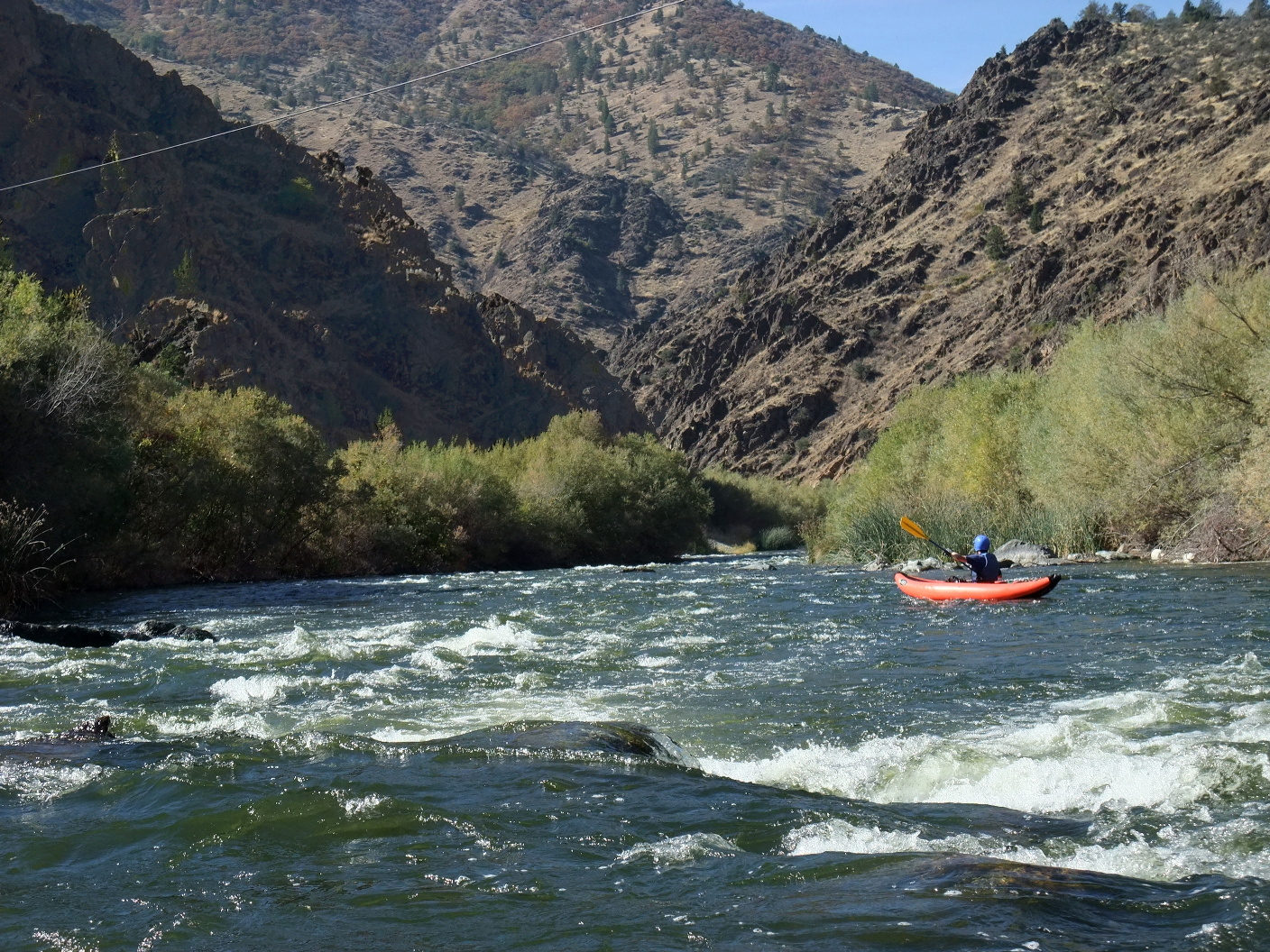
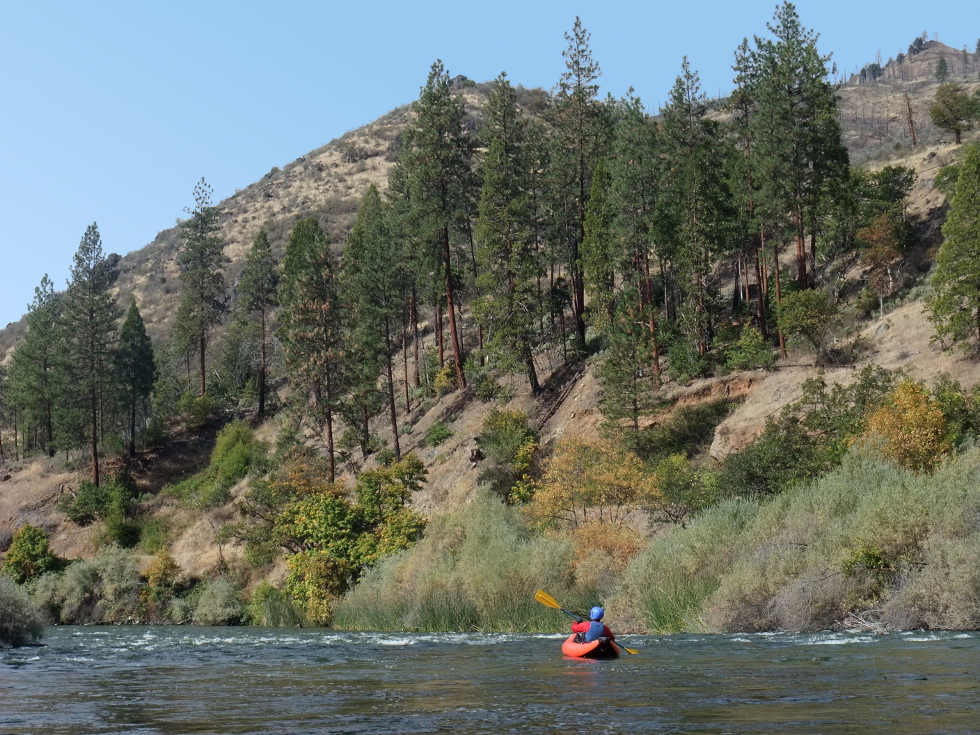
This section makes one of the best open canoe runs in California,
although it is a long drive from major population centers.
Although the Klamath contains slightly brown water and suds
from vegetation in the warm waters of shallow Klamath Lake,
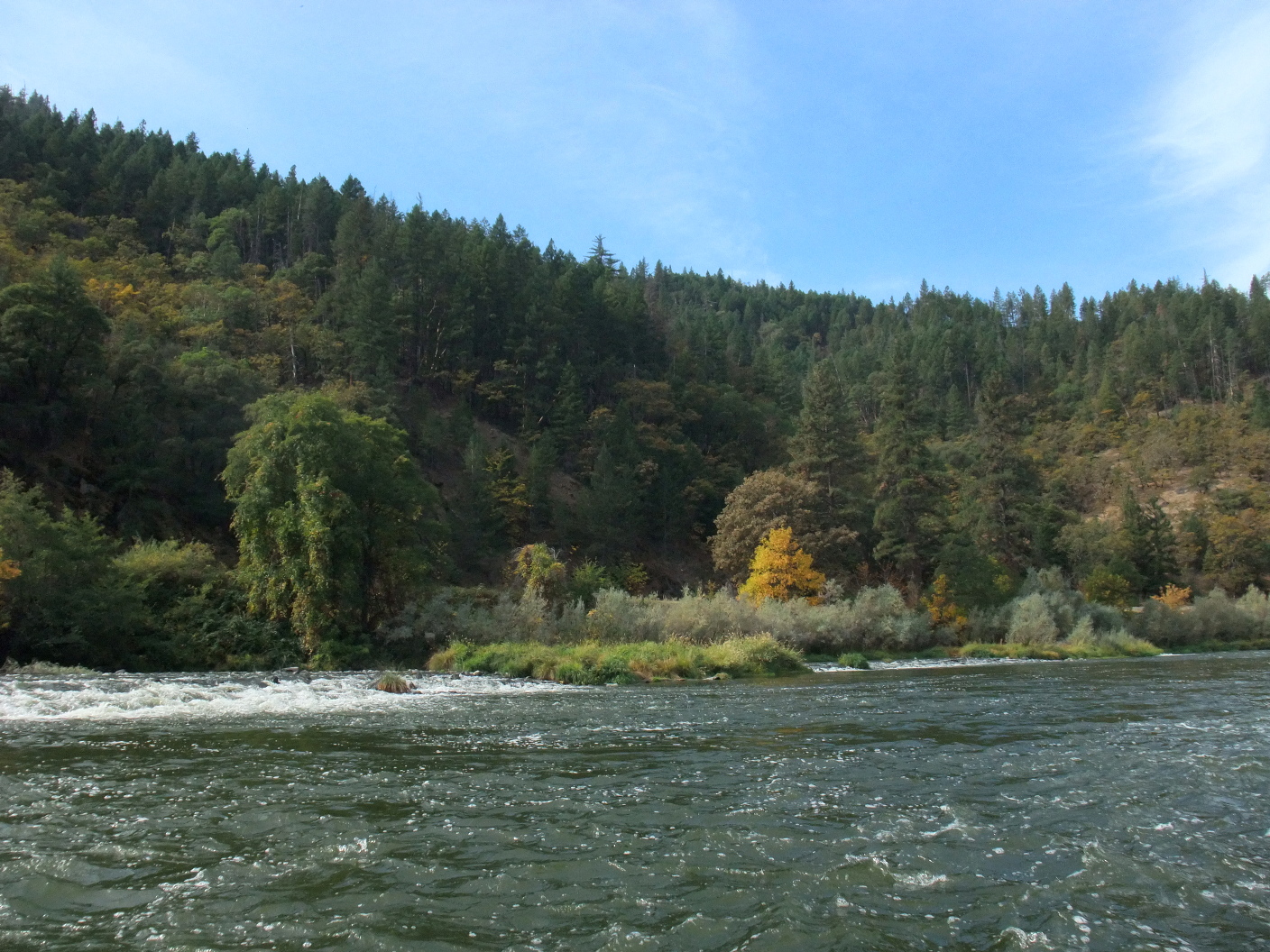
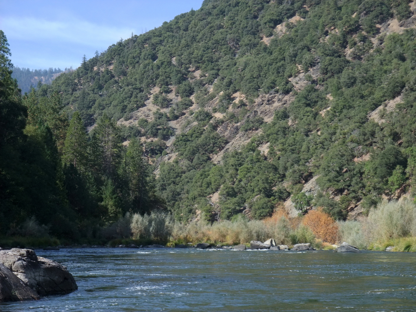
it offers fine fishing, good scenery with benign whitewater,
and reliable flows even late in drought years. Above Happy Camp,
the river is boated primarily by canoeists and anglers in drift boats.
Ideally this stretch contains four class II-III day runs,
using Tree of Heaven as a base of operations:
- I-5 bridge to Tree of Heaven campground (class II only)
- Tree of Heaven to the town of Klamath River (one class III)
- Blue Heron access to Seiad Valley (one class III)
- Seiad Valley to Happy Camp or above (several class III rapids)
In 2001 a new guidebook by Neil Rucker appeared,
The Canoer's Guide to the Wild and Scenic Middle Klamath River,
describing the best routes for canoes, mile by mile.
Neil and his wife run a canoeing business in Redding and maintain the
Canoe West website.
If you boat the Klamath often, Neil's guidebook is highly recommended.
The Cassady/Calhoun California whitewater guidebook
recommends starting at Sarah Totten campground,
but this misses a lot of the good river mileage upstream.
Except for Ishi Pishi Falls near Somes Bar,
the Klamath is runnable for several hundred miles,
all the way from Iron Gate Dam to the ocean.
It would seem to be an attractive long-distance tour,
but highway 96 follows the river for most of its length,
so wilderness campsites are far and few between.
The section below this run, described in
Klamath Happy Camp,
makes a good intermediate run with many class III rapids.
The section below the Salmon confluence starts with some class IV rapids,
and is often combined with a Salmon river run.
The section from Weitchpec to the ocean can be seen by jetboat;
tours start at the mouth of the river near Requa on highway 101.
- mile
0
- Put in at the boat access across Iron Gate Fish Hatchery,
which is on river left. The put-in is on river right near the
bridge. Mileage in this guide is measured from near the dam.
Only class I rapids until Hornbrook.
- 1.9
- Dry Creek enters on the right at a left bend,
marking more than a mile of habitations on the right
including RV park, private campground, and restaurant.
- 3.0
- Little Bogus Creek enters on the left.
Below an island at a left bend, two footbridges appear,
the second from a campground at mile 4.4.
- 5.0
- Willow Creek enters on the left. Southern Pacific railroad tracks
soon join the river on the left bank.
- 5.9
- Ager Road bridge, with river access on the right bank.
- 6.7
- Railroad bridge crosses overhead.
Tracks lead into the town of Hornbrook on the north bank.
- 7.9
- Cottonwood Creek enters on the right, near the town of Hornbrook.
Class II rapid just below.
- 8.5
- Small bridge over the river. I-5 comes into view on the right.
Fast water with occasional riffles in a straight section along the freeway.
- 10.9
- On river left (east side) find the large dirt turn-out along Klamathon road,
where there is an easy but heavily littered put-in on Caltrans land
under the I-5 northbound and southbound bridges.
Just downstream of another bridge is a large highway rest area,
but river access is completely fenced off.
-
- 13.2
- Past the highway 263 bridge, the Shasta River (class III) enters on the left.
Even in late season, it carries a surprising amount of water.
If you run it, look out for the weir .1 mile above the Klamath confluence.
-
- 14
- Snag Hole river access, on a long bar, shortly downstream of Weir rapid.
This access point is not marked, but is easily visible from the road.
Drift boats often put in here because access is better than under I-5.
- 14.9
- Ash Creek rapid, class II, with Klamath River Road bridge to the south bank
visible just ahead. Ash Creek enters on the right just above the bridge.
-
- 15.6
- Badger Creek rapid, class II. Just below, Badger Creek enters on the left.
A-Frame rapid, class II, is .4 mile downstream. Woodrat island appears
another .5 mile downstream, followed by Woodrat Bar on the right.
- 17.5
- Garvey Bar, site of many homes, begins on the left and continues for a mile.
Meanwhile on the right you see Humbug Point, a large south-pointing peninsula.
- 18.1
- Trees of Heaven river access and campground, facing west on Humbug Point,
named after an Asian tree (Ailanthus) transplanted by Chinese immigrants.
This is an excellent place to camp and base your boating operations,
especially after Labor Day when the campsites become less crowded.
Water systems are turned off in October, but outhouses remain open.
- 18.3
- Humbug Creek enters on the left, marking the start of McConnell Bar,
site of much mining activity. A dirt road comes down the creek.
Below the creek is Humbug rapid, class II.
- 19.1
- Blackberry Rapid and island, more a stranded meander at low water.
- 20.1
- Lime Gulch enters on the right. A dirt road goes up the creek.
This is in a long section of easy but closely spaced rapids.
- 20.9
- Cayuse primitive campground on the right, with less than ideal river access.
Cayuse Gulch enters on the right .2 miles downstream.
- 21.6
- Skeahan Bar on right, USFS designated river access.
Easy to see from the highway, but not as easy to spot from the river.
Swiss Bar soon begins on the left, where Swiss Gulch enters,
shortly above Deadman Gulch on the right.
- 22.4
- Rob's Island and small rapid. Below, Kanaka Bar begins on the right,
and continues for almost a mile, to where a USFS road goes up Dutch Creek
-
- 23.4
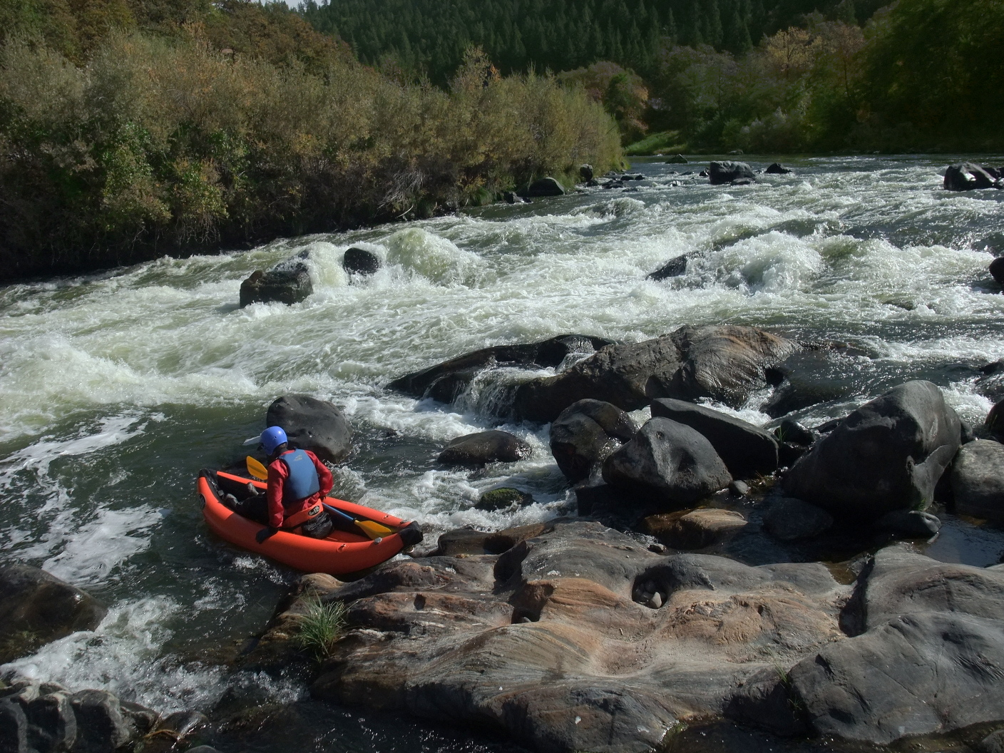
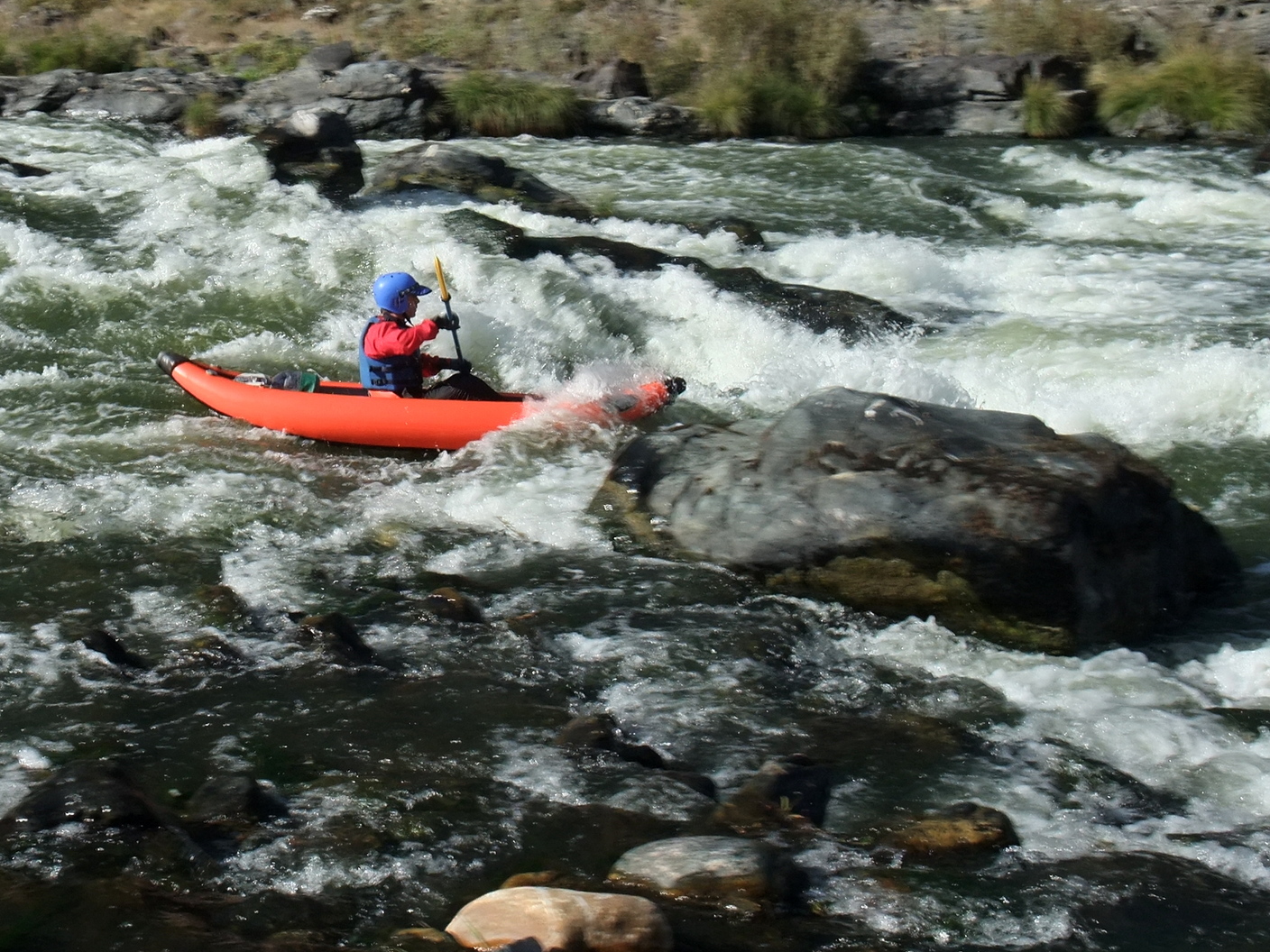
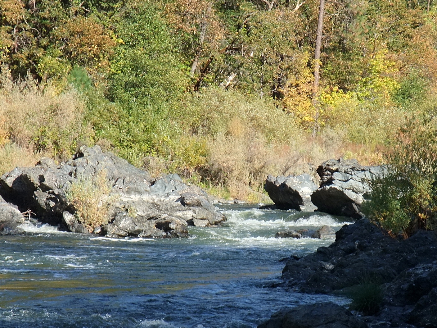
- Class II+ Dutch Creek Rapid, AKA Kanaka Bar Rapid, below Dutch creek.
At low water this one gets rocky, but has a left-right channel.
- 24
- Class III- Schoolhouse Rapid at a right bend, difficult to scout,
with big waves but no mandatory moves. The old schoolhouse was upstream,
marked on the topo map shortly below Dutch Creek.
- 24.2
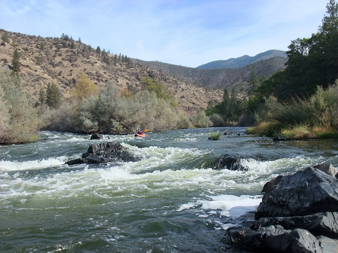
- Class III Honolulu Rapid, AKA Lumgrey Creek Rapid
Immediately after a large eddy on the right, Empire and Lumgrey Creeks
enter river right, very close together. An island splits the river.
Scouting advised from either side, or from the road as you set shuttle.
The left side gets rocky at low flows. To run the left channel,
enter in the middle of the channel and maneuver around rocks as necessary.
To run the right channel, enter just right of a pyramid rock near the
center island, slanting right, and possibly eddy out along the island
to portage the rock cluster constituting the final drop.
-
-
-
-
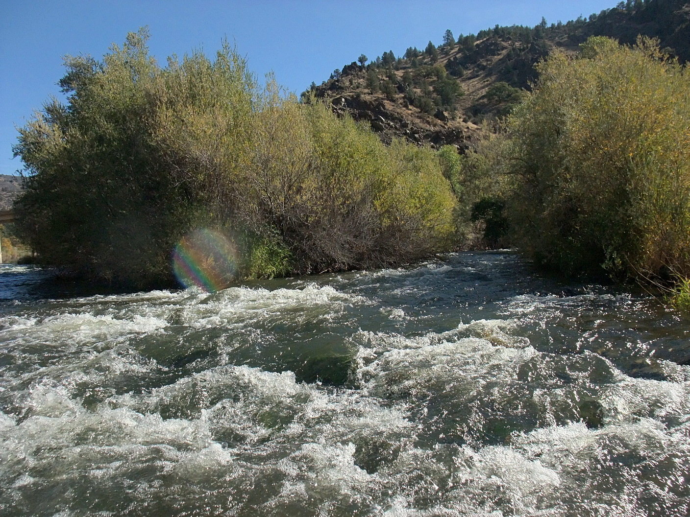
- Below Honolulu Rapid, the river gets less exciting for a while.
The town was originally named Honolulu because inhabitants were Hawaiian.
Later the town was renamed Gottville, its name today.
- 25.0
- Two nearby designated river accesses on right bank.
The USFS calls them Gottville East and Gottville West, which is bigger.
Locals call them Dunnings East and Dunnings West.
Downstream, minor rapids occur every few tenths of a mile.
The river is somewhat nondescript, so habitations are your principal landmark.
- 25.8
- Vesa Creek enters on the left.
-
- 27.5
- Houses in a flat area where Cougar Gulch enters on the right.
- 28.4
- Beaver Creek Lodge on the right, now a private residence.
Shortly downstream is a mobile home park and private campground,
where Miller Gulch comes in on the right.
- 29.0
- Beaver Creek enters on the right, adding a small flow even in late summer.
Class II rapid just downstream, and more ahead.
- 29.6
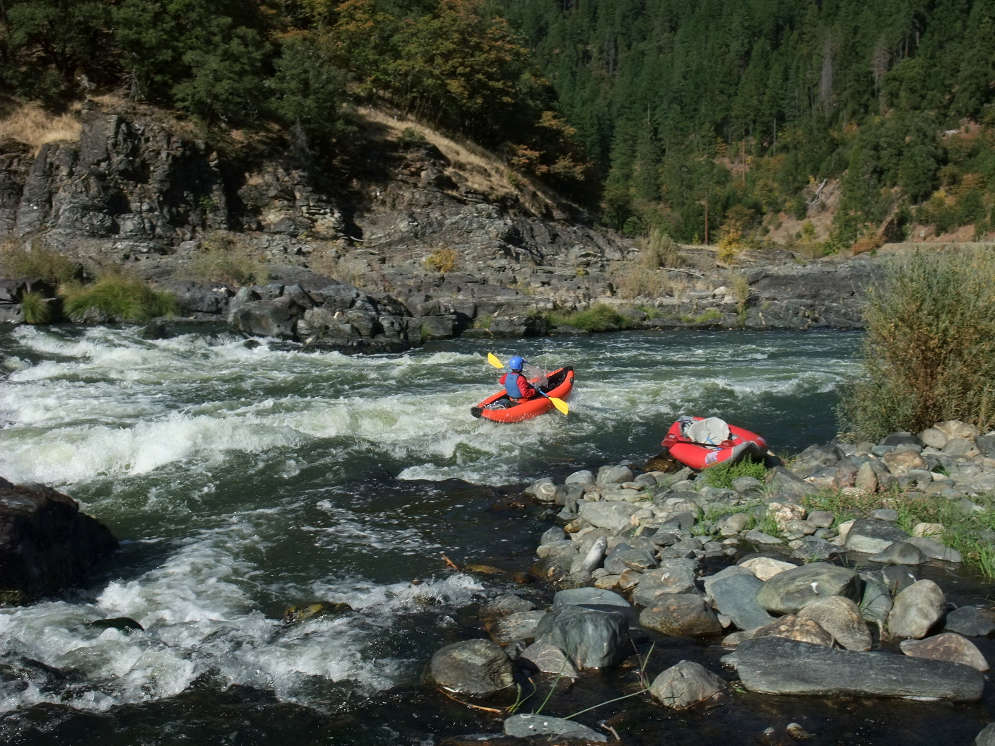
- Funny Girl river access on the right bank, in a small rectangle of USFS land.
This take-out is within walking distance of Quigley's General Store and Deli,
just downstream, where you can purchase victuals and camping supplies.
Driving west, look for an unmarked dirt road at a right bend just before
Quigley's campground. Between here and Blue Heron Access, all easy rapids.
- 30.5
- Herbert Hoover House, including Barkhouse and Secret Service House,
where President Hoover came to fish in the 1930s. Various islands.
- 31.8
- Klamath River Community Hall, situated on Round Bar across the river and
downstream of a small airport and upstream of a golf course.
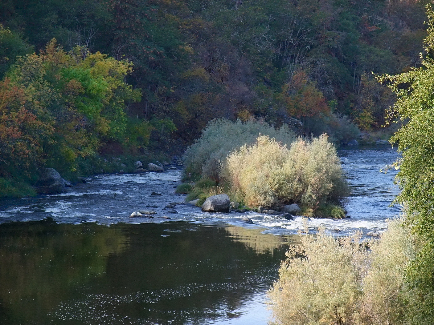
Near the golf course, Little Humbug Creek enters on the left.
Then in the left channel of an island, Grouse Creek enters on the left.
Below the island, Sportsmans Lodge once had good private river access,
but is defunct.
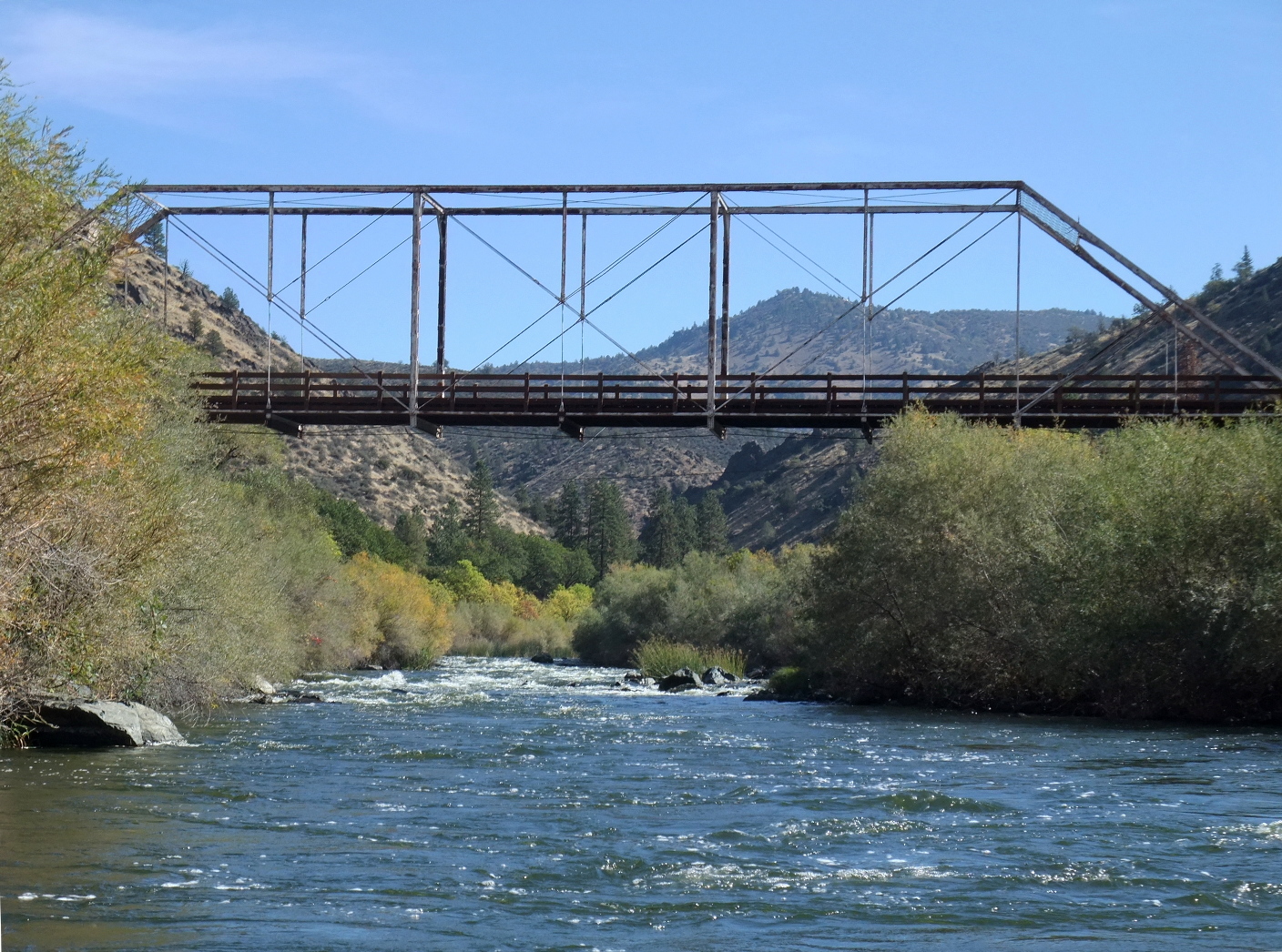
- 33.7
- Walker Bridge, a steel lattice structure that amazingly survived
the 1964 flood, when Happy Camp was completely cut off in both directions.
It has since been replaced. Poor river access.
- 35.2
- Doggett Creek enters on the right.
In another .2 mile, McKinney Creek enters on the left.
- 38.0
- Oak Bar on the left, possible site of Oak Bar Lodge bed and breakfast.
- 40.0
- Brown Bear USFS designated river access on the right bank.
A good take-out for drift boats starting at Funny Girl access,
and a good put-in for drift boats taking out at Blue Heron access.
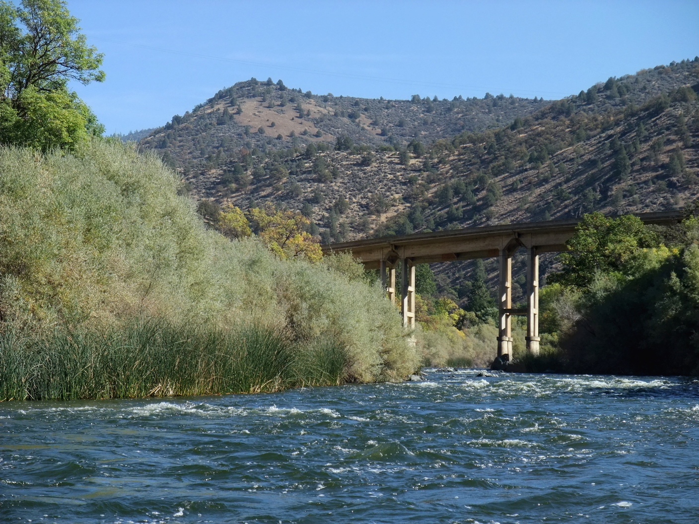
- 41.0
- Highway 96 crosses from river right to river left. Mining activity.
- 42.3
- Town of Horse Creek, with wood and cable suspension bridge,
and a more traditional bridge .3 mile downstream, where Horse Creek
enters on the right. Primitive river access on the left bank.
- 43.5
- Howard Gulch on the right.
In another .5 mile, Everill Creek enters on the left.
- 44.5
- Kinsman Creek enters on the left, across from Sambo Gulch on right.
- 45.5
- Cabin Rapid, class II after a right bend, perhaps the most significant rapid
between Funny Girl access and Blue Heron access.
- 46.2
- Blue Heron USFS designated river access on the left bank, shaded by trees
most of the day. A class II rapid is shortly downstream.
- 47.0
- Scott River enters on the left, adding to the flow.
-
-
- 47.4
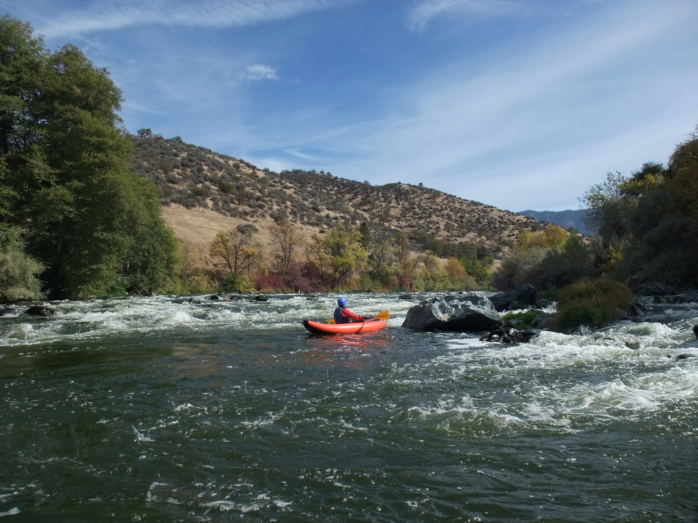
- Class III- rapid at the mouth of Tom Martin Creek; stay right.
- 48.3
- Sarah Totten Campground and river access on the left bank.
This is the highest put-in described in the Cassady/Calhoun guidebook.
Water systems are turned off in October but outhouses remain open.
- 48.8
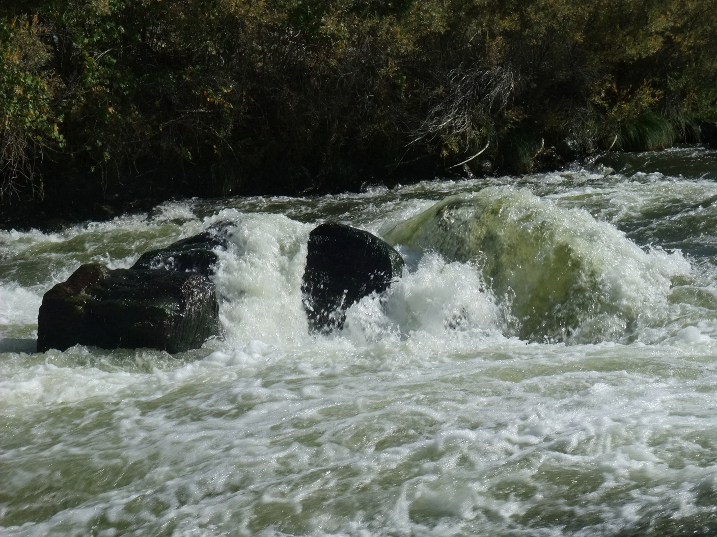
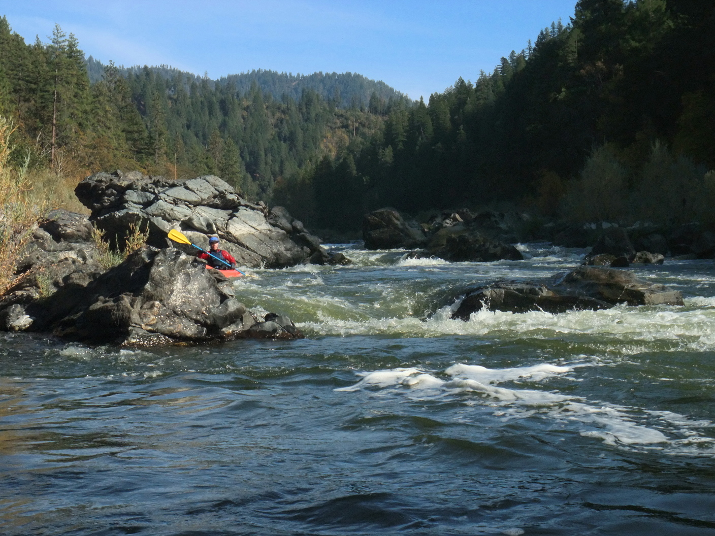
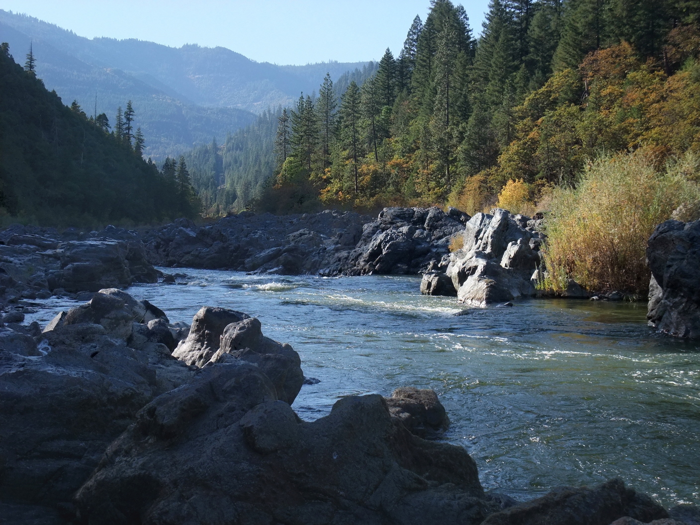
- Class III Hamburg Falls, possibly scout either side, preferably right.
An island divides the river, with most water flowing into the right channel.
At high flows the best route is to stay far right, near shore, the whole way.
At low flows the best route is to enter right of center, just left of some
boulders blocking the right side. Once past, ferry quickly to far right.
The left side is a boulder field, but routes are possible near the island.
-
-
- 49.4
- Jim Creek, then Mitchell Creek, enter on the left.
The town of Hamburg is built on a hill, so access to highway 96
on the left bank is steep, and mostly private land.
- 50.1
- Power line crosses the river. Mill Creek enters on the left.
About .4 mile later, Kuntz Creek enters on the left.
- 50.9
- Power line crosses the river again.
About .3 mile later, Hicks Gulch enters on the right.
- 51.7
- Negro Creek enters on the right. Originally named after a Caucasian
miner, Mr. [N-word], but politically corrected by the USFS.
Ladd Road on the right bank starts climbing above river level.
Old Country Store, closed in 2010, is situated on the left bank.
Small boats can take out on the left bank not far below.
- 52.8
- O'Neil Creek enters on the left, flowing past a USFS campground
on the uphill side of highway 96. Poor river access. Downstream is
a minor rapid, followed by class II Pyramid rapid, usually run left.
After 1 mile and two horseshoe bends, Louie Creek enters on the left.
- 53.9
- Rocky Point designated USFS river access on the left bank.
Some minor rapids follow.
- 54.8
- Granite Point on the left, with a class II+ rapid, usually run either
far left or right of center. Below, Schutts Gulch appears on the right.
- 56.8
- Walker Creek enters on the left. Around a left bend .5 mile below,
highway 96 crosses from left bank to right bank.
- 57.6
- Below the highway bridge, after an island, and after Gard Creek enters
on the left, class II Seiad Rapid appears in a right bend. The town
of Seiad Valley is on the right bank. (Seiad is pronounced sigh-add.)
- 59.6
- Below an island, Grider Creek enters on the left.
After .3 mile, Seiad Creek enters on the right.
After .1 mile, West Grider Creek enters on the left.
- 60.2
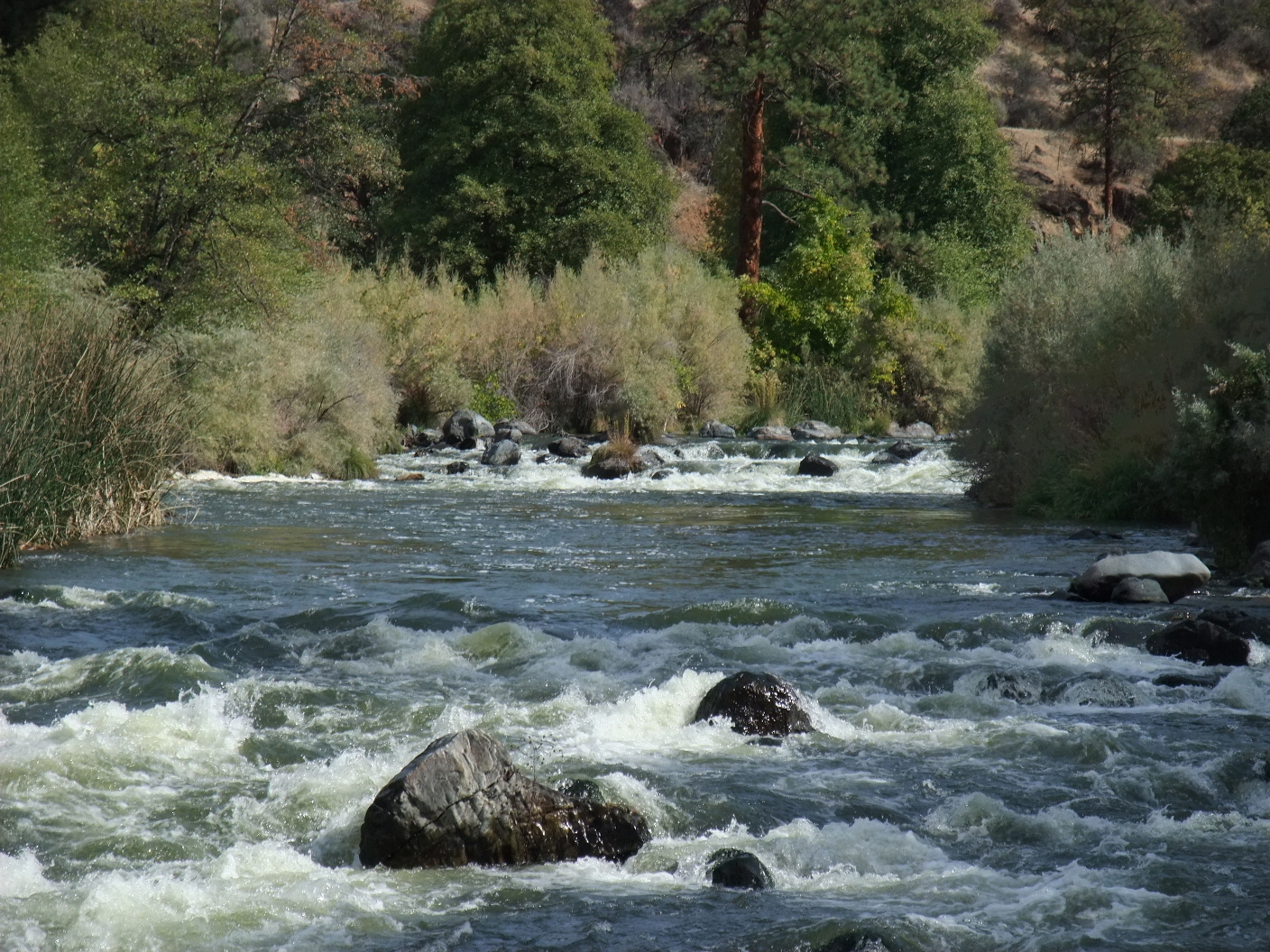
- Class II+ Sluice Box rapid, AKA Grider Creek rapid.
Usually run on the left side of the right channel.
Sluice Box river access is shortly below on the right.
- 61.9
- Bittenbender Creek enters on the right.
- 62.4
- Portuguese Creek enters on the right.
- 63.4
- Fort Goff Creek enters on the right; a USFS campground is nearby.
- 64.1
- Ladd Creek enters on the left; more rapids around two right bends.
- 64.9
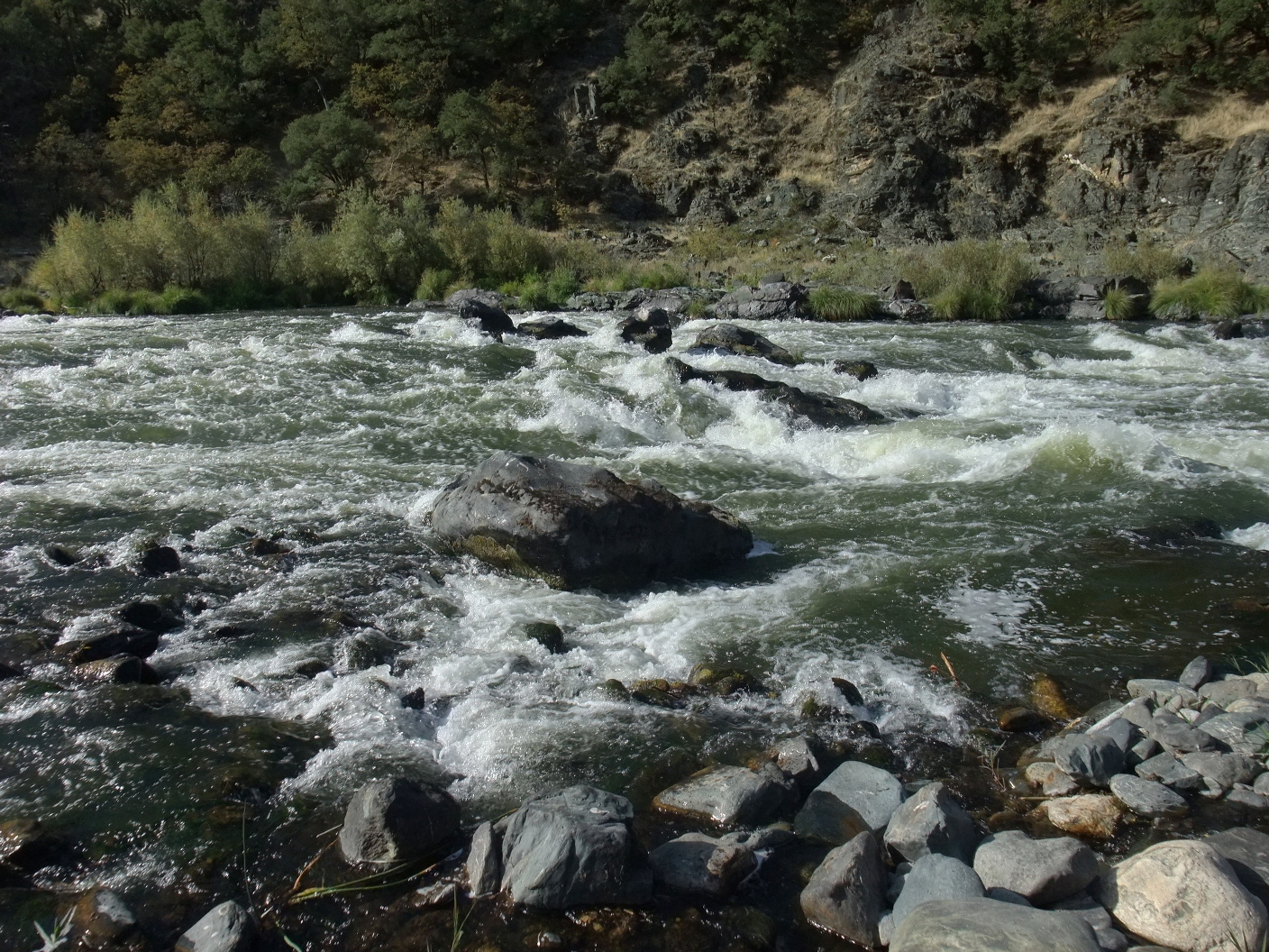
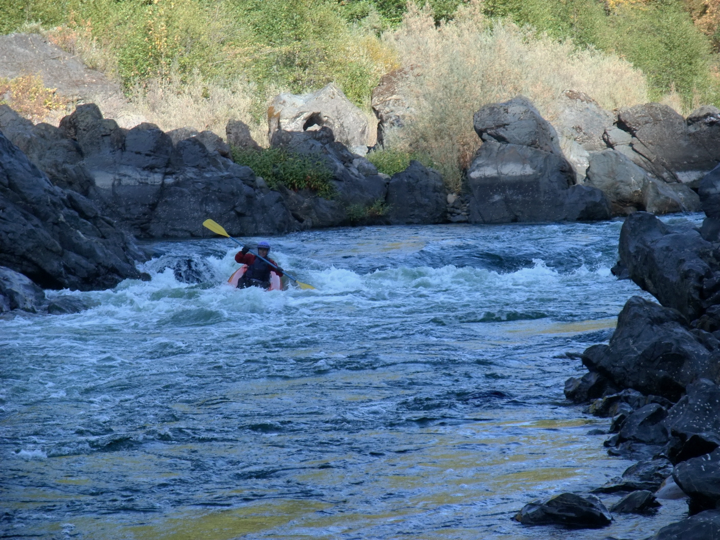
- Class III+ Upper Savage Rapid, possibly scout right, or from highway 96.
It is possible to put in just upstream of this rapid.
Where cliffs constrict the flow on the left, the river drops steeply
and a number of large boulders (holes at higher flows) block the channel,
creating different routes depending on rock movements. Currently (2010),
far right offers the cleanest route, although good routes are available
on the left side too. Good surfing spots just downstream.
-
-
- 65.5
- Class II+ Otter's Crib, AKA Lower Savage, best channel on the right.
-
- 65.8
- Class III Otter's Playpen. Large rock outcroppings block the river,
creating a multiplicity of routes, although at lower flows rafts and
drift boats are limited to the right side. This rapid can be scouted
from either bank, and in small boats most routes work fine.
-
- 65.9
- Class III- Fort Goff Falls, a significant drop between bedrock walls.
-
- 67
- Thompson Creek enters on the right. Nolton boat access downstream.
- 67.8
- Shinar Creek enters on the right.
- 68
- Class II+ rapid near Minetta Bee Mine, with swift water below.
- 70.2
- Joe Miles Creek enters on the left, below stillwater.
- 70.8
- Oak Hollow Creek enters on the right.
- 72
- China Point on the right, China Creek enters on the left. From
here to Happy Camp, rapids are only class I. There is evidence of
mining activity, and many shallows and stillwater sections to cross,
but highway 96 is away from the river, making this semi-wilderness
section, called Cade Canyon, favored by camping canoeists.
- 75
- Williams Point on the right, forming a horseshoe bend.
- 75.8
- Horse Creek enters on the left.
- 76.5
- Fryingpan Creek enters on the left.
- 77.2
- Ottley Gulch on the left, Morgan Point on the right, forming another
horseshoe bend.
- 78.7
- Woods Creek enters on the left, followed by Woods Bar.
- 80.6
- Cade Creek enters on the right.
- 81.7
- Ranch Gulch enters on the right, at the outskirts of Happy Camp.
- 83.2
- Indian Creek enters on the right, marking the end of Happy Camp.
- 84
- Curley Jack campground on the left, across from Curley Jack Creek
on river right.
To reach put-in, exit I-5 at Henley, and drive east on Copco Road
about 8 miles to the Iron Gate Fish Hatchery.
Cross the river bridge and find the river access point.
To reach take-out there,
drive east and then south on highway 96 until you reach Happy Camp.
At the western outskirts of Happy Camp,
turn right and cross a bridge to the Curley Jack USFS campground.
|
|
Creeks Navigation
Home
Recommended Runs
Map of Rivers
Alphabetic Index
Alphabetic Table
Text Search
Sponsored Links
|