| |
| Stretch: |
Lower McCloud Falls to McCloud Reservoir |
| Difficulty: |
class III with possible V- to start |
| Distance: |
12.3 or 13.5 miles (4.5 on reservoir), 1 day |
| Flows: |
put-in minimum: rafts 300, kayaks 200, IK 100 cfs
|
| Gauge: |
measured at McCloud reservoir
(MCD)
estimate 20% at put-in |
| Gradient: |
69 fpm (135 80 80 85 60 40 then 35...) |
| Put-in: |
above or below Lower Falls (class V-) |
| Take-out: |
Tarantula Gulch boat ramp on McCloud reservoir |
| Shuttle: |
25 miles one-way |
| Maps: |
USFS Shasta NF, AAA Northern California,
Topo
|
| Season: |
spring and summer: mostly spring-fed |
| Agency: |
USFS, Hearst Corporation |
| Notes: |
© 1997, 1999, 2013 Bill Tuthill,
CreeksYahoo |
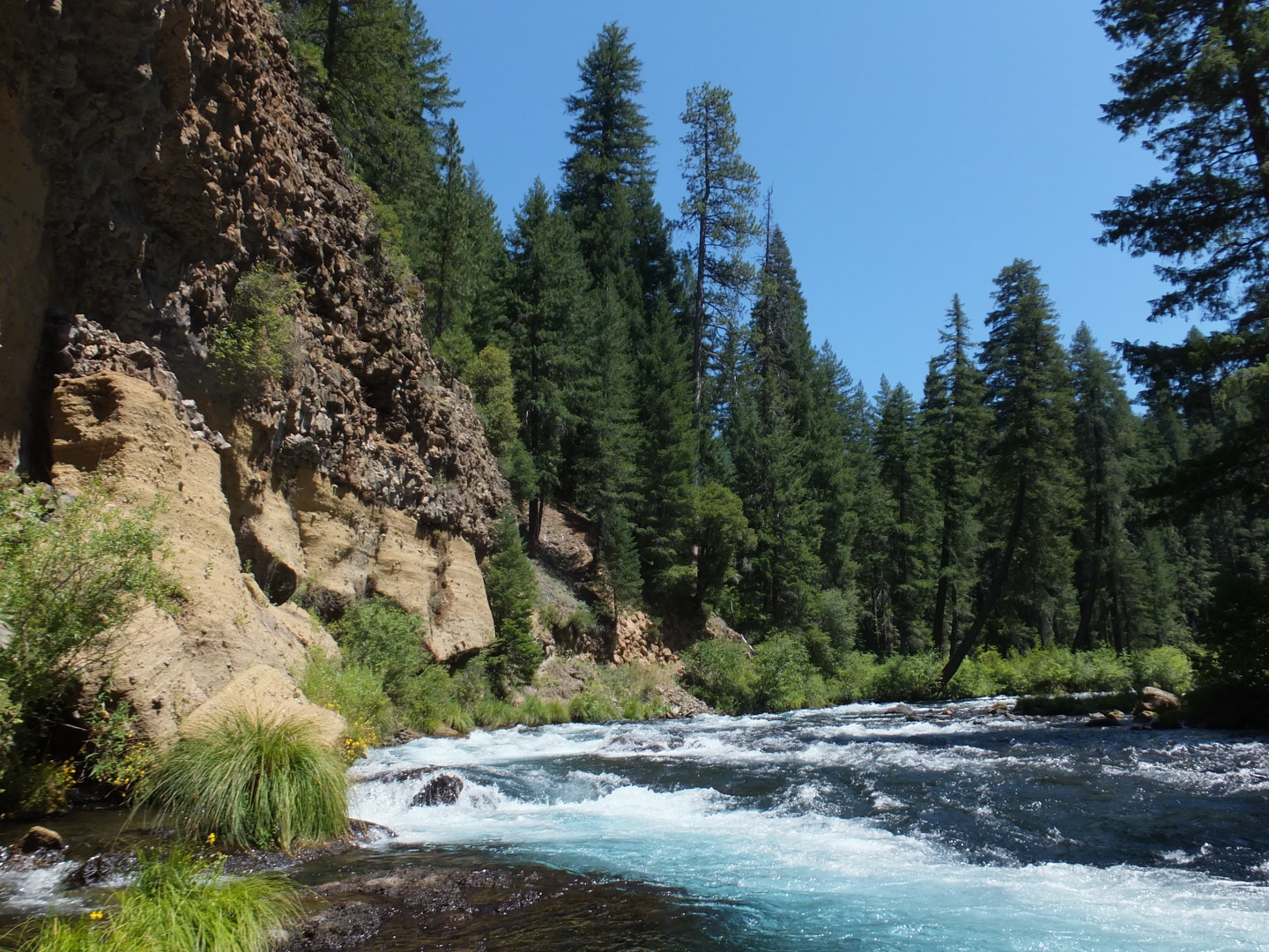
In springtime, the McCloud river from Fowler's campground to McCloud reservoir
is one of the best runs in California, modulo the long reservoir paddle at the end.
For durable boaters, it is an excellent run in the summer,
but you must be willing to river-hike your boat for .3 mile (grunt)
then tolerate low flow for another 1.1 mile. Here is what you get:
- permit not required, no put-in fee
- runnable 10' waterfalls (photo-op) in season, followed by good creekin'
- after Big Springs, many enjoyable kilometers of continuous class III rapids
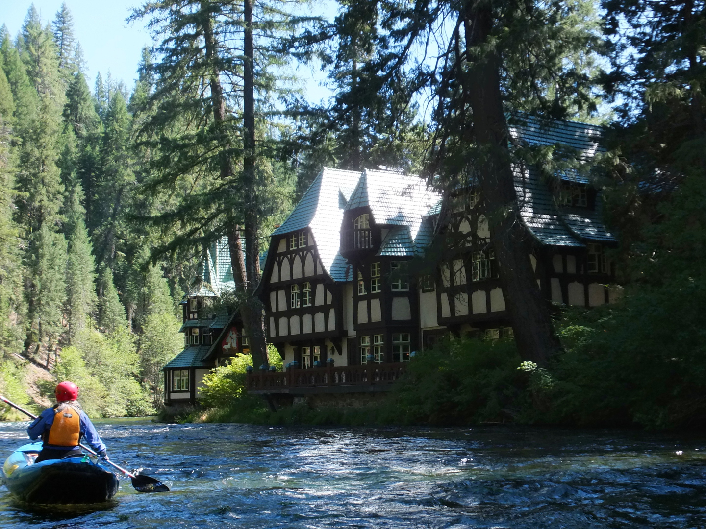
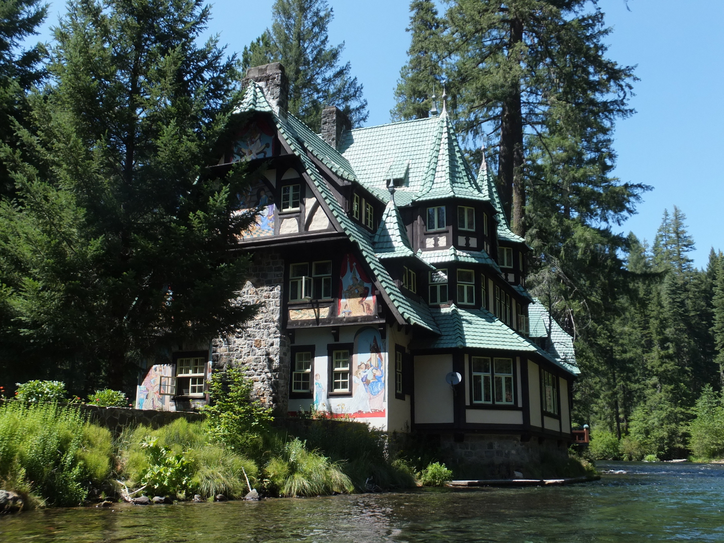
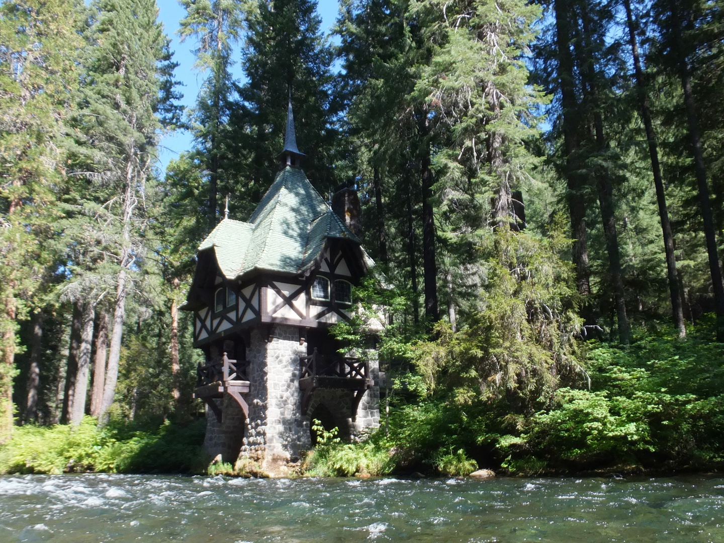
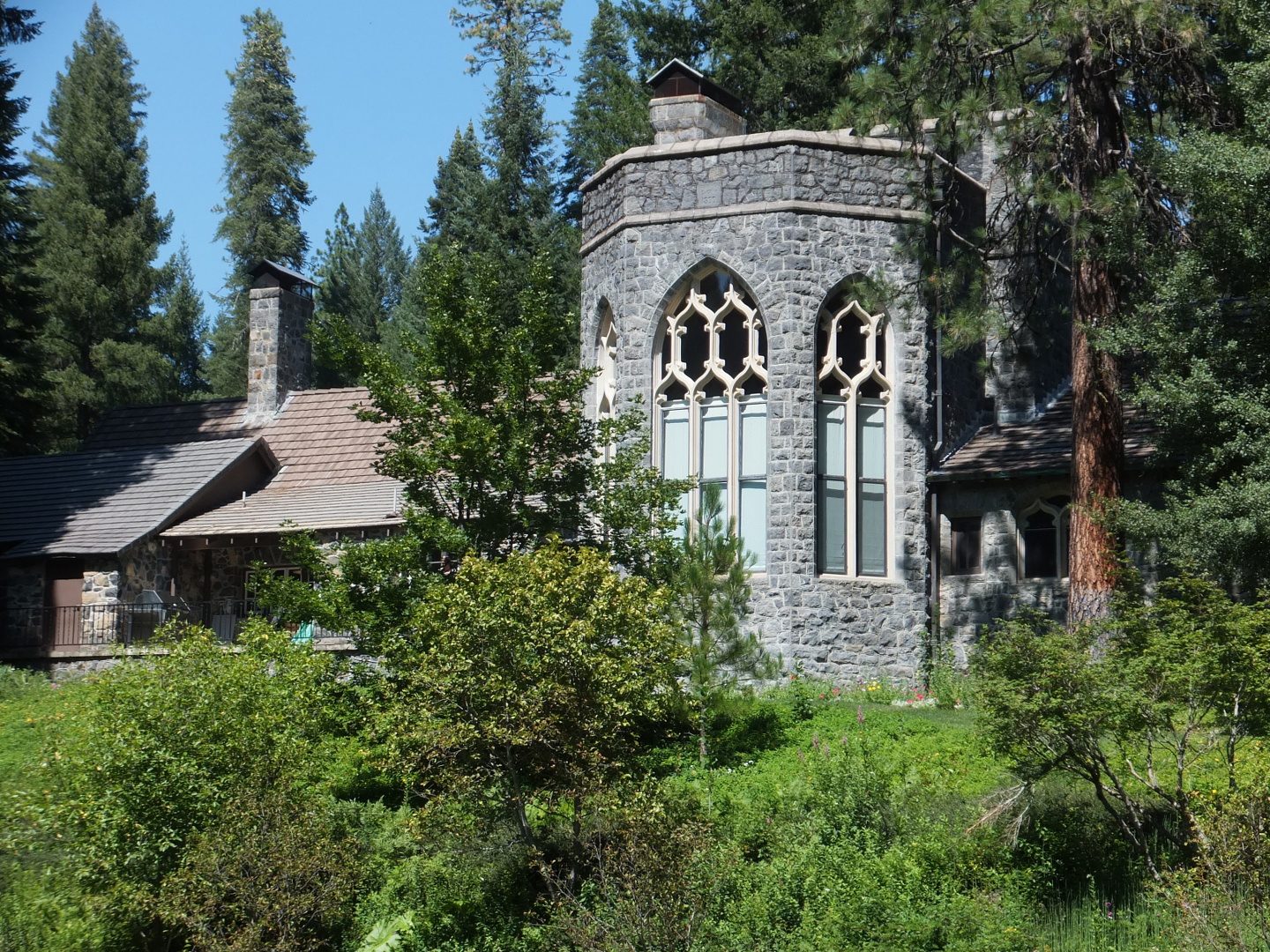
- architectural tour of an estate built by the rich & famous Citizen Kane
- upper body exercise via reservoir paddling
Although we never tried it, I heard that if you start below Middle Falls
(go east on a dirt road that intersects Fowler's Campground road)
you can get another several kilometers of class III creekin' before Lower Falls.
Supposedly the put-in is a bit harder than as recommended below.
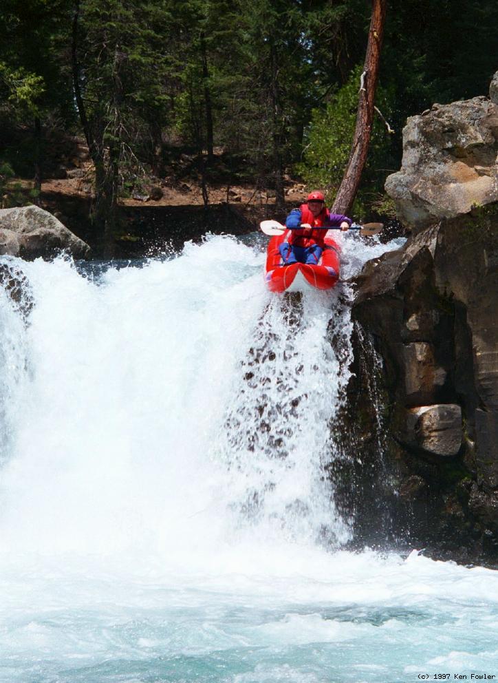
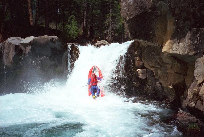
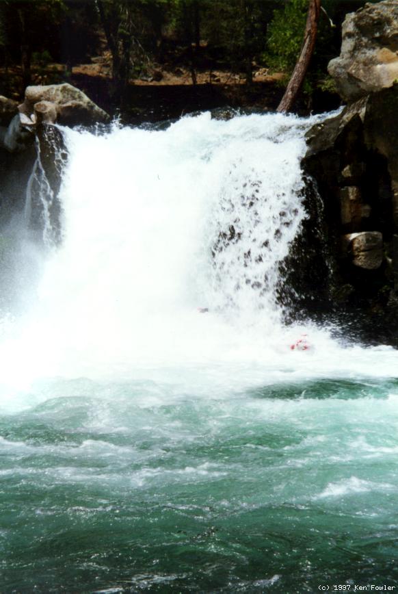
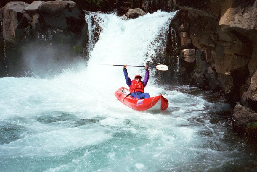
- mile 0
- Lower McCloud Falls, class V-
At higher springtime flows, the easiest put-in is above Lower Falls
if you want to run the drop, or below the falls if you do not.
The waterfalls is rated class V- because of an undercut on the right.
Andy ran the left side over a rocky lip, and landed upright,
well away from the boils and undercut.
-
It is not hard to put in below the waterfalls.
- .6
- The USFS has created an official kayak put-in at Pine Tree Hollow,
with nothing particular to recommend it except privacy.
- 1.2
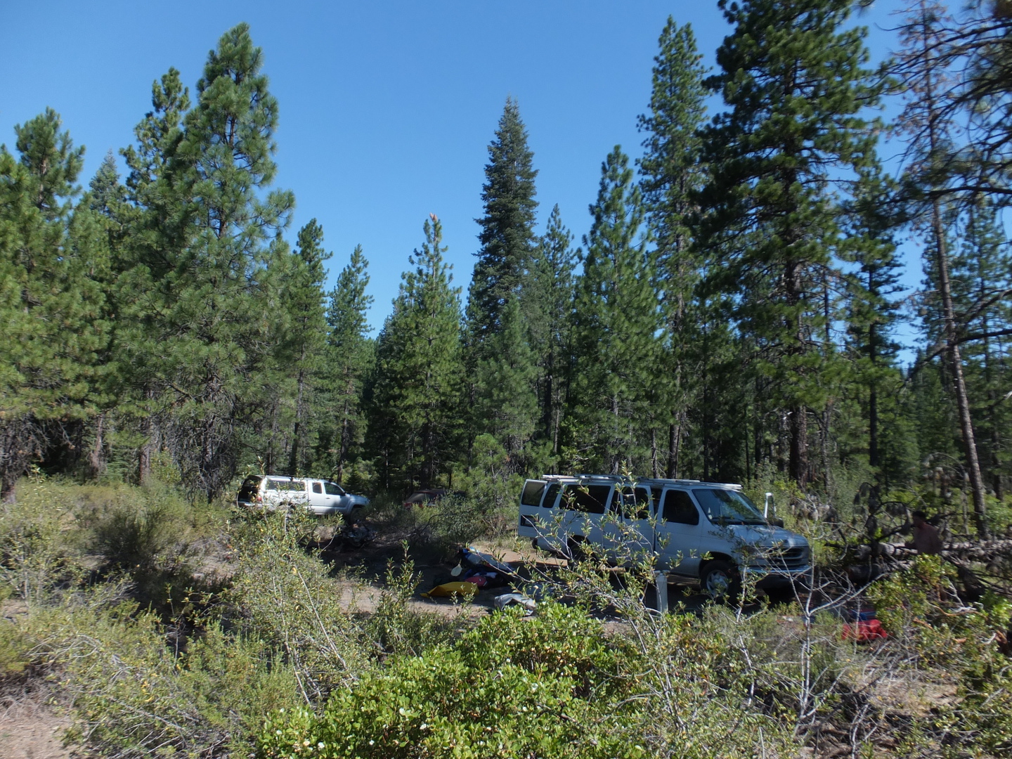
- Low water summertime put-in. Where the dirt road ends, blocked by a log berm,
you can find a notch in the lava cliff at the edge of the river canyon,
and slide your boats down a rudimentary trail to a small put-in along the river.
After snowmelt is over, the so-called river will be too low to run until
you reach Little Spring in .3 mile (usually seems longer).
You can also carry boats past the log berm on an abandoned road and lower boats
over a similar lava cliff downstream, but this might be off public land.
-
- 1.5
- Little Spring enters on the right, making the flow high enough for kayaks and canoes.
Past here the land is mostly private until the reservoir, and the Hearst Corporation
requests that you do not step out of your boat onto the banks.
-
- 2.6
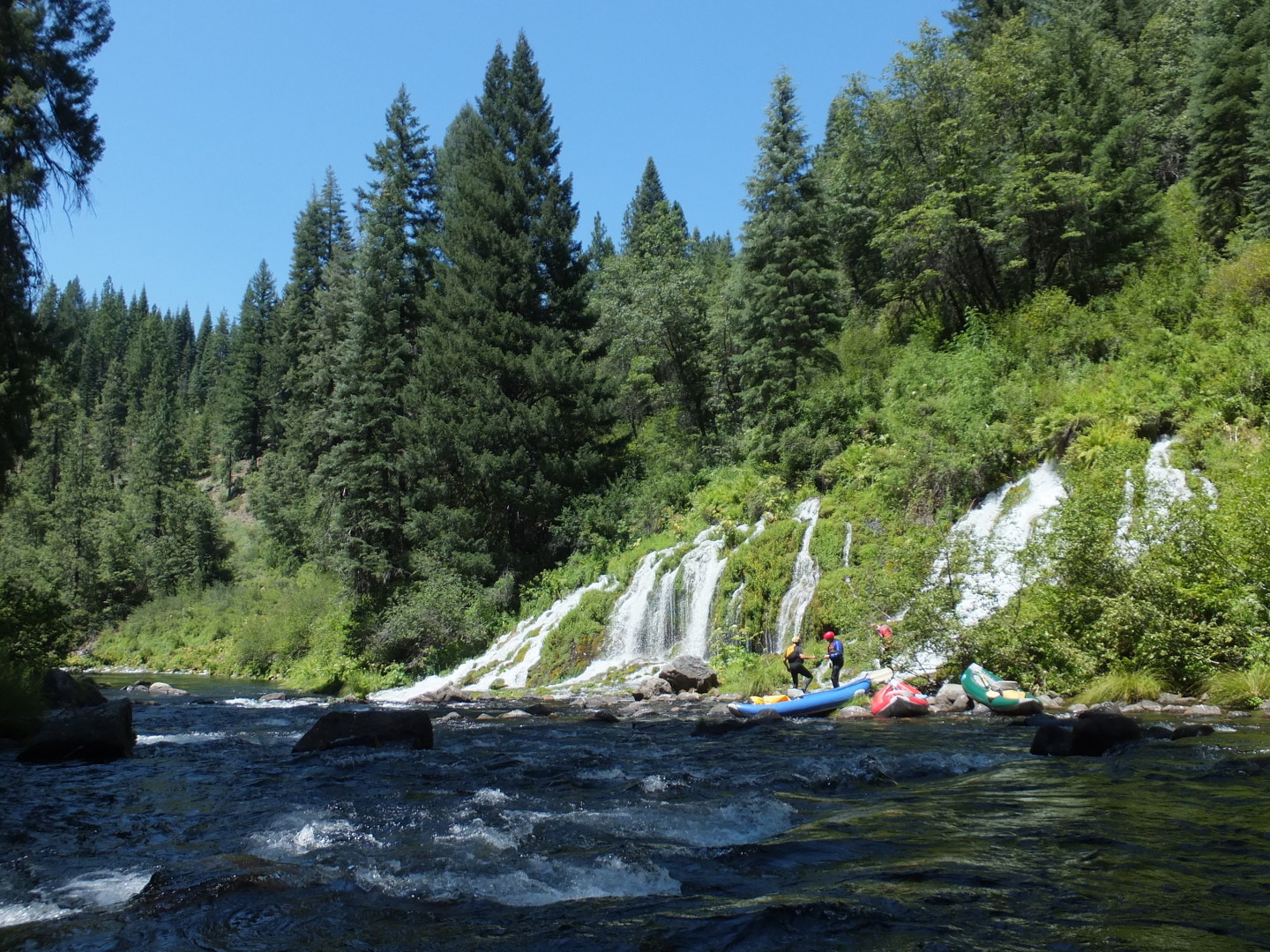
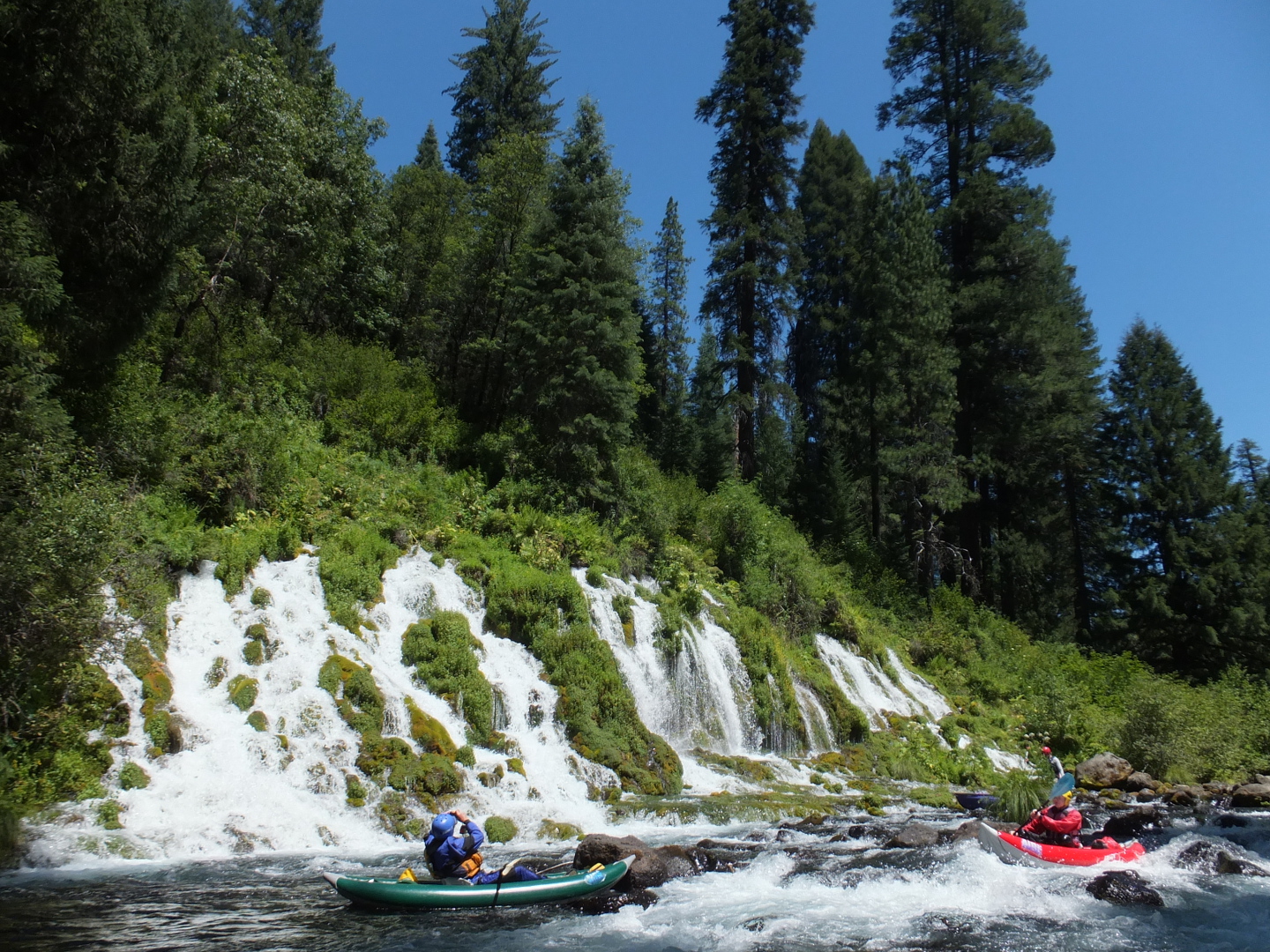
- Big Springs enters on the right.
This is an amazing spot where underground geology creates a seam,
not visible from the surface, carrying as much water as a major river.
-
- 2.9
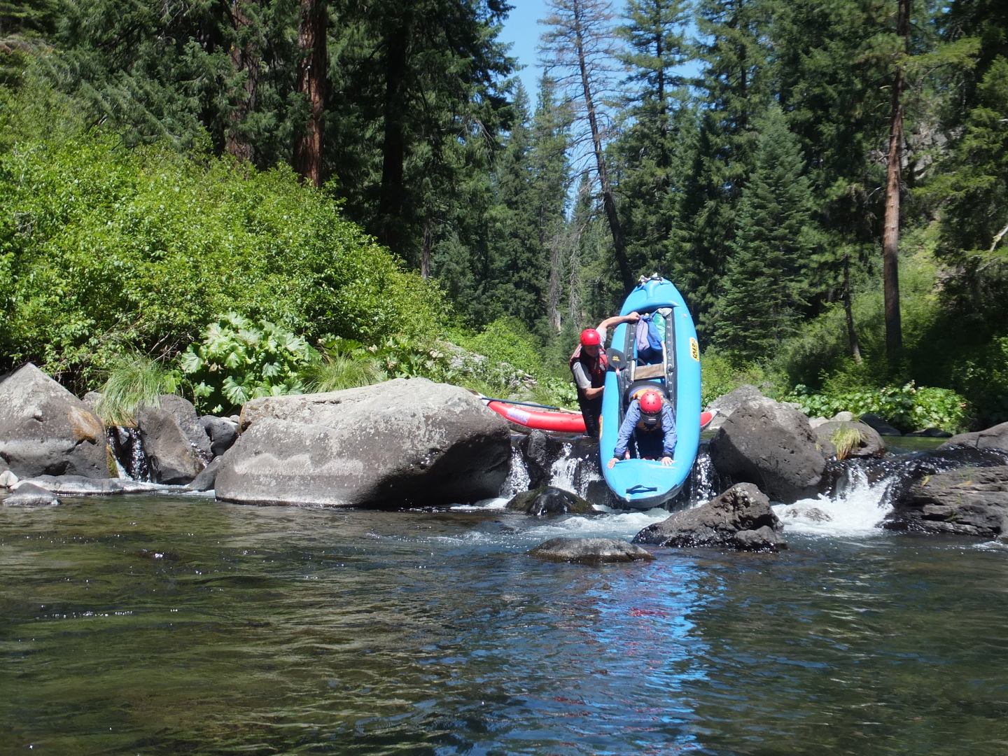
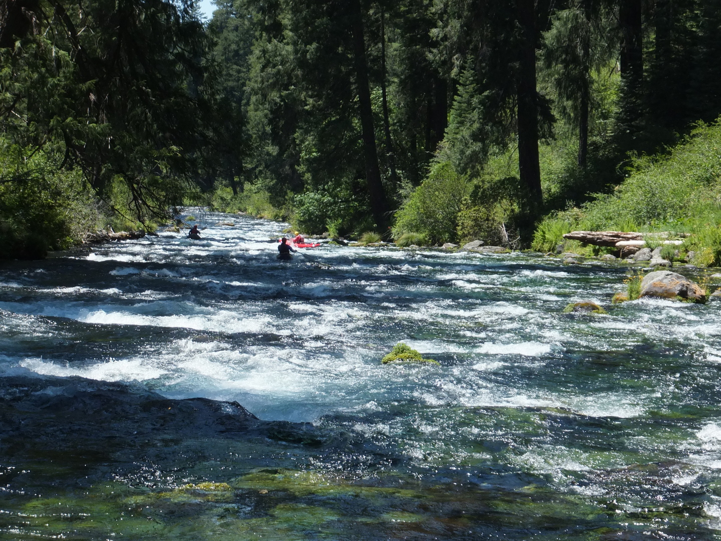
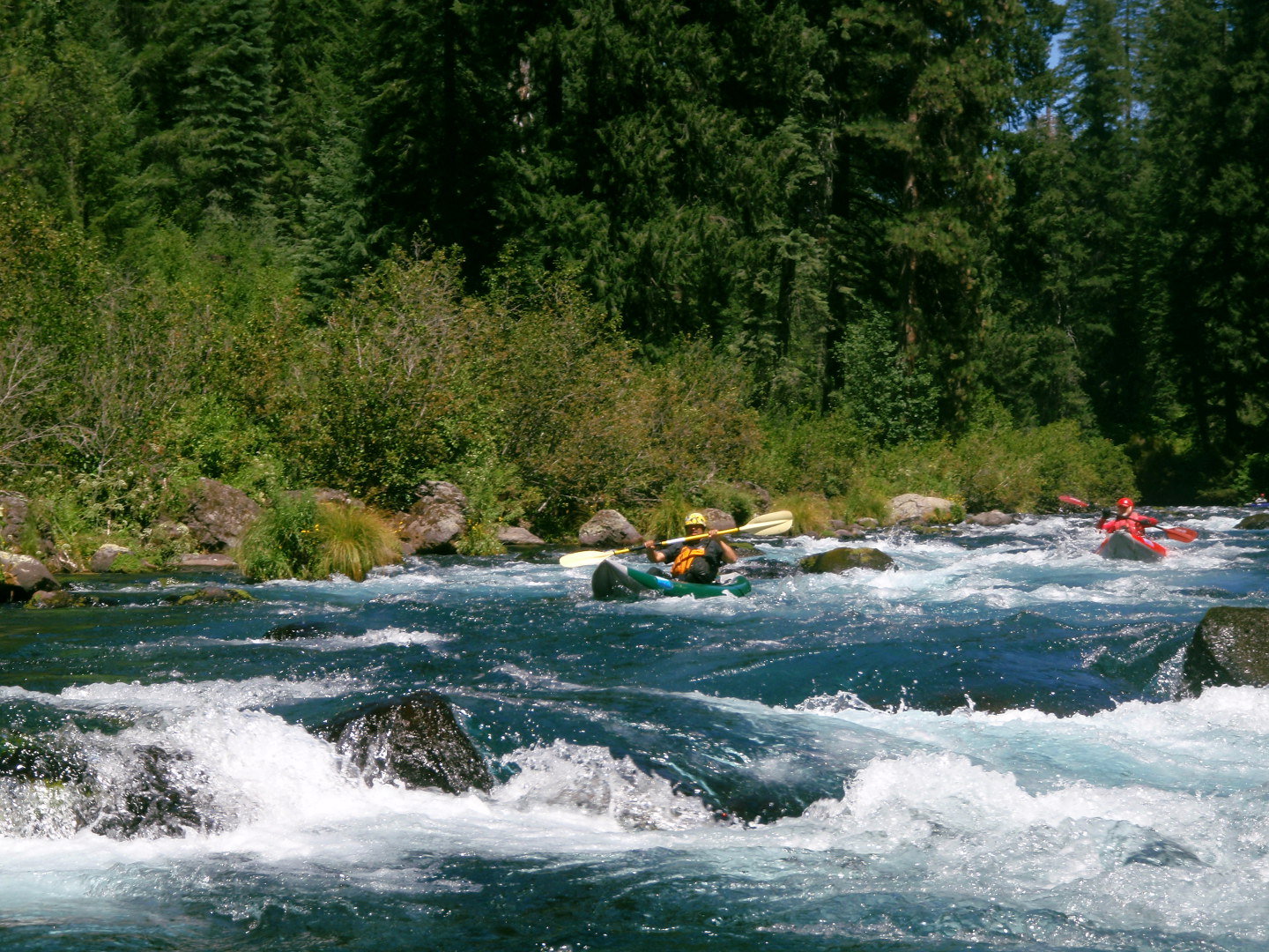
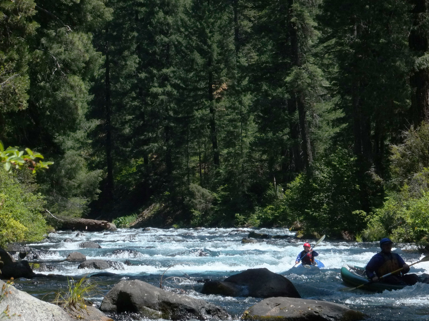
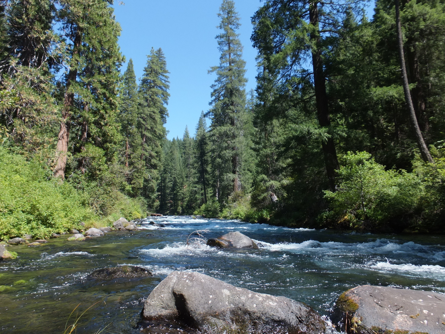
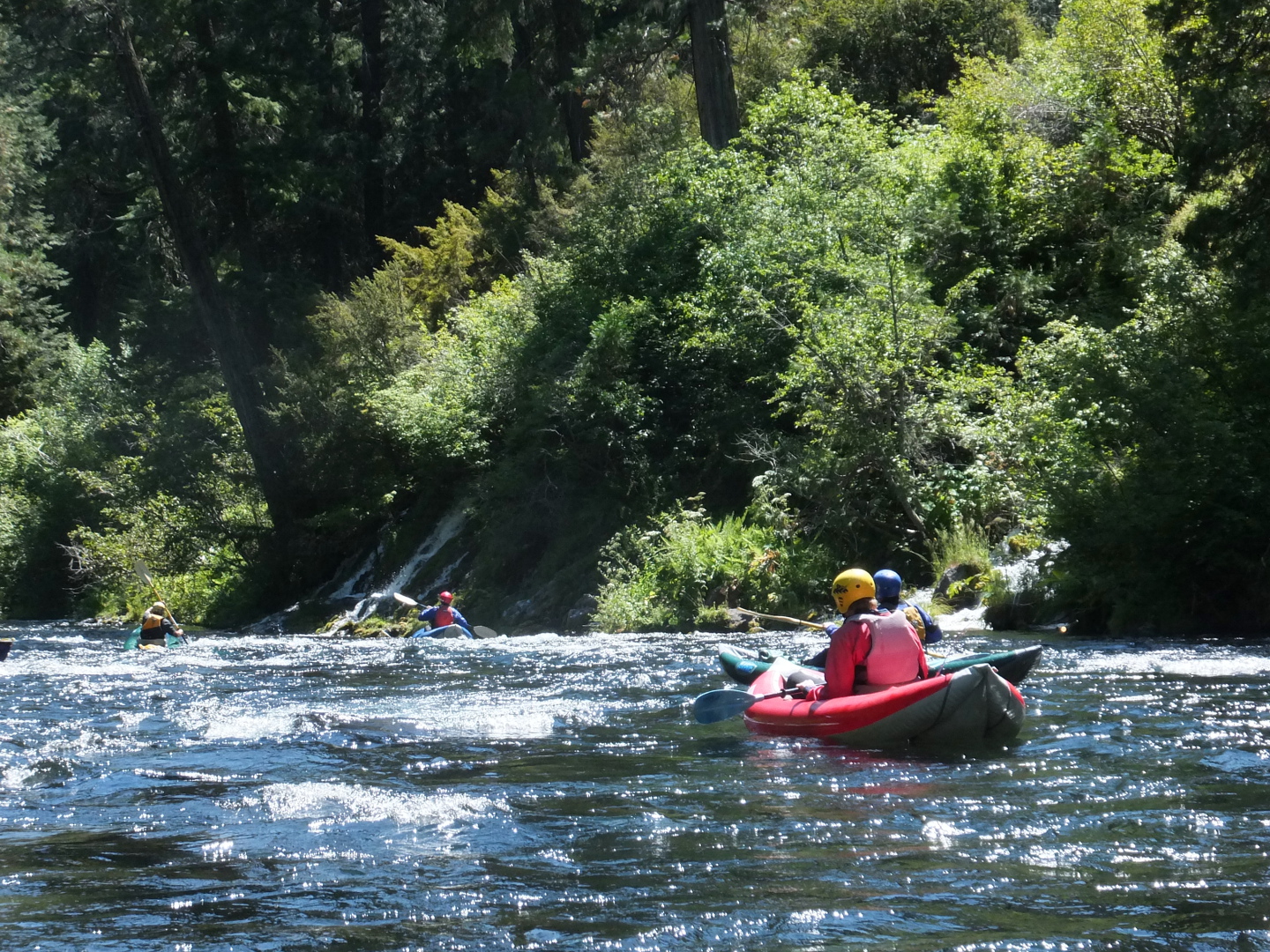
- Continuous class III rapids begin and continue for many miles.
One of the steepest and rockiest sections starts just below the springs.
It comes as a shock after many miles of lower flow.
This section reminds me of wonderful rivers in Oregon and Idaho
such as the upper McKenzie and the North Fork Boise.
-
- Rescue is difficult due to the lack of eddies. Good boat control
is essential to avoid the many rocks just below or above the surface.
-
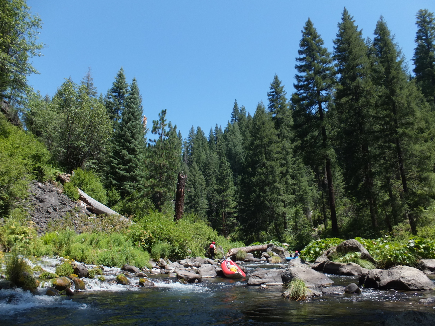
- Be on the lookout for trees across the river, an oft-present danger.
In 2013 we avoided one to the right, and a double-log with an S move.
-
- 5.2
- Concrete bridge. The gradient eases and only a few big rapids remain.
-
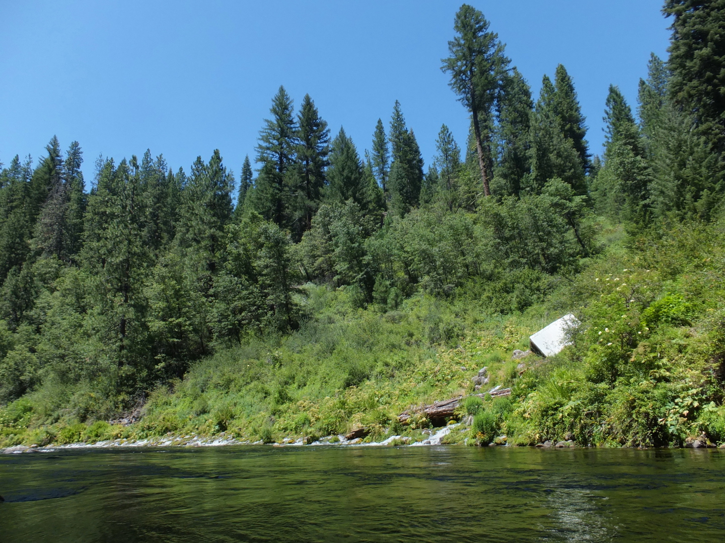
- 6.0
- More springs enter on the right. Some water is diverted from here
into Wyntoon.
- 7.0
- Angel Creek on the left marks the beginning of Wyntoon estate.
-
- 7.2
- Bridge to the smaller south side of Wyntoon.
-
- 7.5
- Flow gauge. Unfortunately this says little about your put-in flow.
- 9.0
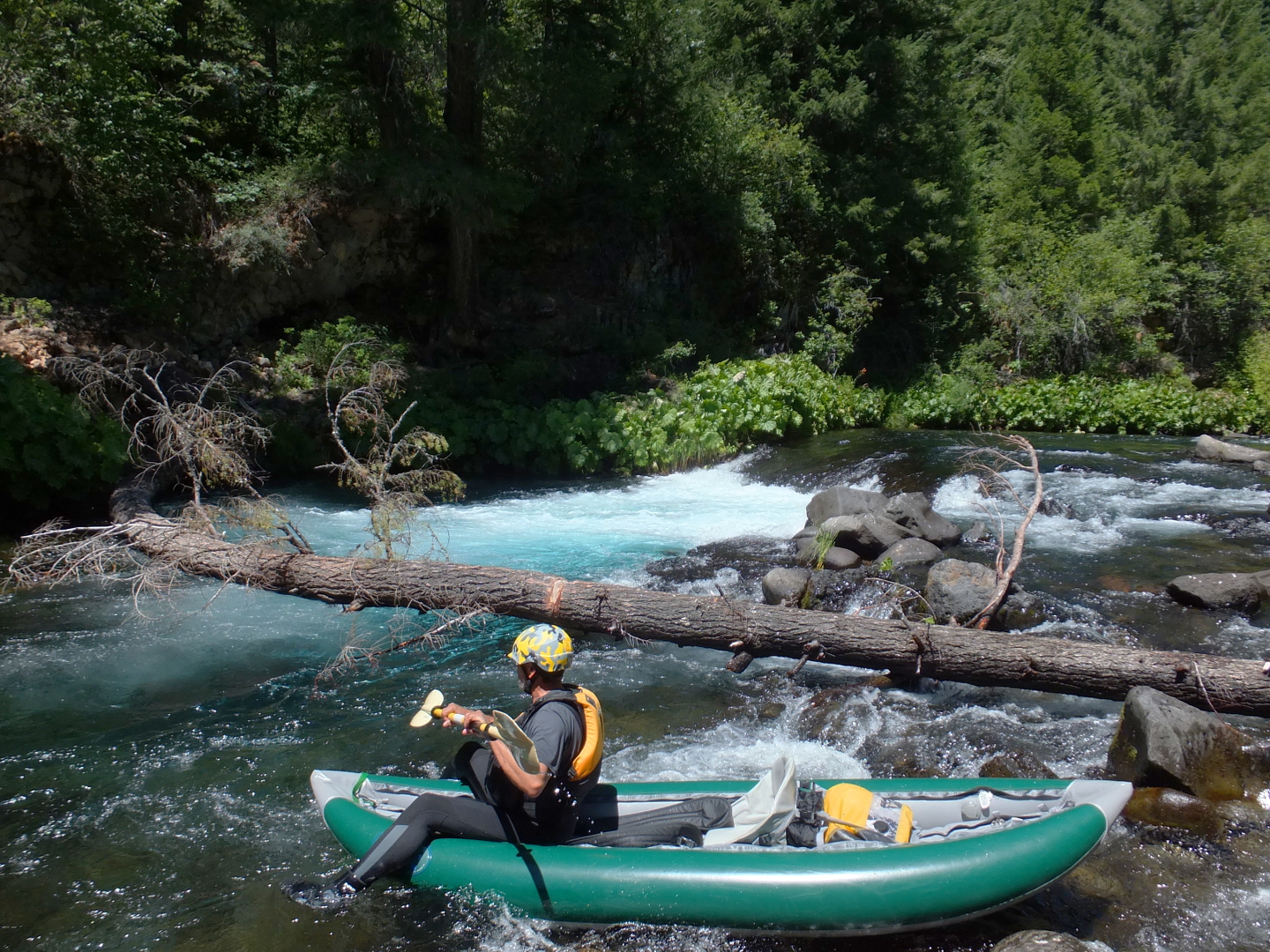
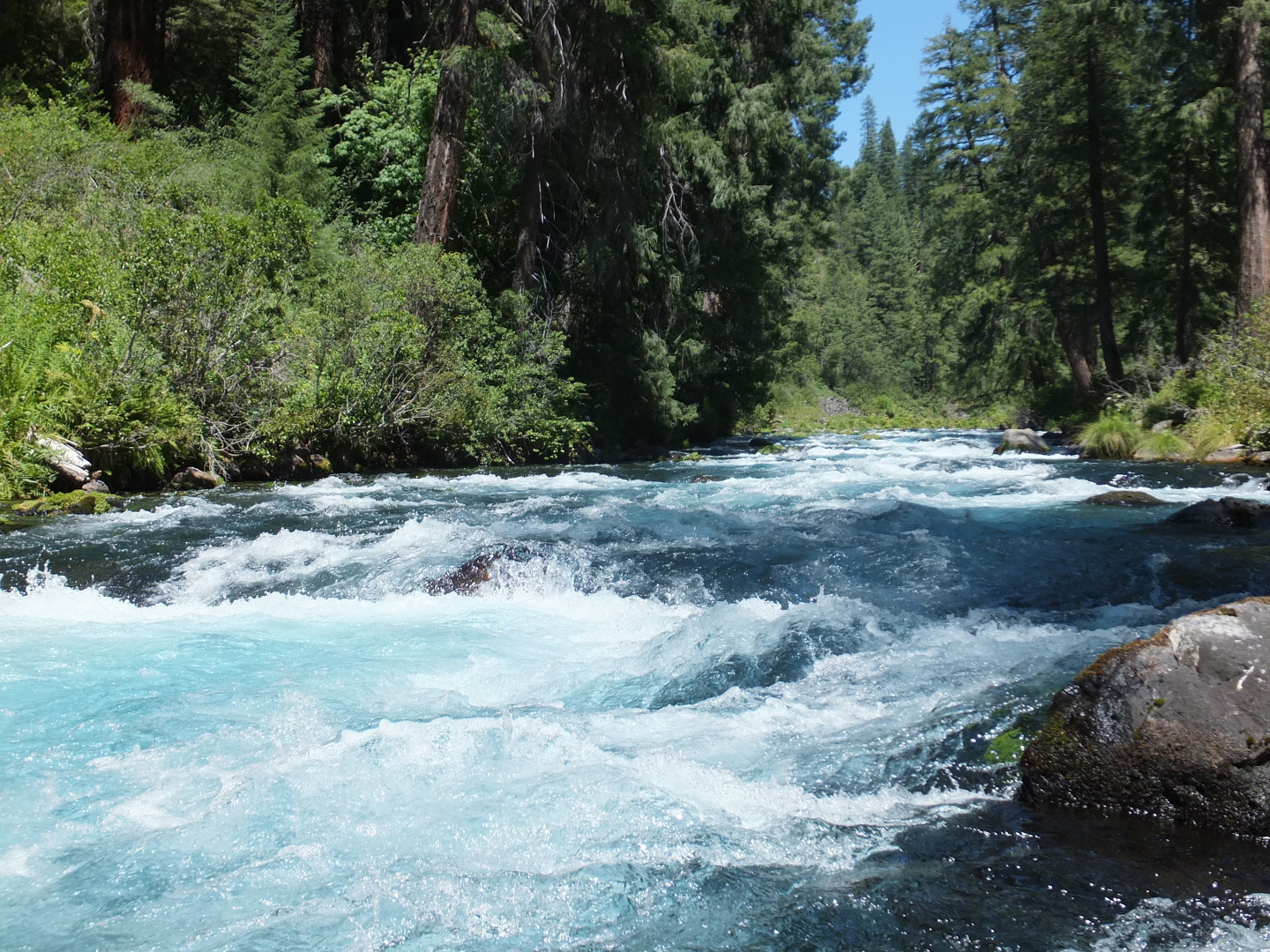
- Huckleberry Creek enters on the left, with silty water diverted from Mud Creek,
changing the color of the water from electric blue to milky turquoise.
The Hearsts diverted Mud Creek so it would not silt up the river past Wyntoon
(see Western Whitewater by Cross, Cassady, and Calhoun).
This is the high-water mark of the reservoir, but often flow continues for a while.
-
- 11.8
- Steel and concrete bridge across the reservoir.
- 13.5
- Motorboat take-out ramp down the inlet of Tarantula Gulch on the right.
Shuttle Directions
To reach take-out, drive east on highway 89 from Interstate 5
just south of Mount Shasta village (6 miles north of Dunsmuir).
At the town of McCloud, turn south onto Squaw Valley Road.
After Squaw Valley road turns sharp right, this becomes McCloud Reservoir road.
About 9 miles from McCloud, turn left suddenly onto Tarantula Gulch boat ramp.
To reach put-in, return to highway 89 and turn eastward.
Continue 5.5 miles to a dirt road, and turn south towards Fowler's Campground.
Proceed .5 mile to a 4-way intersection, go straight,
then almost immediately take the right fork, marked Lower Falls.
Follow this road .5 mile past Fowler's Campground to the river.
For summertime put in, continue on a dirt road past the marked “kayak put-in”
to the end of the road near a log and plowed dirt beam.
|
|
Creeks Navigation
Home
Recommended Runs
Map of Rivers
Alphabetic Index
Alphabetic Table
Text Search
Sponsored Links
|