| |
| Stretch: |
Near triple confluence to end of road on Main Salmon |
| Difficulty: |
Class IV with six class V drops, harder at higher flows |
| Distance: |
36.4 miles, plus 22.5 miles on the main Salmon, 3 to 5 days |
| Flows: |
kayaks 1.5' and higher, rafts 2.5' to 4.5' on the Krassel gauge
|
| Gauge: |
at Krassel, above the Secesh and East Fork
(USGS
site) |
| Gradient: |
40 fpm above the main Salmon confluence |
| Put-in: |
Secesh confluence, or end of road 3 miles below, 3600' |
| Take-out: |
Vinegar Creek (Chittam) boat ramp on the Main Salmon, 1960' |
| Shuttle: |
100 miles (3 hours) one-way, partly on dirt roads |
| Maps: |
USGS 1:1000 Warren, USFS Payette NF, AAA Idaho,
Topo
|
| Season: |
spring into late summer, from snowmelt and springs |
| Agency: |
USDA-USFS, day-use permit required on the main Salmon |
| Notes: |
High-water notes © 2006 Chris Dawkins, Mike Holstrom, Rick Hill.
Low-water notes 2009, 2021.
|
| Photos: |
© 2009 Brian Vogt (Pentax WPi) and Bill Tuthill (SD800).
|
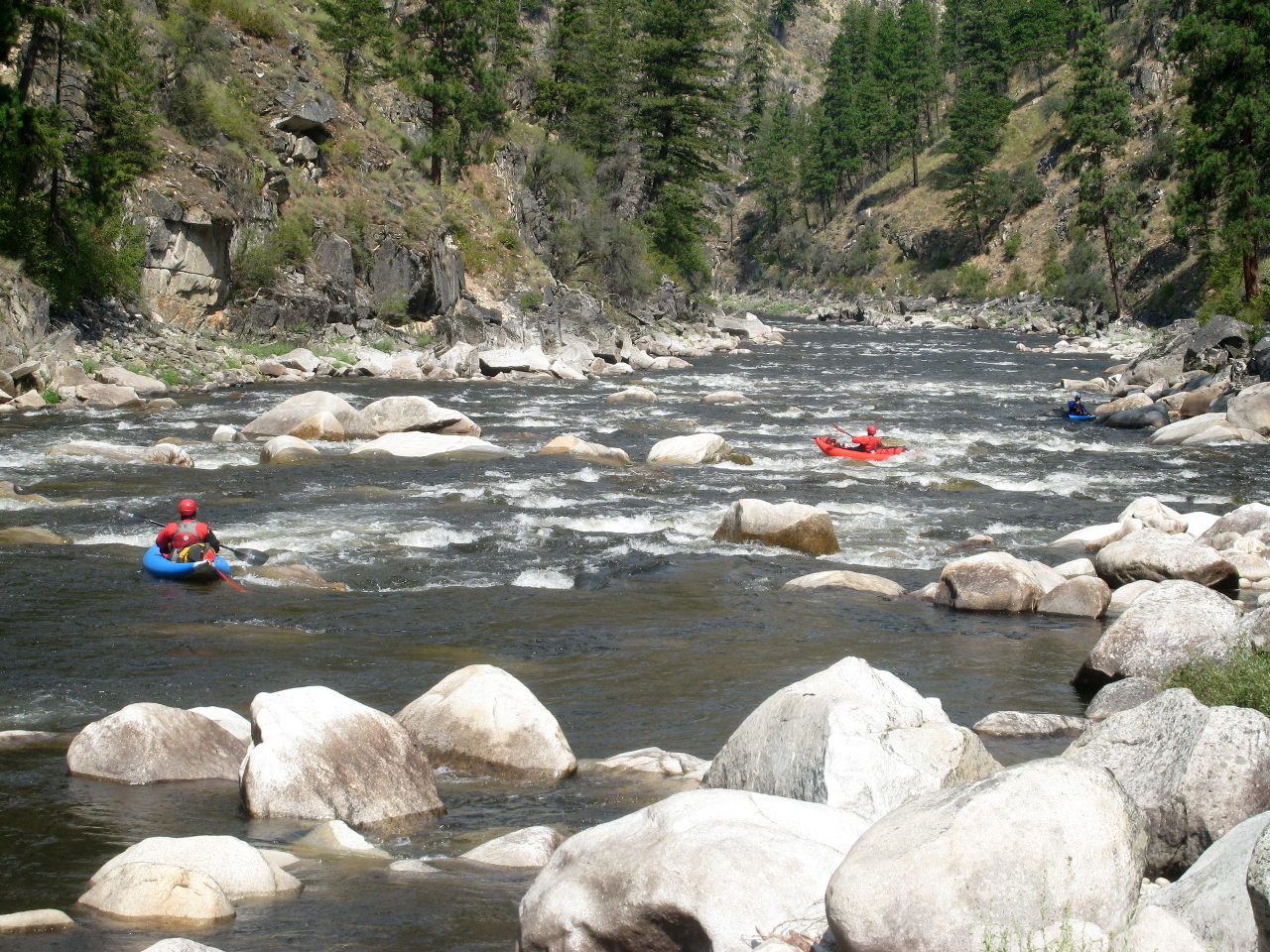
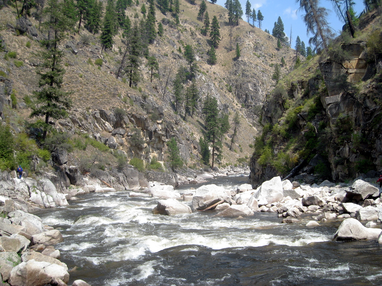
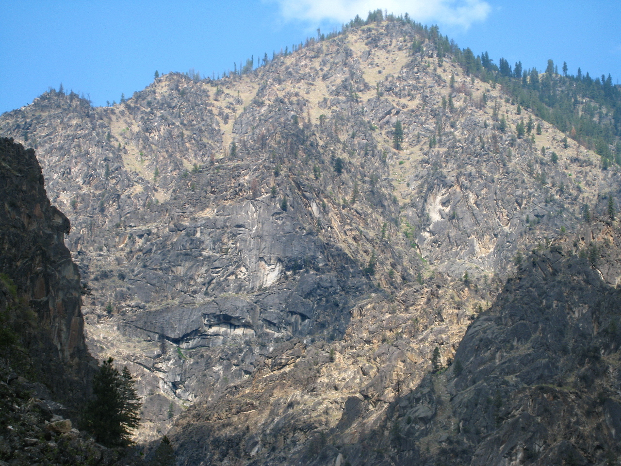
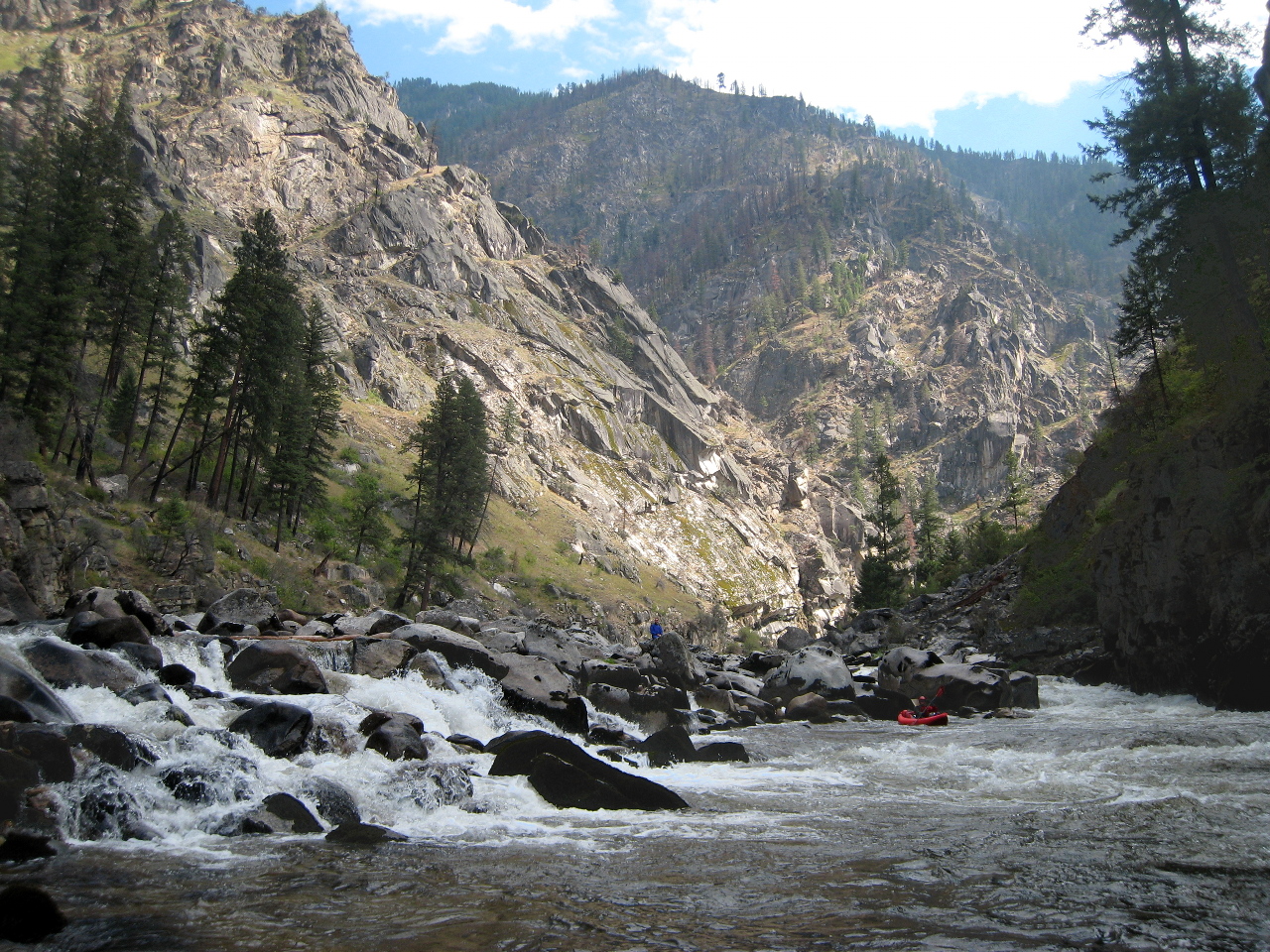
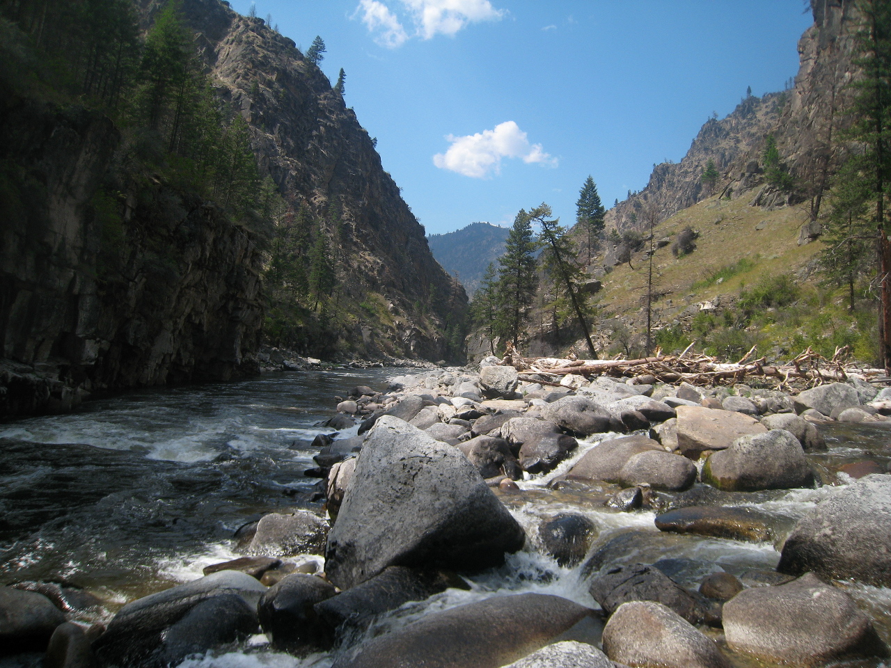
This is perhaps the best expert multiday river trip in the west,
rivalling the Illinois for wilderness and exceeding it for whitewater.
Permits are required for the runout day on the main Salmon,
but are easy to obtain by calling the USFS river office before your trip.
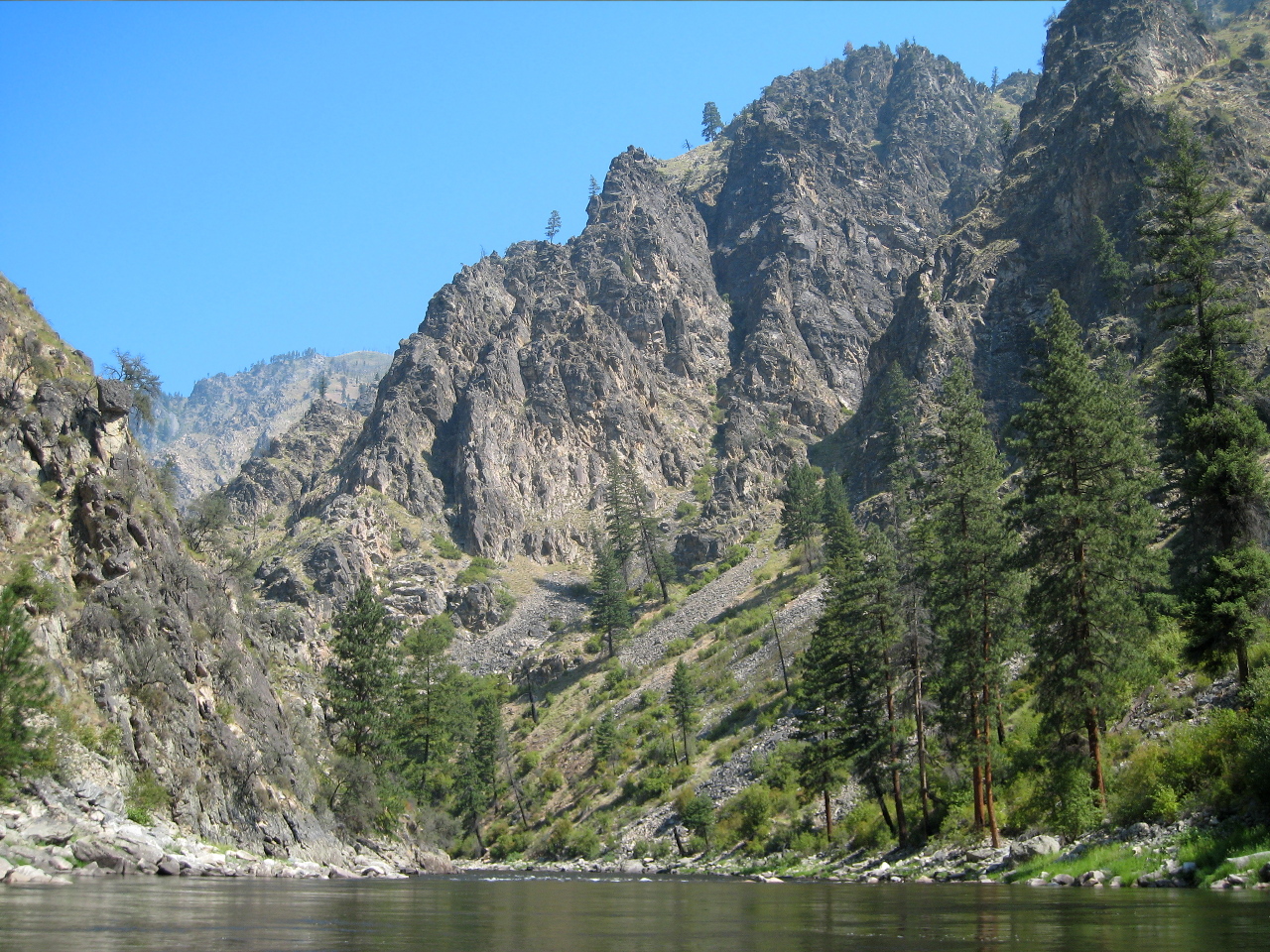
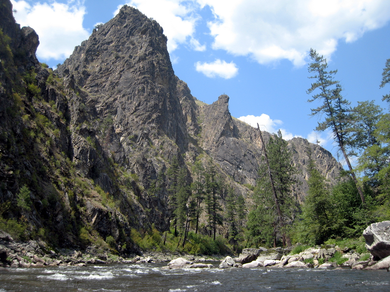
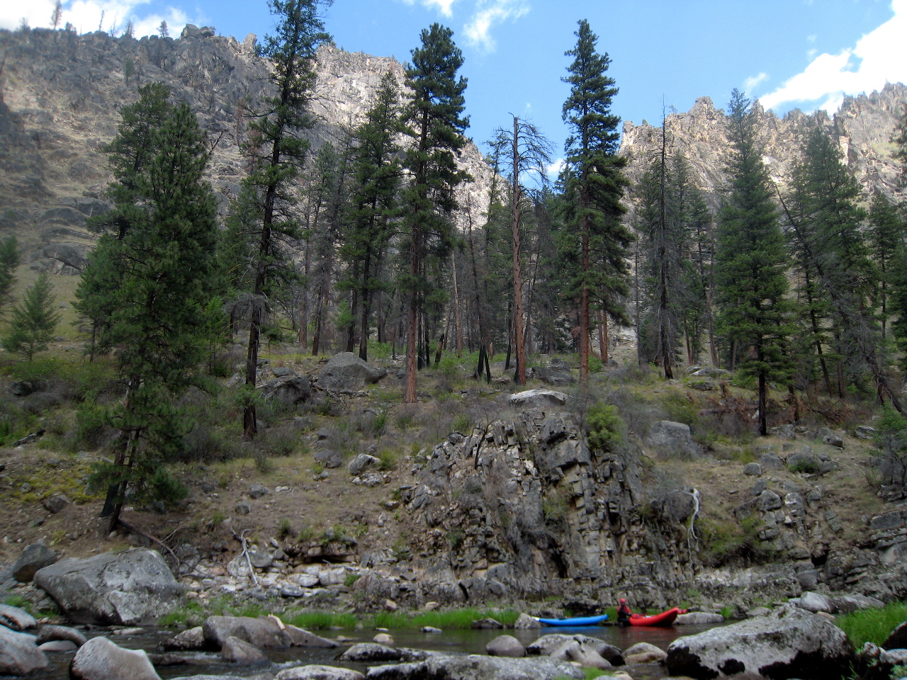
Scenery is similar to the Middle Fork Salmon one major drainage to the east,
and many class II and II+ rapids remind you of ones on the Middle Fork.
Both trips start in deep forest and end in an arid canyon.
The south fork even has its own semi-Impassible Canyon at the end,
although a trail is visible from river level even for that part of the trip.
One difference is that the south fork has not yet been sanitized
into an artificial ranger-patrolled wilderness.
Mining and ranching equipment are strewn across many fine campsites.
Historic relics or mere trash, you decide.
If you can stay near the put-in area for several days,
you are guaranteed a memorable boating extravaganza.
The Secesh offers an interesting 5 mile kayak run
from Ponderosa campground (or the Lick Creek road bridge) to the confluence,
which Grant Amaral's guidebook rates class IV.
Above that is a 15 mile canyon run that Amaral rates class V.
The East Fork of the South Fork offers an excellent raft-or-kayak run.
From Johnson Creek near the town of Yellow Pine, is it about 15 miles to
the confluence, starting with two class V rapids, Flight Simulator and Junky.
Below the alternate put-in at Caton Creek 5 miles below,
it is more a class IV run.
The upper South Fork offers a good 7.5 mile kayak run
from Goat Creek to Teapot Hot Springs,
which Grant Amaral's guidebook rates class IV with one V, Double Drop.
Except where marked, photographs were taken at moderately low flows,
about 2.6 feet on the gauge.
For photographs taken at medium flow, about 3.4 on the gauge, see this
Picasa gallery.
To help you coordinate with topographic maps, mileage is given in
trip distance and/or river miles above the confluence with the main Salmon.
- mile
- 0 / 36.4
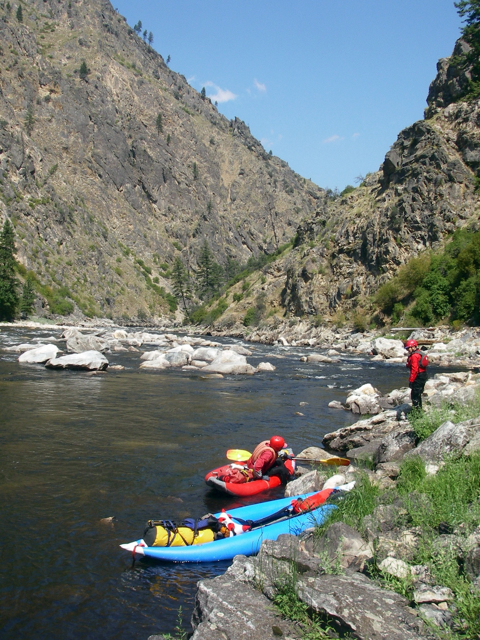
- Confluence of the Secesh and the South Fork Salmon.
The confluence of the East Fork of the South Fork
is less than a mile upstream.
Although many sidestreams come in downstream,
by this point the South Fork has become a large river.
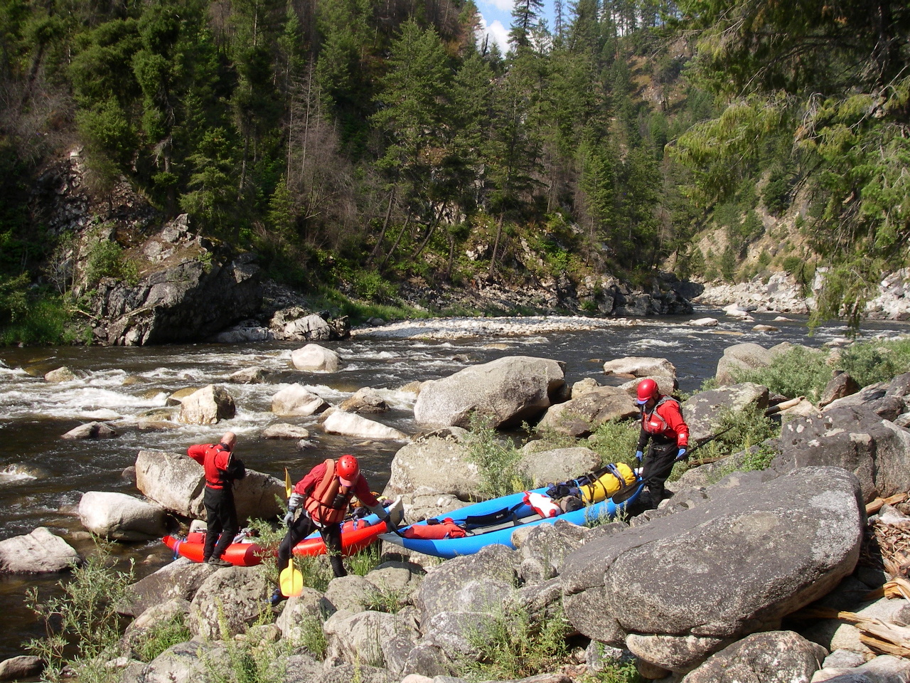
- Rafters usually put in at the Secesh confluence,
because access at the end of road is steep and narrow.
The Secesh was named during the Civil War by Confederate sympathizers
(get it?) whereas the Yankee Fork, a tributary of the main Salmon
to the east, was named by Union sympathizers.
- 3.2 / 33.2
- Only minor rapids from the confluence to the end of road,
where kayakers often put in. No toilet facilities at either put-in
(2009) but two excellent USFS campgrounds (fee for overnight camping)
are available along the shuttle road that follows the Secesh.
-
- 3.4 / 33
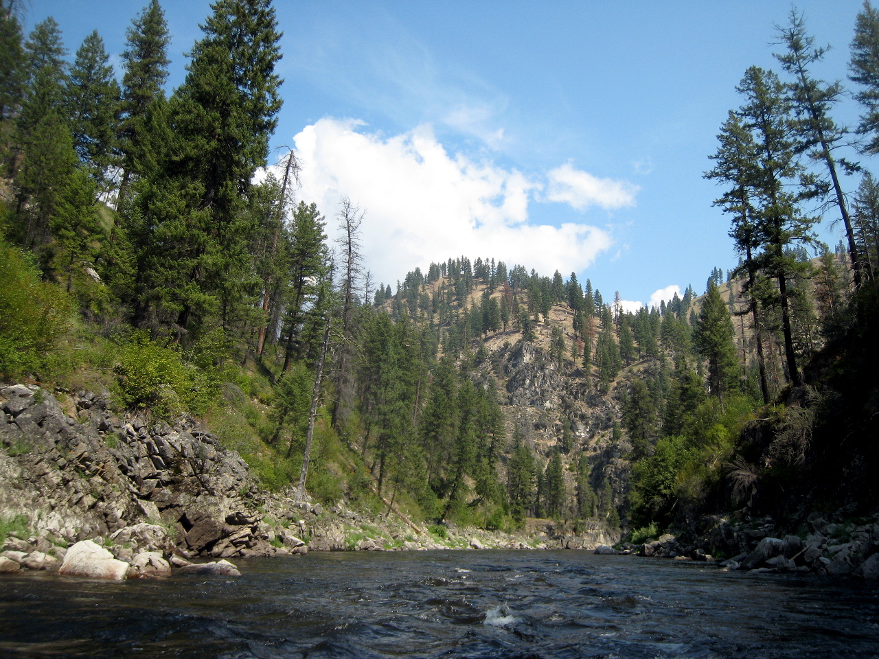
- Easy warm-up rapids, in a beautiful canyon, for the next several miles.
Burn scars from the 1994 Thunderbolt fire are visible as you pass
Moss Creek and Sheep Creek on the right.
- 5.8 / 30.6
- Slide Creek rapid, class III-IV.
On the right above this rapid, Slide Creek drops steeply over bedrock.
The river bends sharp left around a cliff on the left. Big boulders
divide the flow at top. Enter left and stay generally left of center.
At low flows this is a two-part rapid, with the first section
moving left to right, and the second section moving right to left.
At higher flows a large hole develops in the center about halfway down.
-
- 7.5 / 28.6
- Good camps on both left and right, for boaters who get a late start.
Mileage approximate.
-
- 8.3 / 28.1
- Cable crossing. You can see an orange Land Cruiser, with oil drums,
abandoned on the right bank. The river curves left.
- 8.5 / 27.9
- Beautiful waterfall from Fritser Creek on the left.
A class III boulder garden follows, most easily run on the right.
-
- 8.8 / 27.6
- Devil Creek rapid, class V-, scout left.
- The creek that gives this rapid its name comes in on the left just
upstream, but is not highly visible. Find the good scouting promontory
on the left bank above the crux of this rapid. At low flows,
the best line starts on the far left (2009), with a sharp ferry
to the center or right side near the bottom. Big holes in the runout.
At higher flows, the left side gets increasingly difficult, and
a class IV line develops on the right, although a missed move has
catastrophic consequences due to the boulder sieve in the center.
Lesser rapids continue for a distance below, then ease.
-
-
- 10.2 / 26.2
- Nice camp on the right with big sandy beach and tall Ponderosa pines,
although the surrounding scenery is mostly burned forest and scrub.
Below camp, the class III-IV rapids intensify.
- 10.4 / 26.0
- Class III-IV rapid sometimes called Wake Up (by campers),
marked Lawman Ford on the topo map.
Avoid the right channel and take the right side of the left channel.
A couple of class III-IV rapids follow, one in a long straight section.
- 11.8 / 24.6
- Class IV or IV+ boulder garden sometimes called Rick's Rodeo,
near the mouth of Rock Creek. At most flows,
start right and move towards the center near the bottom.
At high flows you encounter big holes and many pour-overs.
Several class III-IV rapids follow, one in a straight section.
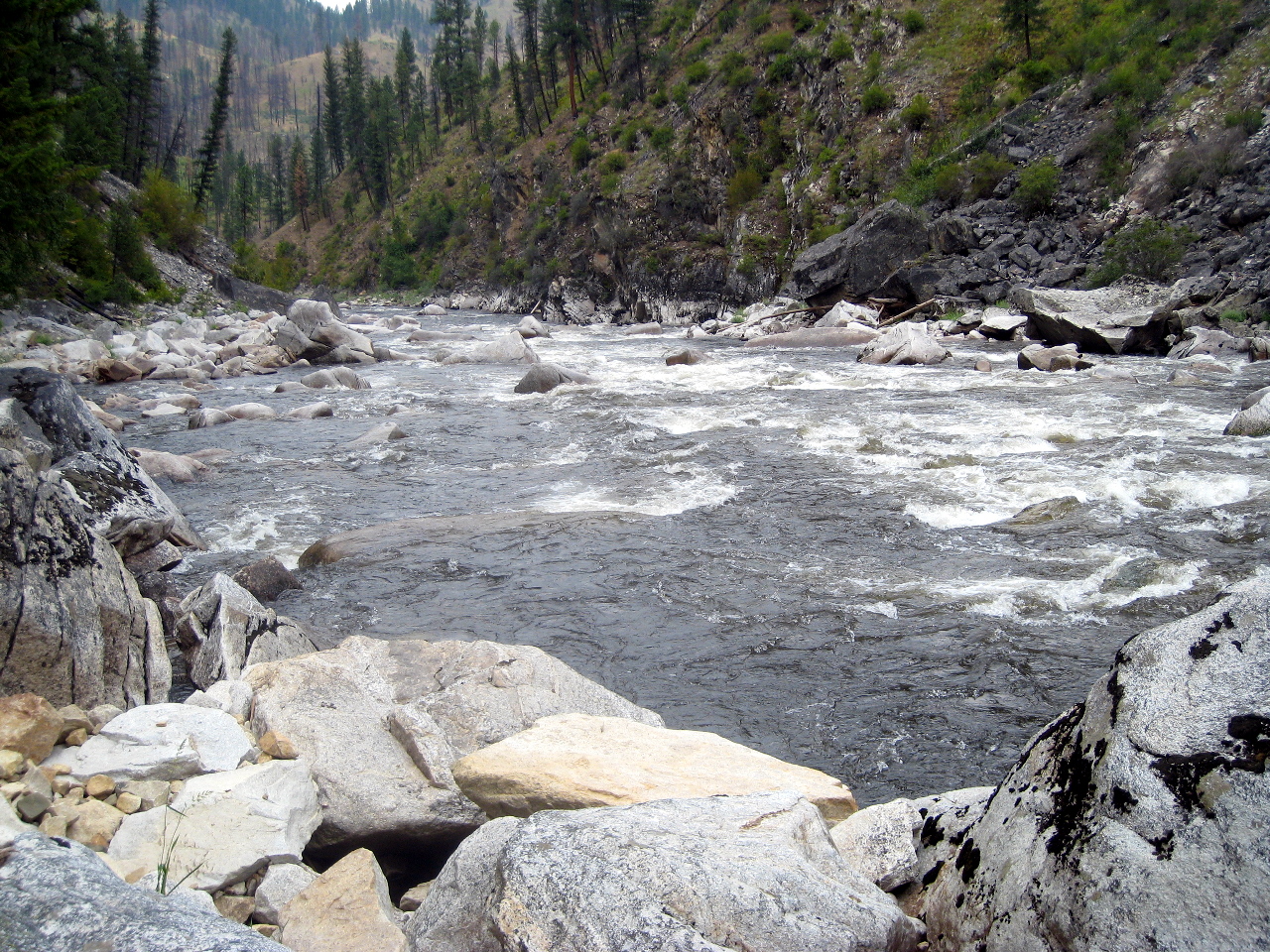
- 13.2 / 23.2
- Rapids ease for a while. Excellent campsites appear on the left,
near river level on a long flat bench covered with Ponderosa pines.
These camps appear to be some of the nicest on the river.
At high flows, the upper camp has a good eddy,
and the lower camp has a decent eddy. If these camps are full,
several similar but lesser beach camps follow on the left bank.
- 14.3 / 22.1
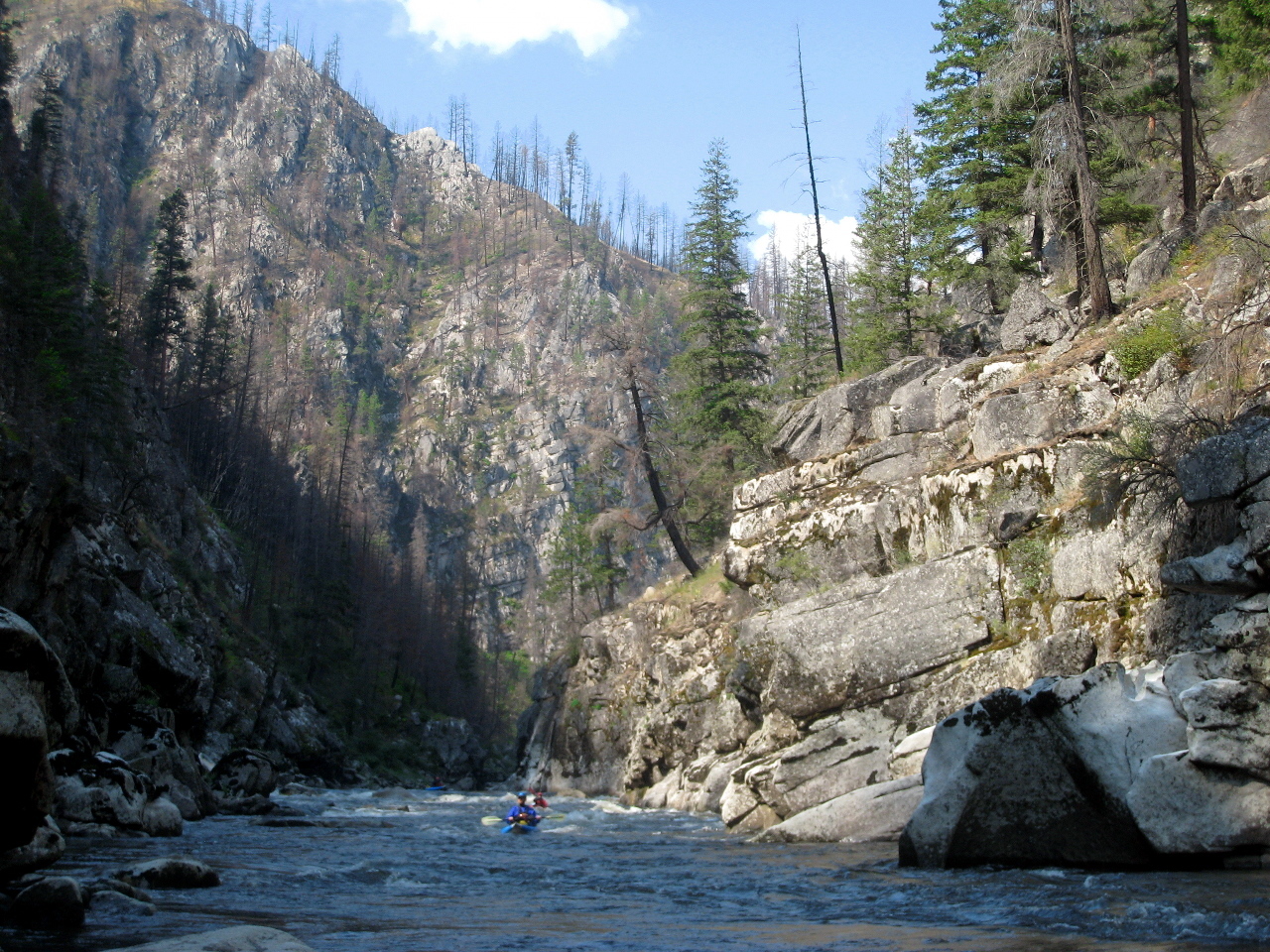
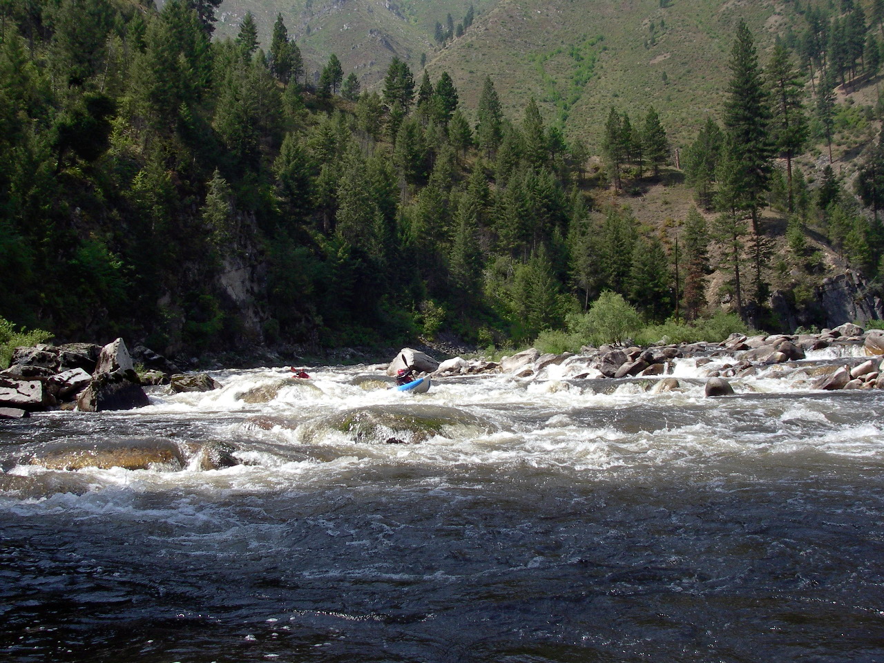
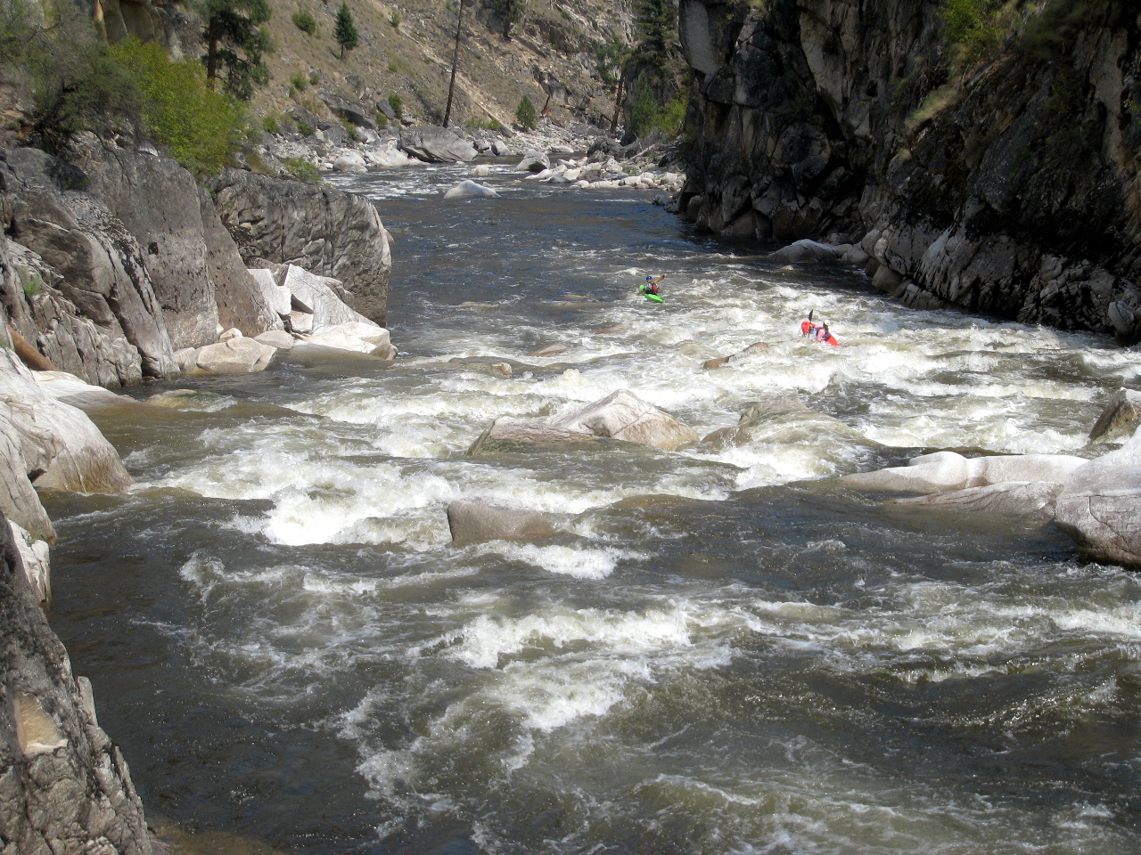
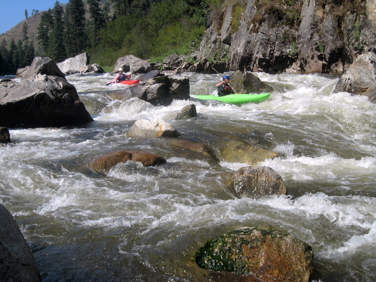
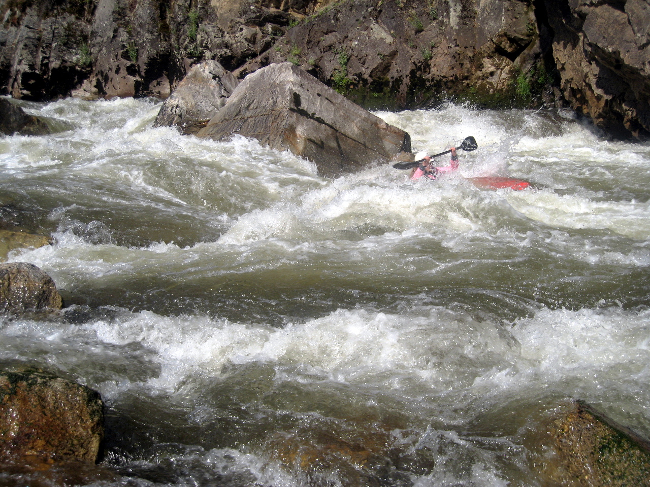
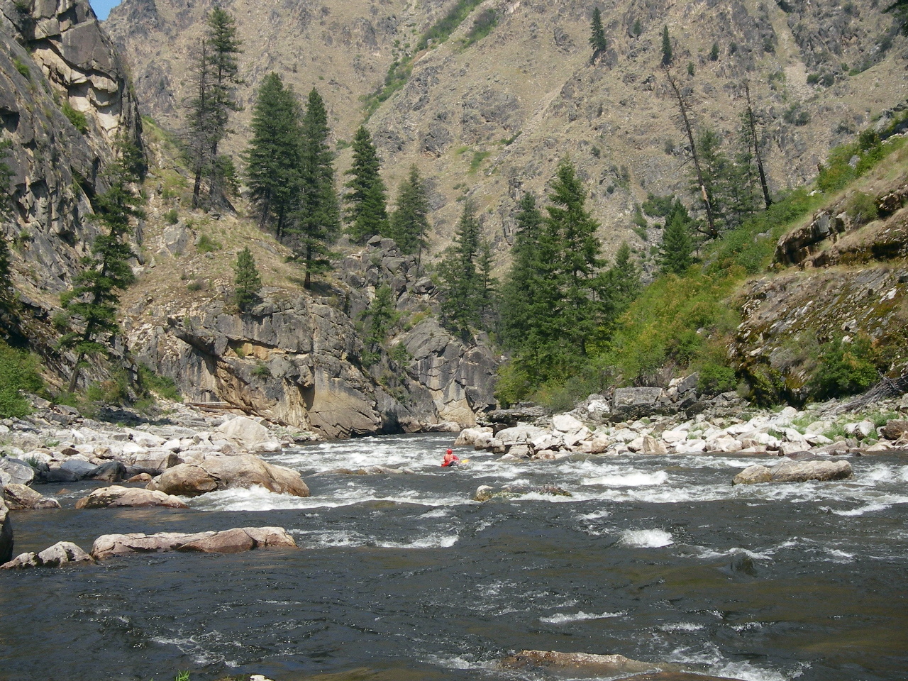
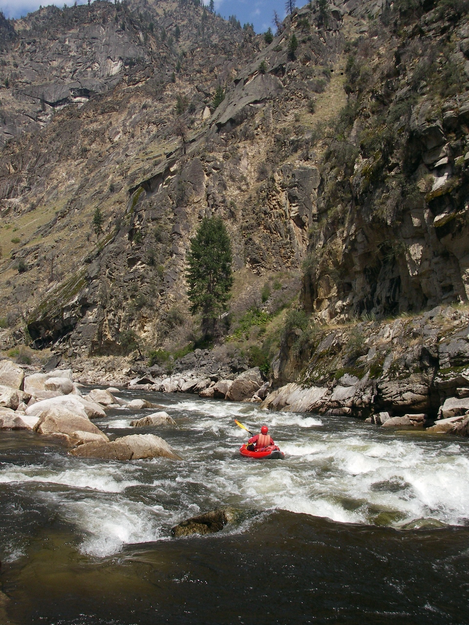
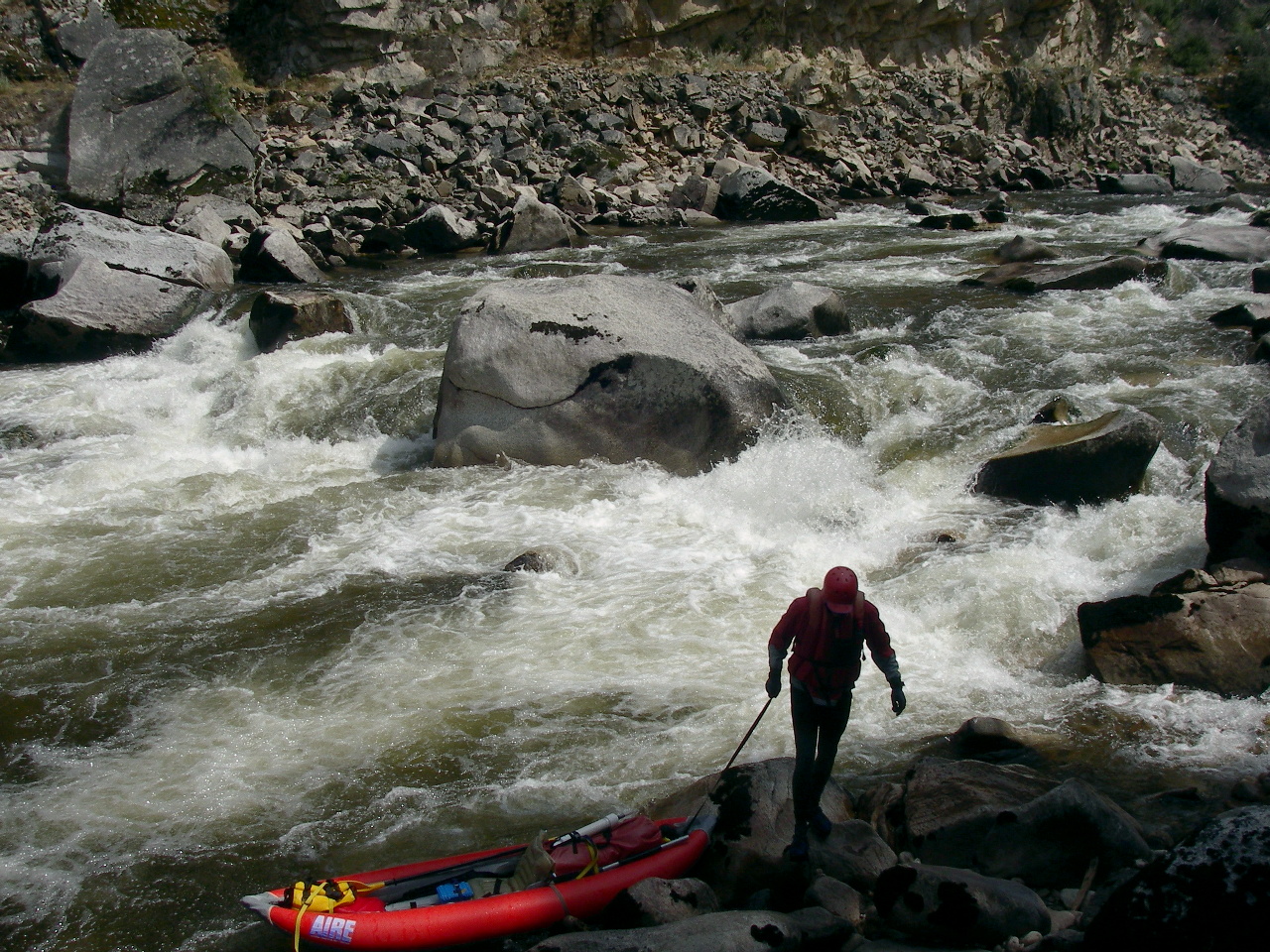
- Surprise Rapid, AKA Citadel, class V-, scout left.
Recognition: about .7 mile of slow moving water, widening at the end,
with a long rocky bar on the left. There is an excellent campsite
at the bottom end of the rocky bar. At high flows, eddy out below
the rocky bar on a sandy beach above the class III-IV entrance rapid.
You can scout the right-curving entrance rapid and Surprise from
this beach, although it is a long walk in a hot drysuit. At low flows
you might want to start your scout below the entrance rapid.
- Surprise Rapid is a long boulder field with big holes and steep drops.
Its alternate name Citadel results from a big triangular shaped rock
in the middle about a third of the way down. At low flow the best
kayak run might be on far left all the way. At medium and high water,
the holes get much bigger. Start in the center and work left,
which can be difficult depending on water level and guard rocks.
Hopefully finish by running the class IV line ending on the far left.
Less-than-ideal heavily-obstructed routes are available right of center
if you miss your move.
-
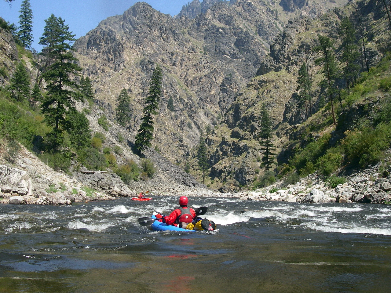
- High-flow picture by Mike Holstrom.
- At high flow, about .2 mile of class III separates the end of Surprise
from the beginning of Elk Creek rapid. You might want to have the
lead boat eddy out on the left and set rescue. At lower flows,
most boaters have sufficient time for self-rescue. Except for the
bravest boaters, the entrance to Elk Creek is on the right.
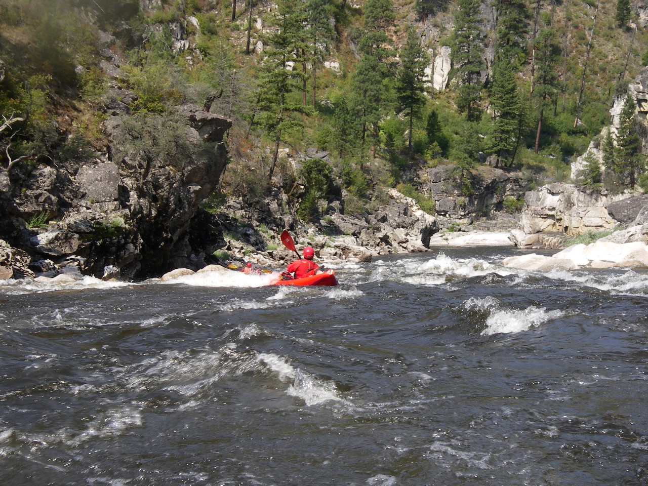
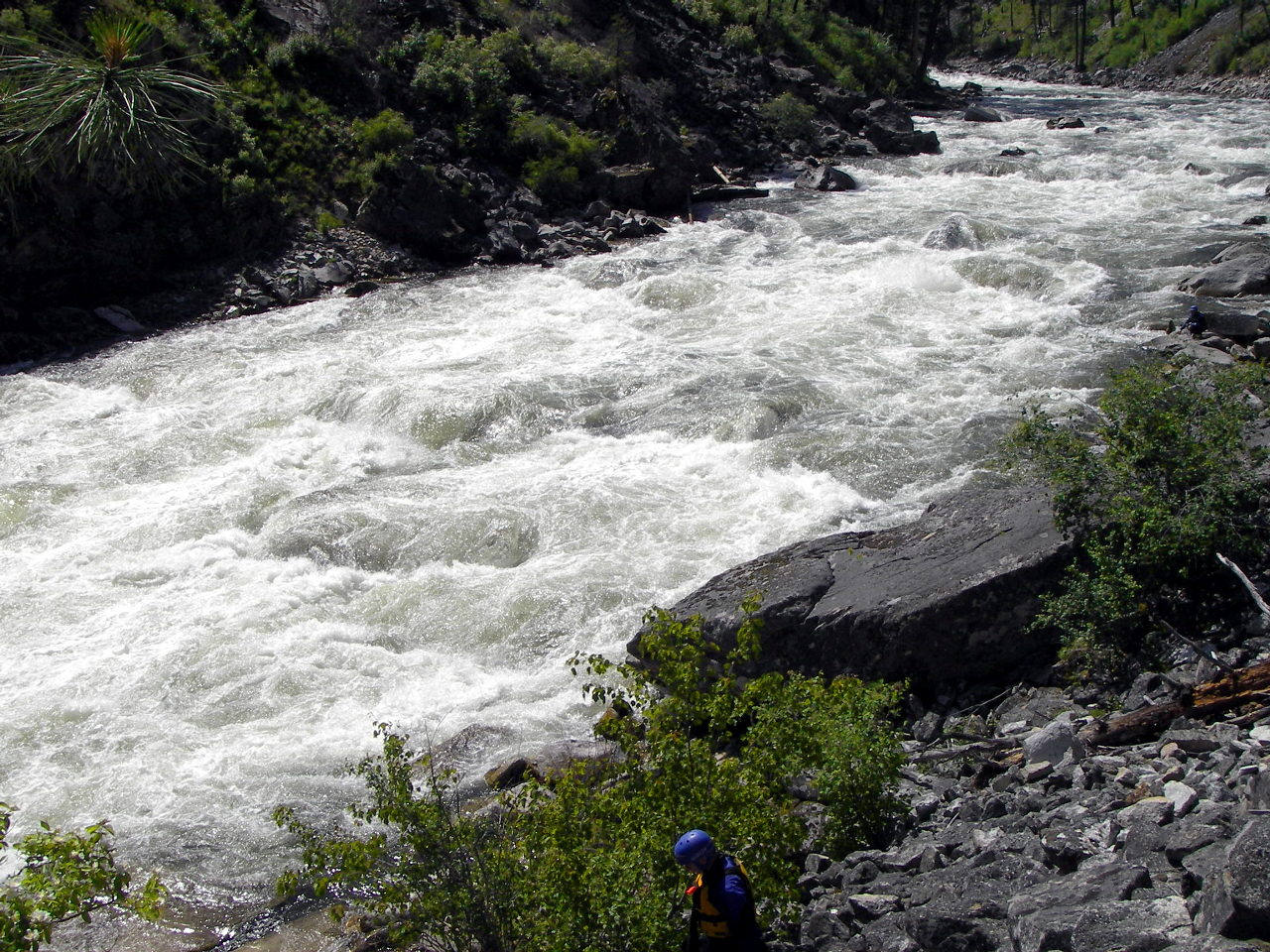
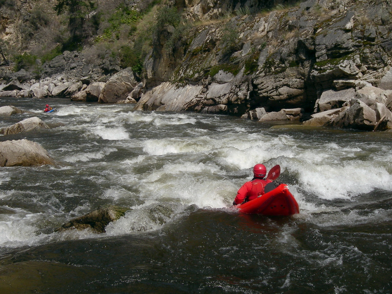
- 14.6 / 21.8
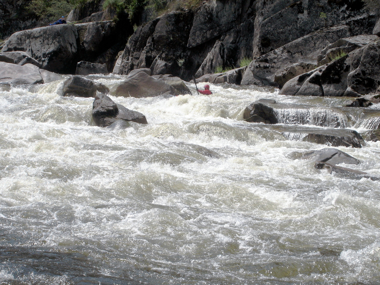
- Elk Creek, class V on the left, class IV on the right.
The left channel contains multiple ledge holes and ends in a steep drop
with a huge river-wide hole against a terminal cliff on the left.
If you want to run the left side for fun, you can scout on the left.
The right channel, which you enter right of a cabin-sized rock
decorated with logs (2009), is less severe. It turns sharp left
as it drops steeply over boulders to join the main channel.
At higher flows, the steep left-facing drop can be troublesome.
Also at higher flows, you might want to work left immediately below,
because the following rapid contains a river-wide ledge hole with a
small tongue in the center right and an easier line on the far left.
-
- 14.8 / 21.6
- Deer Creek enters on the left, forming a long boulder garden.
At low flow, the route is on the right where the river drops first.
At flows above 3.5', the monster holes and river-wide ledge make this
class IV+, but at lower flows it is still a serious class IV rapid.
A big ledge hole (previously mentioned) extends from the right bank
all the way across the river to center left, 70% of the river width.
The hole is worst left of center and center, and is somewhat weaker
on the far right, but the safe line is far left to avoid it entirely.
Even if punched, the left-center hole can pull you back and flip you.
Small pour-overs and rocks on the far left prevent a left bank run.
At high flows, start on the left side of the green tongue (far left)
and pull left until you are past the first hole. Stay left past
the second big hole in river center. Then work back to center in
the bottom half of the rapid.
- 14.9 / 21.5
- Elk Creek comes in on the right, in the midst of Deer Creek rapid.
Buildings are located near the top of a low bench, which continues for
a distance on the right. A picnic table is situated below the rapid,
making a civilized lunch stop possible. Rapids continue for a while,
not as difficult but still class III at minimum.
- 16.6 / 19.8
- Road 340 crosses the river and the rapids ease for several miles.
The USFS guard station is located on river right just upstream.
Good campsite on the left below the bridge, although near the road.
- 18.7 / 17.7
- A beautiful large sandy beach on the left near a village of new houses.
This would make a great campsite if the houses were unoccupied.
- 19.4 / 17.0
- A long class IV boulder garden, starting where K Creek enters
on the left.
- 20.3 / 16.1
- Good campsite on the right, marked by a rusty old winch and cable.
The high bench is more hospitable than it looks from river level,
as evidenced by remains of a cabin foundation and mine-camp debris.
- 21.6 / 14.8
- Grouse Creek Rapid, class IV+, scout right.
Recognition: lots of whitewater noise at a blind right turn.
This is a long boulder garden with big rocks and holes, especially
in the bottom third where it steepens. Check for possible log jams.
At high flows you can find a scout trail climbing up from the eddy
(just below Grouse Creek) to a a high wooded bench on the right.
At low flows you can scout by clambering down rocks on the right shore.
Seemingly at all flow levels, the best route is to enter on the right,
move to the center, then work to the left, although not too soon.
Big wave train at high flows. Sticky underwater rocks at low flows.
-
- 21.75 / 14.65
- The topo map and Western Whitewater by Cross/Cassady/Calhoun
have a pack bridge marked, which disappeared at some point.
Reports indicate it might be rebuilt,
though it's not visible on the satellite image (2021).
- 22.2 / 14.2
- Huge group camp, or set of camps, on the left.
A dirt road leads downstream to the burner and Hettinger Ranch.
Although it is spacious and scenic, the uppermost camp is located
on a low bench above a rocky shoreline where the river shallows out.
If you prefer a sandy beach landing, you can float around the corner,
past the burner, to the lower campsite on river left.
- 22.8 / 13.6
- Burner on left for an old charcoal kiln, and remains of a steam saw mill,
never operated because logging trucks could not negotiate the road down
to the river. Good campsite with sandy beach just downstream.
The landing strip for Hettinger Ranch is up the Smith Creek draw
and to the right. The ranch house is to the left.
- The first significant rapid after the burner, after a right bend,
curving left into the wall, is just a class III, not Greyhound.
- 24 / 12.4
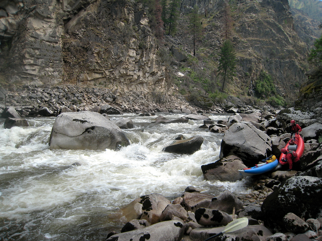
- Greyhound Rapid, class V-, scout right.
This rapid is a steep drop over large boulders, constricted
by a cliff on the left, badly undercut at and below water level.
This is why it is a bad idea to enter left and try to move right.
At flows between 2' and 3' the best (center) route is tight and tricky
even for kayaks, and would be even more technical for rafts (2009).
Enter on the right, move center, thread through rocks, and end center.
The portage on the right is not very difficult, therefore tempting.
At higher flows, multiple runs are available. Below the entrance
in the center is a large mound boulder with water pouring over it.
One run is to start center, moving right of this boulder, because
left of the mound boulder is an 8' ledge with a reactionary wave/hole
backed up by the undercut left cliff wall. After the mound rock,
thread the line between it and the rock below on the right, then
pull hard left to finish in the center. At flows slightly shy of 4'
perhaps, a sneak route opens up in the right center, taking the mound
out of play, so you can start right of center and stay right.
-
- 24.9 / 11.5
- Several more class III-IV rapids below Greyhound, then whitewater
slacks off until after the pack bridge at mile 26.5.
- 25.4 / 11.0
- Good campsite on river left, immediately below an easy class IV rapid
that finishes on the far right. At high flows, you must pull hard left
to make the camp. Recognition: log pile in the center of the river
(2007) approximately 100 yards below the camp, at which point
the short pool ends and an easy rapid bends off to the right.
This camp has a rocky shoreline, but good access, plenty of room,
and lots of shade among the sugar pines.
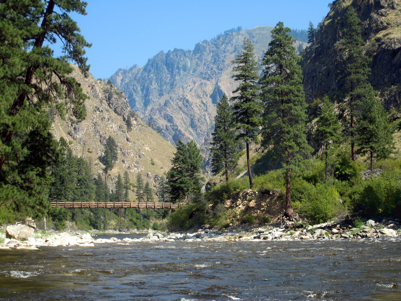
- 26.5 / 9.9
- Porphyry Creek pack bridge, where the trail crosses from river left
to river right. The water moves swiftly in the section below here,
although you encounter relatively easy water between most rapids.
Raines (Fall) Creek is five miles downstream, but at high flows,
these miles pass quickly. Between here and the whitewater climax
at Raines Creek, you encounter many class II-III rapids, and four or
five class IV rapids, depending on flow levels and how you count.
-
- 27.4 / 9.0
- Long Boulder Bar, class IV+ on the left, class IV on the right.
This rapid lures you into the left side, but the water first starts
dropping on the far right, which is probably the best route at
most flows. In the course of this long rapid, two unnamed creeks
enter on the left and right.
-
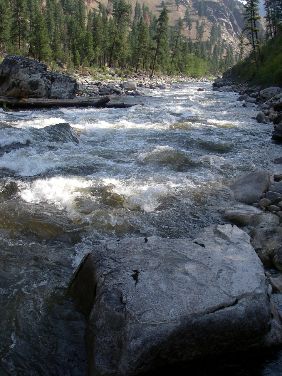
- 28.1 / 8.3
- Chicken Creek enters on the right. About .1 mile below is a rapid.
- 28.5 / 7.9
- Curven Creek enters on the left. About .15 mile below is a rapid.
- 29.0 / 7.4
- Constricted Straightaway, class IV+
Scout either right or left, perhaps depending on flow.
Unnamed seasonally dry creek enters on the right, at a left bend,
followed by this steep rapid. The biggest drop is at the bottom.
At low flows, a semi-sneak route starts in the center and finishes
on the right. At high water (2006-2007) the right side looked bad.
The successful route was to enter left, move toward center around
a large hole, and move back hard left towards the bottom to miss a
hole in the center and the huge bottom-center pour-over.
Essentially this route is a thread-the-needle between two holes,
one formed by the center pour-over, and a hole against the left wall,
which maybe could be punched. You can see the bottom-center pour-over
from above as a huge mound of water in the center of the river.
-
- 29.9 / 6.5
- Rooster Creek enters on the right.
About .05 mile below, Box Creek enters on the left.
- 30.0 / 6.4
- Bending Right, class IV, a boulder garden usually run center
to far right, avoiding some big rocks and holes on the left.
- 30.45 / 5.95
- Beautiful low-water (or trail) campsite on the right situated on
a gravel beach. This might be the best lunch spot until after the
Raines and Fall Creek series of rapids. The river straightens
for a while, then curves right, with easy water for nearly a mile.
-
- 31.5 / 4.9
- Fall Creek #1, class IV, high-water scout right, low-water scout left
Recognition: a gray-rock mountain rises high on the right side
and has two white colored overhangs that look kind of like eyebrows.
They are easy to spot from upstream, but disappear as you get close.
After you see the eyebrows, no significant rapids appear until the
right cliff and horizon line of Fall Creek #1. At low flows, the
best scout is from the rock bar on the left. At high flows, stop in
the eddy on the right just upstream of the cliff and horizon line.
From the river, the cliff appears to drop into a pile of rocks
and then the river. The scout trail runs from this eddy along
the base of the cliff across the top of the rocks above the river
and is not visible from the river. At most flows, the route starts
left of center and moves hard left at the end.
-
- 31.8 / 4.6
- Fall Creek #2, class V-, scout left if possible
- At medium and high flows, the crux of this rapid is a class IV+ slide
on river left separated by a big boulder from a huge class V ledge hole
in the center. Significant rapids continue immediately, all the way to
Fall Creek #3, making this rapid riskier than its inherent difficulty.
At lower flows the left slide starts getting junky, but the center hole
does not start getting benign until very low flows. After the crux of
Fall Creek #2, at most flows you probably need to move to the center
to avoid a rock on the left, but you must decide beforehand whether
to work right afterwards and portage, or whether to move far left and
run Fall Creek #3. It is virtually impossible to scout Fall Creek #3
from the left due to a cliff, and by the time you have moved right,
it is too late to enter the good channel on far left.
-
- 32.0 / 4.4
- Raines Creek enters on the left, and Fall Creek enters on the right.
The first was named after Jim Raines, who had a ranch up the creek
where he was killed, along with two ranch-hands, during the
Sheepeater Indian War in 1879.
- 32.2 / 4.2
- Fall Creek #3, class V, possibly portage right
This rapid is like Elk Creek at mile 14.6, but longer in the entrance
and bigger in the final drop. Also, the right channel is not runnable.
It starts with a class IV boulder garden and ends with class V ledges.
Of course the following advice is not guaranteed due to
inevitable changes in the riverbed.
At high flows > 3.7', after Fall Creek #2 and moving center, work
far left. Run the left side, then run two more ledges left of center.
Move hard left of partially submerged rock and then left of a boulder
in the center to make the left side for the last four ledge drops.
At medium flows around 3.5', stay far left against the bank.
At low and medium flows around 3', after the center move below #2,
work quickly left to miss a large pour-over. Stay far left to avoid
an undercut house-sized boulder located in right center. Drop over an
8' slide between two rocks into a hole, moving left to avoid one hole,
and running the next two holes center, then the class IV run out.
-
- 32.4 / 4.0
- End of possible portage. Milder whitewater continues.
-
- 33.5 / 2.9
- Carlson Creek enters on the left. Airstrip high on a hill
upstream of the creek, mostly out of sight.
- 33.85 / 2.55
- Station Creek enters on the right near a pack bridge.
Just below is a nice camp on the right, where the river starts
a bend to the right. Large area with good access among boulders.
The river soon mellows out.
- 35.1 / 1.3
- The river curves past many new houses of so-called Badley Ranch on
river left. Eddy out river right at a cable car and walk a dirt road
to Mackay Bar Lodge, or continue floating downstream .3 mile to an
excellent set of camps on a large shaded bench on river left. If you
plan to camp, stop at the high end of the bench to check, because the
camp nearest the confluence might be occupied by main Salmon rafters.
-
- 36.4 / 0
- Confluence with the main Salmon river.
Mackay Bar village is situated a short distance upstream.
The end-of-road boat ramp is 22.5 miles downstream.
The 22.5 miles on the main Salmon contain a lot of flatwater,
or gently moving water at higher flows.
Sneak routes are possible in most rapids,
but you must run several big waves and holes,
including a class III- drop about halfway,
and Chittam, a big class III-IV just above take-out.
The end-of-road takeout has an outhouse and three concrete boat ramps,
two quite steep. Vinegar Creek, another big class III rapid,
is about half a mile downstream.
Shuttle Directions
Shuttle service is available from the general store in Yellow Pine.
For details call Tom or Nancy Richter, 208-633-3300.
To reach take-out from Riggins (153 miles north of Boise on highways
55 and 93) turn east across the Little Salmon at the south end of town
onto USFS Road 103. Continue 20 miles on pavement, then on dirt,
to the Carey Creek take-out. A short-cut is available near the
end of road at Carey Creek to Lick Creek road, all unpaved.
To reach put-in from McCall (107 miles north of Boise on highway 55,
or 46 miles south of Riggins) turn east onto Lick Creek Road near
the center of town. Drive past Little Payette Lake and a campground,
where the paved road changes to mostly dirt. Continue uphill over
6700' Lick Creek Summit, obviously closed in winter and early spring.
Descend steeply to the Secesh river, where you find a nice campground
after a bridge crossing. Continue about 11 miles to the confluence.
To reach McCall, assuming paid shuttle, drive west for 20 miles
along the main Salmon on USFS Road 103, first dirt, then paved.
Cross the Little Salmon river into town.
|
|
Creeks Navigation
Home
Recommended Runs
Map of Rivers
Alphabetic Index
Alphabetic Table
Text Search
Sponsored Links
|