| |
| Stretch: |
Fall River Mills to Pit River campground |
| Difficulty: |
Class IV (possible V), harder at higher flows |
| Distance: |
7.5 or 10.5 miles, 1 day |
| Flows: |
rafts and kayaks 900 - 1200 cfs, IK minimum 500
|
| Gauge: |
below Pit #1
(USGS site)
so check AW site for release dates
|
| Gradient: |
47 fpm average, 74 fpm below Big Eddy |
| Put-in: |
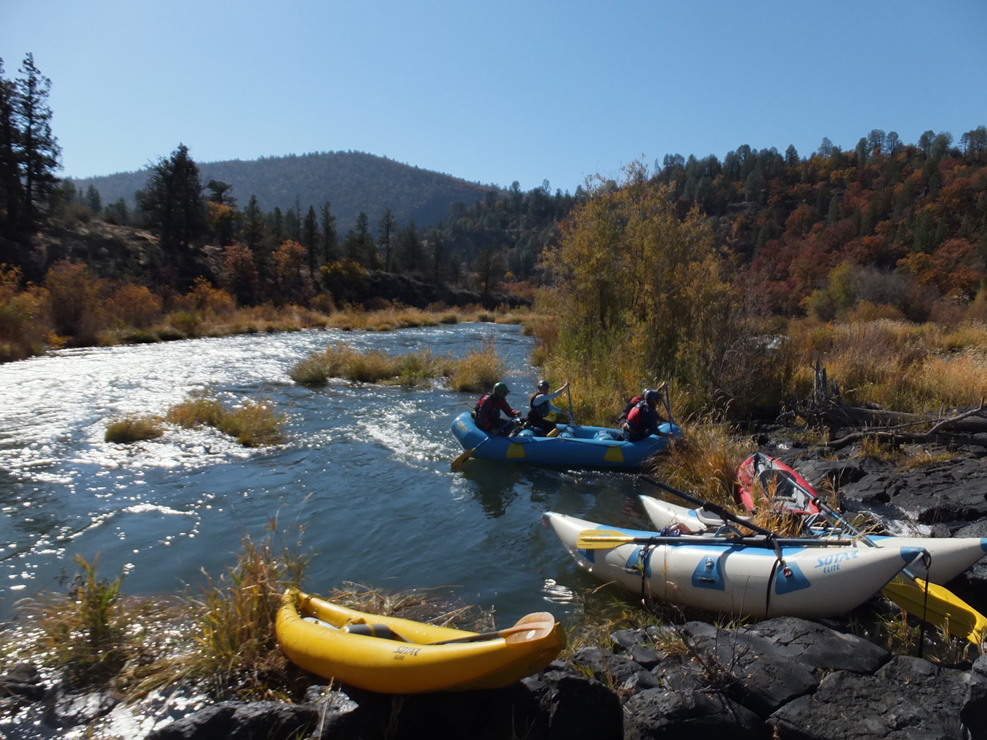
PG&E access across bridge from Fall River Mills, 3240' |
| Take-out: |
BLM campground near Pit #1 powerhouse, 2880' |
| Shuttle: |
8 miles (10 minutes) one-way way |
| Maps: |
AAA Northern California,
Topo
|
| Season: |
scheduled fall releases, spring depending on snowpack |
| Agency: |
PG&E, private, BLM |
| Notes: |
© 2013, 2015 Bill Tuthill,
CreeksYahoo |
Thanks to AW (American Whitewater) for negotiating scheduled releases in October,
this stretch has become an autumn classic, not to be missed.
Foliage is beautiful, water is clear and clean, rapids are plentiful,
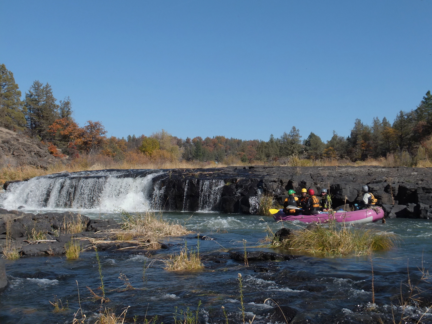
and you can run what might be the safest 20' waterfall in the world.
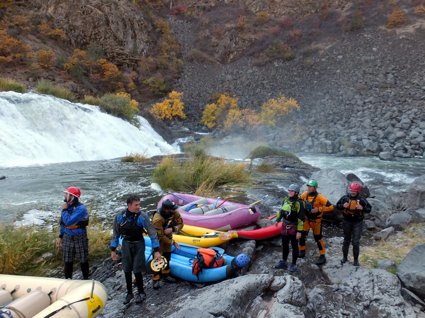
Rapids on this run are caused by relatively recent volcanic activity.
Especially at Big Eddy, lava flows have formed natural dams,
which the river has incised to create unusual and sometimes spectacular rapids.
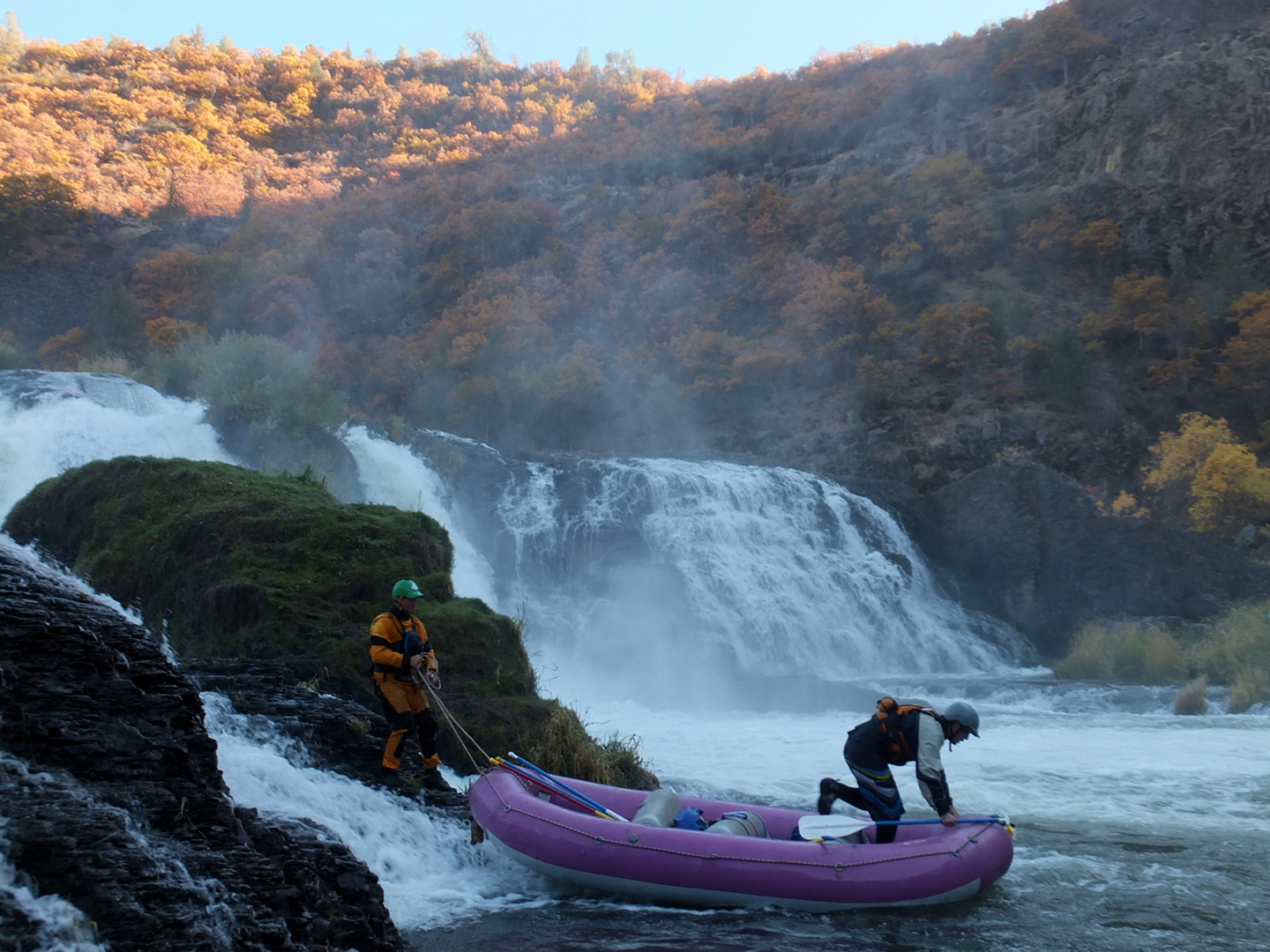
At high flows there is a mandatory portage at Pit Falls,
a 30' vertical drop over a particularly large lava flow.
At moderate flows such as the scheduled release, Pit Falls is a 40' runnable class V,
with a safe 20' class IV waterfall on far right followed by a 20' boat drag.
Photos on this page were taken with the scheduled release flow around 950 cfs.
For the older writeup with Kevin Lewis photos taken at high spring flows,
see this page.
More writeups and photos are available on the
AW website
and at A Wet State.
- 0
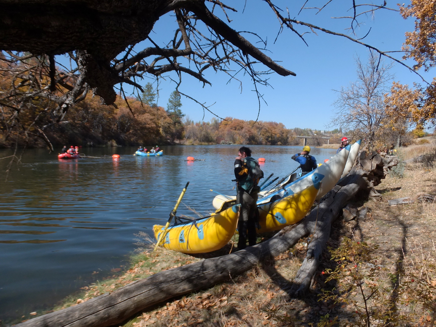
- In Fall River Mills, drive south and east across the bridge,
park at the PG&E access area (with restroom),
and carry boats down a trail slanting downstream.
The barbed-wire fence along the river stops where the trees begin.
If the bridge is closed (as it was in October 2015)
you can park at the edge of town and carry boats across the bridge.
-
-
- .01
- A broken-down dam offers a clean line on far right of the center channel.
The far left and far right channels are very brushy.
- .5
- In a brushy channel, several small rapids in a row.
- .7
- After an eddy, a rough dirt road reaches the river on the left bank.
This road begins unobtrusively at the top of a rise south of the PG&E put-in.
Soon the river enters a canyon with virtually no gradient.
- 2.0
- Big Eddy Estates on the left. The traditional access here is not recommended
because it is a archaeological site, and the Achomawi tribe was not happy
that kayakers camped there during the 2013 government shutdown.
The Pit river is so named because the Achomawi dug pits to trap game near the water.
- 2.1
- Right entrance to Brushy Chute, rather tight for rafts.
- 2.2
- Small Ledge, a moderate drop with a few small boulders
- 2.3
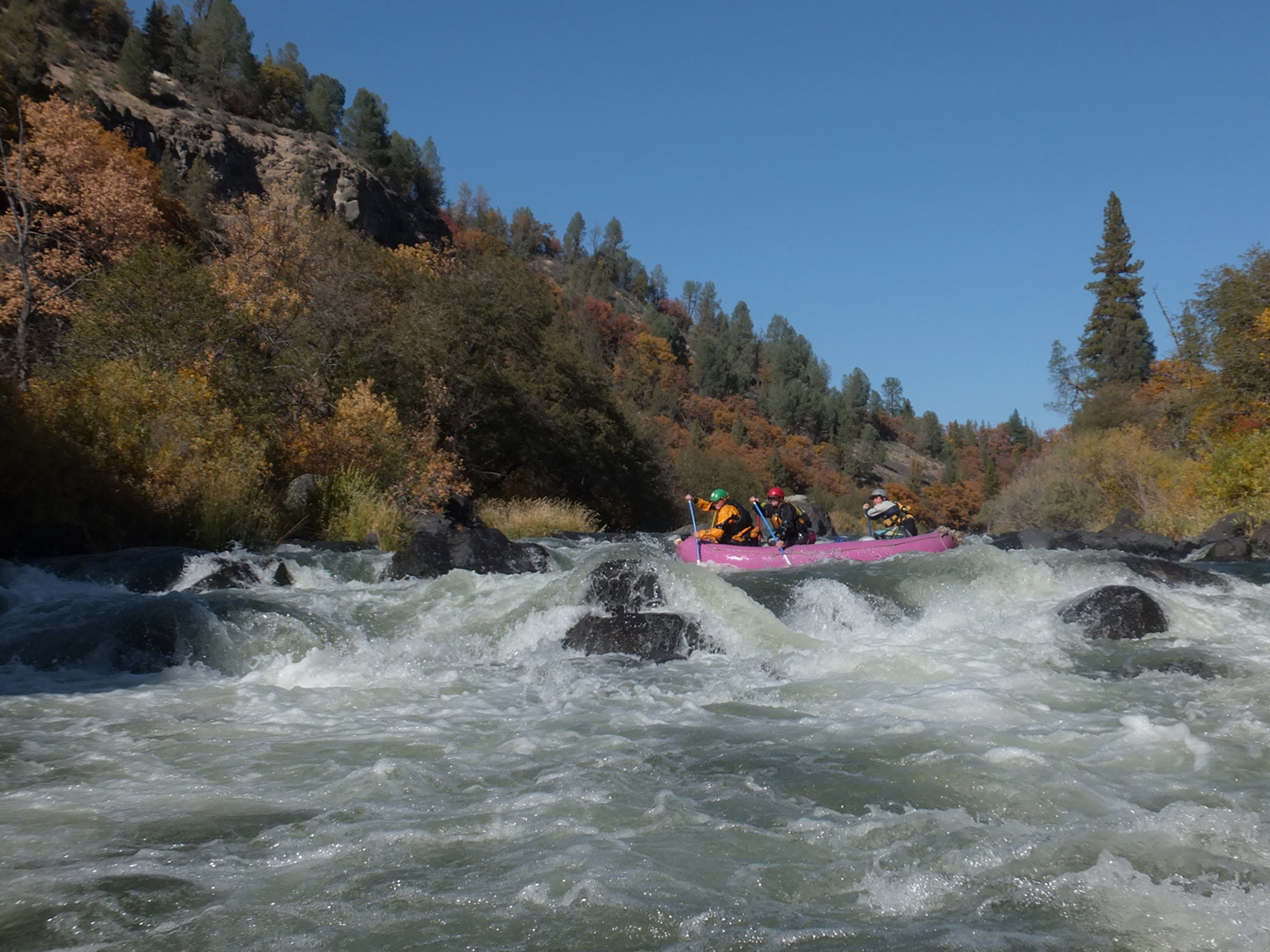
- Diagonal Wave, class III-IV
The river turns left around a corner, obscuring your view of this
large refraction wave off the left bank, and lava ledge on the right.
Rafts can easily punch the wave, but kayaks might want to finesse a better line.
-
- 2.4
- Clean but brush-obscured broken ledges, perhaps best entered on the left
then thru a rightward slot moving to the middle,
finally following the primary flow in the right channel.
-
- 2.5
- Mary Go Round, Class III-IV. A very unusual rapid where the river flows
all the way right, with scheduled release flows spilling over a scenic ledge,
then sharply back again to the left.
-
- 2.6
- Below Mary Go Round is a large eddy on the right.
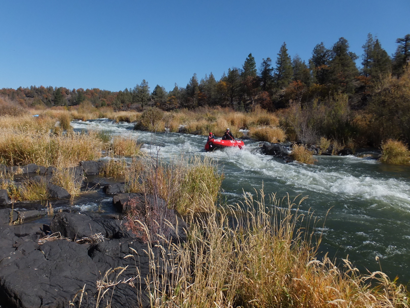
After you exit that eddy on lower left comes a steep chute with big waves.
The rapids then ease a bit but do not stop until after the next big one.
- 2.9
- Unhappy Ending, class IV. A series of boulder drops ending in a fence.
Kayakers prefer a right exit to the rock-strewn boulder fence drop.
Even with meager scheduled release flows, rafts can probably slide over it.
Below this rapid lies the easiest stretch.
-
- 3.4
- After a long right bend from southward to westward in an easy section,
a narrow channel appears on river right. This is the best route
to avoid a very rocky drop at the end of the left channel.
- 3.5
- Spring on the left, very scenic, possibly good to drink.
Afterwards the rapids pick up, but no significant drops occur until Pit Falls.
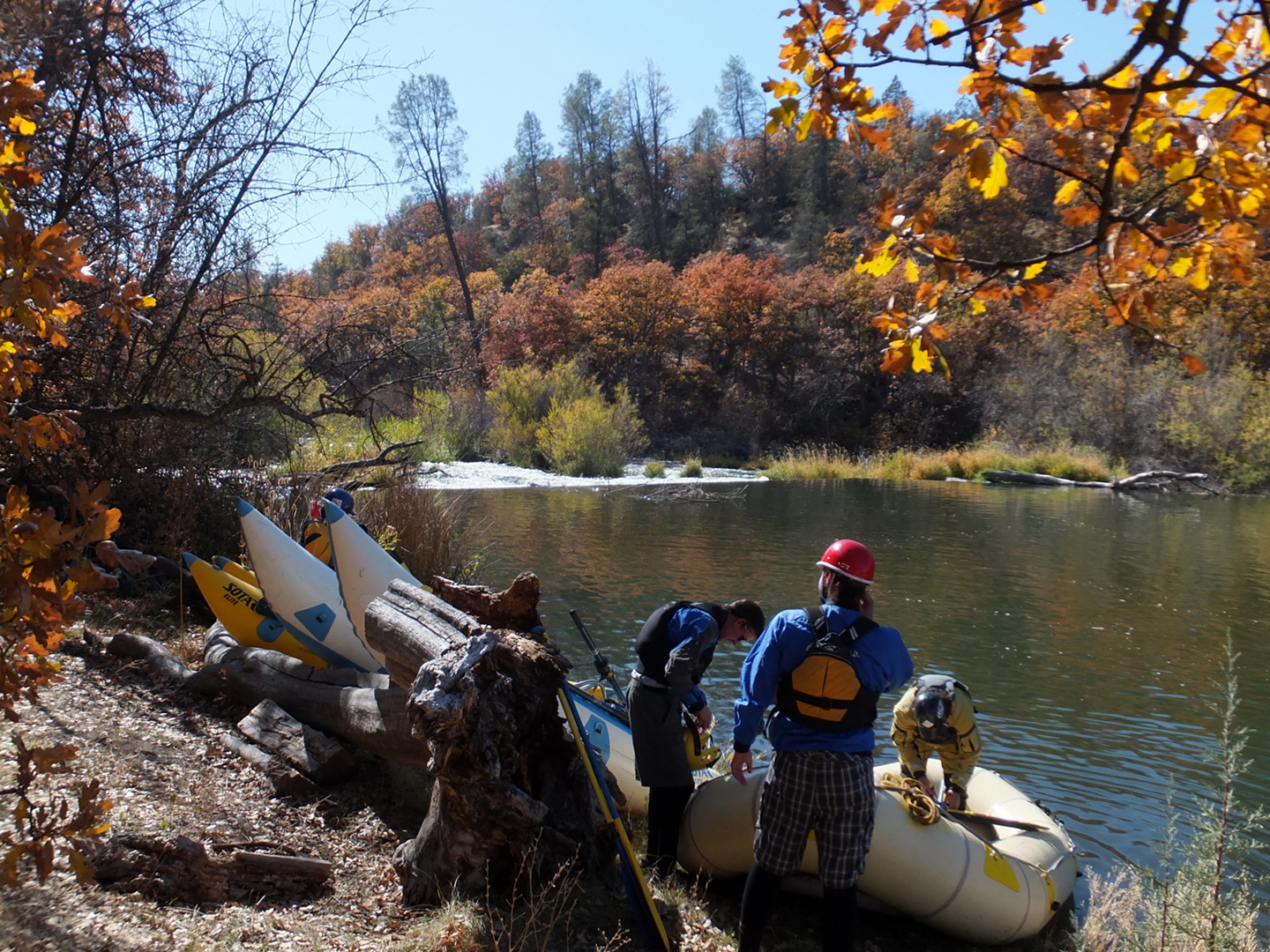
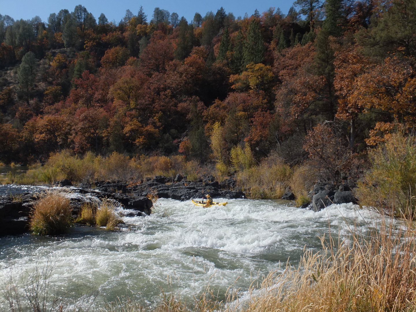
- 4.7
- Scouting opportunity on the right as you approach Pit Falls.
- 4.8
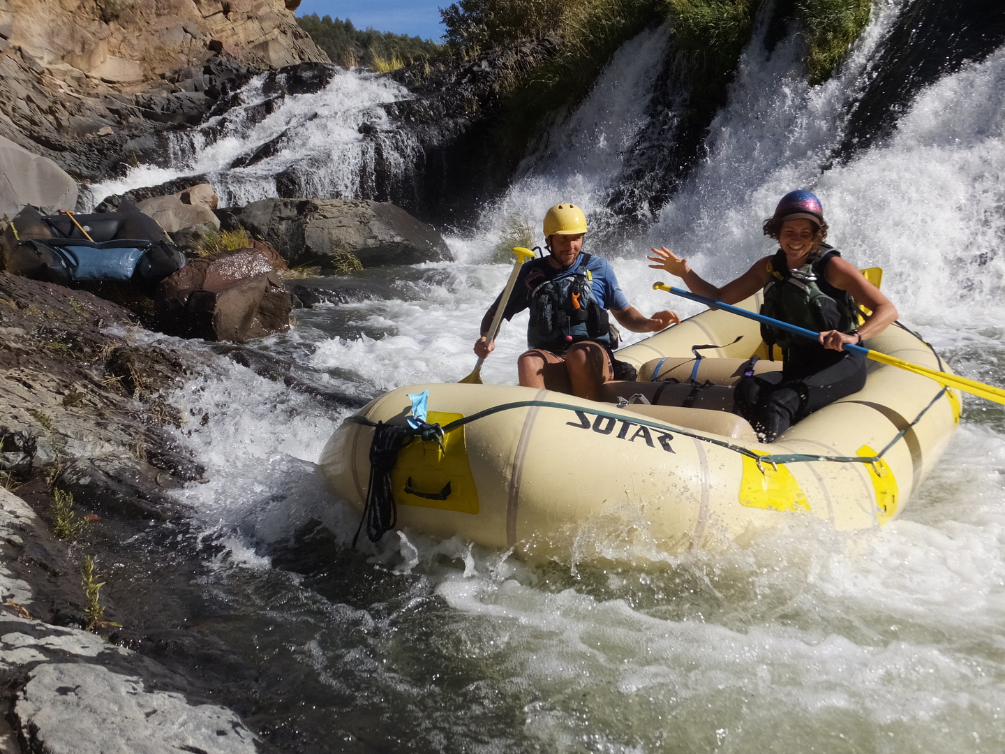
- Pit Falls, class V- on left, class V center, IV on right (recommended)
Among grassy islands on river right, you float to the top of the ledge.
In the pool above the 20' slide waterfalls, the eddy circles clockwise,
trying to move you right, but work left and try to enter dead center.
At the bottom, inflatables can go right of the boulder to unload,
but hardshell kayaks should stay left of the boulder in deeper water.
-
- At scheduled release flows, the safest exit is to drag your boats
over the shallow waterfall along the right bank.
The main falls is frequently run; injuries have occurred but are rare.
-
- 4.9
- Old iron bridge where an abandoned road crosses from left to right.
A large boulder probably from a landslide sits in the middle of the bridge (2015).
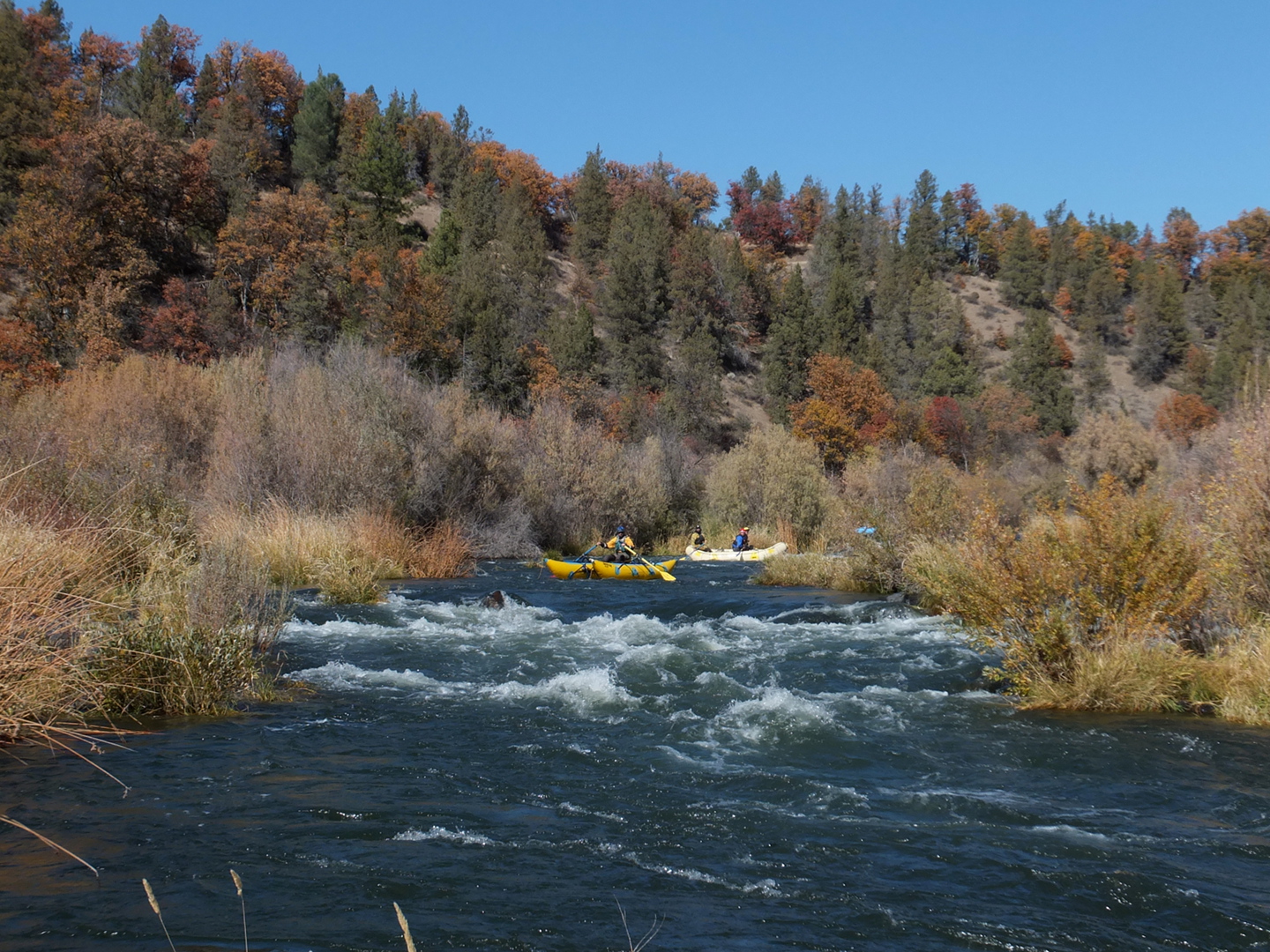
From this point onward, fun rapids continue, often with large hydraulics,
with increasing space between as you approach the end of the run.
- The first rapid is a long class II-III straight-away.
The second is a similar class II-III at a tree-lined left bend.
After the river straightens again comes a significant rapid.
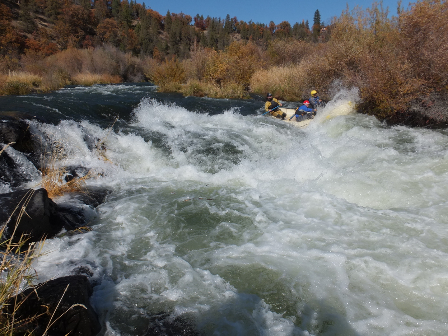
- 5.3
- Big Ledge, class IV
The right side offers a sneak route, however overhanging tree branches
make it virtually impossible to reach the channel on far right.
The center is currently the best choice, with a rock slalom followed by
a steep ledge and turbulent outflow. A short recovery pool follows.
- 5.5
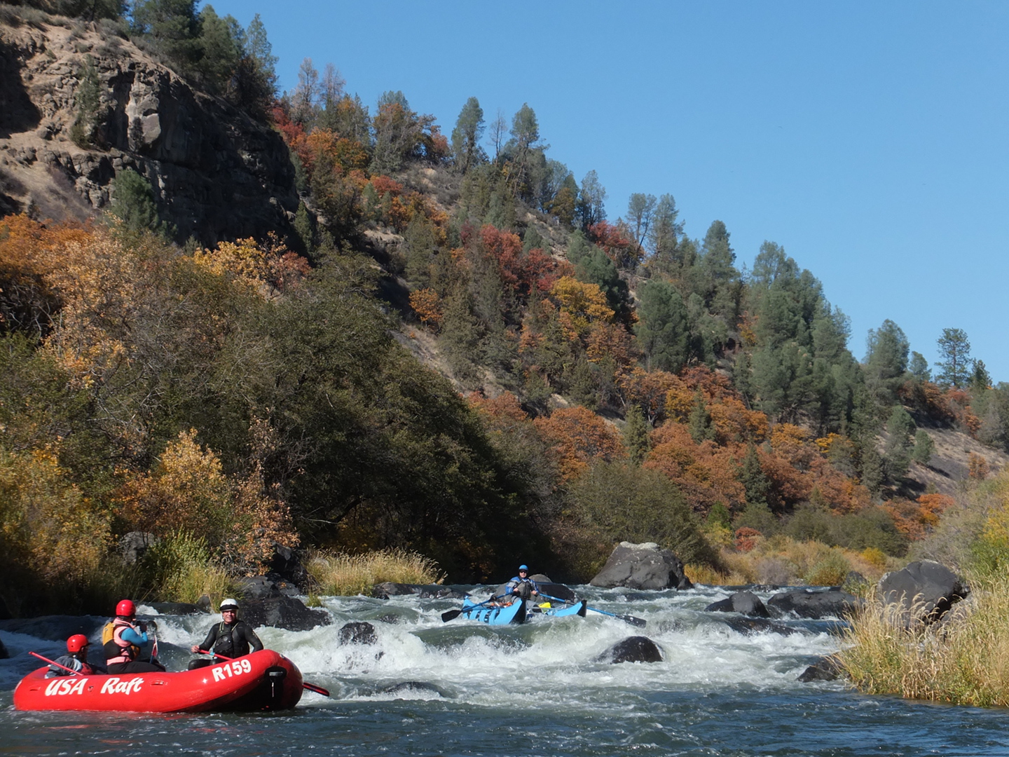
- Longest Rapid, class IV-
A continuous series of class III rapids for half a mile, punctuated by big rocks.
Some people say this is their favorite rapid on the entire run.
- 6.1
- Wave Rapid, class III+
Most of the flow passes left of an island and moves swiftly
towards the tree-lined left bank. Left of a large boulder
near the end of the rapid lurk two large holes in a row, generally runnable.
A semi-sneak right of the large boulder is rock-strewn.
- 6.3
- Footbridge Rapid, class III
A series of rocky islands where you must start on the left
and finish on the right, usually thru a channel about halfway down.
Logs tend to accumulate among the rocks, so be on guard.
Footbridge to Pit #1 powerhouse below.
- 6.8
- Ledge, class II+
Bedrock forms a river-wide ledge in the left channel, runnable anywhere
you think best to avoid the overhanging trees on the left bank below.
- 7.2
- Flow channel from Pit #1 powerhouse enters on the right.
- 7.5
- Campground rapid, very shallow and rocky.
You must stay right in order to make the take-out eddy.
If they recognize the spot, rafters sometimes enter a narrow brushy channel
and drag their boats into the campground lagoon.
- 7.6
- Take out in the picnic area of the beautiful BLM campground.
-
- Below the BLM campground, good surfing waves abound with increased flow,
although the gradient is only 30 fpm for 3 miles to the highway 299 bridge.
Pit #2 powerhouse was planned in this section but never built because
the elevation drop was insufficient. This section offers excellent fishing.
- 7.9
- Alternate take-out, if the campground is closed due to another government shutdown.
You can reach this take-out by following the dirt road above the campground.
- 10.5
- Highway 299 bridge, access on river right, last good take-out.
This is my favorite take-out at a highway bridge anywhere in California.
Shuttle Directions
To reach lower take-out, drive 59.5 miles east from I-5 near Redding on Highway 299.
After descending to Hat Creek the highway goes along white cliffs to the Pit bridge.
To reach the upper take-out, drive 3 miles east from the Highway 299 bridge
and turn right on Pit 1 Powerhouse Road.
At the bottom of the hill near Clearwater Lodge,
turn right onto a dirt road leading to the BLM campground and picnic area.
To reach put-in, drive on Highway 299 7 miles uphill and east from the bridge,
or 4 miles from the stop sign on Pit 1 Powerhouse Road.
You might want to check out Pit Falls from the scenic rest area near top of the hill.
In beautiful downtown Fall River, turn sharp right onto River Street,
and follow this across a bridge to the PG&E developed river access.
|
|
Creeks Navigation
Home
Recommended Runs
Map of Rivers
Alphabetic Index
Alphabetic Table
Text Search
Sponsored Links
|