|
Stony Creek near Willows |
Above Stonyford lies the class IV run described here. Below Stonyford, Stony Creek has at least two navigable stretches, separated by Stony Gorge reservoir. The first run from Stonyford to the reservoir is described only by Anne Dwyer in her 2000 guidebook, Easy Waters of California. The second run from Stony Creek reservoir to the confluence with Grindstone Creek is described by Dwyer, and also by Dick Schwind in his 1974 guidebook, West Coast River Touring. Probably back then, the diversion dam above Stonyford actually diverted water, so Schwind did not find flows high enough to boat. There is a third possible run from Grindstone Creek to Black Butte reservoir that does not appear in any guidebook.
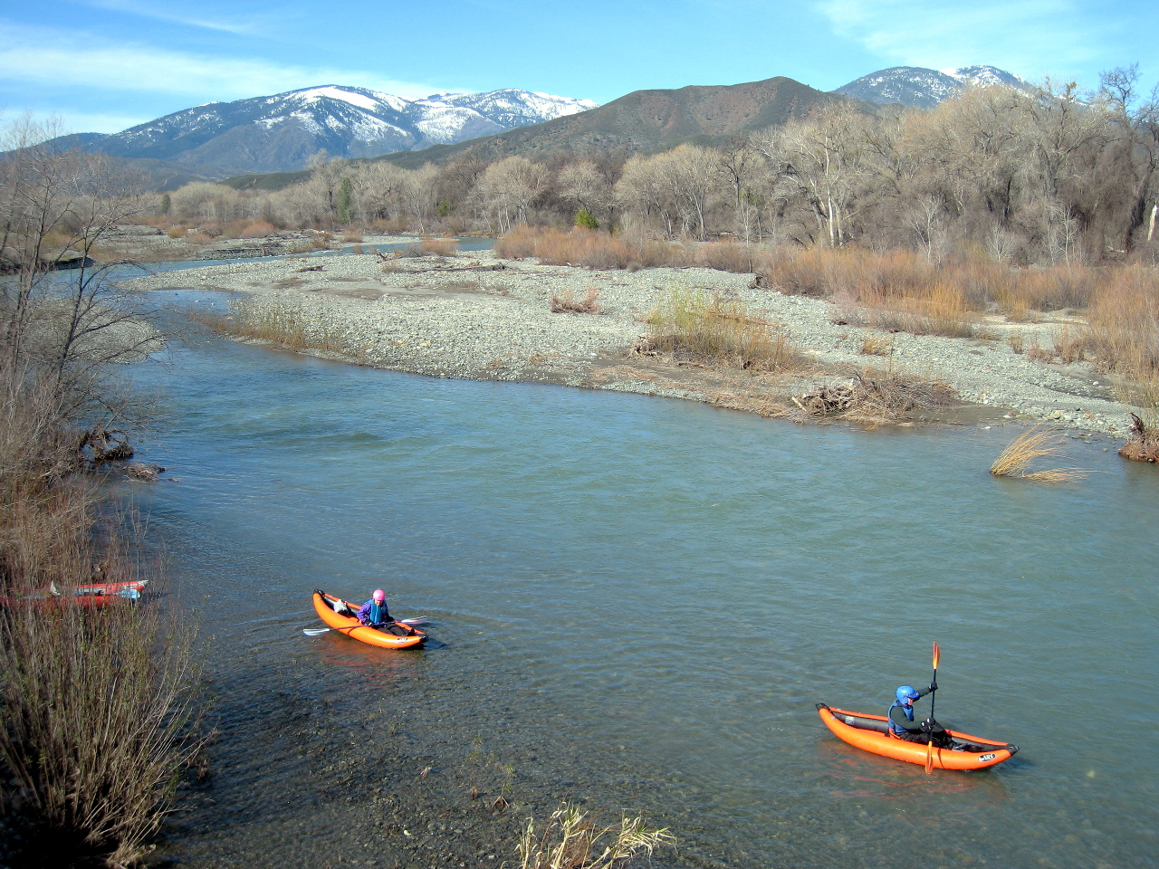
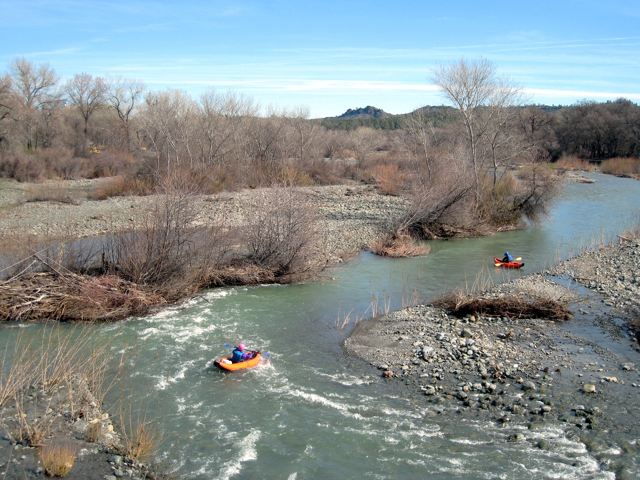
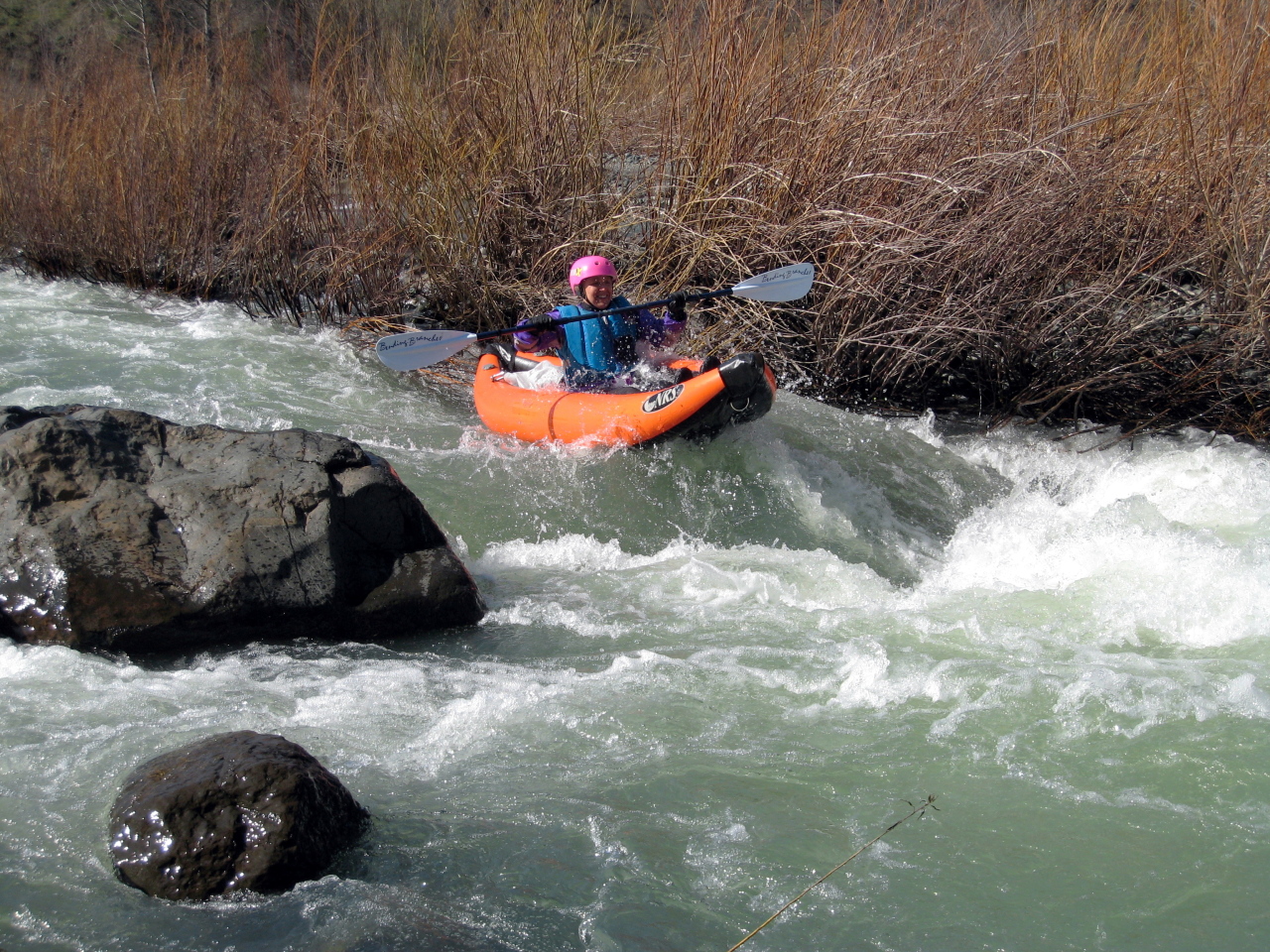
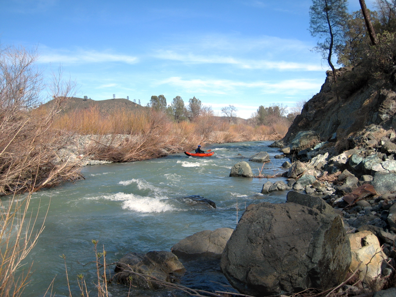
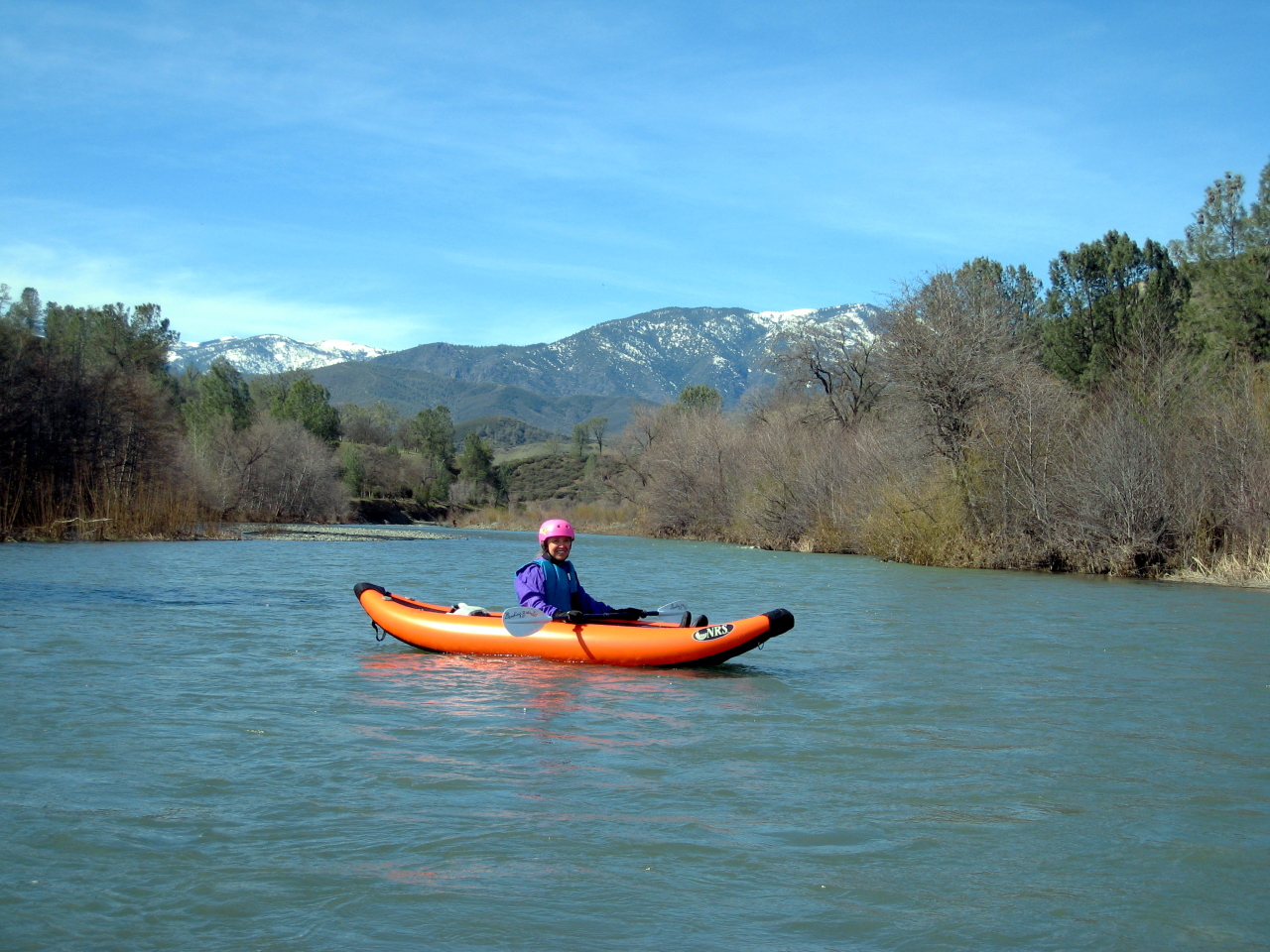
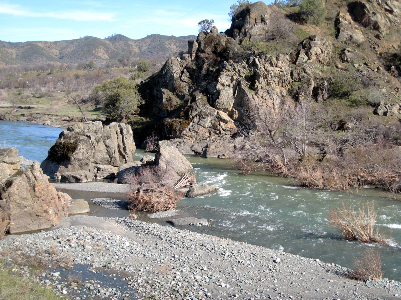
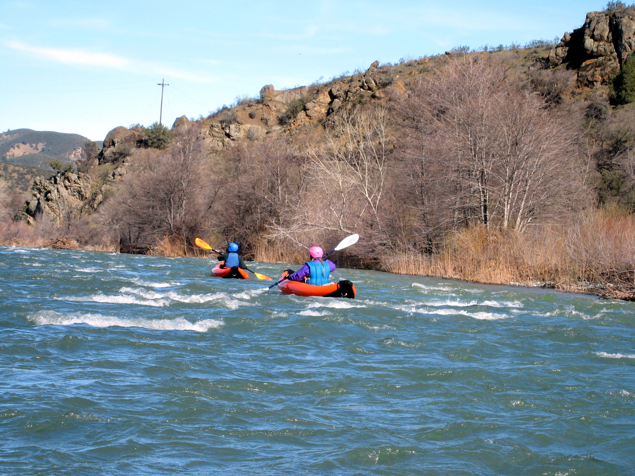
Stonyford to Road 303, 1000-1500 cfs, early springThe stretch from the Road 306 bridge a half mile north of Stonyford to the Road 303 bridge 5 miles south of Stony Gorge reservoir is 7 miles long according to Ann Dwyer, but seems shorter. This is a lovely run, one that still delivers pleasure when done repeatedly. If caught at a respectable flow, it has a lively pace that builds as the run goes on. The scenery is open Coast Range foothill countryside: blue oak and grey pine woodlands on low-lying hills, punctuated by unique rock formations. Prehistoric-looking sycamores and the odd bit of farm equipment are sometimes visible on river left in the first half of the run. The ubiquitous willow is evident in and alongside the river throughout. The first half of the run is a maze of braided channels with willow thickets and a few tree stumps clogged with driftwood to maneuver around. Several lively class 2 rapids ensue at around mile 3, when one channel emerges close by a steep, rock-encrusted cliff. Then comes a straight, flat stretch with the road visible briefly on the left, after which comes Two Channel rapid, at a sharp right bend in the river. The left channel is slack, flat water. The right channel, as is shown in the photos, involves a little rock-dodging at the top, then edging right to punch through (or skirt past) a moderate sized hole between willows on the left and a rock on the right. After the two channels merge below, the busy water continues as the river bends left before emerging into a straightaway: Willow Alley, so named because during most of the ensuing wave train you are paddling between two rows of willows. Once again at this point, the road is briefly alongside the river. Willow Alley ends just above Big Rock Rapid which is shown in one of the photos. With a minimum of steering, the current takes you to the right of the cabin-sized boulders. The class 2 waves continue as Stony Creek veers right, away from the road, and separates into two channels one last time. The right channel is wider, and offers more opportunities for wave dancing. You'll see a weathered wooden barn on the right as the river bends left for the consummation of the run: The Corridor Of Laughing Waves, a straightaway over a hundred yards long filled with rollicking whitecaps, many of which are wide, diagonal waves coming from both shores, created by unconformities in bedrock on the river bottom- much fun. Take out on river right, shortly before the road 303 bridge. You'll merely have to push aside some undergrowth and walk up a short embankment to a dirt road where you should park your car.
Elk Creek to Grindstone Creek, 12 January 2002, ~1750 cfsThe stretch from Stony Gorge reservoir to Grindstone Creek is also nice. A road leads from the town of Elk Creek to a park below the dam. Some guy in an official looking pick-up truck told me I couldn't put in right below Stony Gorge Dam, which is the put-in spot recommended by both Schwind and Dwyer. So we went about a mile downstream, where a bridge crossed over the river just below the town of Elk Creek. Schwind says there is some tricky maneuvering right below the dam. There was a rapid with hidden rocks just upstream of the bridge. Opposite the town, there is an old mine on river right. The run itself was swift, with many riffles and small rapids with waves ricocheting off both shores. The scenery was California rural at its finest: gray pines and blue oaks in the background, with cottonwoods and willows in the foreground. The human element was represented by a few old barns and abandoned farming equipment, with a man and his two sons operating some sort of machinery. Overall the run was quite serene and pastoral. I saw golden and bald eagles flying off from the dead tops of streamside cottonwoods. The few rapids consist of bedrock ledges, and according to Schwind, the most interesting is 2 miles into the run, immediately above a state highway bridge, the only bridge until takeout. Above this the run is class II, but below it is mostly class I. Grindstone Creek enters on the left at mile 6.6, and you can take out there on private property, or upstream at mile 5.2 or 6.4, where the road comes close to the river. Downstream of Grindstone Creek the topographic map shows few contour lines, and the river meanders into many bayous as it passes Julian Rocks on the left. This is a roadless area, and Julian Rocks might make an interesting sidehike. It is possible to take out just above still water on Black Butte road, which rounds the southwest tip of Black Butte reservoir.
Shuttle DirectionsTo reach Stonyford from I-5, drive west on highway 20 from Williams approximately six miles. Veer right onto King Road, which soon changes to dirt. After two miles, turn right (north) onto Leesville-Ladoga Road, which alternates between packed dirt and poorly repaired pavement. After crossing a pass and driving nine scenic miles, turn left (west) onto Ladoga-Stonyford Road. Drive eight miles to the town of Stonyford. The put-in bridge is about half a mile the other side of town. For more action it might be possible to put in along Fouts Springs Road, but I have never tried it. To reach take-out, continue north past the put-in bridge. Shortly beyond Big Rock, turn right and cross a bridge. There is good parking along a dirt road on the east side of the creek. To reach the lower run, below Stonyford reservoir, drive north on Road 306 to Elk Creek. For the lower run you could also find shortcuts from the town of Maxwell and parts further north on I-5.
Frost's Trip Report, 13 January 2002
|
Creeks NavigationHomeRecommended Runs Map of Rivers Alphabetic Index Alphabetic Table Text Search
Sponsored Links
|