| |
| Stretch: |
Holm Powerhouse on Cherry Creek to Lumsden Campground |
| Difficulty: |
Class V with some portages, harder at high flows |
| Distance: |
7.2 or 8.6 miles, 1 day |
| Flows: |
rafts 700 - 1800 cfs, kayaks 600 - 1500 then harder
|
| Gauge: |
add Holm release
(CBD)
to Early Intake
(TBI) |
| Gradient: |
105 fpm average, 200 fpm in Miracle Mile |
| Put-in: |
on lower Cherry Creek below Holm Powerhouse, 2160' |
| Take-out: |
at a campsite below Lumsden Falls bridge, 1500' |
| Shuttle: |
12.5 miles (50 minutes) one-way, mostly on dirt |
| Maps: |
USFS Stanislaus NF, AAA Yosemite,
Topo
|
| Season: |
summer, from hydropower dam release |
| Agency: |
USFS,
guided Whitewater Rafting |
| Notes: |
© 1998, 2002 Bill Tuthill,
CreeksYahoo |
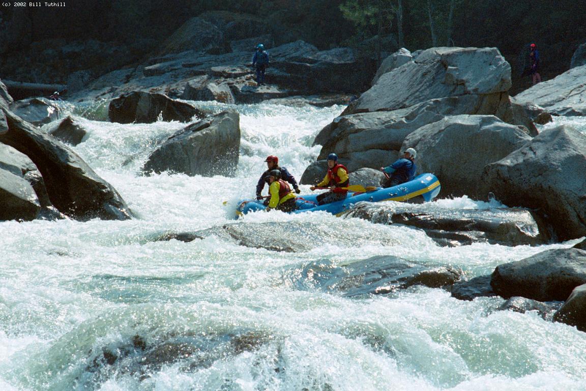
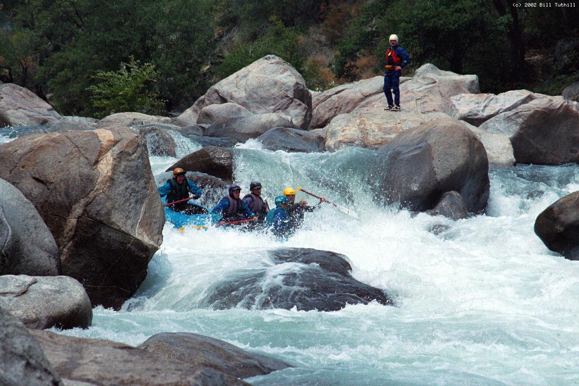
This is California's toughest class V stretch that is run commercially.
The Middle Fork Feather
is about as difficult and more remote,
and the Kings Garlic Falls run seems more hazardous.
Neither of those stretches is commercially rafted.
On most summer weekends,
there seem to be more kayakers than rafters on Cherry Creek.
The two recommended portages are much easier with kayaks!
Many pictures of this run (including first tuber descent) are available on
this website
and in a
Dreamflows gallery.
Cherry Creek into the Tuolumne is a superb class V run for hardshell kayakers,
and an exciting raft run, but it is not great for inflatable kayaks.
One problem is that there are many angled hydraulics,
and because inflatables sit on top of the water,
not slightly underwater like hardshells,
so it's all too easy to tip over and swim.
And when you do swim, there are many hazards,
including spots where the current flows under big boulders.
Expert kayakers seem to feel this is a comparatively safe run.
Perhaps it is, if you follow the proper lines
and have an unfailingly quick offside roll.
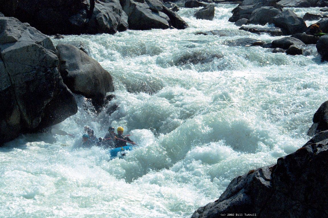
Rafters often get trounced or beat up on this run, however.
Many rapids are very technical,
so precise boat control is needed to avoid flips,
and swimmers should be picked up immediately.
If you really want to inflatable kayak this run,
which has been done many times, so far without loss of life,
the best plan is to phone Sierra Mac to schedule a commercial rafting trip
(800-457-2580 or 209-532-1327).
Or if you are friendly with expert rafters, you could volunteer to bow paddle.
Either way you can learn the river.
Study the mile-by-mile guide before and after your trip.
Once you know the river, wait for relatively low water,
say around 800 cfs, and boat carefully all day.
Lower flows are not beneficial because they expose more boulder tunnels
without significantly reducing problem hydraulics.
One final note:
the Cassady/Calhoun book mentions Coffin Rock near the end of Miracle Mile,
without saying that the river lulls you into thinking you should stay center,
which is wrong, because the center chute takes you right into Coffin Rock.
A boater died there in 1992 when a raft overturned against Coffin Rock.
The best route is far right in a narrow channel among big boulders.
-
mile
0
- For years the put-in was at a primitive camp on river right
below the bridge, but now (2002) most boaters use a dirt slide
from a parking area on river left.
- .2
- Just around the corner from put-in, the river widens into a rocky drop.
The left channel, against a cliff at the bottom, is very shallow and
can flip rafts. The right channel is less obstructed.
- 1
- Confluence of Cherry Creek and the main fork Tuolumne, which should
have less water when you do this run, being impounded by Hetch Hetchy.
Easy hike up to the road, for people who want to quit now.
- 1.5?
- Another unnamed shallow rocky drop that can flip off-course rafts.
- 2
- Corkscrew, class V-, possibly scout left
The far right channel is usually runnable, but very narrow.
The more-normal route is the middle of the wide left channel.
On the far left of this channel, an undercut rock lurks below
the horizon line.
- 2.4
- Jawbone, class V-, scout right
Big boulders at the top obstruct your view of this very steep
rocky drop. Most boaters run it down the middle.
- 3.2
- Mushroom, AKA #1, class V, rafters scout left, kayakers scout right
A boulder jumble followed by severe whitewater, a short pool,
then another big rapid called Toadstool. Rafters usually start
on the river-left side, turn sharply right into the Cattle Call,
backpaddle, then either drift down the right side near Skull rock,
or ferry back to the left of the foaming Mushroom formation.
Kayakers usually start by running a falls on the far right,
hugging or eddy hopping along the cliff on the right bank,
then make the same right or left side choice as rafters.
The final drop looks bad but seems somewhat forgiving.
-
- 3.4
- Toadstool, class IV+ or V, pre-scout left or scout right
Most of the current splits around a pyramid rock. Going right
leads to a multistage class IV+ drop. Going left (a mistake)
sometimes leads boaters into an inescapable eddy, or at best,
a steep rough drop. Class IV rapids follow shortly below.
- 3.9
- Catapult, class V-
After a long class IV boulder garden, a cable crossing overhead
indicates the final steep drop ahead. Boulders block your view.
The right channel falls into a big hole, while a narrow channel
angling left-to-center offers somewhat of a sneak route.
- 4-5
- Miracle Mile, drops 200 feet in a mile, adds up to class V
There is no definitive beginning or end to so-called Miracle Mile,
it is just an accident of distance measurements from put-in.
- 4.1
- Chuck's Wave, AKA Just a Slalom, AKA Gar's Lunch, class V
A very large hole against the left-hand bank, easily negotiated by
narrow kayaks, but rather sticky in rafts. This is followed by a
very long boulder garden, a bad place to swim.
- 4.7
- Blind Faith, the name of the rapid that leads into Coffin Rock
(see introduction). Stay far right, then traverse left just
below Coffin Rock, which recently fell over (2002).
- 5-6
- Another mile just as difficult as Miracle Mile, but not as steep.
This includes a boulder slalom, a wide and shallow rock garden,
a wrap-rock slalom known as Lombard Street, then Christmas Hole,
a vertical drop of 8 feet.
- 6.1
- Airplane Turn, class IV+
The river turns left and slalom-drops into a sticky hole.
- 6.4
- Lewis' Leap, AKA #2, class V-, scout right
The leap itself is in the center, but in recent years an easier
route has developed on extreme river right, ending in a traverse
to the center, followed by some lesser holes.
-
- 6.8
- Flat Rock Falls, AKA #3, class V, rafts line left
Actually a series of falls culminating in an apparently dangerous
drop onto a flat rock, with lots of water going underneath into
a body trap. Kayaks often sneak far right around this drop.
If you wait for dam-release flows to recede in late afternoon,
lining rafts is a bit safer. It is possible to take out on
river right above this rapid, but it is easier to line left,
portage Lumsden Falls on the left, then float to the campground.
- 7.0
- Lumsden Falls, class V+?, portage left
The final drop forces boats against an undercut wall on the right,
but boats almost always wash out. A bigger problem is the almost
total unavailability of clean entrance routes, especially for rafts.
- 7.1
- Lumsden bridge overhead. When portaging, drop boats into the water
on the rocky left bank just upstream of the bridge.
- 7.2
- Upper Lumsden campground makes a nice easy take-out, especially if
you have run out of dam-released water. There is a wide trail
leading up to the dirt road just above where the following rapid
swings left around a boulder garden.
- 7.5
- Against the Wall, class III+, a boulder then bedrock drop
on extreme river left.
- 7.7
- Horseshoe Falls, class IV+, scout right
Most boats take the narrow chute-falls on the far right, but
the main center drop is perhaps more straightforward.
- 8.3
- South Fork Tuolumne enters on the left, usually not contributing
much water when Cherry Creek is in season.
- 8.5
- Meral's Pool Table, class IV, a long rock garden. Lower Lumsden
campground is high on the left bank.
- 8.6
- Meral's Pool, an easy take-out and put-in for the lower Tuolumne.
For shuttle instructions,
see the Cassady/Calhoun guidebook or the Holbek/Stanley kayaking guide.
To find nearby food and lodging, type Groveland into the box and click Search.
|
|
Creeks Navigation
Home
Recommended Runs
Map of Rivers
Alphabetic Index
Alphabetic Table
Text Search
Sponsored Links
|