|
Arroyo Valle near Livermore |
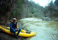
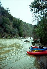
Four of us sponson boaters ran Arroyo Valle in early January 1997. We expected an adventure, but we did not expect a great run with tons of fun whitewater. Marred by cowburned scenery, muddy water, and a tough portage, this run is not a classic like the South Fork Eel, but it is similar in nature. I recommend this run, and would do it again. Put it on your list for days when everything else is too high. Inflatables are safer than hardshells on this run, because of numerous pinning possibilities and shallow head-bonking rocks. A hardshell trip in 1993 resulted in one death (perhaps a blow to the head) in then brush-choked rapids near the end of the trip. The AWA river inventory listing is mistaken in two respects: this is a 21 (not 28) mile run, and is class IV+ (not IV) with a portage and one V, or two portages, plus barbed wire hazards. Flow information was then available only from rangers at Del Valle reservoir, but has since been added to the USGS website. We had less than 100 cfs at put-in and 750 cfs at take-out, which is probably the ideal flow for inflatables. The first two miles are very bony, and involve several barbed wire crossings amongst the braided channels. The muddy (1996) Arroyo San Antonio comes in at mile 2, more than doubling the flow, and causing siltation problems for the reservoir. On our trip, all other side creeks were relatively clear. Moderate gradient and class I-II rapids continue for many miles. This was a blessing in the cold early morning air. Eventually the gradient increases, class III rapids appear, and the canyon deepens. Watch for barbed wire at the bottom of a rapid, and in a swiftly moving section of water. After a creek comes in on the left, two tree-infested rock-pile class IV rapids occur at a gradient line before Colorado Creek.
After Colorado Creek, the gradient increases and class IV rapids occur frequently. One IV+ involves an 8' waterfall with recirculating trough on the right and undercut on the left. It's dangerous but fine if your line is good. Another IV+ has a slalom around huge hydraulics with a rough falls at the end. When you see a power line crossing the creek ahead, be on guard for the tough portage. In a section where the water seems to disappear among big boulders, there is a hidden eddy to the left. The rapid (Power Line 1) seems unrunnable, forcing a portage high over rocks on the left bank. The rapid just below (Power Line 2) is a class V that one of us ran, although there is an easy portage at river level on the right. Fortunately the creek eases up at this point, giving you time to recover from the portage. A road appears high on the right bank. There are only class III rapids until you see a railroad flatcar bridge about 3/4 of the way from powerline to take-out. This is a potential take-out, although the dirt road along the left bank might be gated. A ways below the bridge, there is another gorge with several class IV rapids. After this, the canyon opens up and several ranches appear. There are two low-water crossings with potentially deadly reversals at high water (we ran them), and a man-made falls near the Del Valle campground, which would make an excellent but costlier take-out. Soon the regular take-out bridge appears. Long carry up the left bank. To reach take-out, take the N Livermore exit off 580, drive thru the red lights of Livermore, and turn R onto Mines Road, which leads to Del Valle reservoir. Park on the far side of the bridge leading to the campground. To reach put-in, return to Mines Rd, and turn R where signs say Mt. Hamilton. Stay on this road, which changes names, until it goes over a pass and descends into Arroyo Bayo. Put in where a dirt road descends to (and at low water crosses) the creek.
|
Creeks NavigationHomeRecommended Runs Map of Rivers Alphabetic Index Alphabetic Table Text Search
Sponsored Links
|

