|
Battle Creek South Fork |
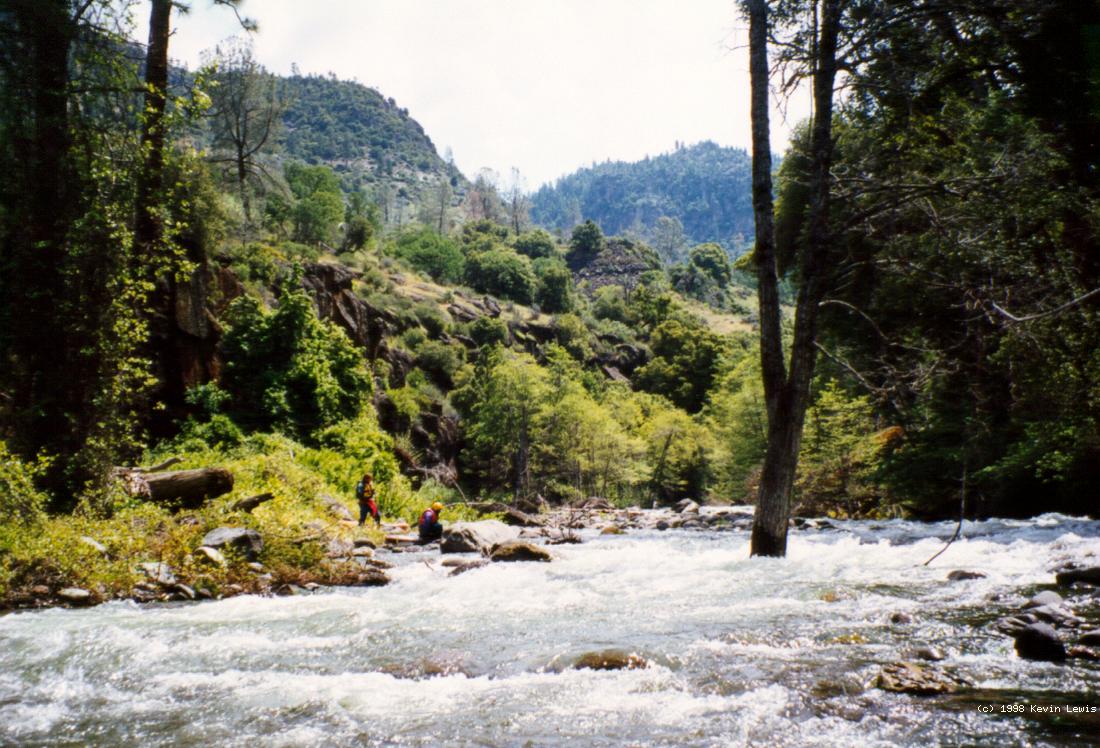
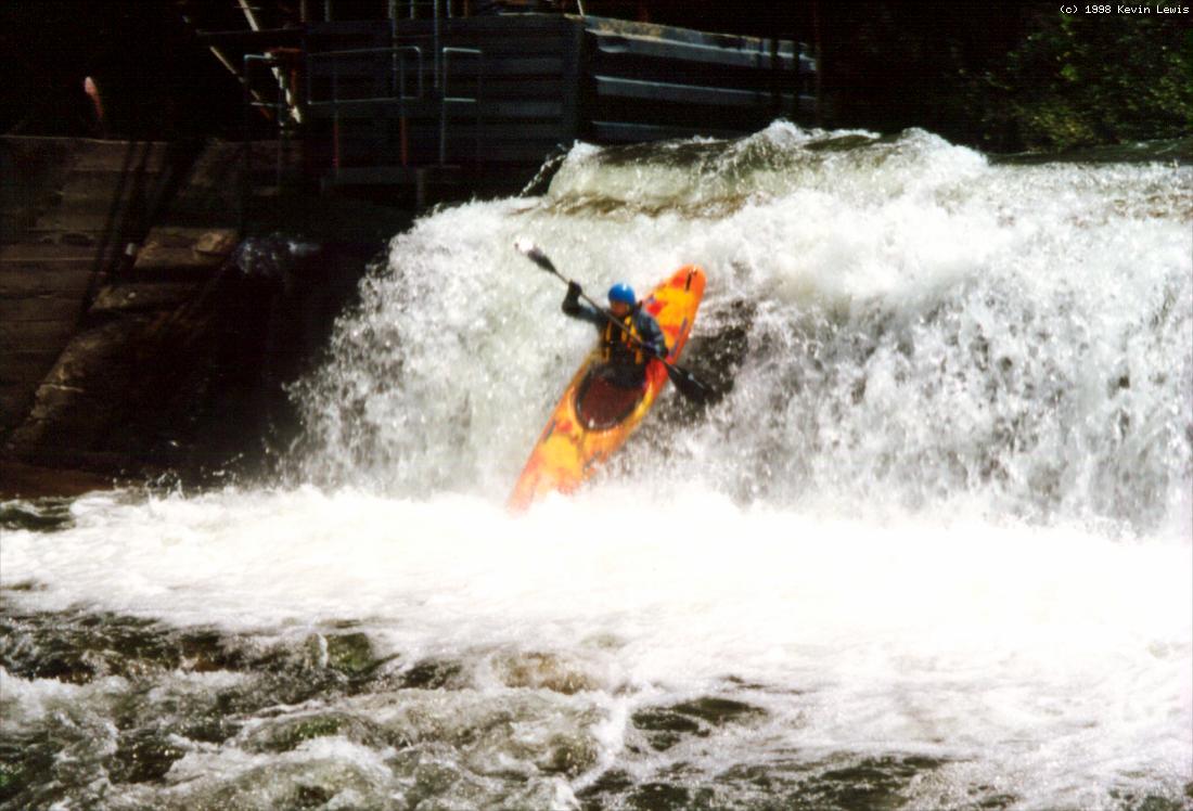
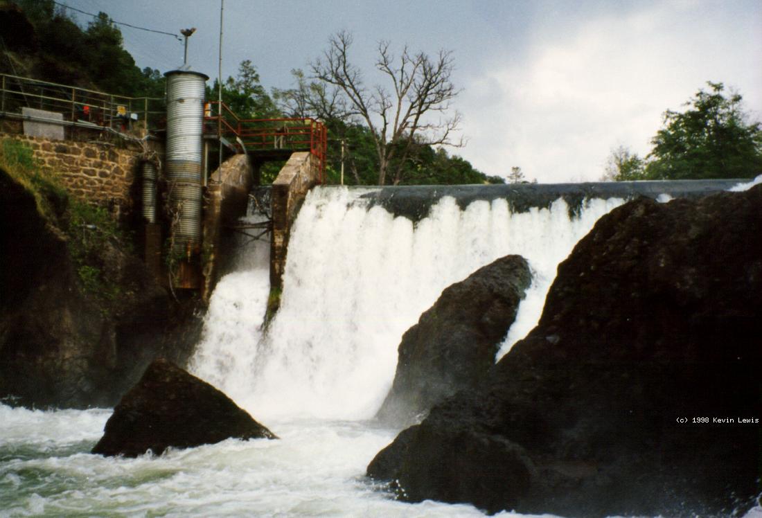
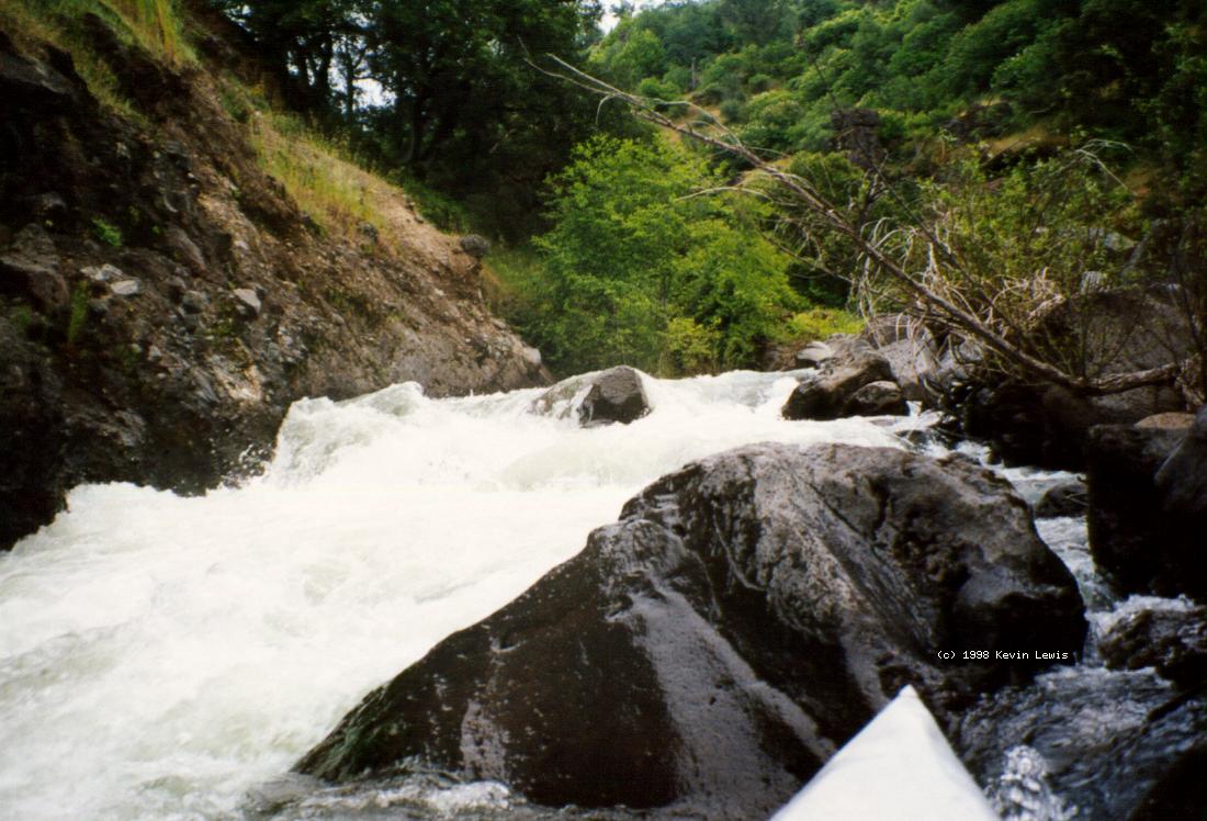
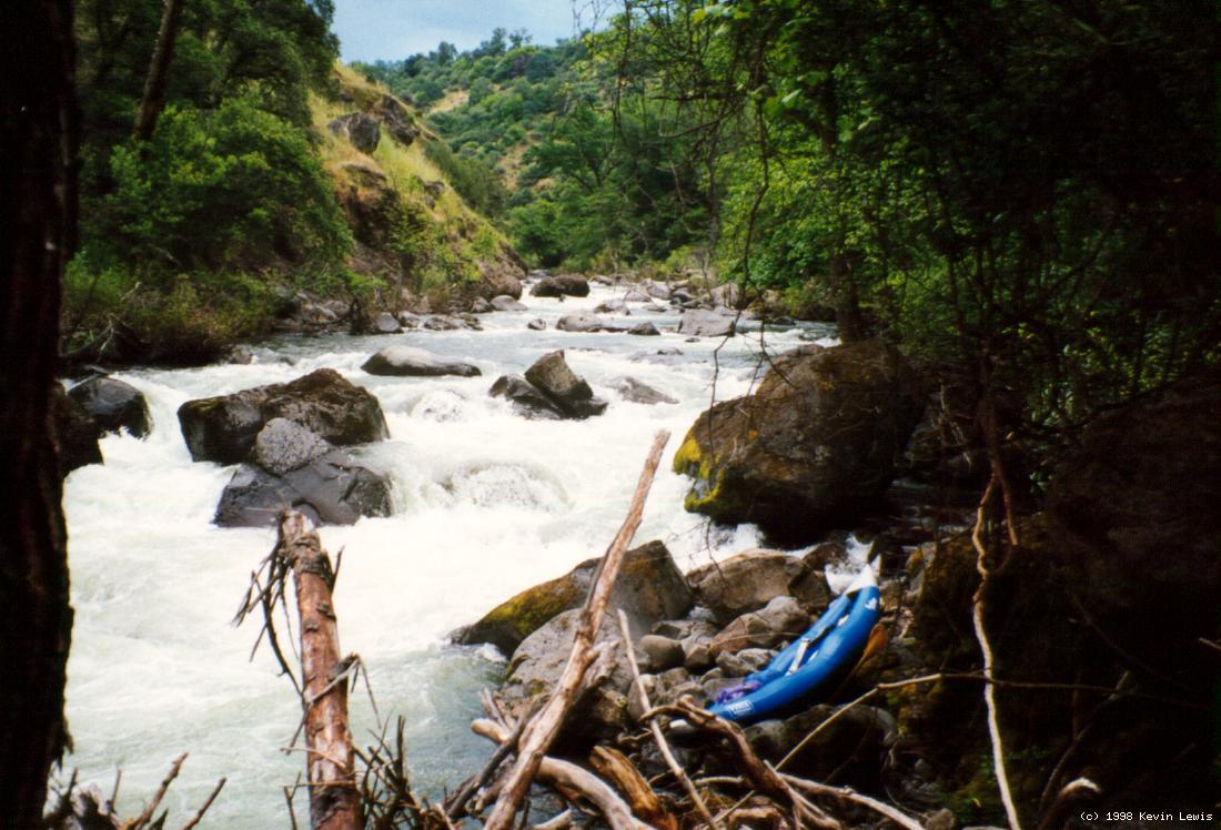
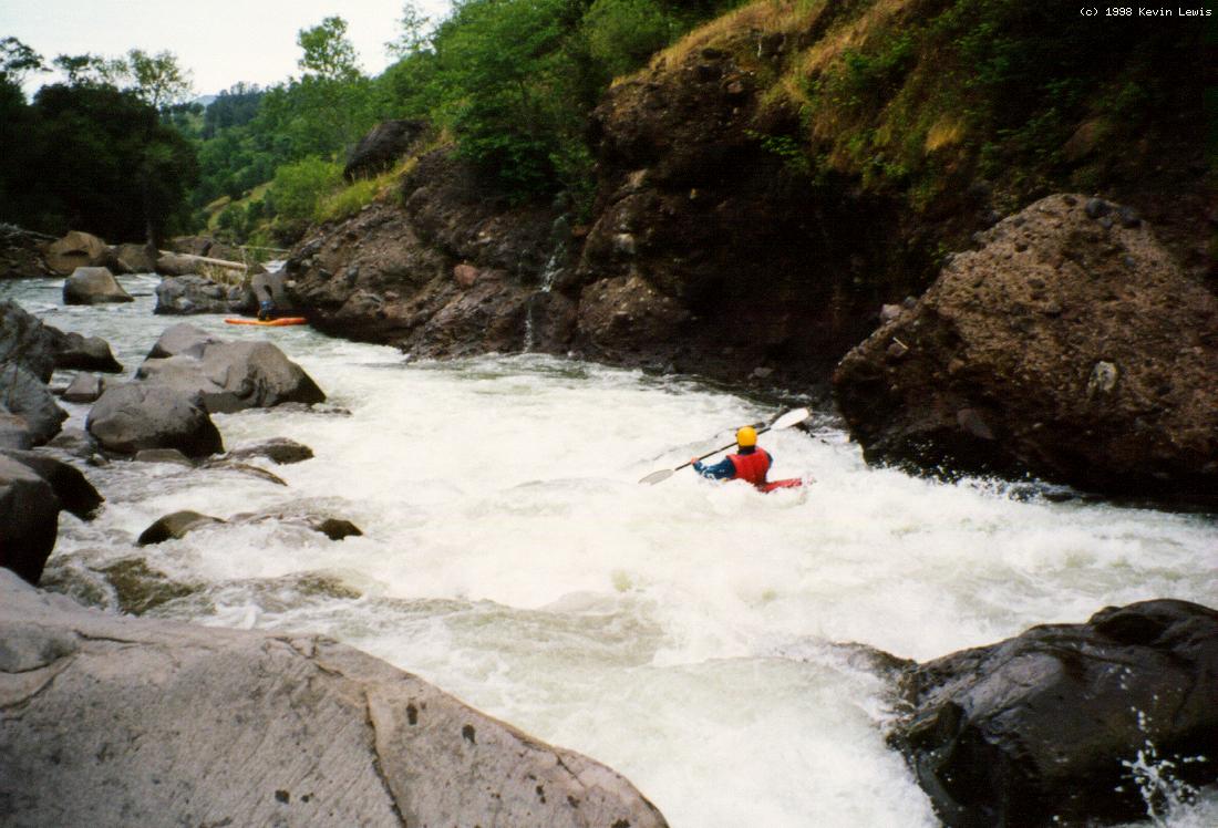
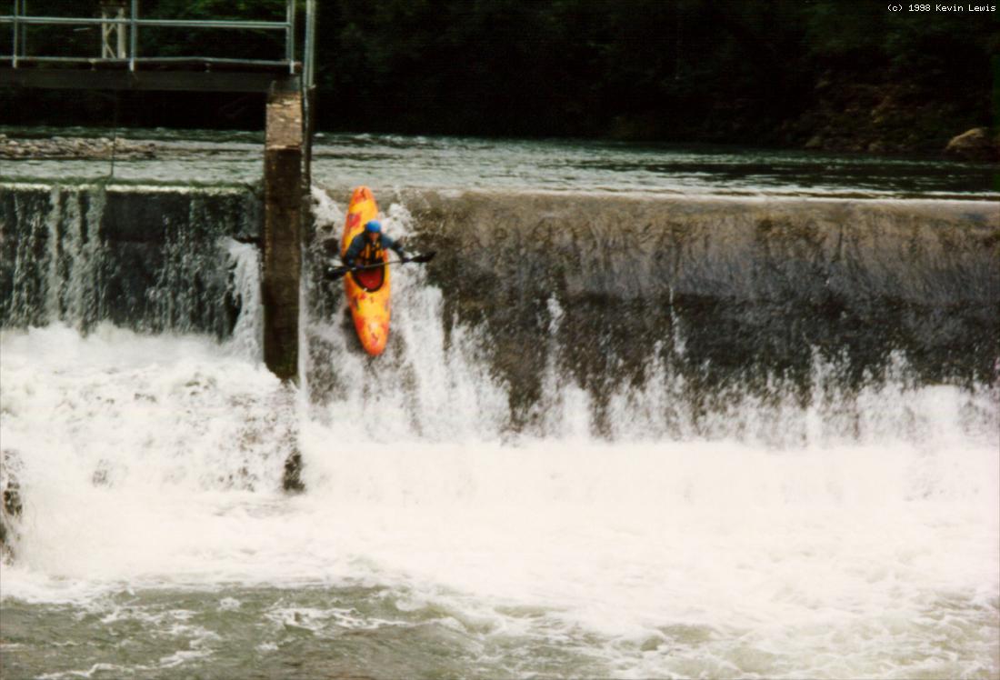
South Fork Battle Creek ExploratoryOn Saturday 6 June 1998, three Shasta Paddlers (Kevin Lewis, Jim Pepin, and Ron Rogers) extended the upstream navigability of South Fork Battle Creek by a total of 11.5 miles. After driving as far as a 2WD van could go on the poorly maintained Ponderosa Way on the north side of the canyon, the 3 of us carried/dragged our kayaks across country for 1/2 mile, and down 1000 feet in elevation, to the distant creek. This was near Grapevine Gulch, to which Snoqualmie Creek is a tributary. It was fairly easy walking down the grassy (but rocky and brushy in places) slope, until we reached the top of the cliff-bounded, inner creek gorge. The second side drainage we tested proved descendable, with the only hazard being a dense poison oak thicket, which proved ample enough for one of us to need to go to the doctor for a shot. After putting on, and paddling 100 yards of swiftly moving water, we quickly found ourselves at PG&E's South Powerhouse diversion dam, part of the uppermost hydroelectric system on this creek. Jim ran the 10 ft dam on the right, and the rest of us portaged on the left shore. We were then rewarded with fairly continuous rapids, with many class 3s and 4s. The first mile has a gradient of approximately 140 fpm. The next 6-7 miles descended at about 95 fpm, followed by 2-3 miles of something less than 75 fpm.
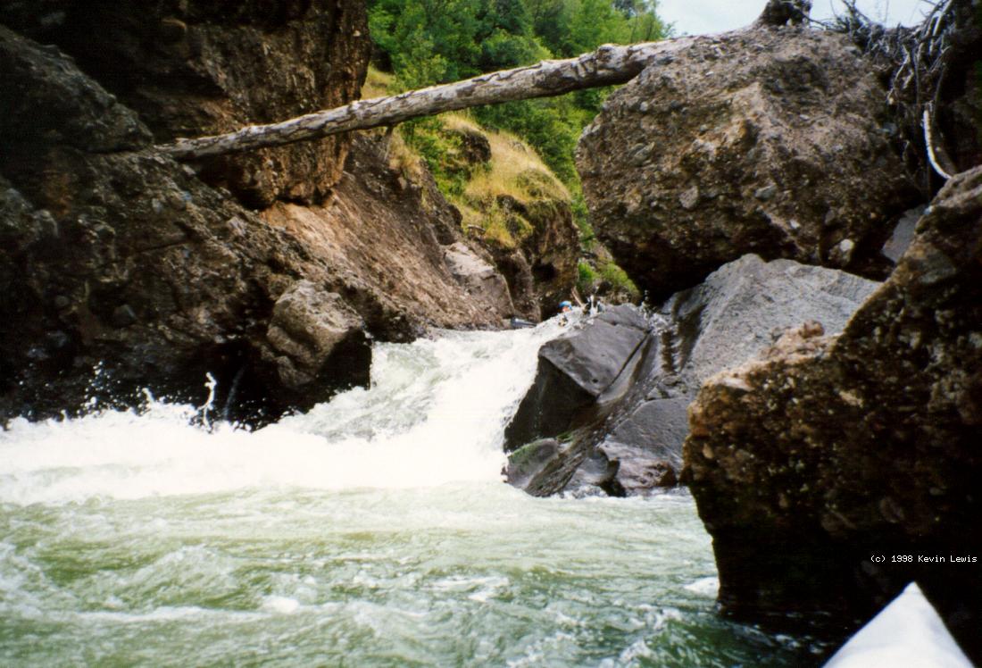
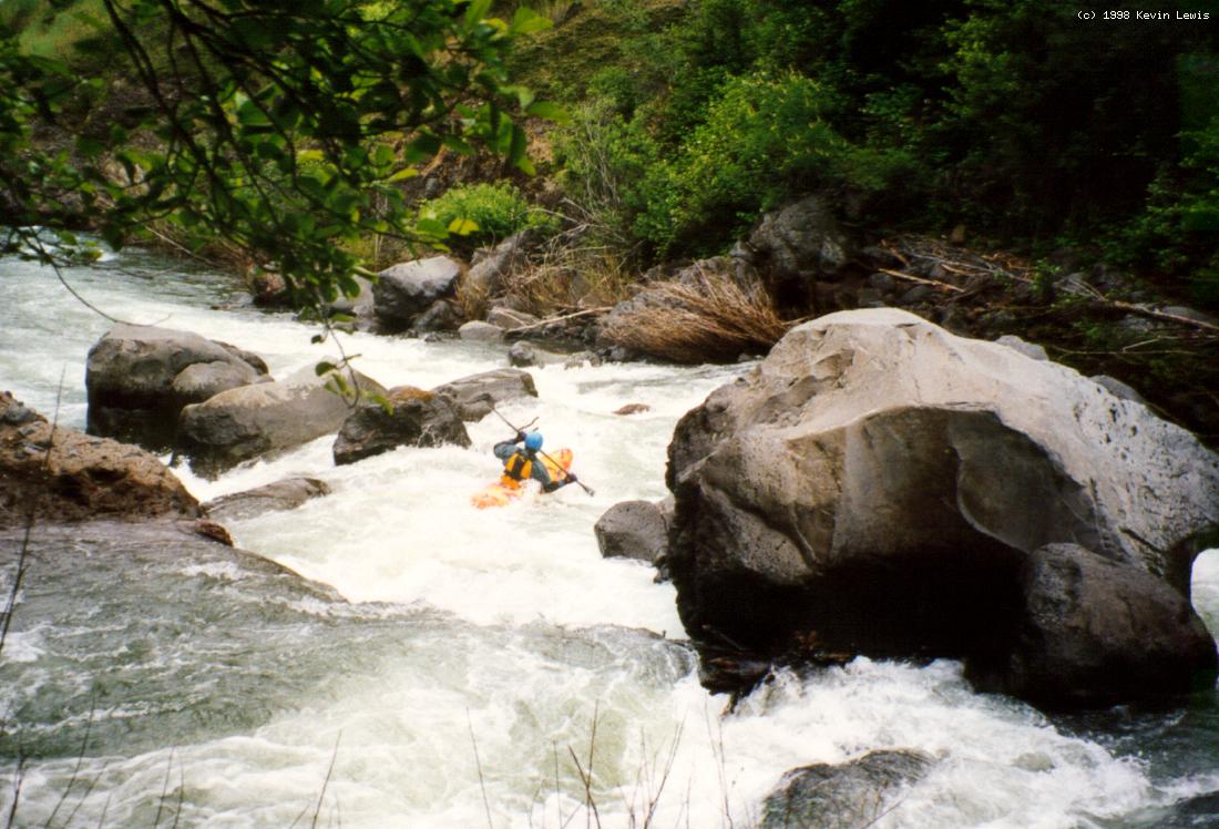
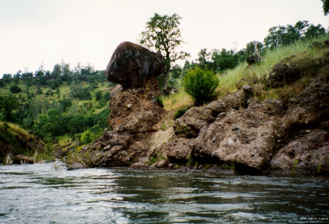
Except for the 3 hydroelectric developments encountered along the way, this is a very remote, wilderness-like run. The canyon has been deeply carved into volcanic rock and mudflows of the Cascade Range. Many side tributaries and clear springs feed the lushly vegetated inner gorge. During our trip, the CDEC (BAT) flow at the Coleman Fish Hatchery, downstream on main Battle Creek, was reading 1500 cfs, which gave us a low to moderate flow level. At around mile 7, we encountered the South Powerhouse, and just downstream, the imposing Inskip Diversion Dam. We portaged this 25 foot high, unrunnable dam on the left, in front of a half a dozen anglers at the remote Oasis Springs (fly fishing) Lodge. In the less than 75 fpm segment, our complacency started to grow, being tempered only by our knowledge of a final steep gorge, scouted from our airplane overflight the day before. This mile-long, almost 120 fpm gorge is more pool/drop than the rest of the run and contains 2 or 3 class 5.0 drops. These required serious shore scouting, but running all of the rapids seemed to be easier to execute than they looked from the shore.
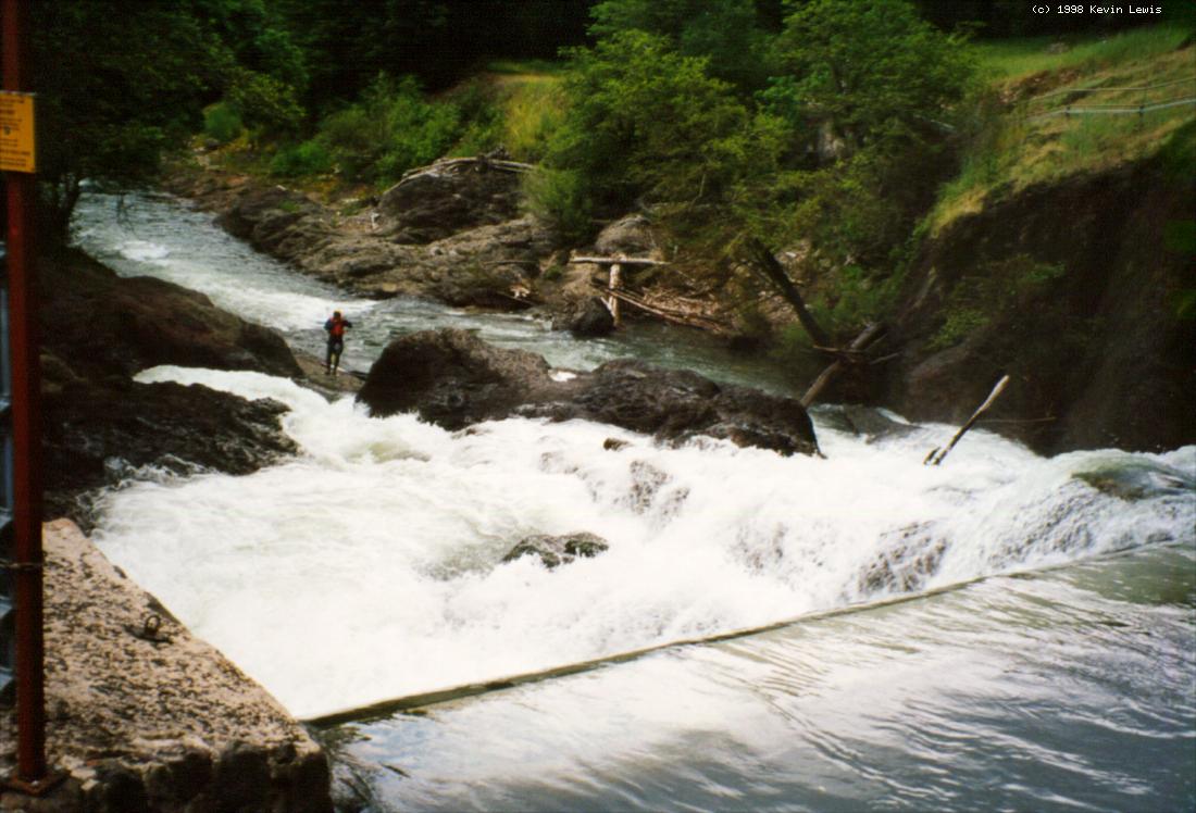
The final half mile to the Inskip Powerhouse and Coleman Diversion dam is pretty flat, giving the entire 11.5 miles an average gradient of 90 fpm. Jim skillfully lightened his boat by sliding over the steeply sloping, concrete dam and scraping the unwanted plastic from his hull bottom. Being back in known territory, we paddled the remaining mile to the Manton Road crossing on the South Fork and took out. The trip was well worth the effort, and we would all be willing to go back and do it again some day.
This leaves un-run the upstream 3.8 miles to the Ponderosa Way bridge. The first mile down has a gradient of 210 fpm, the 2nd mile 280 fpm, and the total 3.8 miles has a gradient of 205 fpm. Upstream of this bridge is really scary, steep stuff of probable interest to Brandy Creek (Whiskeytown NRA) IK crash-and-smash types. Access in the area is a big problem because of steep canyon terrain, private property, a gate on the southern segment of Ponderosa Way, and a long, 4WD access road on the north side of the canyon. The 40 miles of Battle Creek, from its mouth on the Sacramento River, up the South Fork to Ponderosa Way bridge, has been found eligible for inclusion into the National Wild and Scenic River System by the Bureau of Land Management.
|
Creeks NavigationHomeRecommended Runs Map of Rivers Alphabetic Index Alphabetic Table Text Search
Sponsored Links
|