Carson River East Fork


Stretch: near Markleeville to near Gardnerville
Difficulty: Class II+, harder at higher flows
Distance: 20 miles, 1 or 2 days
Flows: kayaks 500 - 4000, rafts 600 - 4000 cfs, IK minimum 400
Gauge: flow measured below Markleeville (USGS site)
Gradient: 25 fpm average, more higher up
Put-in: along highway 89/4 at Hangman's bridge or upstream, 5500'
Take-out: rocky beach above defunct diversion dam, 4980'
Shuttle: 25 miles (40 minutes) one-way
Maps: Tahoe NF, AAA Lake Tahoe Region, Topo
Season: Spring and early summer, from snowmelt
Agency: USFS, BLM, private, guided Whitewater Rafting
Notes: © 1998, 2009, 2012, 2019, 2020 Bill Tuthill, CreeksYahoo

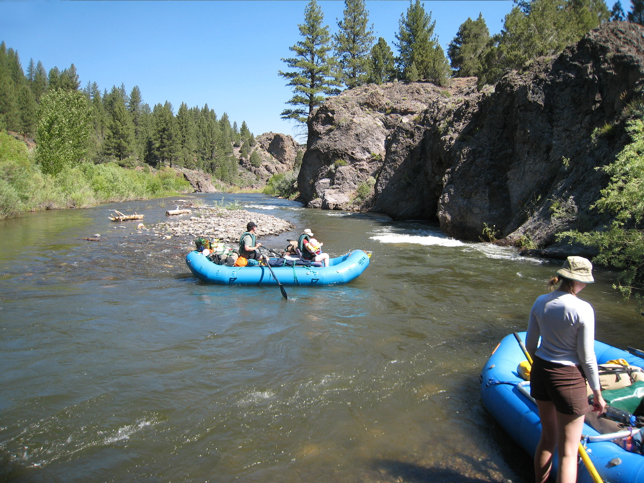
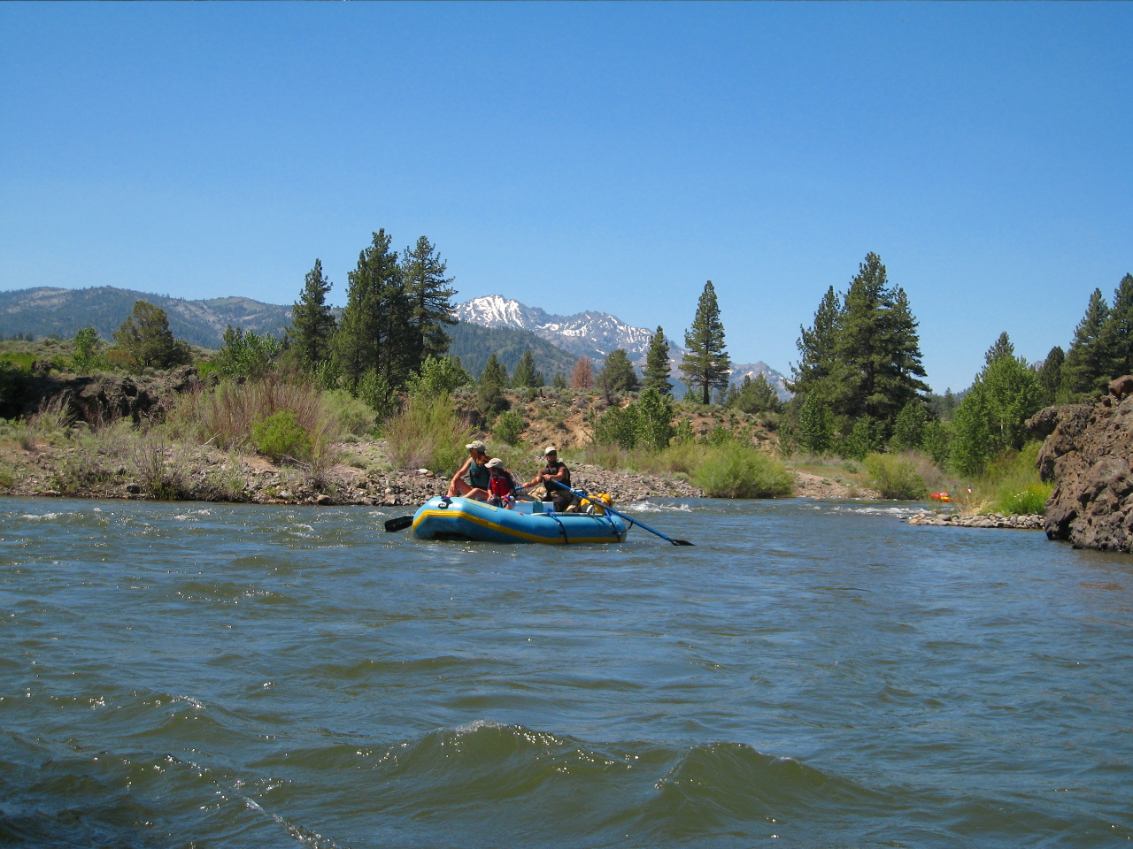
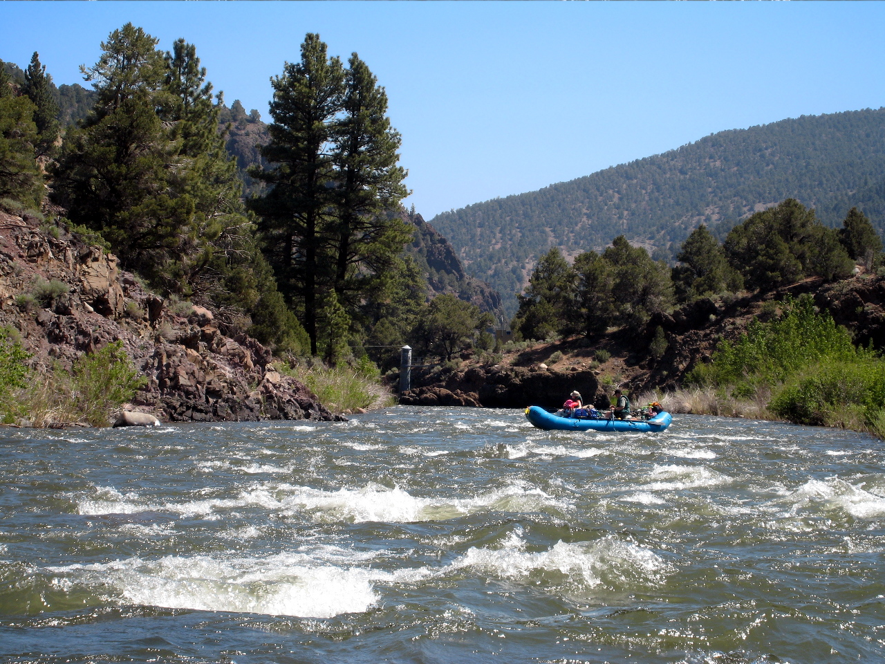
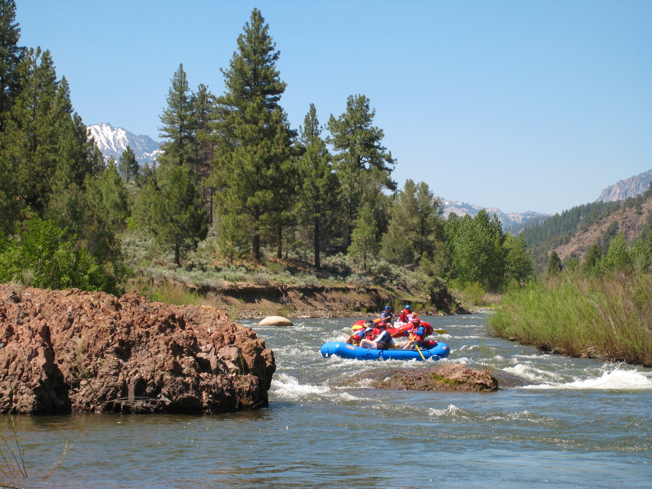
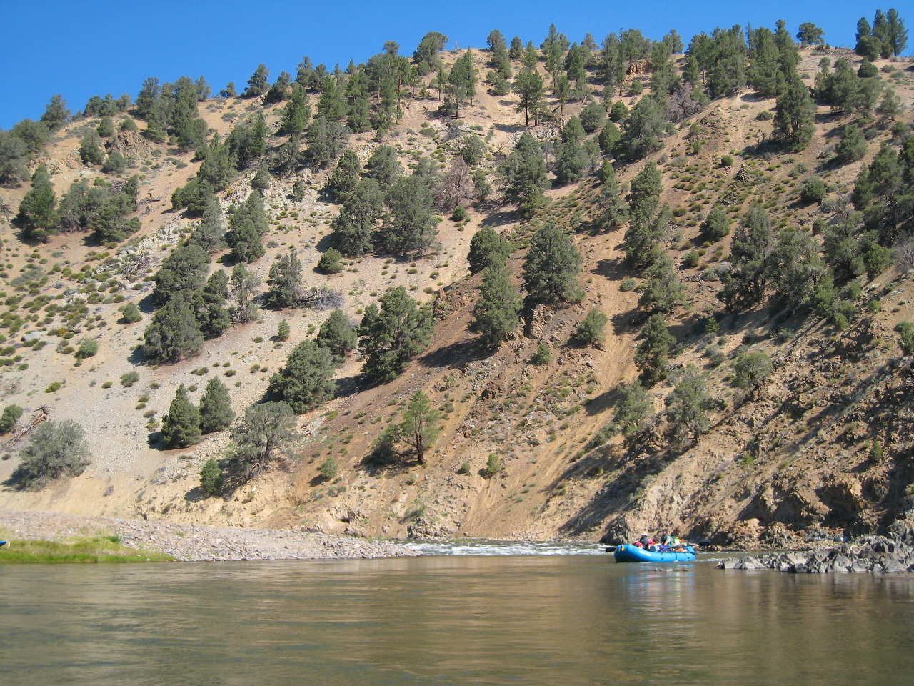
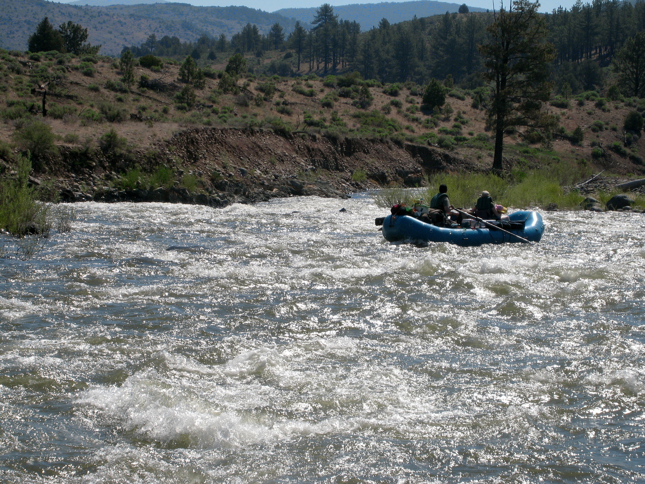
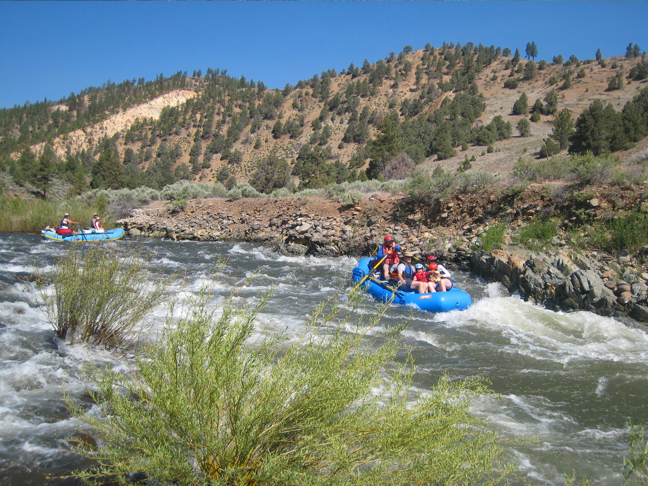
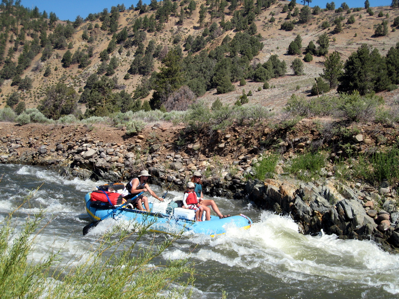
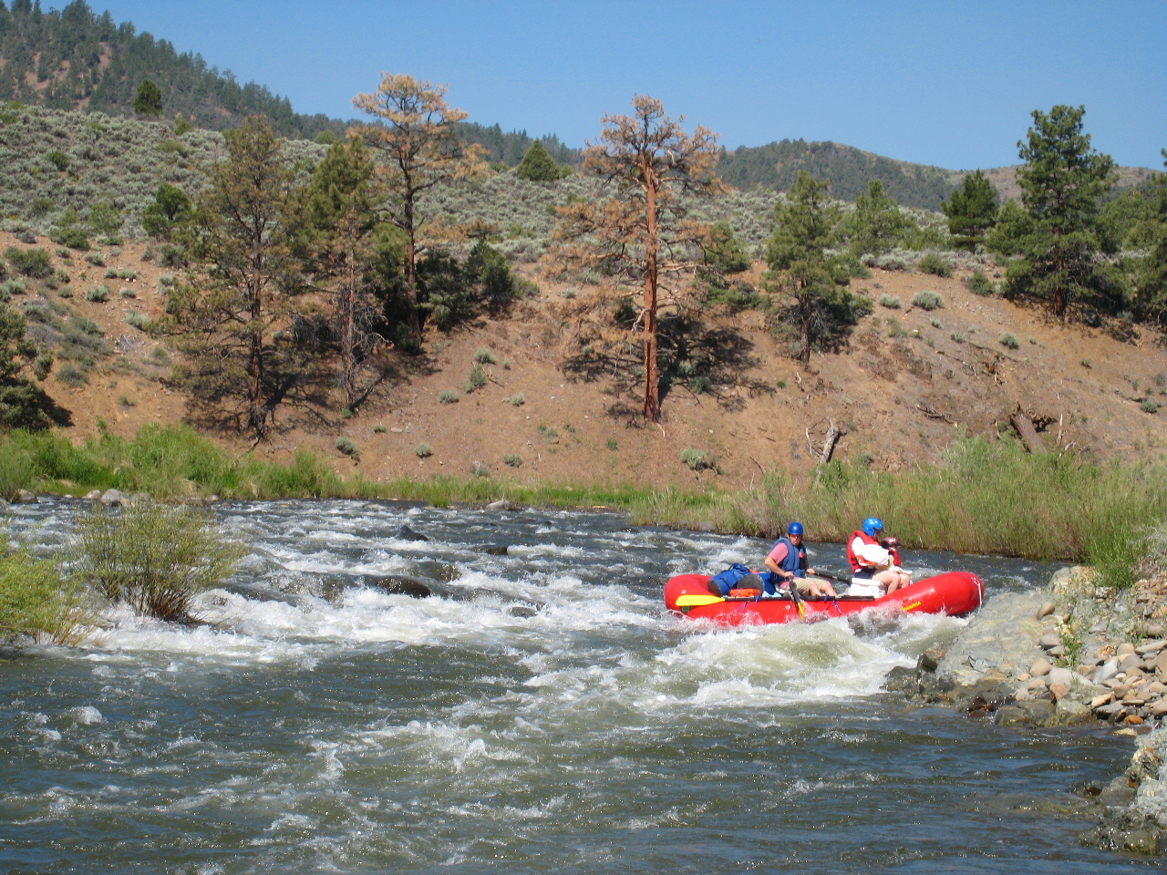
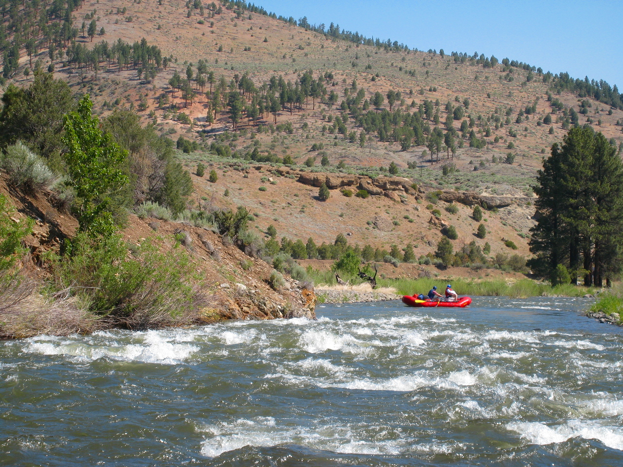
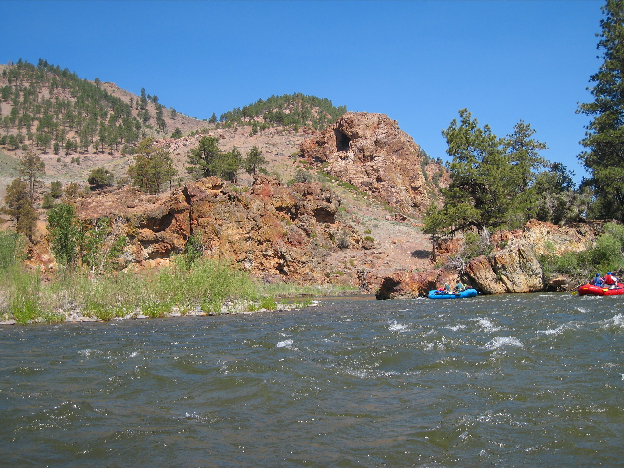
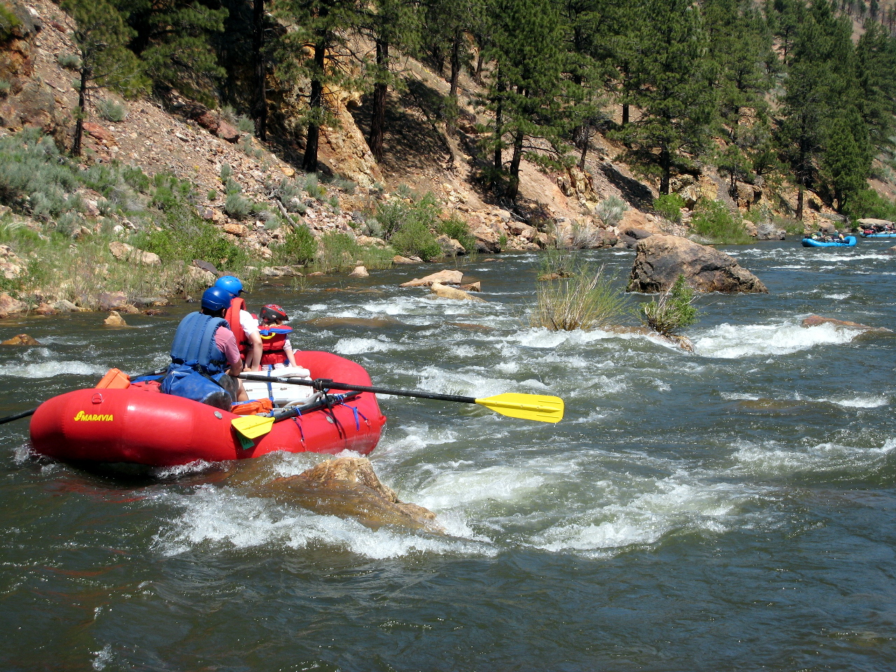
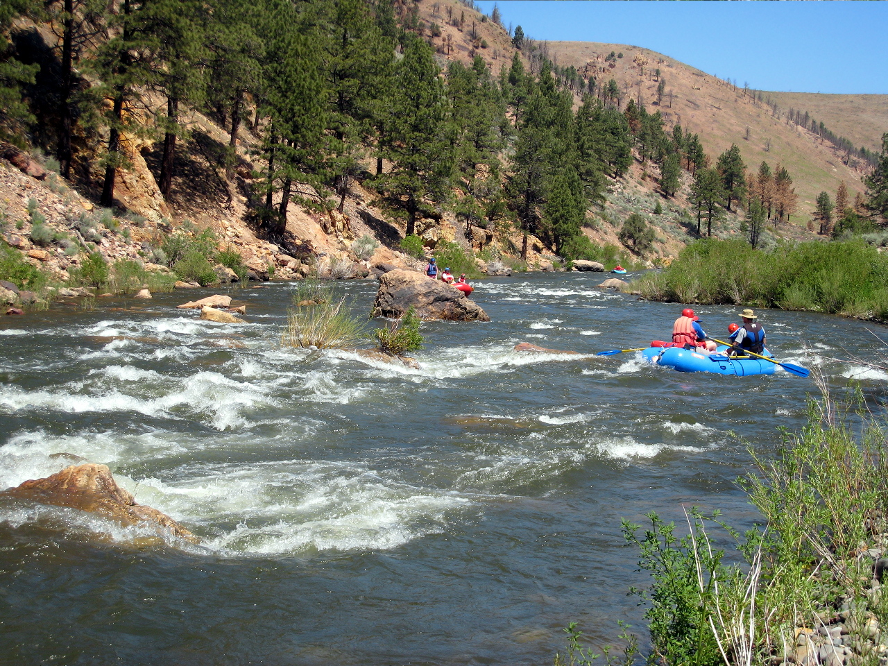
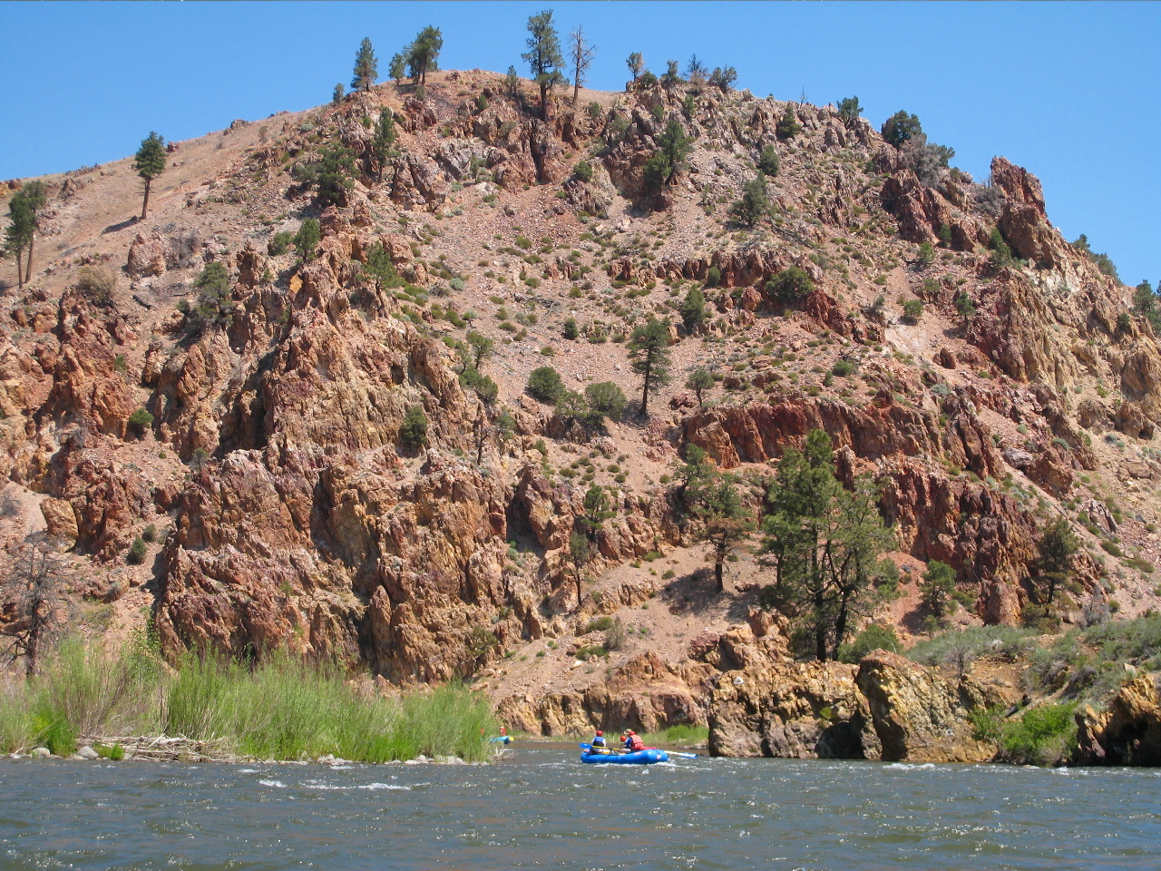
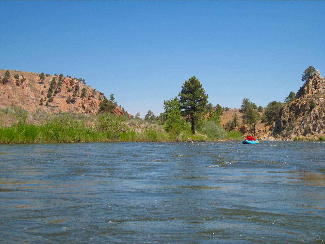
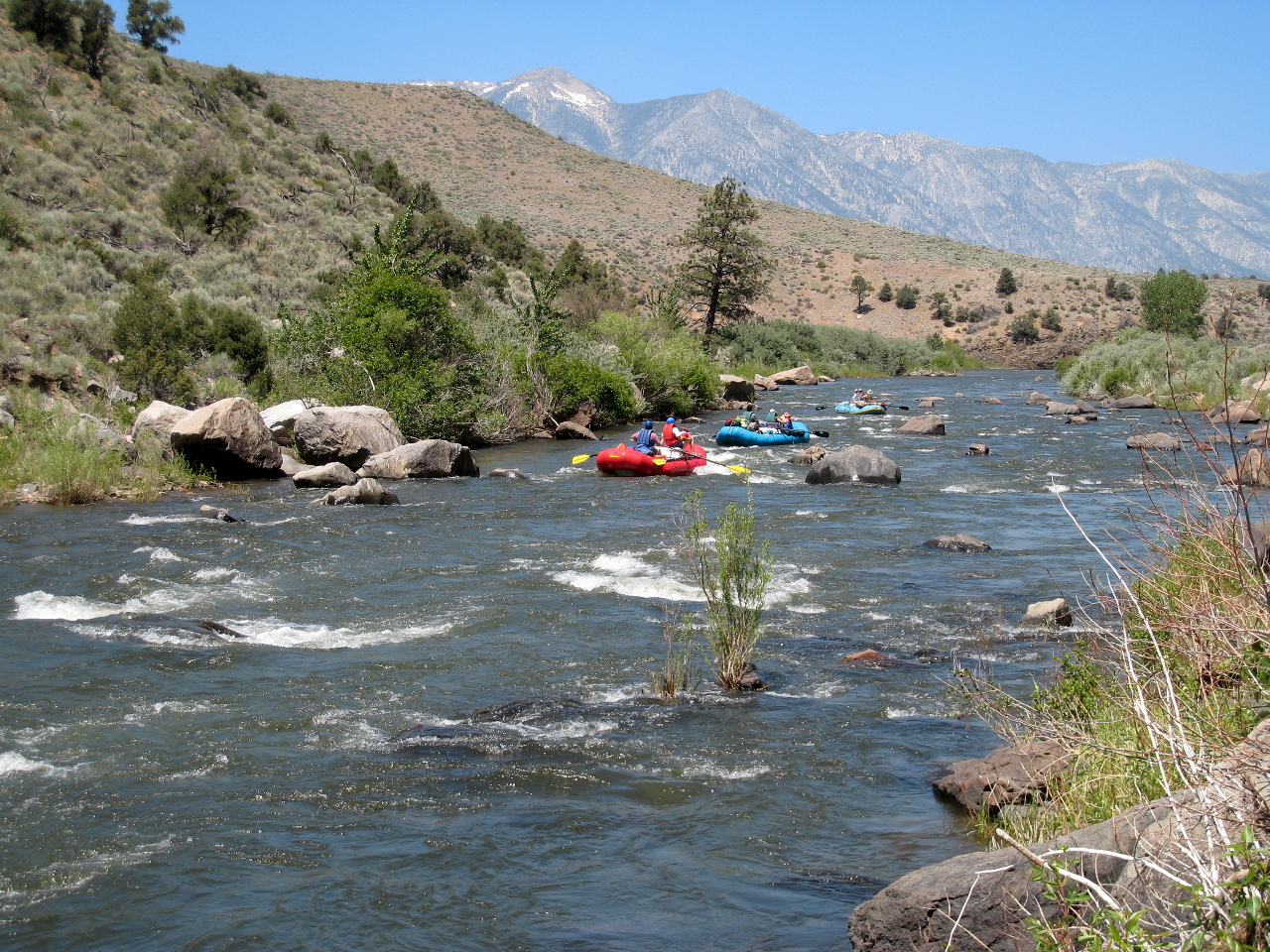
Starting in pine forest and ending in the high desert, with frequent glimpses of distant snow-covered peaks, offering several hotsprings near midpoint, and containing many fun rapids, this is one of the finest novice runs in California. Its mild class II+ rating can be deceptive however, because the water is swift and cold, the rocks sharp and abrasive, and the bedrock banks sometimes undercut. Flows are highest in the morning, so consider the peaks when deciding if it is too low or too high to run.

After the flood of 1997 the class III rapids above Hangman's Bridge became more class II-like. It is best to avoid crowds and put in at one of the many roadside turnouts south of the bridge, rather than at the bridge. Note that there are no sanitary facilities above Hangman's Bridge, so overnight camping and parking is not permitted alongside highway 89/4. The further up the highway you go, the more the rapids approach class III. The Cassady/Calhoun guidebook describes this upper run in detail, with its 65 fpm gradient and continuous class III rapids. Intermediate boaters usually like to start way upstream for some morning excitement.

Along Markleeville Creek between town and put-in is a nice USFS campground that is often filled on Friday nights. The other side of put-in, Carson River Resort rents cabins and campsites; see www.carsonriverresort.com for pictures and reservations.

mile 0
Put in at Hangman's Bridge, or at a turnout along highway 89/4. There is a good one about .4 mile upstream from Hangman's Bridge, and another one just downstream of the highway 4 and 89 junction. Toilet facilities are available at the Hangman's bridge put-in. Wide-open class II rapids start immediately.
.4
Hangman's Bridge, the normal put-in, with attendant crowds and a very small beach. Below, rapids can be tight at times, and the lava rock walls are sometimes undercut. A choice of channel is best resolved on the left (1997).
East Fork Carson CA East Fork Carson CA
Typical into-a-cliff rapid below the bridge  Near the confluence with Markleeville Creek
2
Markleeville Creek enters from the left, increasing the flow by more than half. Rapids become larger but generally safer.
East Fork Carson CA East Fork Carson CA
Semi-continuous rapids near the gauging station  Big Rock or Hole in the Middle rapid
6?
The river channel has changed, and although the best route appears to be on the left, most of the water flows to the right thru an old established line of willows.
8.8
Ponderosa bench on the right makes several excellent campsites, all within walking distance of a hotspring on the right bank downstream, and a nicer rock-lined hotspring on the left bank.
East Fork Carson CA East Fork Carson CA
Rapid above first hot springs, left and right  Entrance to Sidewinder from above
9
Sidewinder or Rattlesnake, class III+, scouting recommended
This rapid changed during the high water of 2017, and continues to change. The river splits around several islands as it drops over a diagonal ledge. The formerly popular left channel is now mostly a waterfalls. Newly exposed sharp rocks have ripped holes in rafts and caused injury to swimmers. Three routes are possible: extreme left to avoid the falls at some risk, middle channel right of an island into a nasty looking V-shaped drop, and impossible to boat-scout extreme right over a bouldery drop. Both 2020 photos from left bank.
This is how it used to look:
East Fork Carson CA East Fork Carson CA
Entrance to Sidewinder from below  Hardest part is avoiding the left wall
East Fork Carson CA East Fork Carson CA
Perfect position after avoiding left wall  After a short break, Sidewinder part 2
9.3
A big hotspring cascades into the river. A large bench nearby used to make an excellent campsite, but became less attractive after a recent forest fire. Trees are starting to grow back. Good campsites on river right were unaffected by fires.
9.9
A small bench campsite with another small hotspring up a creek.
East Fork Carson CA East Fork Carson CA
Ponderosa pines and junipers cling to the rock  Scenic bend with tall Ponderosa pines
10.3
Nevada State Line.
10.7
Wrapper's Rapid, class II+
Recognition: .2 mile upstream, there's a cave high on the left bank. At low flows, a curtain of rocks creates a slalom that many novice rafters fail to negotiate. There is often at least one wrap here every Sunday during rafting season, except at high water.
East Fork Carson CA East Fork Carson CA
Narrow entrance to Wrapper's Rapid at this flow  The slalom is easier to negotiate on the right
10.8
Hazard: Bryant Creek emerges out of Leviathan Canyon on the right. Guidebooks say that Old Leviathan mine, a superfund site with evaporation pits containing 15 million gallons of acid mine leachate, pollutes the creek with arsenic and other heavy metals, and advise not drinking river water below here. Mitigation efforts started in 1984. No pond overflows have occurred since 1999. However it remains advisable to avoid filtering or purifying water below this point.
East Fork Carson CA East Fork Carson CA
Cliff dwarfs raft at a steep spot in the canyon  The canyon opens up in places
15.9
A deep canyon with fantastic shapes in the basalt cliffs was the planned site of a dam, fortunately never built.
16.9
Horseshoe bend with many swallow's nests in the left bank cliffs. Dirt ranch roads become visible.
East Fork Carson CA East Fork Carson CA
Long class II rapid with views of the high Sierra  Occasional class II rapids continue to the end
20.4
Grafitti warns you of a dangerous eroded diversion dam and falls ahead. Swift water continues. The take out is a gravel bar on the right bank, only a short distance downhill from a dirt parking lot.
 
Hazard! All guidebooks warn of the hazardous diversion dam and waterfalls below take-out. The flood of 1997 eroded the right side of this structure, creating what looks like a class V+ rapid on river right. The former low-water crossing shortly below has been replaced by a bridge.
Upper run. Some boaters put in near the junction of highways 89 and 4, or further upstream following a dirt road along the river to Wolf Creek. After the flood of 1997 this section became less difficult and is now fairly continuous class II-III with some passages between large boulders.

Upper upper, thanks to Chris R. If you are willing to carry boats 8 miles from Antelope pack station (above the town of Walker CA) there is a 15-18 mile run on the upper upper. It is mostly class I to III, with downed trees and one class V drop (or portage) in the upper half, and some IV rapids in the lower half. Watch for barbed wire. The lower half still resembles the West Walker before the 1997 flood. You can access the lower half with a 5 mile walk down from Heenan Lake. Due to carry, even the lower half is infrequently run, but 1000 cfs on the Markleeville gauge is deemed a good flow, giving you about 100 cfs after the carry from Heenan Lake.

Trip report from Trent Pierce, May 2019. “A friend and I attempted the Lower Upper Upper section this weekend, hiking in at Heenan Lake with our packrafts. We had around 1400 cfs on the Markleeville gauge. At this water level, we found it to be very continuous Class III with most eddies partially blocked by willows and containing many dangerous strainers, some in blind corners. The first Class IV drop was almost entirely filled with wood, with only a thin line runnable, and fed into more continuous Class III with even more strainers. After a spill and a time-consuming boat retrieval, we hiked out after the first Class IV. Scouting the roadside section from Highway 4 to Hangman’s Bridge revealed several more river-wide strainers in swift-moving current. Overall, I would recommend folks stay away from these upper sections unless they have lower water and are prepared to do a lot of scouting and portaging around wood.”

Shuttle Directions

To reach put-in, drive south on highway 89/4 to Markleeville, and continue about a mile past town to Hangman's Bridge, where there is an outhouse. You can find better put-in spots upstream between the highway and river. Even on Friday nights, campsites are often available at a USFS campground down a dirt road before the bridge. Shuttles are readily available by inquiring at stores in Markleeville.

To reach take-out, drive north to highway 88, turn right, and descend into Nevada. You can take a shortcut by turning right on Centerville Lane, and left across a bridge before Dresslerville, although going all the way to Minden and turning right on highway 395 thru Gardnerville works too. On 395 just past the Lahonton Fish Hatchery, turn right onto a dirt road where the highway starts climbing a hill. The BLM parking lot is uphill at the end of the dirt road. Vandalism has been reported often in the past.

Good shuttle service has been available in Markleeville or Minden NV. Family Mountain Shuttle Service (Mindy and Paul Washam, 775-392-1903) has been providing reliable shuttle service for many years. Great Basin Sports in Minden is willing to do shuttles; the woman to contact is Pat Fried at 775-450-3446. The Markleeville General Store has recommended River Rat Shuttle Service: call Laura at 775-901-6492. Due to vandalism in the past, it is preferable to leave your vehicle at take-out only for a short time, not overnight.

To find nearby food and lodging, type Markleeville into the box and click Search.

Custom Search
 

 Creeks Navigation

 Home
 Recommended Runs
 Map of Rivers
 Alphabetic Index
 Alphabetic Table
 Text Search

 Sponsored Links