Chetco River in Oregon


Stretch: Carter Creek to Steel Bridge near Brookings
Difficulty: Class IV, one class V, possible portages
Distance: 9.1 miles hiking, 25.6 miles boating, 4 to 5 days
Flows: kayak minimum 900 cfs, IK minimum 450 cfs, day of put-in
Gauge: measured near take-out above Brookings (USGS site)
Gradient: 47 fpm average, 75 fpm from mile 3.5 to 7.5
Put-in: after hike down from end of road, Carter Creek confluence, 1410'
Take-out: steel bridge several miles upstream of South Fork bridge, 200'
Shuttle: 108 miles (over 3 hours) one-way
Maps: USFS Siskyou NF, AAA Southern Oregon, Topo
Season: Early summer, from recent rain and/or snowmelt
Agency: USFS, Siskyou Wilderness area
Notes: © 2012 Bill Tuthill. Photos © 2012 Brian Vogt & Doug Soule.

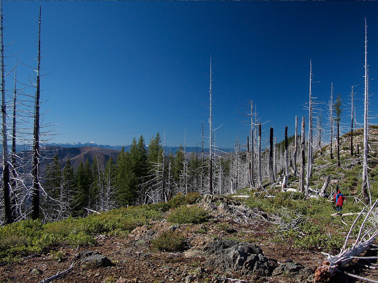
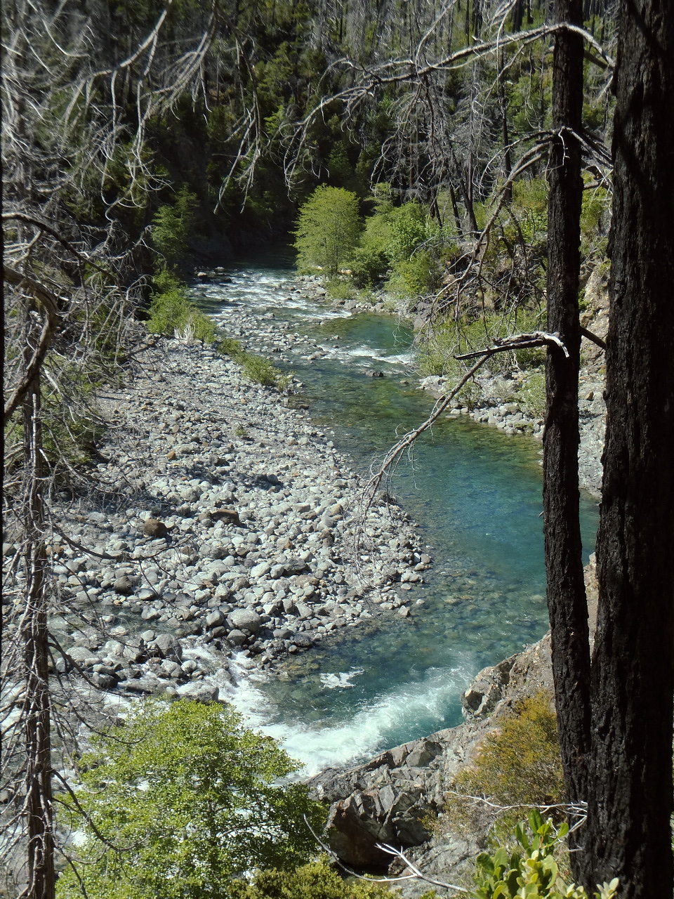
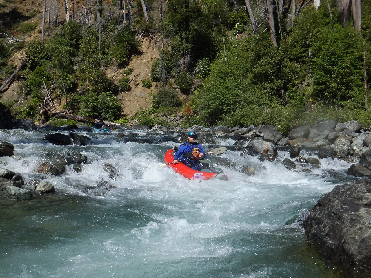
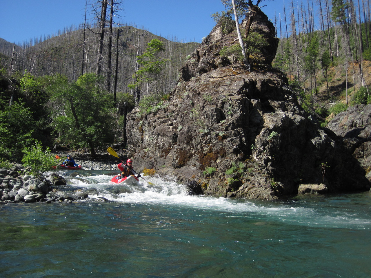
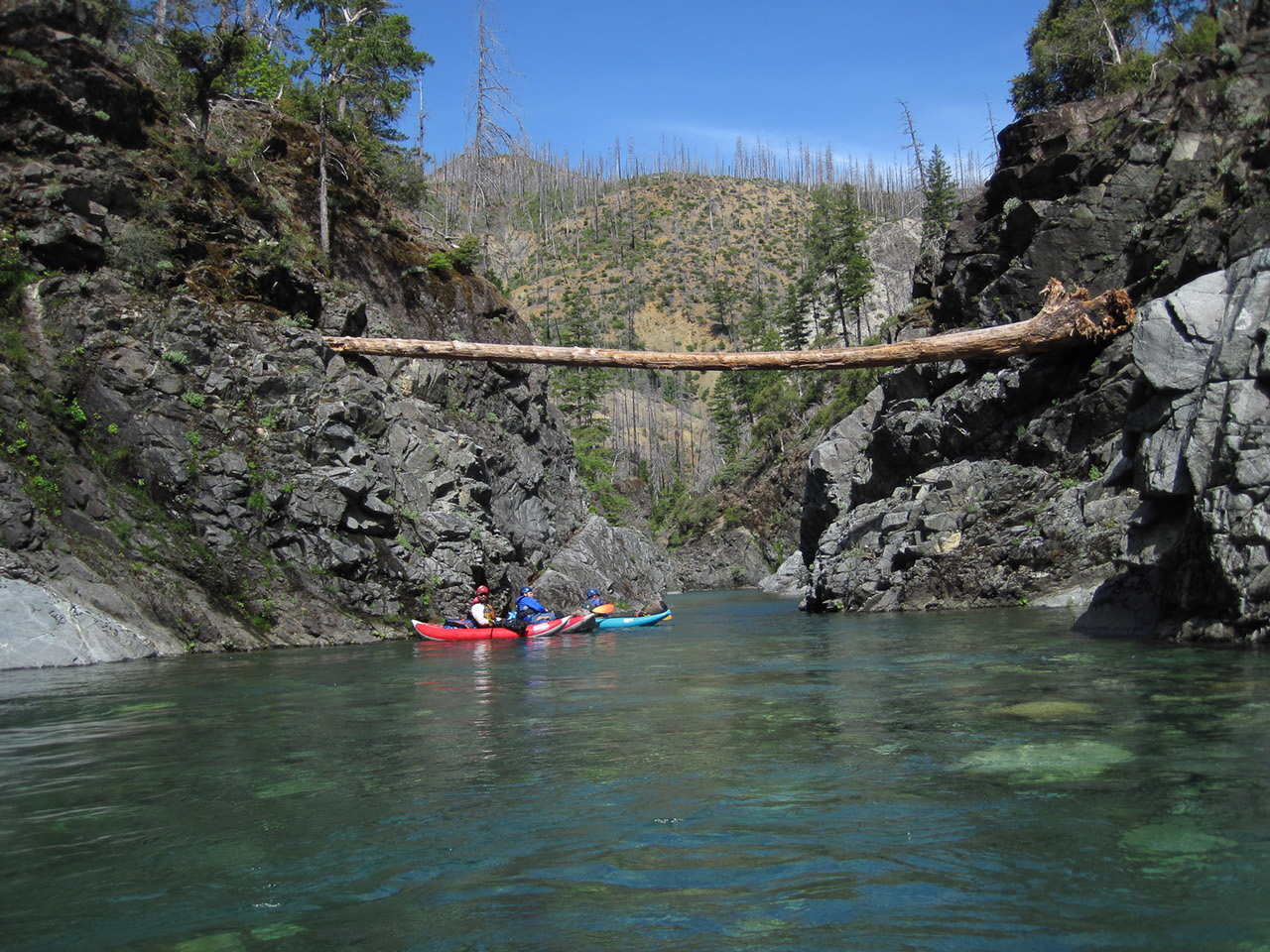
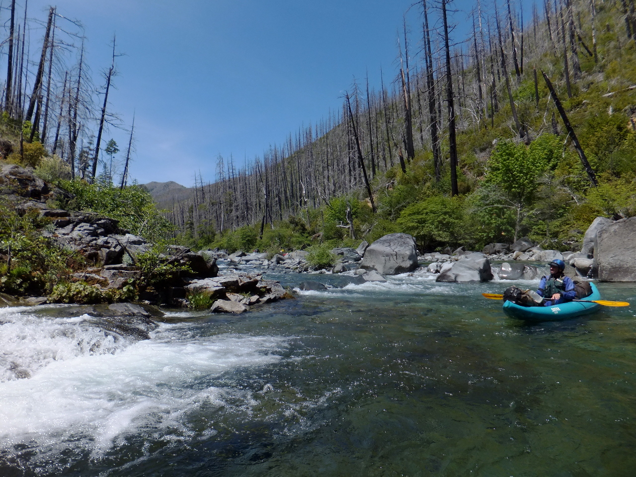
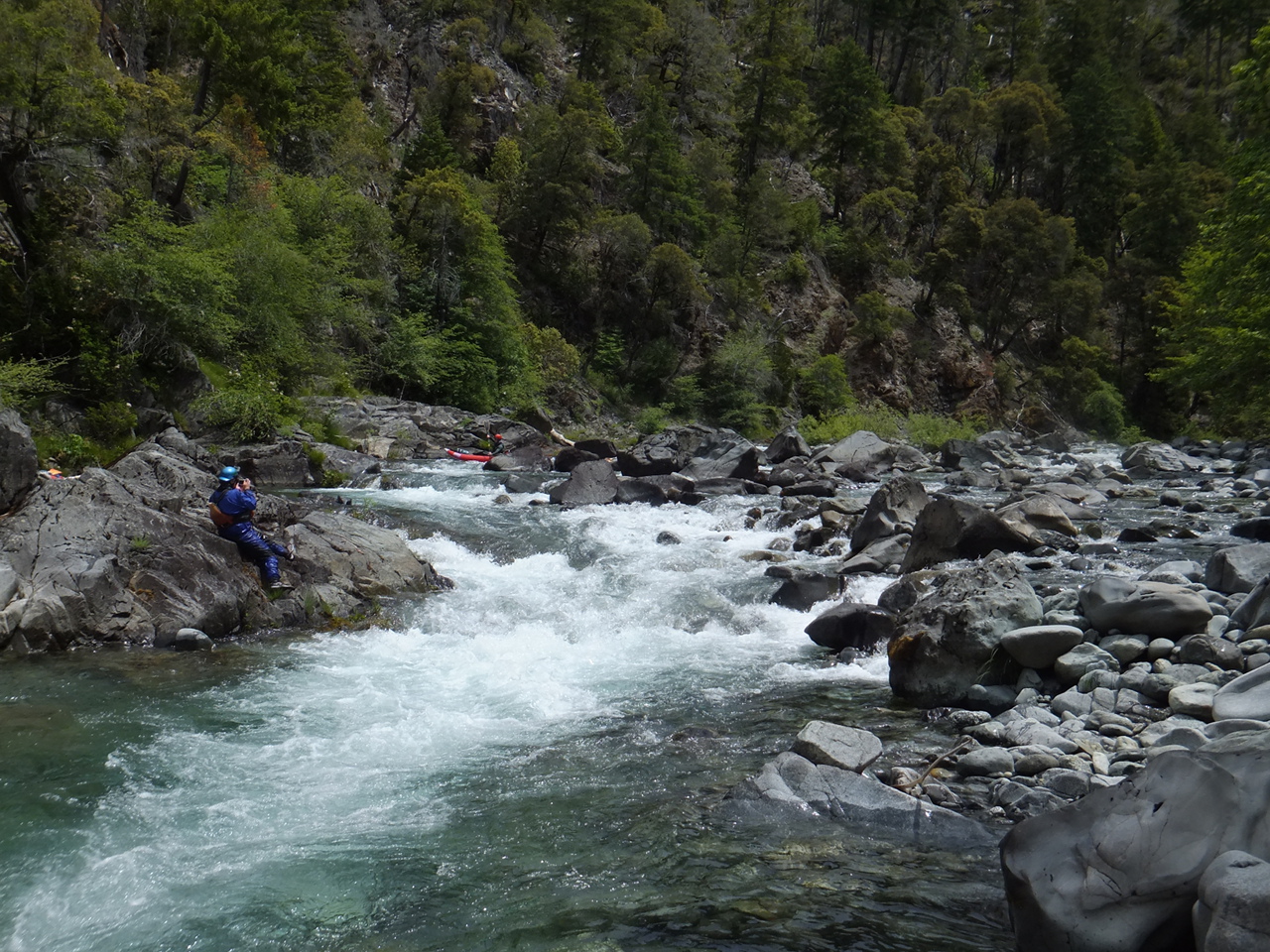
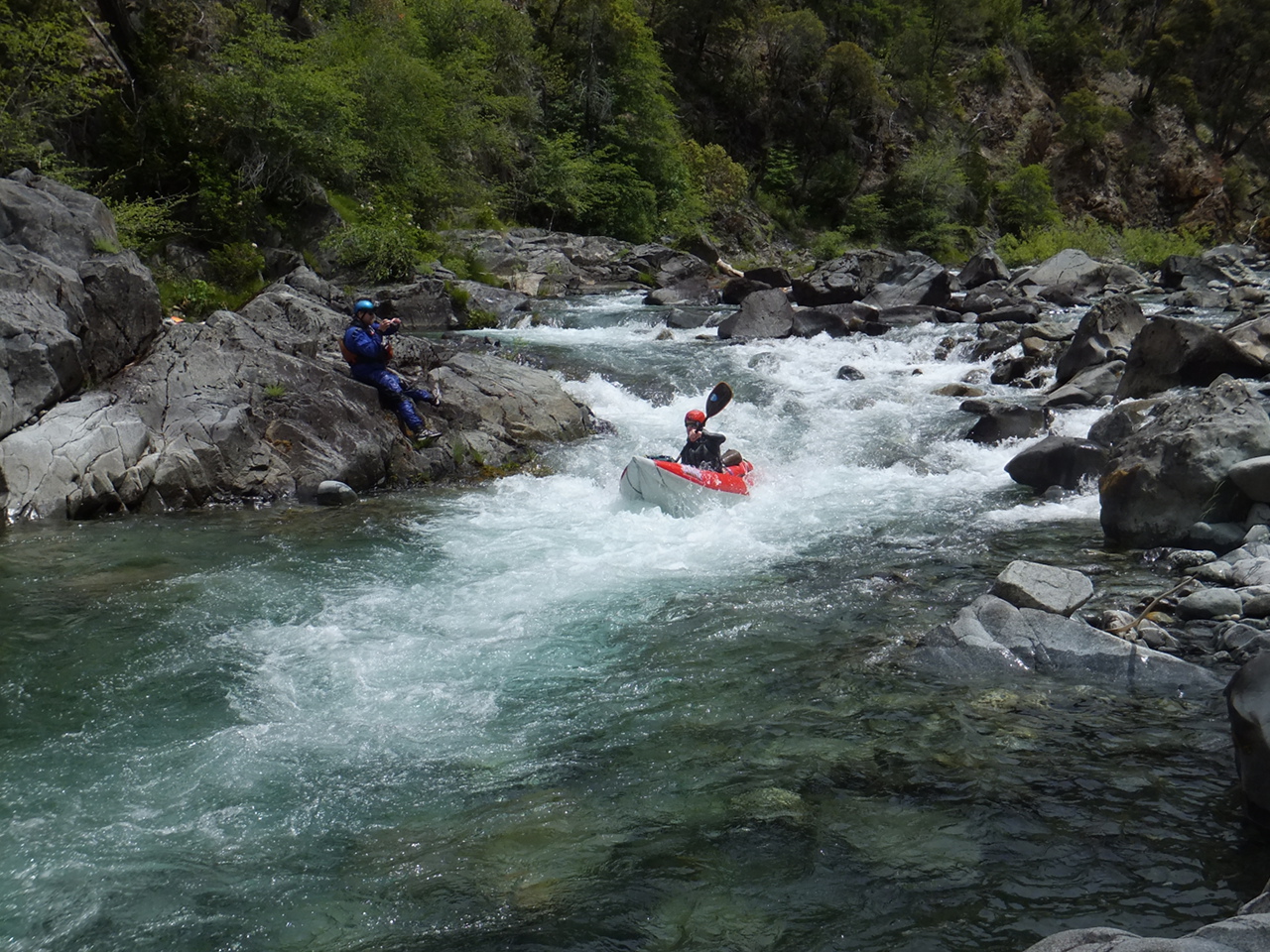
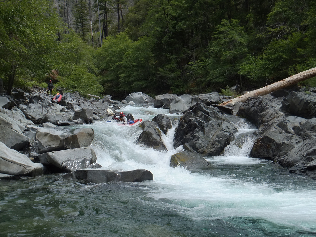
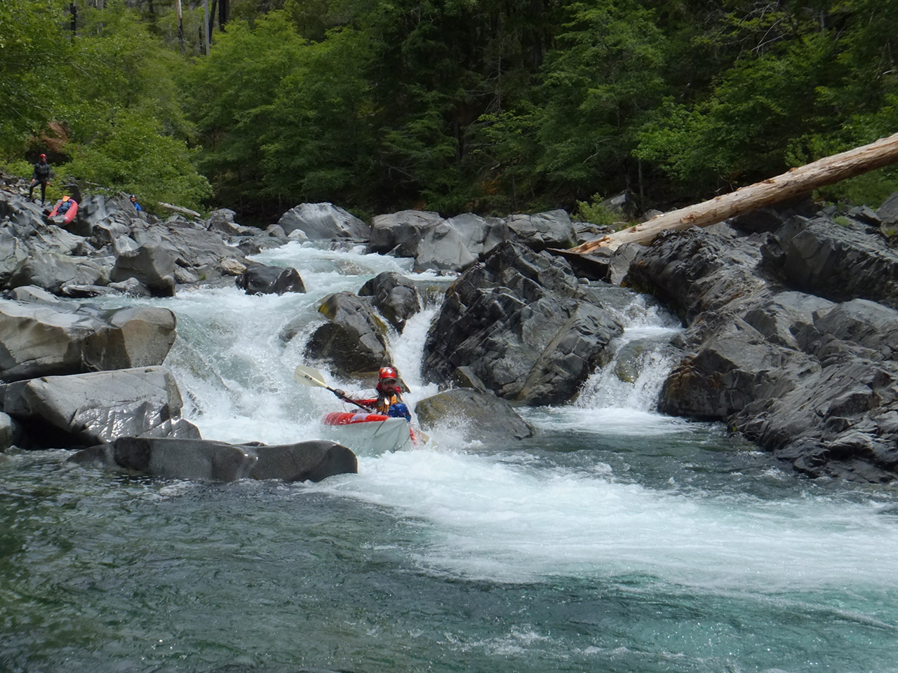
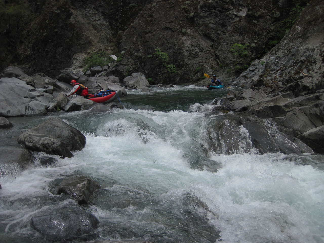
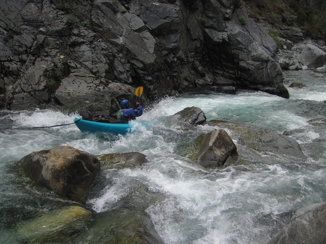
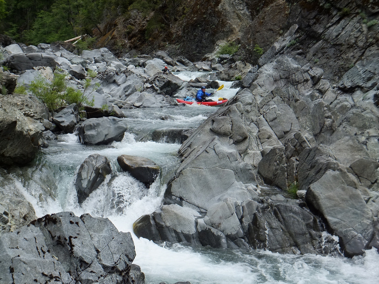
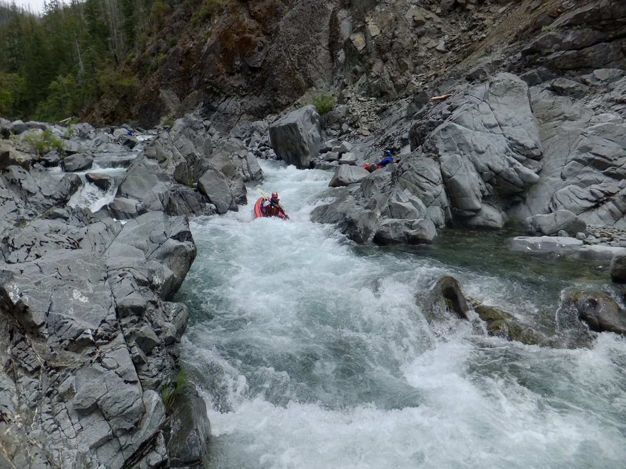
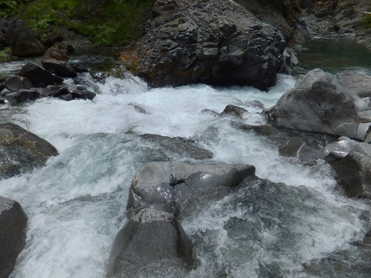
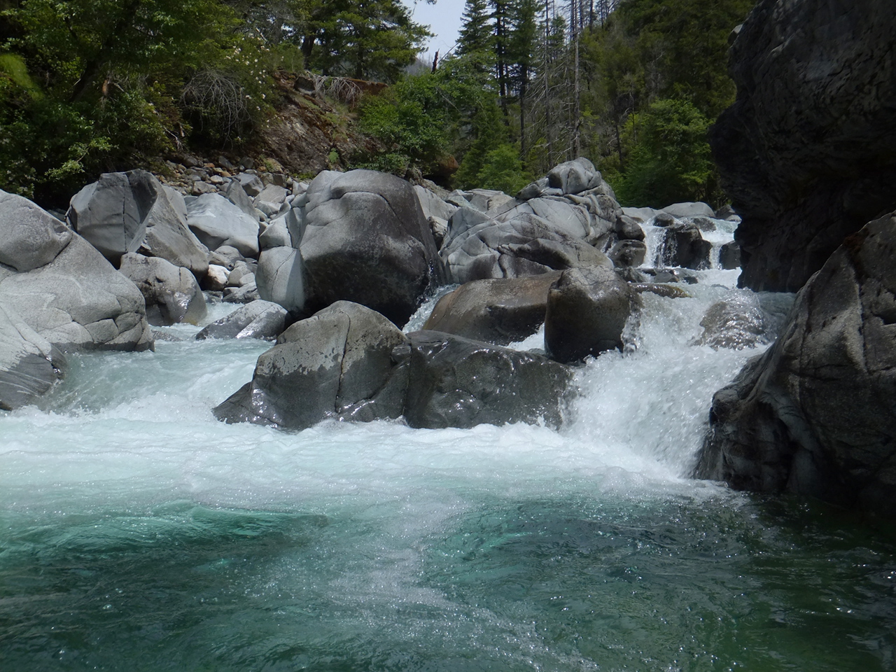
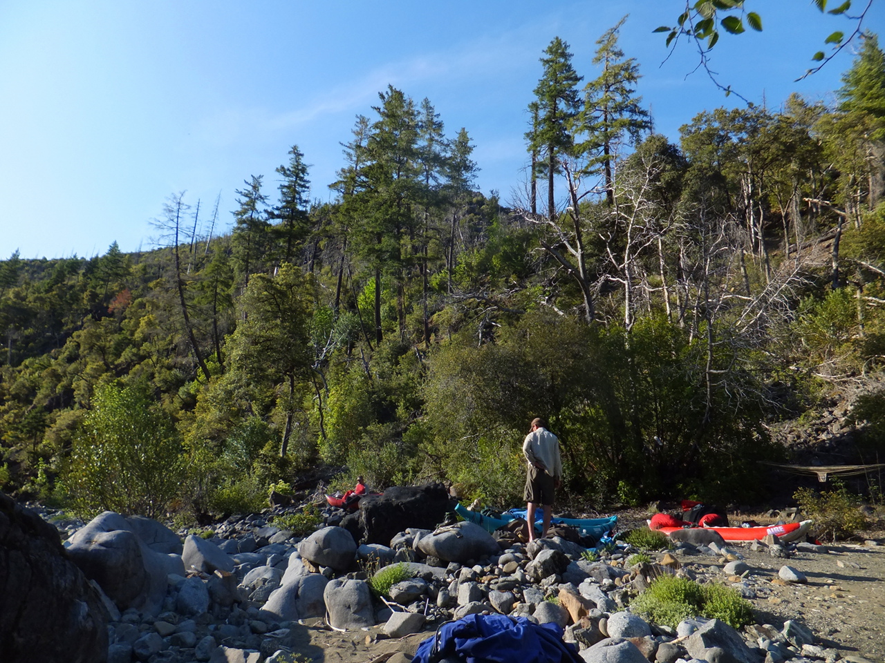
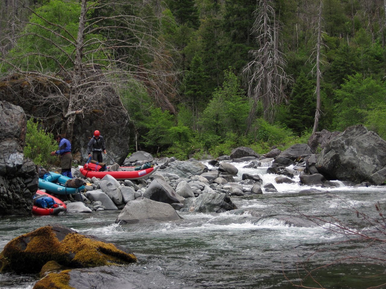
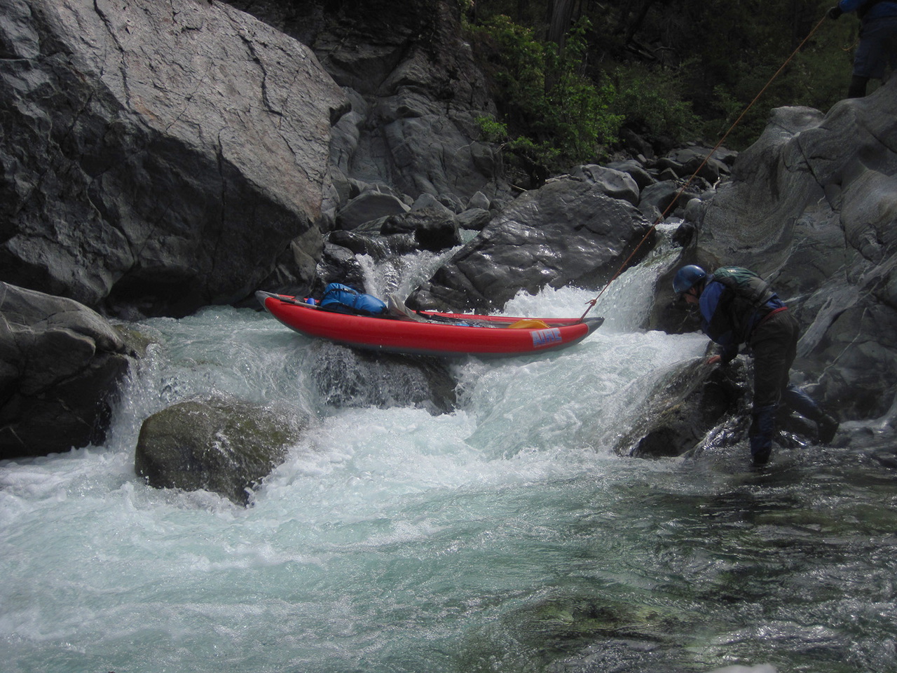
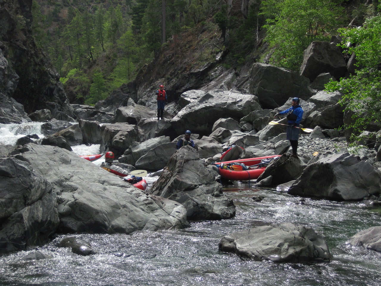
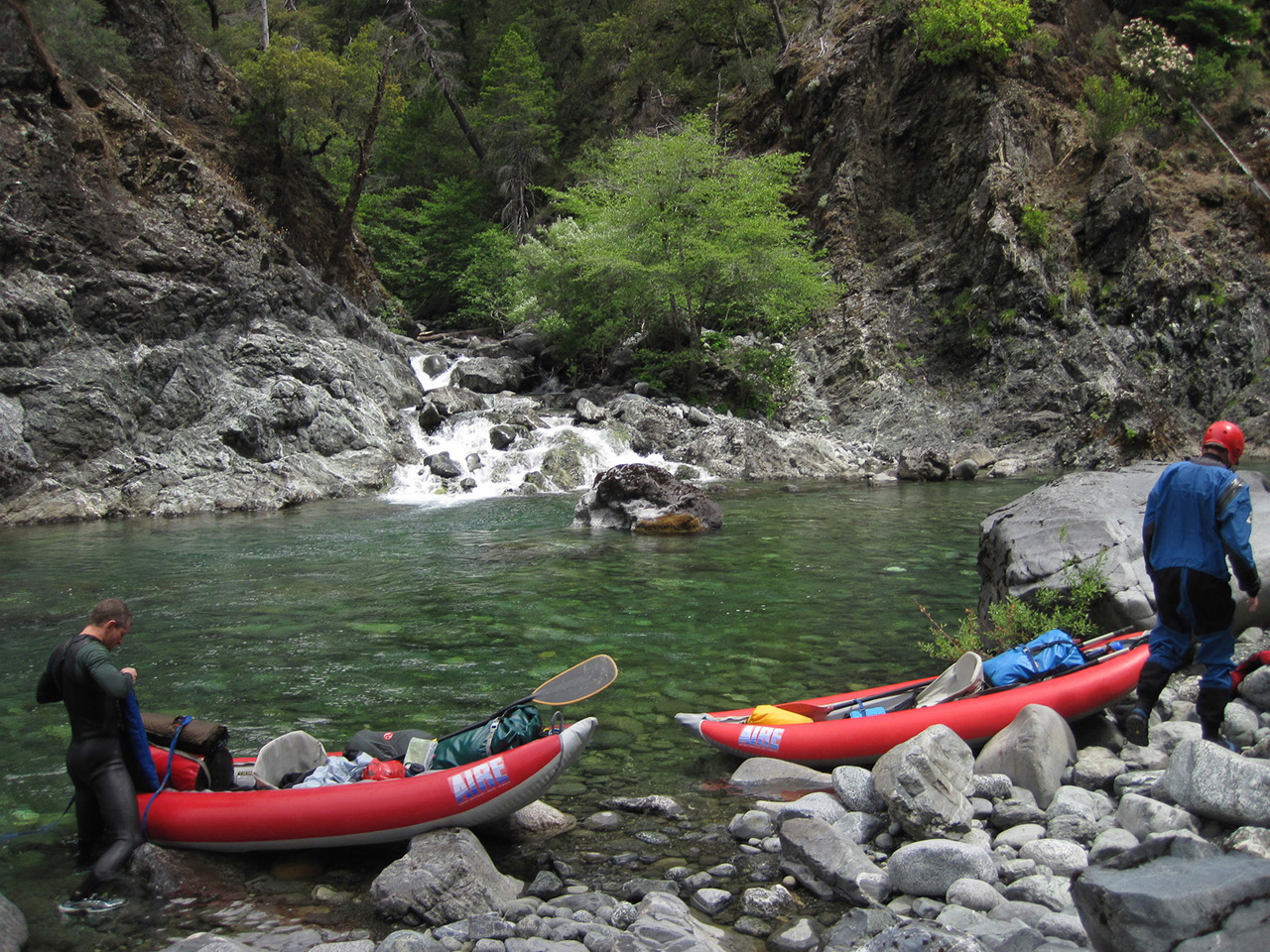
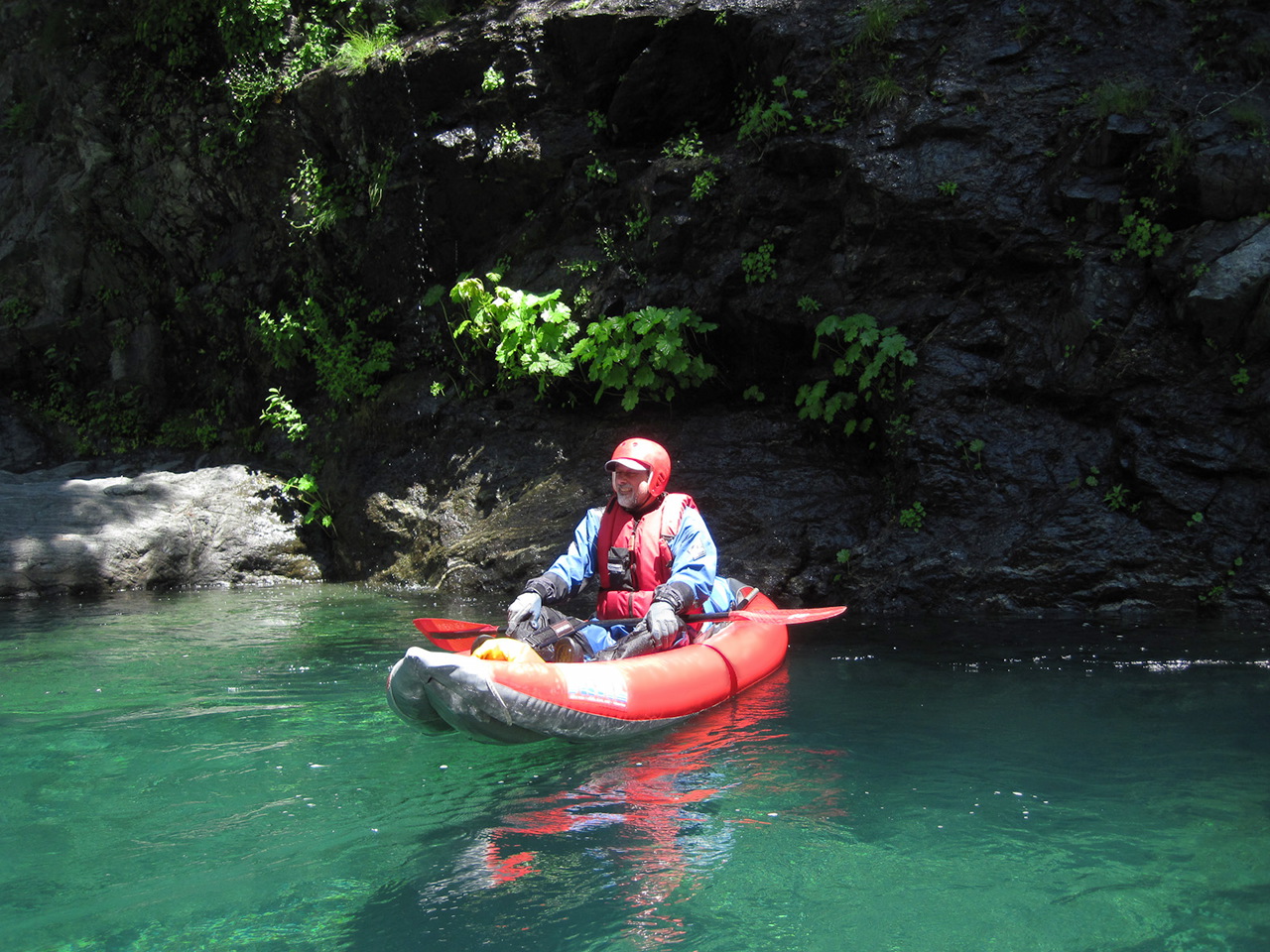
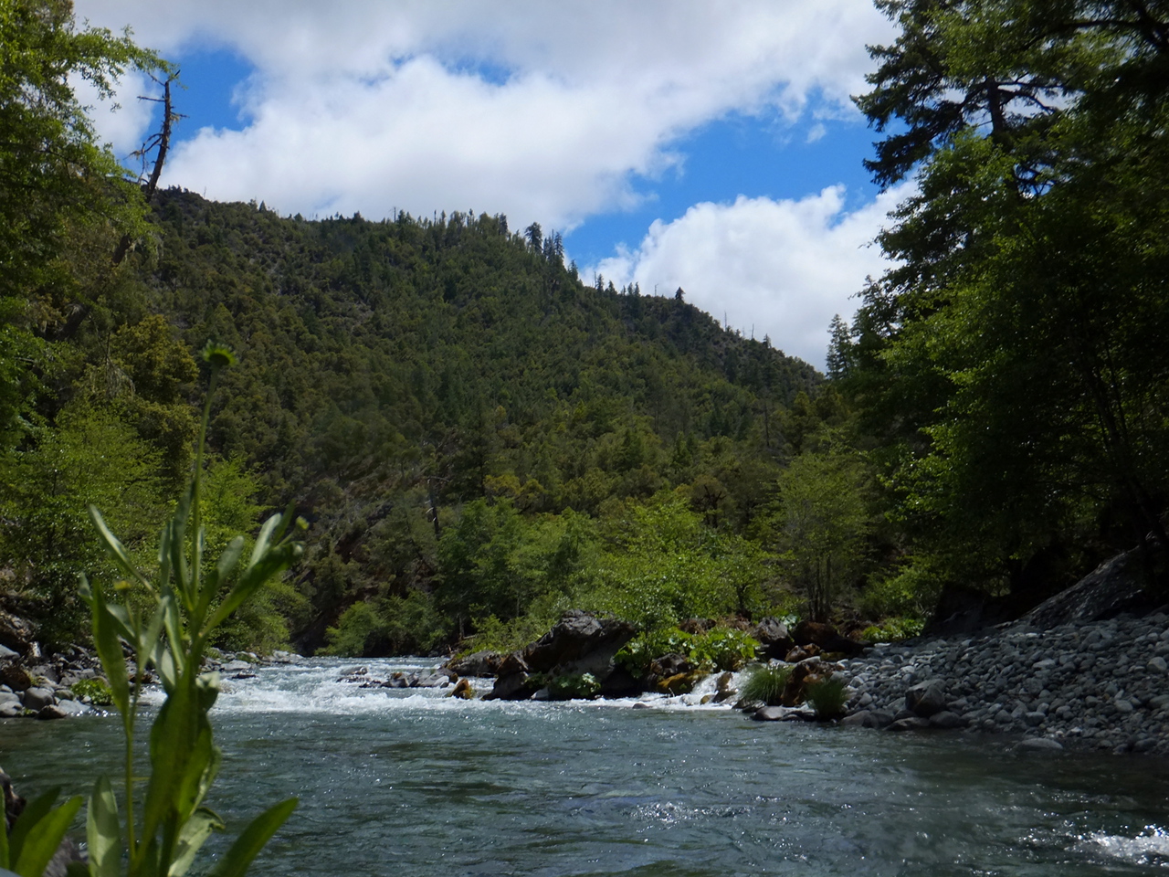
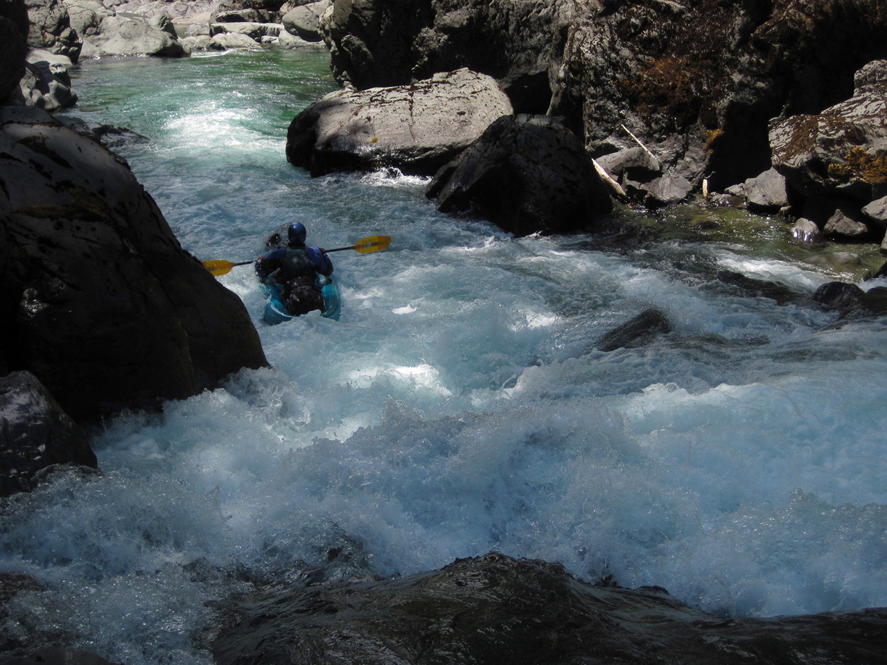
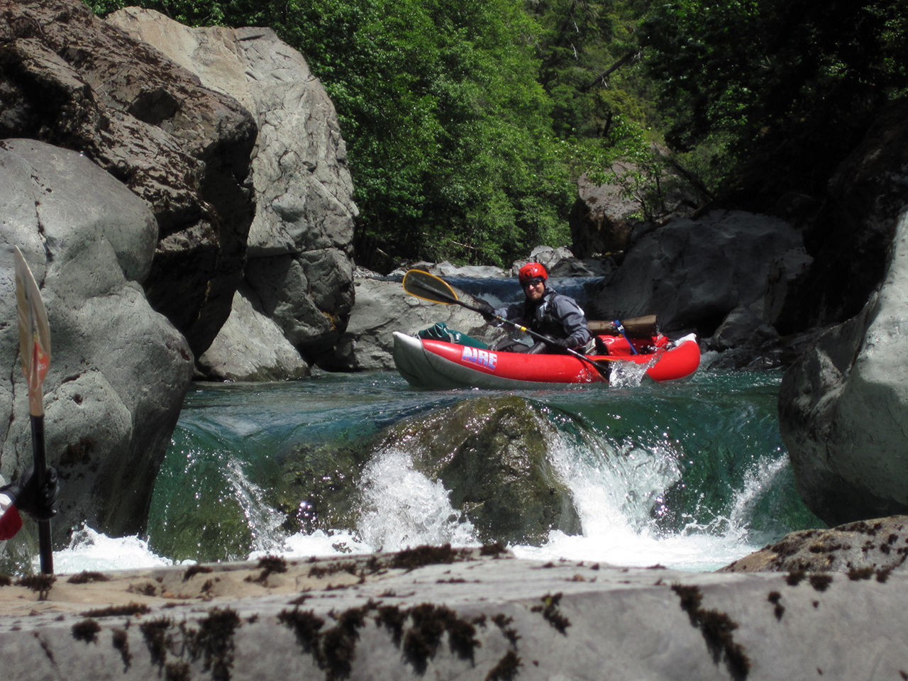
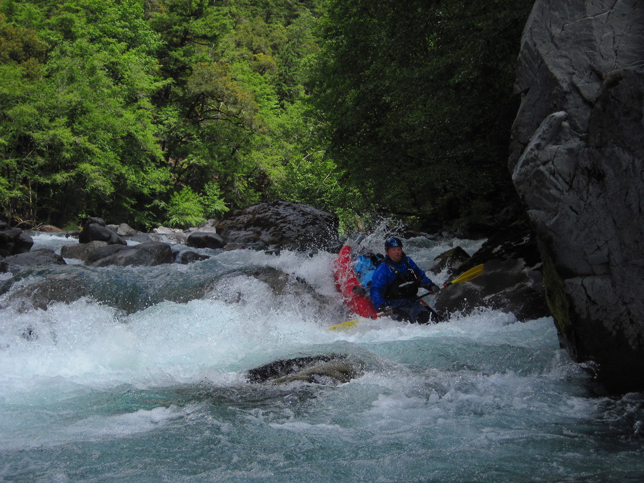
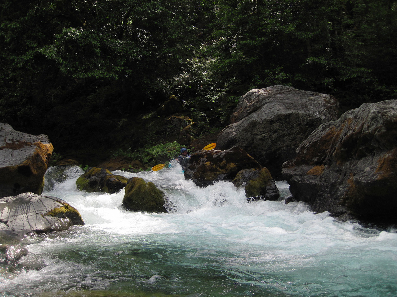
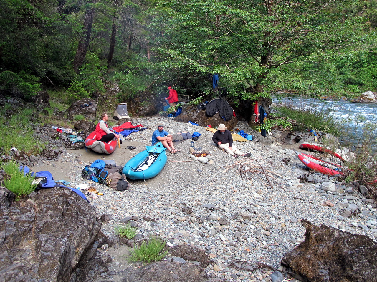
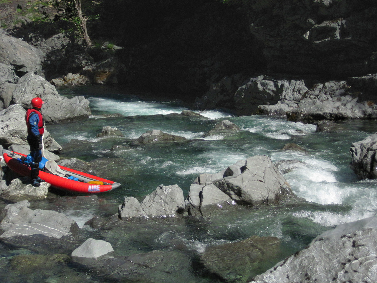
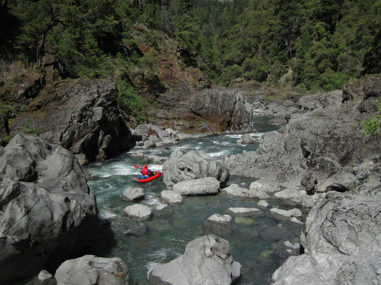
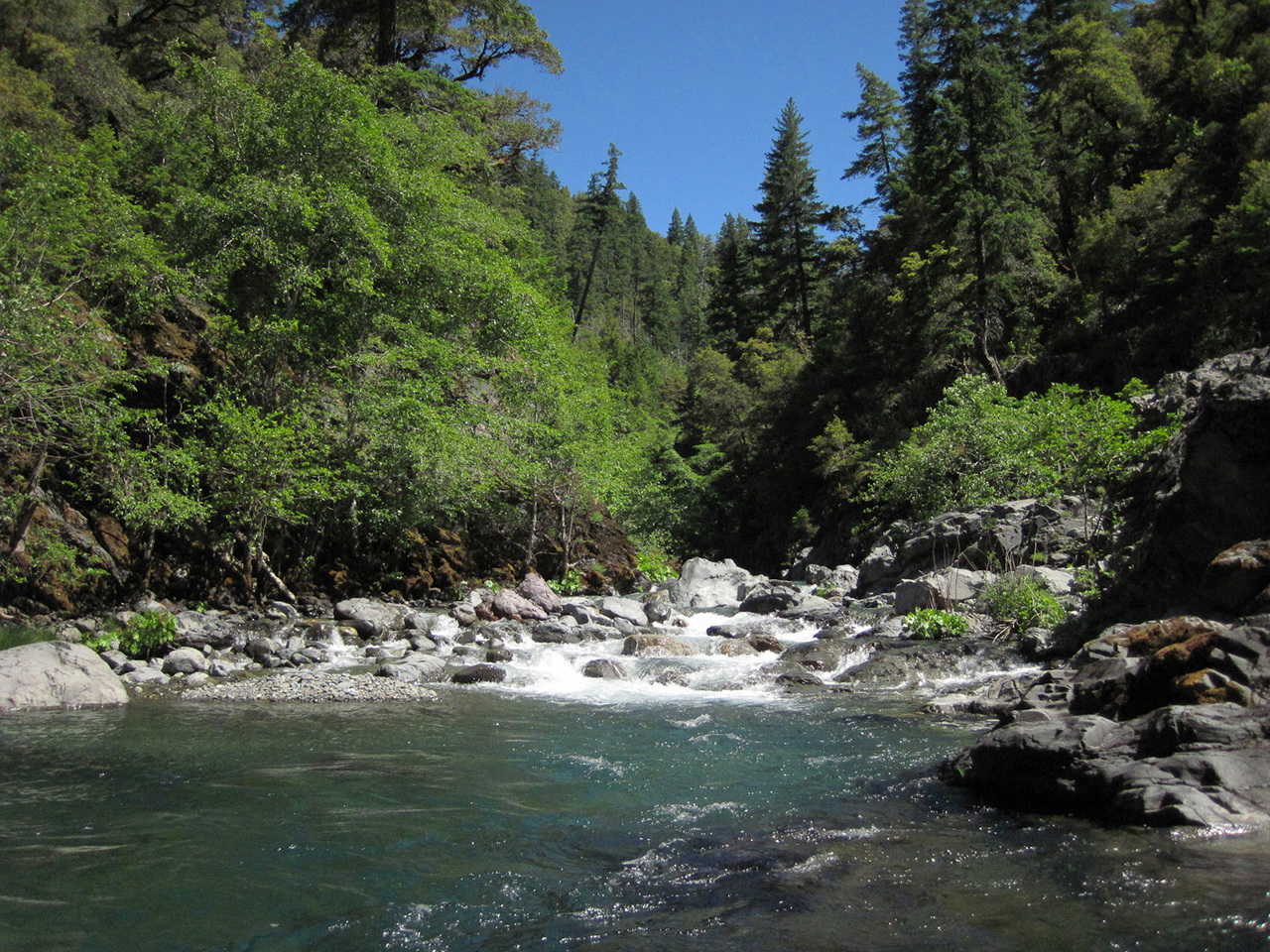
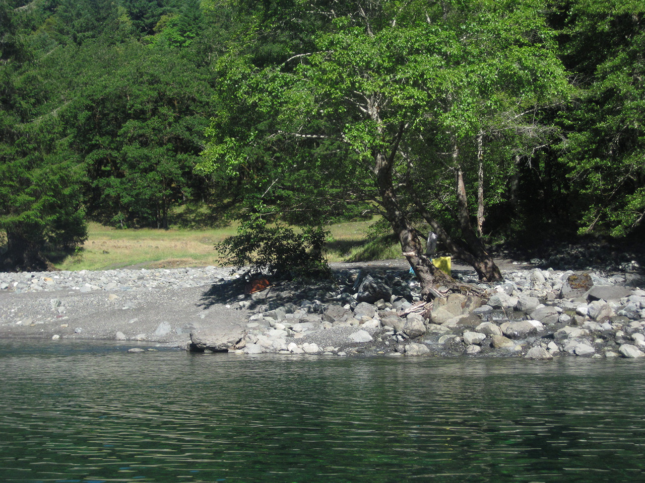
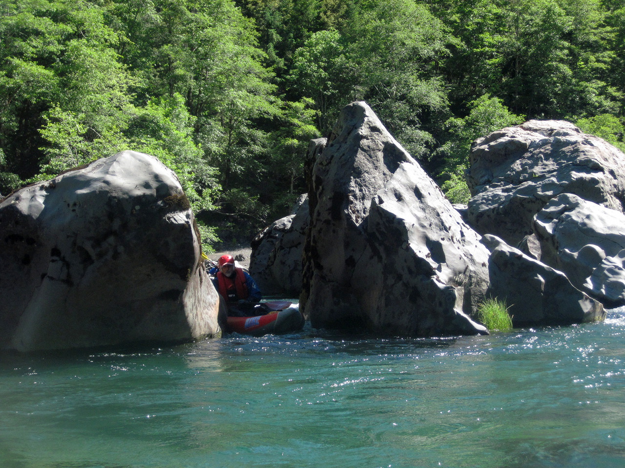
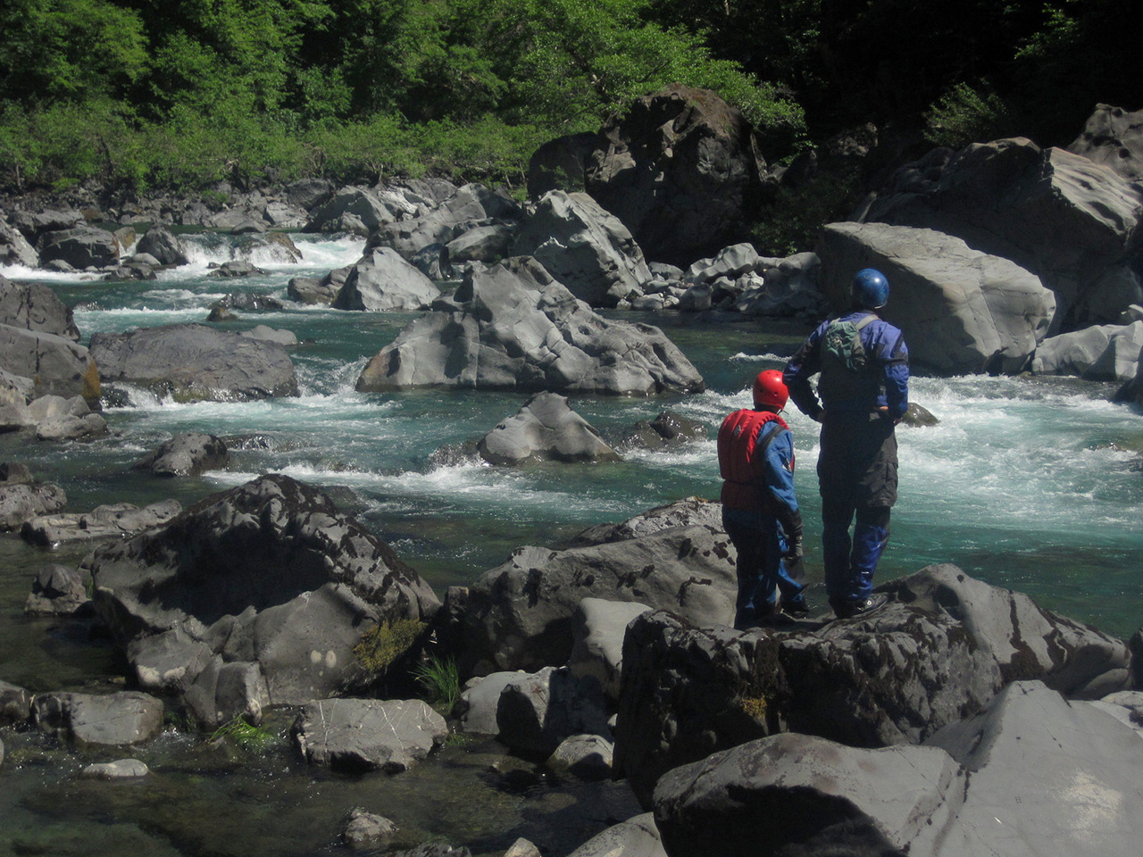
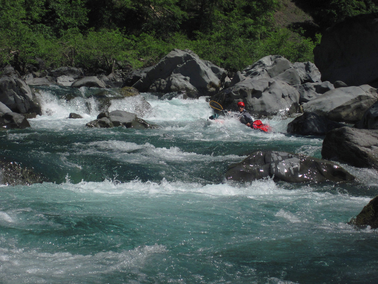
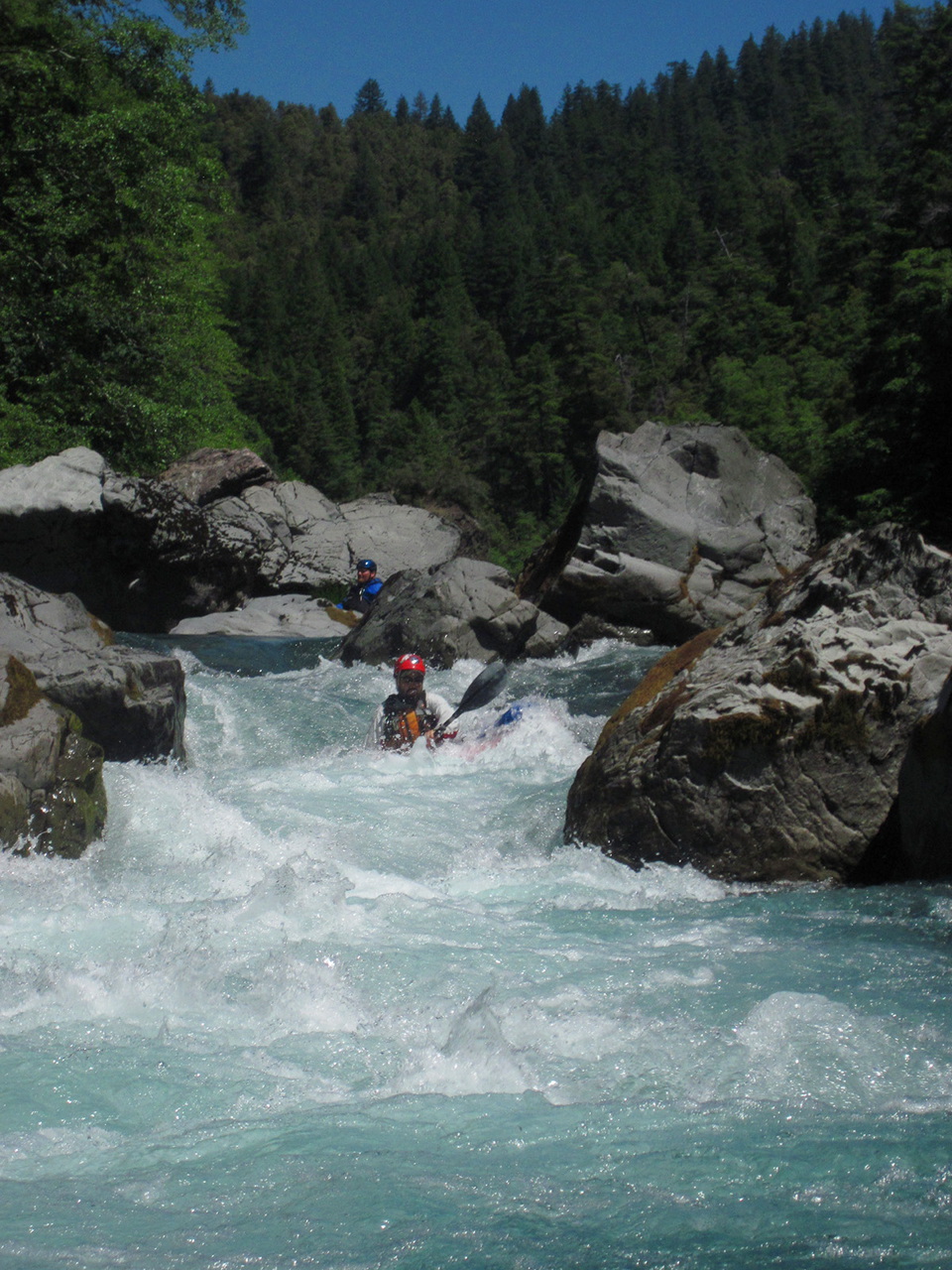
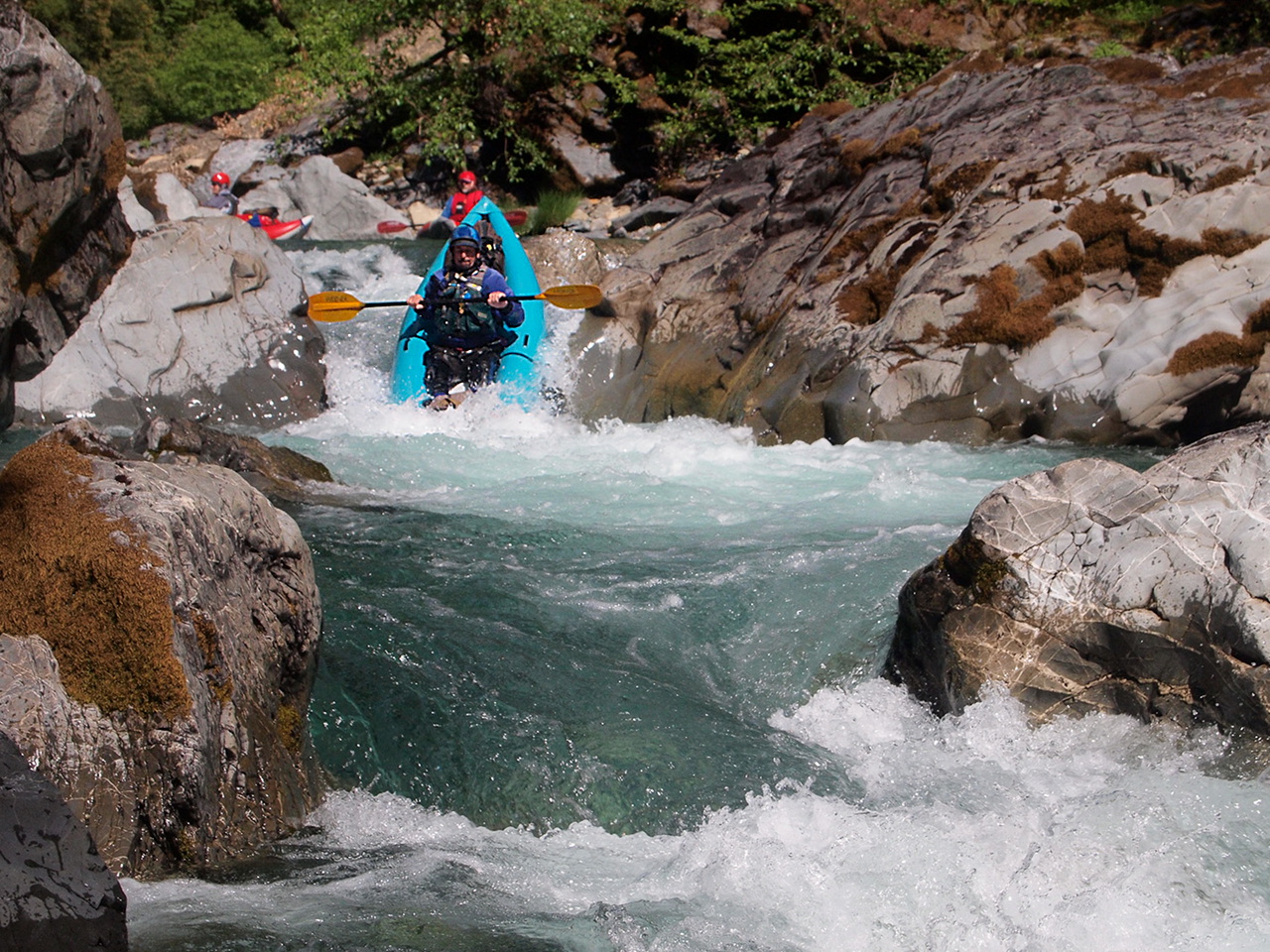
This is one of my favorite runs in the western US. Because of the requirement to carry boats and camping equipment a long distance to the river, it is not everyone's cup of tea. But once you reach the river, the clear green water is amazing, and you encounter challenging rapids from beginning to end, with only a short break near Tolman Ranch. Brian Vogt sums it up well: “Deep and pristine wilderness, gorgeous green water, and high quality whitewater combine to make this trip a classic.” Jason Shappart estimates about 150 class III-IV rapids, with a quarter of them being class IV.

In previous years boaters reached the Chetco from a river crossing near the Illinois river put-in, but the trail following old mining roads has been lost underneath blow-downs following the 2002 Biscuit fire. In 2011 the Siskyou Mountain Club cleared another trail following old roads, and this is currently the most viable route to the river. It is a tough hike with gear! The trail starts at a top-of-ridge trailhead around 4200' elevation, ascends to about 4800' elevation, and descends almost 3400' to put-in. Total trail distance is about 9 miles, but the distance seems longer because the last 2 miles drop steeply over 2000' to the Carter Creek confluence.

In 2011 Zach Collier posted this blog and published a Chetco article in the American Whitewater Journal. Probably fewer than a dozen people had previously boated the upper Chetco. In 2012 Brian Vogt posted a trip report on Jason Rackley's Oregon kayaking website, the [upper] Chetco River. Jason Shappart also wrote a how-to guide and trail report, published on paper and also here online. In 2013, Northwest Rafting was issued a permit to run the upper Chetco, and you can read about their trips here!

-9.1
Trailhead at end of the road. Packers are strongly recommended for carrying your boats, while you tote camping gear. Many thanks to the Siskyou Mountain Club for clearing this trail in 2011.
Chetco River Kalmiopsis Wilderness OR Chetco River Kalmiopsis Wilderness OR
The hike-in along Babyfoot rim trail Bench camp view of rapids below put-in
mile 0
Put in at the Carter Creek confluence, where there is a narrow rocky beach. The bench camp high above the river is the last spot until Slide Creek where you can pitch more than a few tents.
Chetco River Kalmiopsis Wilderness OR Chetco River Kalmiopsis Wilderness OR
Relatively steep gradient but easy rapids Surrounding hills burned by Biscuit fire
.6
Unnamed creek enters on the left in a cliffed-up area.
1.0
Magic Gorge, a deep green pool in a relatively straight section.
Chetco River Kalmiopsis Wilderness OR Chetco River Kalmiopsis Wilderness OR
Cliff above where unnamed creek enters Magic Gorge, with high-water log remnant
2.6
Babyfoot Creek canyon enters on the right, although it is easy to miss.
3.0
Slide Creek enters on the right. Good campsites abound, both at the confluence and for a short distance downstream.
Chetco River Kalmiopsis Wilderness OR Chetco River Kalmiopsis Wilderness OR
Slide Creek on left and upstream rapid A rare sandy beach shortly below Slide Creek
3.5
Upper Gorge begins, class IV-V as the contour lines keep coming.
Chetco River OR Chetco River OR
Long boulder garden and ledge  Most difficult near the end
Chetco River OR Chetco River OR
Steep boulder pile, scout right  Exit is constricted by twin rocks
Chetco River OR Chetco River OR
Entrance to two-part rapid  Doug in first-part crux slalom
Chetco River OR Chetco River OR
Jeff moves into second-part jaws  Jason stays upright after the jaws
Chetco River OR Chetco River OR
The undercut class V from above  The class V from below after portaging
5.5
Granite Creek enters on the right, ending a section with gradient over 100 fpm. Difficult rapids continue, however.
7.2
Taggarts Bar on the right, the only good camping since Slide Creek. It is a large rock and boulder bar, like Solitude on the Rogue, but without sand, and not as flat up high. In the upper reaches it offers some shade trees.
Chetco River OR Chetco River OR
Boat-beds and hammock at Taggarts  Launching the next morning from Taggarts
7.3
Lower Gorge resumes, class IV with continuing high gradient. This section is not as steep as the Upper Gorge, but still contains many rapids that require scouting.
Chetco River OR Chetco River OR
Gorge is very steep in the section  Lining, possibly runnable with more flow
Chetco River OR Chetco River OR
Finding a route below the lining drop  Many of the drops are pure fun!
Chetco River OR Chetco River OR
Long boulder garden above Sluice Creek  Sluice Creek enters on river right
7.5
Sluice Creek enters on the right and the gradient decreases. Some rapids may require scouting, but from here down many rapids are easy to read and run, so you can cover miles more easily. Miraculously, just as you are able to look up from constant whitewater, the scenic inner canyon is mostly untouched by the Biscuit fire.
7.9
Possible camp across from Box Canyon, smaller than Taggarts Bar.
Chetco River OR Chetco River OR
Seeping waterfall in a calm section  Unnamed creek enters on river left
9.7
Chetco Bar marked on the topo map, but we did not see good camping.
Chetco River OR Chetco River OR
Steep drop amid easier rapids  Narrow boulder drop section
Chetco River OR Chetco River OR
Big hydraulics considering low flow  Dangerous rapid with tunnels on left
11.1
Very good campsite on the right. A boulder bar with flat spots higher, shade trees, then a sand and gravel beach followed by a rock outcrop.
Chetco River OR Chetco River OR
Camp beach from the rock outcrop  Challenging rapids continue
Chetco River OR Chetco River OR
Rapids are technical but less steep  Beautiful Rogue-like scoured canyon
14.5
Tin Cup Creek enters on the right.
15.4
Very good campsite on the right, with a small sandy beach and many tent sites hidden in the trees lining the river.
Chetco River OR Chetco River OR
Tin Cup Creek enters on river right  Boulder Creek enters on river left
17.1
Excellent campsite on the left, after a swimming hole with flat rocks, with a low gravel beach and tree-covered boulder bench higher up. A road-like flood channnel leads .1 mile downstream to Boulder Creek, which marks the end of Siskyou wilderness area.
18.4
Mislatnah Creek enters on the right, followed by Tolman Ranch. You can take out here, with permission, but many good rapids remain. This stretch is the only relatively flat section of river. Good campsites abound, although some might be on private land.
Chetco River OR Chetco River OR
Tolman Ranch and Mislatnah Creek  Narrow slots with beach in background
22
Unnamed creek enters on the right, above a sandy beach camp. Just downstream, large striped (candy cane) rocks obscure the channel. Though slots are narrow, the gradient is virtually flat.
23?
Big Rock Block, False Conehead (scout right).
Chetco River OR Chetco River OR
Scouting False Conehead  Eric after initial big drop of False Conehead
24?
False Candycane (possibly scout left), and many other significant rapids from here to just around the corner from take-out.
Chetco River OR Chetco River OR
False Candycane stripes on upper left  Looks rocky but has plenty of water
Chetco River OR Chetco River OR
Steep drop of unnamed rapid  Try roping your boats up to bridge
25.6
Steel bridge, first public road accessible from the river. There is a faint trail up a culvert gully on the left below, or you can attach boats to a rope and haul them up to the bridge.
26
Conehead, class V, followed by Candycane, class V. These are the toughest rapids in the so-called Chetco gorge, which purportedly can be run even at low summer flows.

Shuttle Directions

To reach take-out, drive to Brookings Oregon. Just north of the highway 101 bridge across the Chetco river, turn upriver (east) and follow signs towards Alfred Loeb state park. Past the park, cross the river on another bridge to the south bank. Continue upstream past campgrounds and cross the south fork Chetco, after which the road turns sharp left. Proceed uphill away from the river to the next bridge crossing. Although you cannot see it from above, this is the steel frame bridge. It is 20.1 miles and about 50 minutes from Brookings to the steel bridge.

To reach the trailhead to put-in, return to Brookings. Drive south 15 miles on highway 101 to North Bank Road, a shortcut to highway 199, and turn left. After 6.7 miles, turn left onto highway 199 north. Follow highway 199 upriver over the pass and thru the tunnel into Oregon. About 2.7 miles north of Kerby (3.7 miles south of Selma) turn west onto Eight Dollar Mountain Road. After 2.8 miles, bear left and cross a green bridge over the Illinois river. In another .2 mile the road changes to dirt, USFS road 4201. Ascend, steeply at times, another 12 miles to Babyfoot Lake trailhead, where you find a vault toilet and many flat spots for camping. It is 15.3 miles and about 40 minutes from highway 199 to the trailhead.

To reach put-in from the trailhead: near the parking area, take the trail on the right (west) side of Hungry Hill and follow the countour line. After a quarter mile, you reach a trail junction. Go left (west) uphill towards Babyfoot Lake rim. The right (northwest) trail leads to Babyfoot Lake and is an alternate route, longer but less steep. After climbing steeply to the rim, the trail stays fairly level until it descends to an old road, meeting the alternate route around mile 1.4. The trail soon enters Siskyou wilderness area and follows this old road almost all the way to Bailey Cabin. When it reaches the edge of a hill, the old road switchbacks sharp left. At 3.2 miles, in a non-burned forested area, the road switchbacks right at a junction with the trail to Canyon Peak. The old road is heavily infested with manzanita for another mile at least. In an open area above an old mine, take the road fork leading uphill. Follow this to the top of a ridge, then go gently downhill along the ridge. Near the low point of the ridge, at around 6.5 miles, a side trail leads to Bailey Cabin site, where you find year-round water. The trail continues uphill to the shoulder of Bailey Mountain, at 7 miles, then descends continuously to the river, reached after 9.1 miles. The bench above the river has many flat spots for camping. Carry your boats down a steep trail to put-in at the mouth of Carter Creek.

To arrange packers, you could try contacting Mike Pierce, 4807 Granite Hill Road, Grants Pass OR 97526. Mike is one of the few people who have boated the upper Chetco.

To find nearby food and lodging, type Cave Junction Oregon into the box and click Search.

Custom Search
 

 Creeks Navigation

 Home
 Recommended Runs
 Map of Rivers
 Alphabetic Index
 Alphabetic Table
 Text Search

 Sponsored Links