|
Cottonwood Creek North Fork |
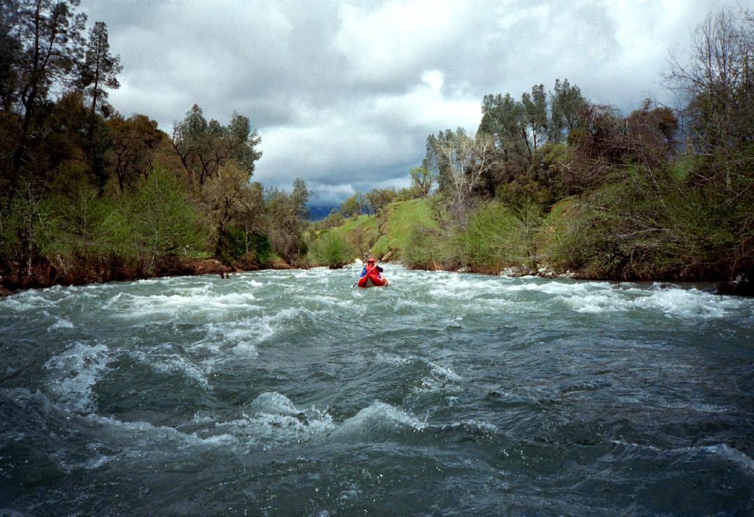
This run was never described in any California guidebook, although it is mentioned in the AWA Whitewater Inventory. Several miles of excellent class III-IV rapid (with many surfing spots) lie immediately upstream, although that stretch lacks legal public access. Shasta Paddlers ran the section way upstream from the end of Sunny Hill Road to the Ono bridge in March 1995 (described here) and it has been run occasionally since then. The excellent class IV run just mentioned is from the final portage of that run to the Ono bridge, and, with public access, would make an excellent addition to these 8 miles. The Ono bridge has a prescriptive but not deeded right-of-way. Landowners near the bridge sometimes call the sheriff when they see boaters, so keep a low profile to avoid conflicts. It is possible to stay within the 100' prescriptive right-of-way while lowering your boats down a steep embankment on river left just downstream of the bridge. If challenged by the landowner or the sheriff, be polite but firm in asserting your rights. You might want to take a copy of section 131 of the Harbors & Navigation code, which makes it a misdemeanor to obstruct navigation in California. North Fork Cottonwood has some good class IV! The lower run from the Ono bridge down to the upper bridge on Lower Gas Point Road is fun. It starts with steep bedrock ledges, some of which deserve a scout, continues over some big funnel drops in between bedrock, then mellows out into continuous class II-III.
About 4 miles into the run, the creek enters a canyon. Watch out for a dangerous keeper on the left of an old diversion dam, which is scoutable and runnable on the right. Just around the corner is a river-wide hole called Whopper Stopper. Scout right and look very closely. Although the right side appears to be punchable, it is actually a dangerous recycle that feeds into a huge center hole. Boaters who do not wish to punch the center hole should probably elect to portage this on the right. Lower Gas Point Road crosses on its upper bridge just downstream. It is possible to take out just above this bridge, at a low-water crossing for heavy vehicles. From this point the north fork is class II-III swiftwater to the downstream Lower Gas Point Road bridge, and to your take-out at Foster Road. To reach take-out, exit I-5 at Cottonwood and drive west on Gas Point Road about 13 miles to where it turns sharply north to follow the North Fork. Bear left (almost straight) onto Foster Road, and drive downhill and park on the far side of the bridge. Barbed wire is everywhere. To reach put-in from there, return to Gas Point Road and turn left (north). After about 7 miles, turn left at the 4-way junction near Igo. Continue on Platina Road about 4 miles to the unfriendly town of Ono. A commando put-in is advised because there is no legal parking near the bridge, and it is a long walk downhill from town, where parking is available.
|
Creeks NavigationHomeRecommended Runs Map of Rivers Alphabetic Index Alphabetic Table Text Search
Sponsored Links
|