|
Coyote Creek east of Morgan Hill |
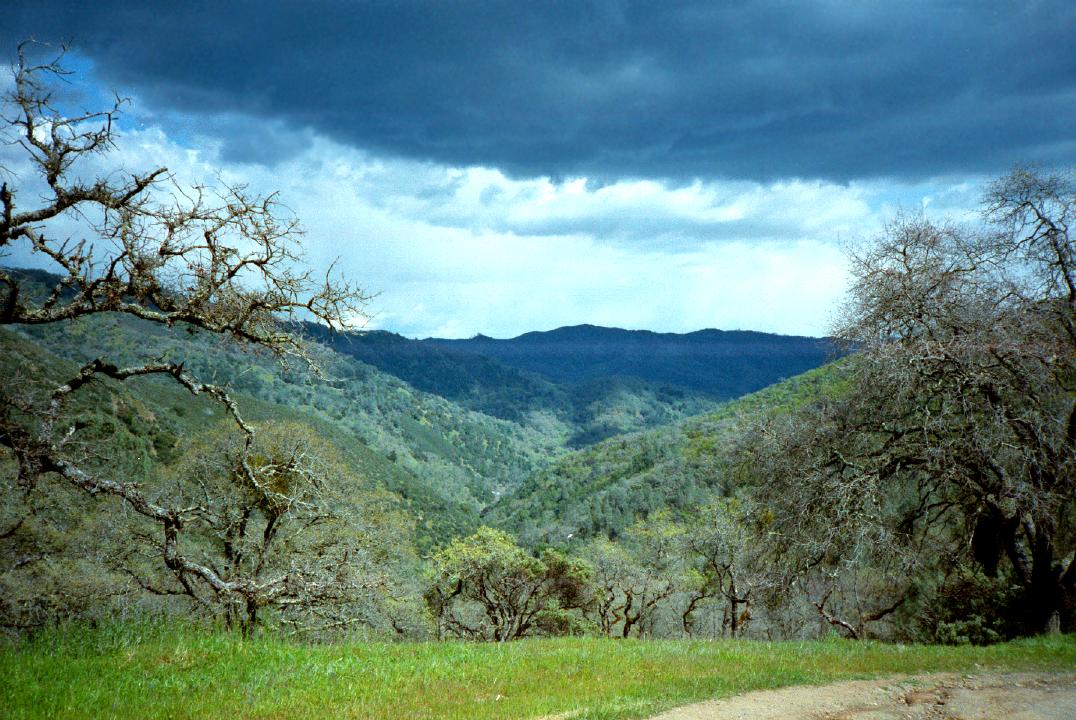
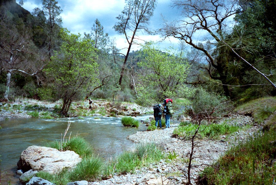
Henry Coe park is popular with hikers and backpackers. This section of Coyote Creek traverses an area with few trails and no roads. Before colonization, Poverty Flat (downstream of put-in) was one of the largest settlements in the bay area, providing native Americans with year-round food and water. This scenic creek can be run after a large rainstorm. The put-in requires a 4 mile carry from Park headquarters downhill to the water, just past the confluence of the little fork and middle fork. Once on the creek, be on guard for logjams, the principal hazard. About six miles into the trip you pass Gilroy Hot Springs on the right, a private spa, currently Japanese-owned. The remainder of the run follows a road to Coyote reservoir. Scott Cochran highly recommends this run, which he labels very constant class II+ with a couple of class III rapids, and probably a solid III at higher flows. He ran it with about 100 cfs at the take out and 30 cfs (!) at the put in. This was barely runnable, and he thinks 150 cfs at the take-out is the functional minimum, with optimum somewhere between 200 - 300 cfs. Because there is no gauge, check the Arroyo Hondo (AHD) flow. Scott and a buddy ran it when AHD was at 5.8 feet, so he suspects 6.5 feet would equate to Coyote's functional minimum. Scott reports that the scenery is very pretty, but the shuttle is long. The hike down is pleasant, but because of the 1000' elevation loss and steepness near the end, portage wheels might be a good idea. I actually hiked down once without a boat and took these pictures.
Shuttle DirectionsTo reach take-out, take highway 152 east from highway 101 near Gilroy. After bending right onto Pacheco Pass Road, turn left on Cañada Road. Continue over a hill and then drive north thru a long valley. After 3 miles, turn right on Gilroy Hot Springs Road, and proceed to a bridge and locked gate with small parking area. To reach put-in from there, return to highway 101. Drive north to the East Dunne exit and head east, climbing into suburban hills for about three miles. At the top of the first ridge, bear right at a Y in the road, where a sign says “Henry Coe State Park 10 miles.” The road crosses a bridge and follows Anderson Reservoir for a bit. Then it climbs and becomes a narrow winding mountain road. From the parking area at the Henry Coe visitor's center, follow hiking maps to Poverty Flat. The old road goes gently, then suddenly, downhill. |
Creeks NavigationHomeRecommended Runs Map of Rivers Alphabetic Index Alphabetic Table Text Search
Sponsored Links
|