| |
| Stretch: |
Sandy Flat Camp to Democrat Picnic Area |
| Difficulty: |
class IV with one portage (class IV+ above 3000 cfs) |
| Distance: |
11.7 miles, 1 day |
| Flows: |
rafts 1000 - 3000 cfs, kayaks 600 - 3000, IK minimum 400 |
| Gauge: |
same as release from Isabella Reservoir
(ISB) |
| Gradient: |
37 fpm average |
| Put-in: |
Sandy Flat campground below Borel powerhouse, 2270' |
| Take-out: |
Democrat Picnic Area well above diversion dam, 1840' |
| Shuttle: |
14 miles (20 minutes) one-way |
| Maps: |
Sequoia NF, AAA Sequoia,
Topo
|
| Season: |
year round, from dam release |
| Agency: |
USFS, private, USFS permit required,
guided Whitewater Rafting |
| Notes: |
© 1998 Bill Tuthill,
CreeksYahoo,
thanks to Gordon L. Bainbridge |
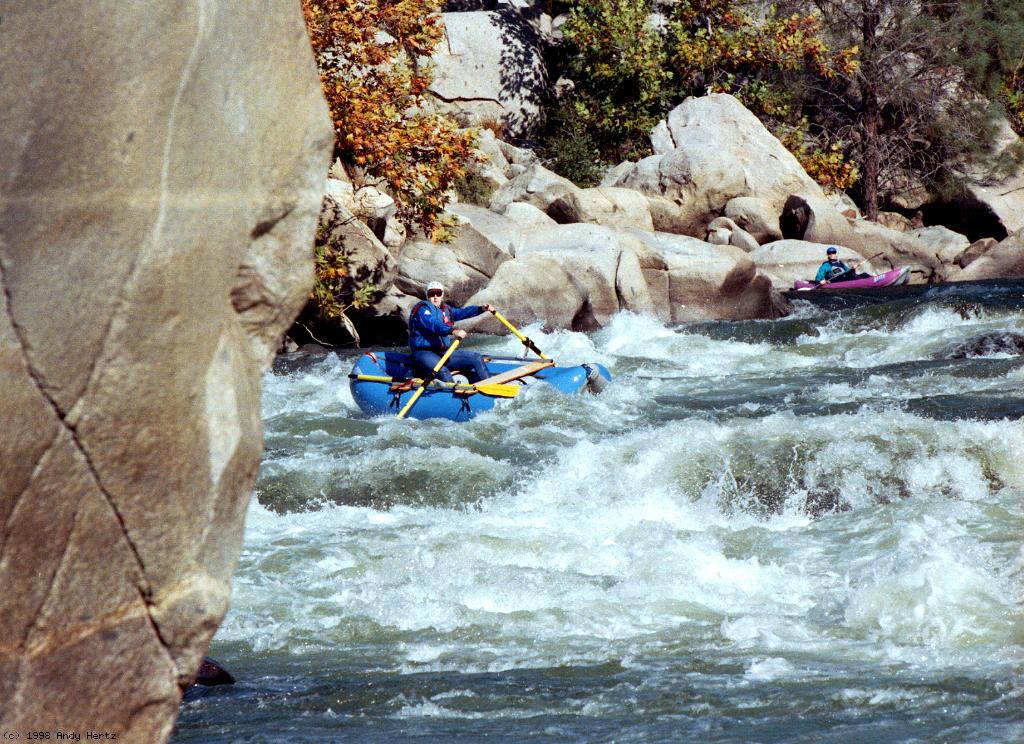
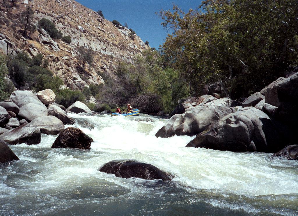
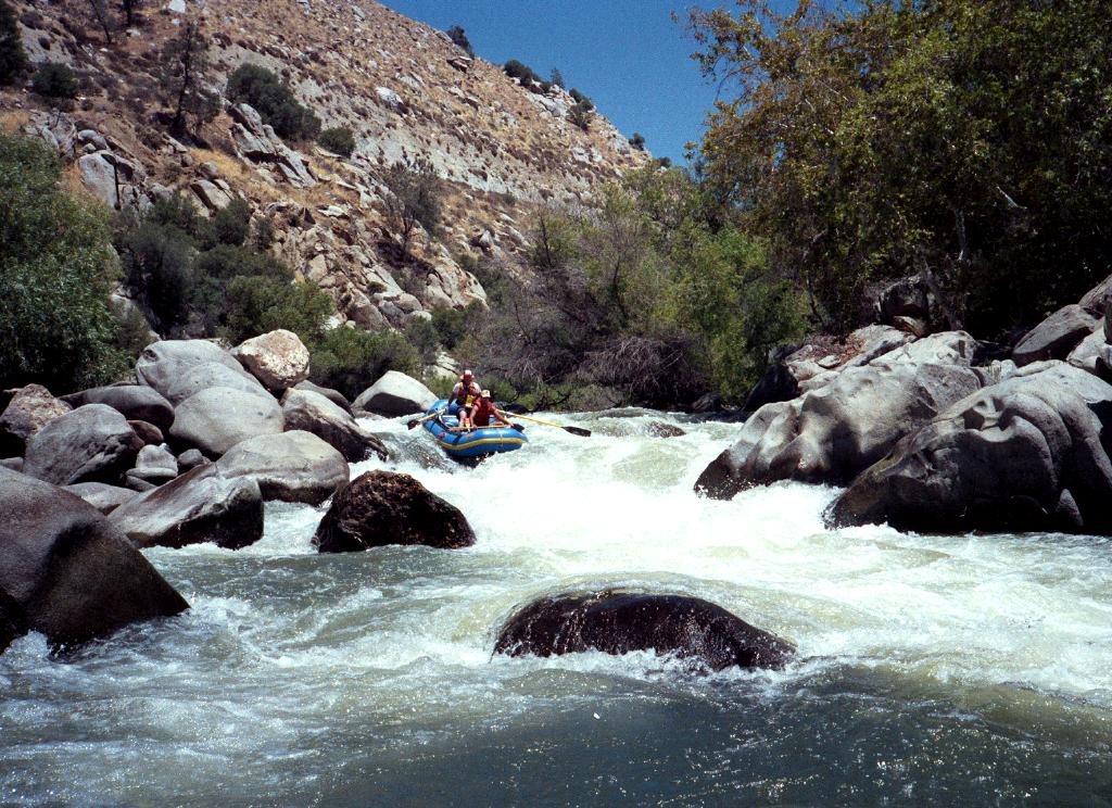
This is probably the best transitional class III-IV run in California.
It is the prime “local” run for southern California boaters,
and is well worth the long drive even for northern Californians.
The scenery (gray pine amid sand and granite) is very fine indeed,
despite cattle grazing and mucho litter left by picnickers.
Because of year-round flows, you can boat this stretch in the fall
after a full summer of honing your paddling skills.
(In drought years however, flows sometimes drop under 400 cfs;
below this level, hardshell kayak pins are a substantial danger.)
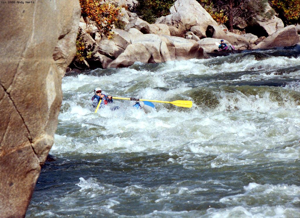
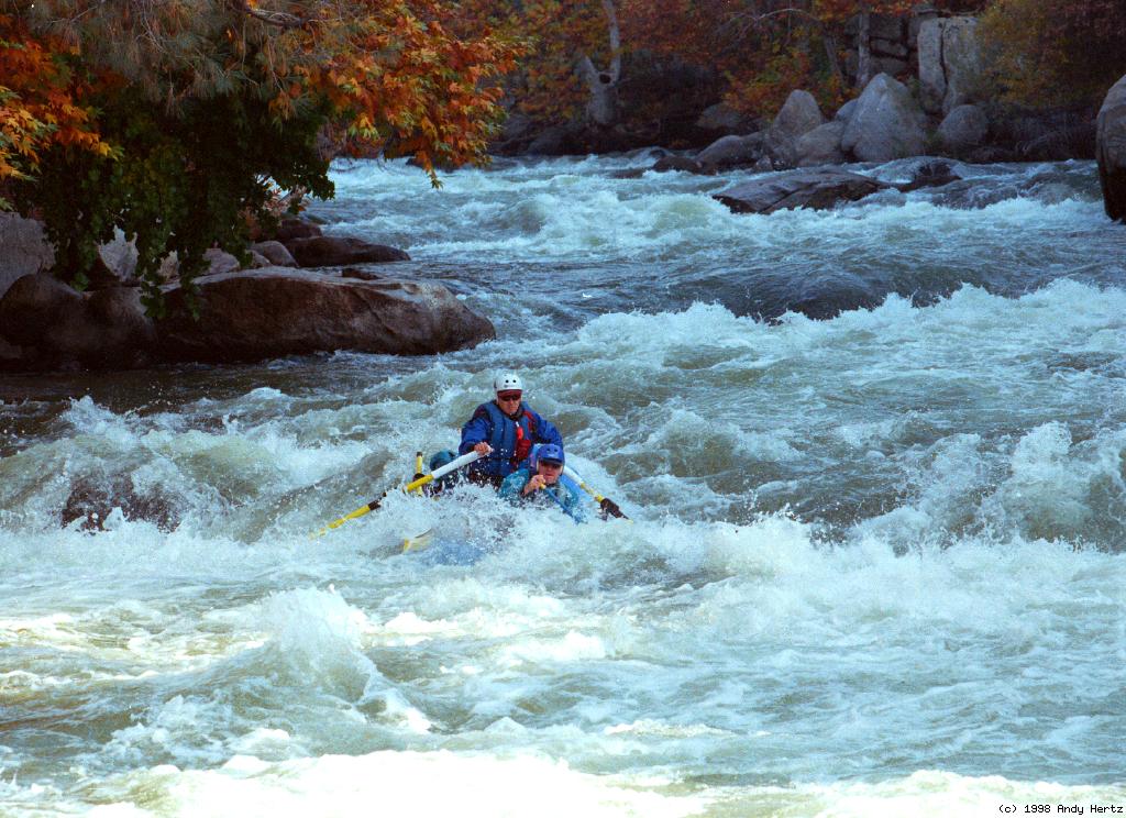
You must cope with only a handful of class IV rapids,
all easily scouted, and none inordinately difficult or dangerous.
However note that there is one strongly recommended portage
around a class V+ rapid, Royal Flush.
The Forest Service once made it easy to recognize all major rapids
by placing tasteful wooden signs on the bank upstream of each one,
but some signs might have fallen down recently.
About 600 cfs is diverted from Isabella Dam thru Borel Powerhouse
and reaches the river .3 mile above the put-in described below.
When the upper stretch is runnable, the lower stretch can be
more difficult than with its year-round 24-hour base flow.
Note that the release from Isabella Reservoir
includes the 600 cfs diverted thru Borel Powerhouse.
It is possible to put in way upstream near Isabella Dam,
but these 6 miles can be brushy after a series of drought years.
That section is also less scenic, contains much flatwater,
and is often right next to the freeway.
One long and constricted rapid around mile 2.5 (3.5 miles above Hobo)
is fun for kayakers, with five blind but workable entries,
but almost impossible for rafts below 1000 cfs.
- mile
0
- Put in on the left bank where the river snakes along Sandy Flat
campground (USFS fee area). There are good campsites across
the river if you prefer more seclusion than Sandy Flat offers.
- .6
- Hobo Campground (USFS fee area) on the left, alternate put-in.
- .7
- Hobo Rapid, class III. The river curves left past dangerous
brush along shore, and constriction causes some big waves.
- 1
- Miracle Hot Springs and private campground on the left bank, now
considered the official put-in. With its elaborate hotsprings,
this might be a good place to camp in late fall, when the weather
is cool.
- 2.3
- Remington Hot Springs on the left bank, public, right at river level.
- 2.6
- White Maiden, class IV, scout left
A long and complicated solid class IV rapid. At flows above 1500 cfs
the easiest route is on the left side. At moderate flows, it is
necessary to cut back right at the bottom: the standard exit is a
constricted chute against the right bank, although inflatable kayaks
can stay in the center and slide over the rock pile. Below 850 cfs,
the easy route on the left disappears, and boaters are forced right.
Granite boulders provide a good elevated view. When walking back
to your boat, check your perspective several times to ensure that
you enter the same channel that you elected to run.
-
- 3.1
- Sundown Falls, class IV-, where the river drops several meters
on the left side into a right-refracting reversal. A nasty
undercut there becomes visible below 650 cfs.
-
- 3.2
- Silver Staircase, class III, a long boulder garden with many
possible routes.
- 4.3
- Dead Man's Curve, class IV, scout right
The river drops steeply over a boulder bar, requiring maneuvering
around rocks (holes at higher flows), then pushes against a rock
on the right. At normal flows, it is also possible to run down
the far left side, although most people come in hard and fast,
moving diagonally to the right and behind the big boulder at the
top to avoid the big holes in the middle. Often people succeed in
avoiding the holes, relax, and then are flipped by the converging
waves at the bottom. Arguably the hardest rapid on this run,
provided you portage Royal Flush.
-
- 4.5
- Commercial outfitter camp on the left bank. For emergencies,
a dirt road climbs to a locked gate at the old highway.
- 4.8
- Cable crossing for an old hard rock mine, followed by two
class II rapids in quick succession.
- 5.2
- False Flush, class III. Dangerous at high flows, because a
class V+ rapid is just below. Run left of the center hole,
then move quickly to the right bank, where you find a portage
trail around the next rapid.
- 5.4
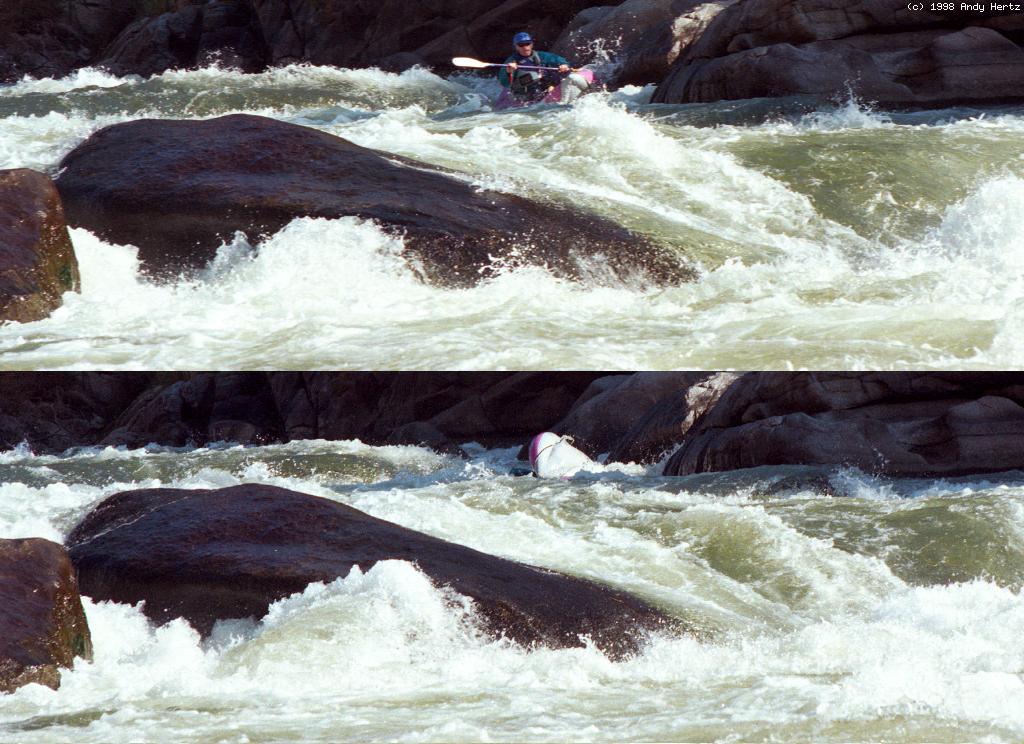
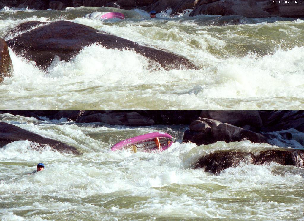
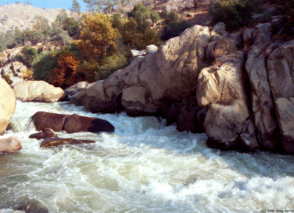
- Portage! Royal Flush, class V+
The river bends left around a boulder, drops sharply into a
series of large holes, then rushes past a badly undercut cliff
on the left. Of course this rapid has been run successfully,
but swimmers often end up trapped by the undercut. There are
many stories of near-death experiences, including ones in which
a swimmer removed his PFD to escape, only to be battered by the
many class IV drops below. At high flows, boulders on the right
become a massive sieve. The USFS has created a fine portage trail
on the right. The easiest place to put in after the portage is
underneath the pedestrian bridge that joins the shore and the
big rock that kayakers often use for a seal launch. After floating
under the pedestrian bridge, it is fairly easy to slide leftwards
around a minor swirlie, entering the main current without getting
into the class IV drops mentioned above.
-
- 7
- Planned USFS access point on the left, just above a class II rapid,
might be open by the time you read this.
- 7.1
- Delonegha Hot Spring on the right bank, public and often crowded.
Also, who needs a hotspring after a sweaty portage?
- 7.6
- Highway 178 bridge crosses overhead. In the late 1990s it became
legal to park about 150 meters west (downstream) of the bridge
and to take out (or put in) at the bridge. This is a good way
for late-rising boaters to split up the run into two days.
- 7.7
- Mill Creek (the name should be illegal) enters on the right.
Class II-III rapids start to come thick and fast.
- 8.4
- Surprise, class III, a series of standing waves with a rock
lurking in the final wave.
- 8.8
- Hari Kari, class IV-
The river drops over a boulder bar before a right hand turn into
a large wave and hole. Much easier below 1200 cfs. Best scouted
from the left bank, but the view only shows where to enter the
rapid (center or center-left) and hints that you might need to
move right in a hurry. Kayakers usually enter in the middle of
the river between rocks and work right as quickly as possible,
cutting behind the huge rock at river right bend to avoid holes.
- 9.1
- Horseshoe Falls, class IV-, scout left
Three distinct drops as the river bends right past an island.
At low flows this rapid is longer but not much harder than other
rapids you have just been running. At high flow the second drop
contains a huge horseshoe-shaped hole, hence the name.
Halfway through, there are good eddies on river left and right.
Below 900 cfs, boaters usually enter Horseshoe from center-right
to avoid the entrance rocks and then cut hard diagonally left.
If you don't cut hard left, you will hit an underwater rock,
which can stop a boat and deliver a terrible shock to the knees.
Above 1200 cfs, it is possible to run the bottom 30 meters on
far right, avoiding the falls altogether.
-
- 9.8
- Sidewinder, AKA Bailmore, class III+, several S turns and big drops.
- 9.9
- China Gardens. For the next mile the river bends around a large
peninsula where immigrant laborers (and later miners) lived during
the late 1800s. This is a good but sometimes crowded place place to
camp, and a possible take-out.
- 11.3
- Pinball, class III-IV, scout left
A long and complicated boulder maze with many possible routes,
much harder at high water. Depending on your comfort level with
rock dodging, you might skip scouting, because it's difficult to see
all routes from shore. At most flows, the easiest way to get through
Pinball is to enter the rapid center-right, paddle about 8 meters
and swing left around a big rock. Then continue working toward the
left side until a route down to the bottom becomes visible.
- 11.6
- The river splits around an island. Take the left channel or you
will miss take-out.
- 11.7
- Take out on the left bank. Your vehicle should be parked uphill.
Downstream .3 mile is Democrat Hot Springs, now guarded private
property, then a 10 meter high diversion dam .5 mile further.
The Forest Service requires a permit for this run.
Permits may be picked up at the Isabella Ranger Station,
or at the Cannell Ranger Station in Kernville (quite a ways upriver).
Breakfast is available in and near Kernville,
and upstream campgrounds are generally more pristine
than those below Isabella Reservoir.
Shuttle Directions
To reach take-out, drive east from Bakersfield on highway 178.
The road climbs a narrow canyon with many steep rapids and a few waterfalls.
After the river levels out somewhat,
look for a sign saying Democrat Hot Springs,
and turn left onto a dirt road and proceed to a parking lot.
If you leave a vehicle there, it is likely you'll need to pay a fee.
To reach put-in from there,
return to highway 178 and continue upstream.
After crossing the second bridge over the river (back to the south bank),
drive .5 mile, turn right,
and right again almost immediately onto the old highway.
Continue west another .9 mile to the dirt road turnoff
to Sandy Flat USFS campground.
To find nearby food and lodging, type Bakersfield into the box and click Search.
|
|
Creeks Navigation
Home
Recommended Runs
Map of Rivers
Alphabetic Index
Alphabetic Table
Text Search
Sponsored Links
|