| |
| Stretch: |
Curley Jack Campground to below Ukonom Falls |
| Difficulty: |
Class III with one IV- (harder above 5000 cfs) |
| Distance: |
18 to 37 miles, 1 to 3 days |
| Flows: |
rafts 1500 - 15000 cfs, kayaks 1000 - 5000 then harder, IK minimum 600 |
| Gauge: |
flow measured 26 miles upstream at Seiad Valley
(KSV)
|
| Gradient: |
17 fpm average, exceeds 20 fpm in spots |
| Put-in: |
campground on left bank across from Curley Jack Creek, 1060' |
| Take-out: |
Coon Creek access upstream of Cottage Grove, 760' |
| Shuttle: |
20 miles (30 minutes) one-way |
| Maps: |
USFS Klamath NF, AAA Northern California,
Topo
|
| Season: |
Year round: rain, snowmelt, dam-controlled |
| Agency: |
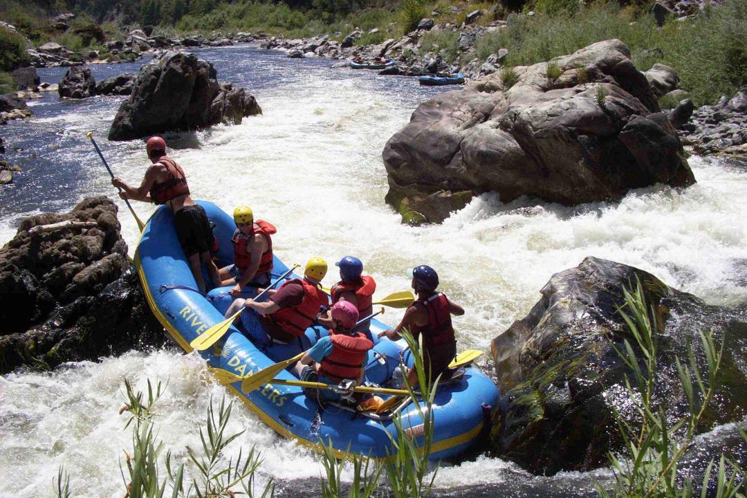
Karok, USFS, private,
guided Whitewater Rafting |
| Notes: |
© 1998 Bill Tuthill,
CreeksYahoo |
With brown water and suds from vegetation
in the warm waters of shallow Klamath Lake,
and being a very long drive from most population centers,
the Klamath is not the most overcrowded whitewater destination.
However it has reliable flows even late in drought years,
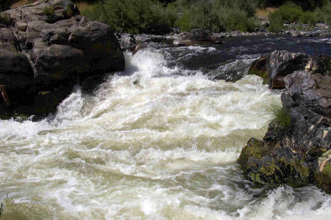
and this stretch provides fine scenery with many fun class III rapids.
Just as the rapids taper off,
scenery improves markedly as the road climbs high above the river,
so a multiday camping trip is a good way to enjoy this section.
Except for Ishi Pishi Falls near Somes Bar,
the Klamath is runnable for several hundred miles,
all the way from Iron Gate Dam to the ocean.
It would seem to be an attractive long-distance tour,
but highway 96 follows the river for most of its length,
so wilderness campsites are hard to find.
The section above this run, described in
Klamath Iron Gate,
offers many good novice runs with occasional class III rapids.
The section below the Salmon confluence starts with some class IV rapids,
and is often combined with a Salmon river run.
The section from Weitchpec to the ocean can be seen by jetboat;
tours start at the mouth of the river near Requa.
- mile
0
- The USFS campground across the river from Curley Jack Creek makes
a good put-in.
- .3
- Elk Creek enters on the left.
- 3.1
- Rattlesnake, AKA Kanaka Rapid, class III. The left side usually
contains a sneak route. A right-of-center hole offers the most action.
- 3.6
- Kanaka Creek enters on the left.
- 3.7
- Devil's Toenail Rapid, class III. At a boulder bar on the left,
enter right and work quickly left to avoid a big rock at the bottom.
- 4.5
- Wilson Creek enters on the left. In quick succession above and below
are Mixmaster, Funnel, and Trench rapids, all of which can verge on
class III at certain flows.
- 5.6
- Buzzard Creek enters on the left. Do not drink even filtered water
out of this creek, which contains toxic residue from an old mine
upstream.
- 5.7
- Oak Flat Creek enters on the right.
- 6.4
- Wingate Creek enters on the right.
- 7.3
- Clear Creek enters on the right. Downstream of here to Ferry Point,
both sides of the river are sacred to the Karok Indians. Please do
not stop or camp in this section, especially during the summertime
World Renewal ceremonies.
- 7.8
- U-Fish Creek enters on the left.
- 8.7
- Douglas Creek enters on the right.
- 10.2
- Ferry Point, where the old Crescent City to Scott Bar trail
crossed the river by ferry before entering the Marble Mountains.
- 10.3
- Titus Creek enters on the left, near an unnamed class III- rapid.
The river splits around an island.
- 11.8
- Bridge overhead, and soon Independence Creek enters on the left,
near an unnamed class III- rapid. Downstream, highway 96 starts
climbing high above the river.
- 14
- Crawford Creek enters on the right.
- 15.2
- Dutch Creek enters on the left.
- 15.3
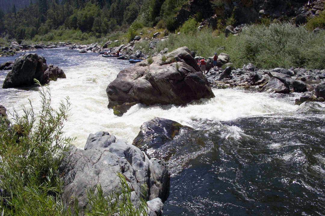
- Dragon's Tooth, AKA Little Blossom, class IV-, scout right
Rafts and drift boats must enter just left of a car-size midstream
boulder, then pull hard right to avoid a downstream rock outcropping
on the left side. (This move is similar to the one in Blossom Bar
on the Rogue.) Kayaks also have a choice of rock-strewn routes on
the far right, and can even go far left at certain flows.
- Photos courtesy of Scott McKinnon, who also sent some Ishi Pishi
pictures that I didn't post because they make it look too easy!
Here is
Scott McKinnon's website.
-
- 16.6
- King Creek enters on the right, near a class III- rapid.
- 17.2
- Ukonom Creek enters on the left. A .7 mile hike upstream leads to
the double chutes of Ukonom Falls. There is much contention for the
relatively small campsite at the mouth of the creek.
- 17.9
- Coon Creek river access on the right bank. Rapids ease after this
point. There is worse access 5 miles downstream at Dillon Creek.
- 18.5
- Swillup Creek enters on the right.
- 18.9
- Thomas Creek enters on the left, near class III- Blue Swillup Rapid.
- 19.7
- Elliott Creek enters on the right.
- 20.8
- Aubrey Creek enters on the right, across the river from the largest
monolith along the entire Klamath River.
- 22.3
- Three Creek enters on the right.
- 22.9
- Dillon Creek enters on the right, near a boat access and USFS campsite
on the right bank. Below here, there are only 2 class III rapids and
3 class II rapids in the 17 remaining miles to Ishi Pishi Falls.
- 24.1
- Carter Creek enters on the left, then Rattlesnake Bar on the right,
then Burns Creek enters on the left.
- 24.6
- Soldier Creek enters on the right, before Lone Pine Bar.
- 25.2
- Squirrel Creek enters on the right.
- 25.5
- Persidio Bar on the left, with good river access. Across the river,
Mud Creek comes in on the right. Just below, Kennedy Creek enters
on the left, and Dobbins Creek enters on the right.
- 26.7
- Ti Bar on the left, with campground and river access. Just downstream,
Ti Creek enters on the left.
- 27.7
- Rock Creek enters on the right.
- 28.5
- Eyese Bar on the right, offering a good campsite away from the road.
After about .4 mile slackwater, there is an unnamed class III- rapid
left of a midtream island.
- 30.1
- After a class III- rapid left of a midstream island, Sandy Bar Creek
comes in on the left.
- 30.8
- Stanshaw Creek enters on the left.
- 31.9
- Irving Creek enters on the left.
- 33
- Horseshoe bend, where the river makes a big U-turn.
- 33.4
- Halverson Creek enters on the right.
- 34.3
- Highway 96 crosses to river right, then at mile 35.5 crosses back
to river left.
- 36.6
- Green Riffle river access, last designated take-out before class V+
Ishi Pishi Falls, which would require a back-breaking raft portage.
In some years, Ishi Pishi Falls looks runnable at low flows.
To reach take-out from I-5, drive east and then south on highway 96
until you pass Happy Camp and Clear Creek; if you reach Cottage Grove
you've gone too far. To reach take-out from highway 101 near Arcata,
follow highway 299 to Willow Creek, turn north on highway 96, and
continue just past Cottage Grove to the Coon Creek river access.
To reach put-in from there, drive north for about 20 miles. When you
reach the outskirts of Happy Camp, turn right and cross a bridge to
the Curley Jack USFS campground.
To find nearby food and lodging, type Happy Camp into the box and click Search.
|
|
Creeks Navigation
Home
Recommended Runs
Map of Rivers
Alphabetic List
Alphabetic Table
Text Search
Sponsored Links
|
|