| |
| Stretch: |
Mark West Resort to Santa Rosa |
| Difficulty: |
Class IV (class V above 1000 cfs) |
| Distance: |
4 miles, half day |
| Flows: |
kayaks 400 - 2000 cfs, IK minimum 300
|
| Gauge: |
estimate by analogy with Santa Rosa Creek
(USGS site)
|
| Gradient: |
60 fpm |
| Put-in: |
along road near Mark West Resort |
| Take-out: |
embankment above Quietwater Drive |
| Shuttle: |
3 miles |
| Maps: |
AAA Sonoma and Mendocino,
Topo
|
| Season: |
Winter, entirely rain-fed |
| Ownership: |
private land |
| Notes: |
© 1998 Bill Tuthill,
CreeksYahoo,
thanks to Jerry Albright |
Mark West Creek is a great run if you live in San Rafael,
a good run if you live near San Jose,
but probably not worth the drive if you live in San Diego.
It's similar to the San Lorenzo River [sic] above Santa Cruz.
The scenery isn't as good, although the rapids are better,
and the water, although muddy after a storm, contains fewer micro-organisms.
Randy Hodges files this trip update in January 2002:
We ran Mark West Creek in Northern California today.
There is a tree down across the river at about mile 2.
At moderate water, you will be able to ski-jump it on the right.
The Chronic Log Jam is now gone.
Tennis Ball Falls had a tennis ball in the crack below it on river left.
Otherwise fun and beautiful: moss-covered trees forming a canopy
over the river, big rocks, high gradient.
Hazard! Always watch for downed trees.
Just below Tennis Ball is a long rapid called S Turn,
where logs and debris can hang up after big rains.
This section should be scouted if you are the first boaters after a storm.
-
mile
0
- Put in along the road at one of several turn-outs downstream of
Mark West Lodge, where they recently opened a New Deli (2003).
If you have breakfast there, they might allow you to park in the
safety of their lot. There is a gauge on the Leslie Road bridge;
at stages between 1 and 2.5 feet, this is a class IV run.
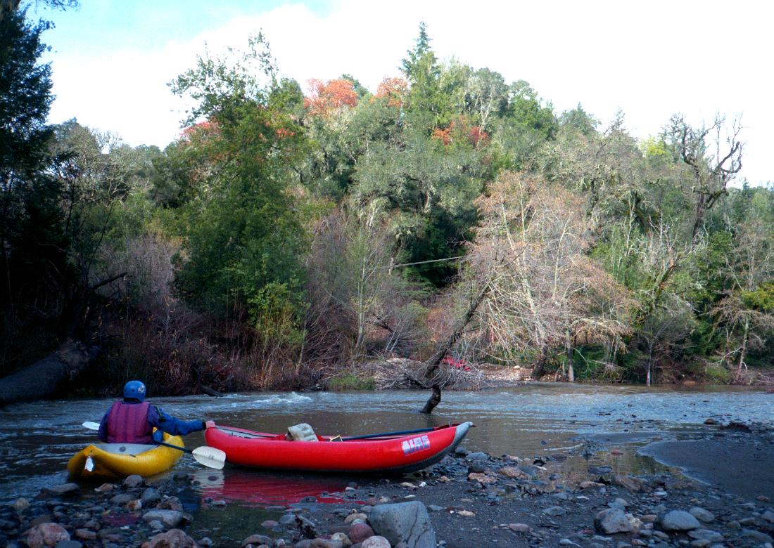
-
 Waiting at put-in
-
- The first mile contains swift water and moderate rapids.
Be careful of downed trees, often a problem.
-
1
- After the first bridge, rapids become class III-IV,
with breaks in between.
-
- The gradient eases deceptively, but the biggest rapids are still ahead.
-
2.5
- Tennis Ball Falls, class IV,
named for the tennis balls that accumulate among rocks on the left.
-
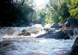 Moderate ski jump in first drop
-
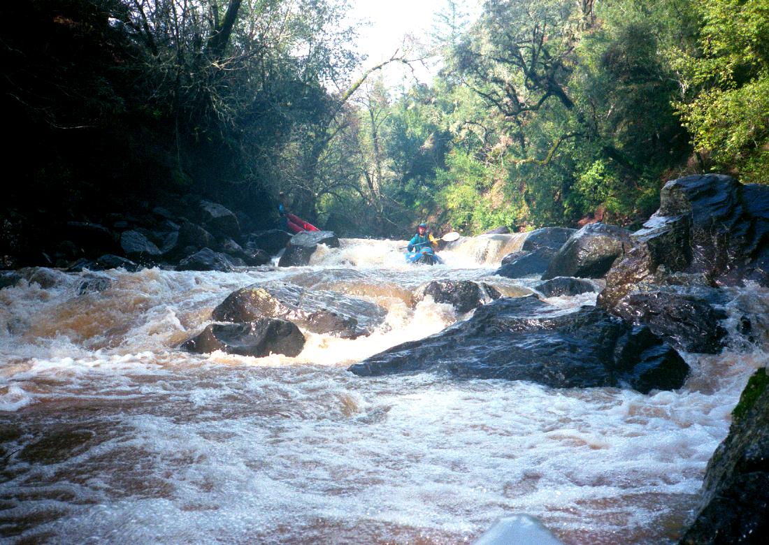
2.7
- S-Turn, AKA Heck's Corner, class IV,
a long boulder garden where the river drops 85 feet in half a mile.
The best route seems to be mostly left.
-
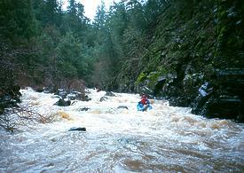 At the bottom of S-Turn
- 3.2
- Michelle Way, private bridge. This would make the best take-out,
avoiding the chronic logjam zone, but this is a private road,
and public parking on Mark West road is a long ways from the river.
- 3.5
- Chronic logjam zone.
-
 Just below this year's logjam
- 4
- Riebly Creek enters on the left. You can carry your boats up a high
embankment just downstream (in 1998 the fence was down), or continue
.1 mile to a place where the embankment is still steep but not so high
(in 1998 you had to lift boats across a barbed wire fence). It is
a good idea to station a traffic watcher to let boaters know when
it is safe to cross the highway.
- 4.3
- Quietwater Drive, private bridge. Both this street and the recently
subdivided lots adjoining it are private property. Some boaters
take out illegally at the bridge and carry boats up to Mark West Rd,
although this is not recommended. There are several legal take-outs
downstream, but brush can be a big problem.
To reach take-out, drive east on Mark West Road from highway 101 in
north Santa Rosa. Just after the road starts curving uphill, park in
a large turnout on the right, about 200 meters past Quietwater Drive,
away from the creek. Do not park on Quietwater Drive.
To reach put-in, continue east on Mark West Road to the resort and lodge
where the road crosses the creek for the first time. Park at one of several
roadside turn-outs nearby, where you can slide boats down the bank.
|
|
Creeks Navigation
Home
Recommended Runs
Map of Rivers
Alphabetic Index
Alphabetic Table
Text Search
Sponsored Links
|
 Waiting at put-in
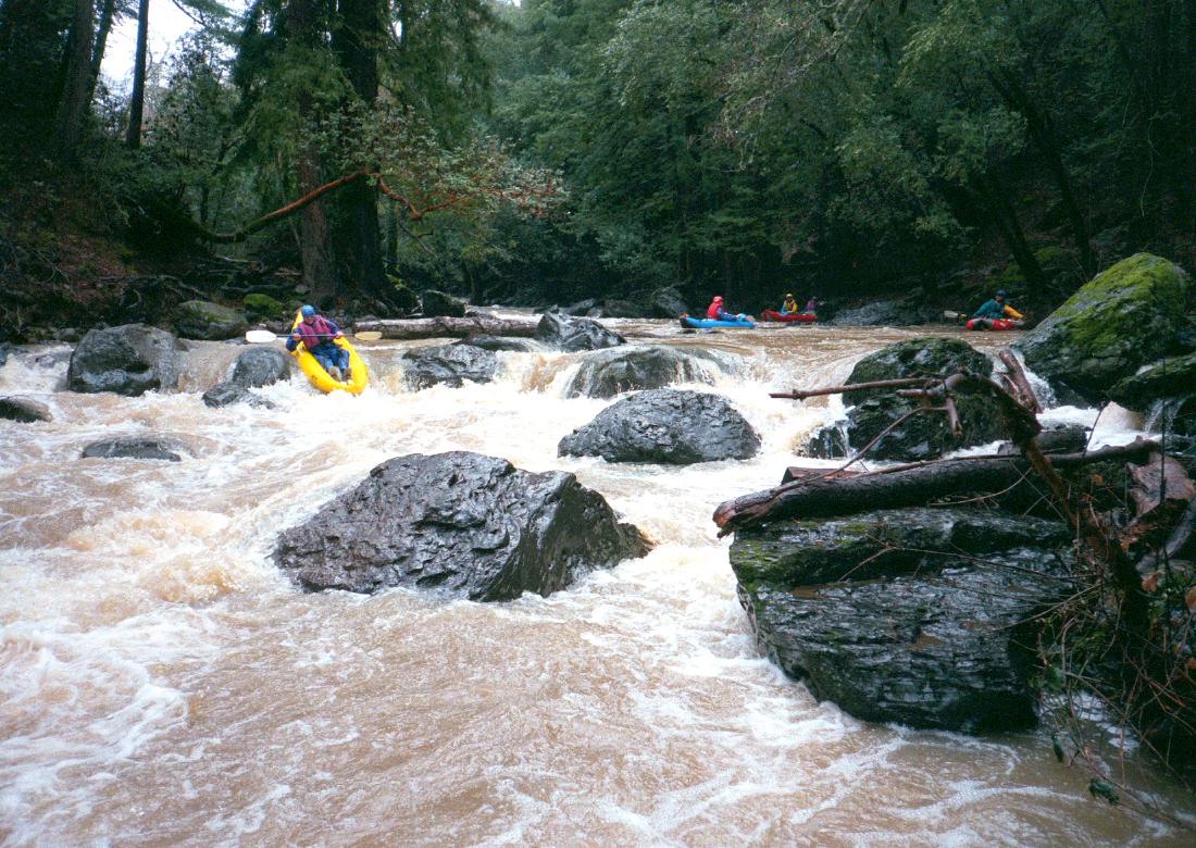

 Moderate ski jump in first drop
 At the bottom of S-Turn
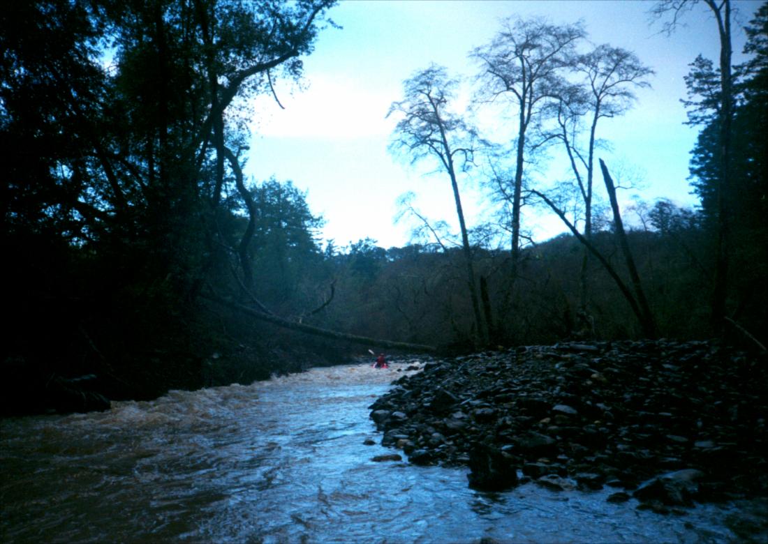 Just below this year's logjam