| |
| Stretch: |
Electra Powerhouse to Highway 49 bridge or below |
| Difficulty: |
Class II+, class III above 1500 cfs, brushy above 3000 |
| Distance: |
3.2 or 5.1 miles, half day |
| Flows: |
rafts 800 - 4000 cfs, kayaks 500 - 3000 then harder, IK minimum 450
|
| Gauge: |
slightly less than the inflow to Pardee
(PAR) |
| Gradient: |
24 fpm average, highest in mile 2.5-3.5 |
| Put-in: |
Pool near Electra Picnic Area, 670' |
| Take-out: |
Rock outcropping on left above warning sign, 593' |
| Shuttle: |
3 miles (10 minutes) one-way, on a narrow paved road |
| Maps: |
Delorme N California, AAA Lake Tahoe Region,
Topo
|
| Season: |
Year round, from dam release |
| Agency: |
BLM, private, EBMUD |
| Notes: |
© 1998-2012 Bill Tuthill,
CreeksYahoo |
This might be the best training run in California, partly because of
reliable summertime flows, and also because the rapids increase in
difficulty as the run progresses, allowing boaters to build up confidence.
There is one of almost everything on this run: some shallow boulder bars,
long stretches of riffles, a wrap-rock goalpost, a turbulent chute, an S turn,
a bridge piling, a rock dodging channel, a sweeping turn,
and finally, a steep falls into an underwater rock (scouting advised).
However if you continue to the Middle Bar take-out,
it then gets progressively easier.
Taking out at Middle Bar more than triples the shuttle distance,
so you might want to do the run only once if you take out there.
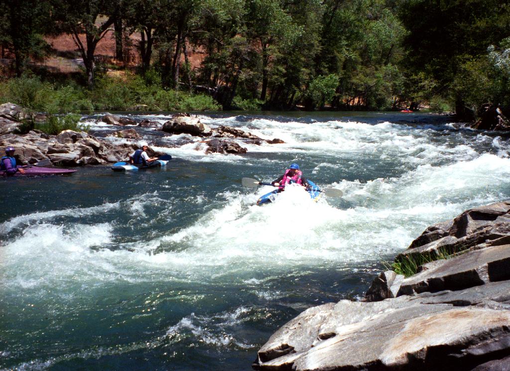
Most people do this run at least twice in a day. Prevail upon your friends
who drive pickup trucks or cars with good roof-top racks, so you can
load your boats for a quick shuttle without deflating and reinflating.
Finally in 2012, an official take-out is available near the Highway 49 bridge!
Camping and cultural enrichment are available nearby at Indian Grinding Rock
State Park, where native Americans practiced free trade before economists
even thought about it. At one time this was the largest acorn paste factory
in America. During the fall, weather is nice and campsites are less crowded
than in summertime.
Beginners should stay off this river at high flows, when current goes into
and thru riverside trees, making rescue difficult and swimming dangerous.
At such times, there are many other good river choices. With very high flows,
a whirlpool even develops near the bridge piling at mile 2.7!
In December 2002, Katherine Evatt of
the Foothill Conservancy
reported that EBMUD was building a parking lot,
sanitary facilities, and take-out at Middle Bar.
Great news! This work is all completed.
Under terms of a new hydropower license, PG&E also added more parking
at Electra and new paths down to the river below the old beach put-in.
Foothill Conservancy also worked with BLM, the State Lands Commission,
and others to develop parking and take-out just below the Highway 49 bridge.
- mile 0
- You can rig your boats in the shade and carry them across the sandy beach
to the cold river. If you are a beginner, a calm pool gives you
an opportunity to get accustomed to your boat's handling characteristics.
- .1
- Wide and shallow boulder bar. Looking down at the varied rockbed
sometimes makes you feel like you are flying.
-
- .6
- Goalpost move between two wrap rocks, after a long chute beside
some willow trees.
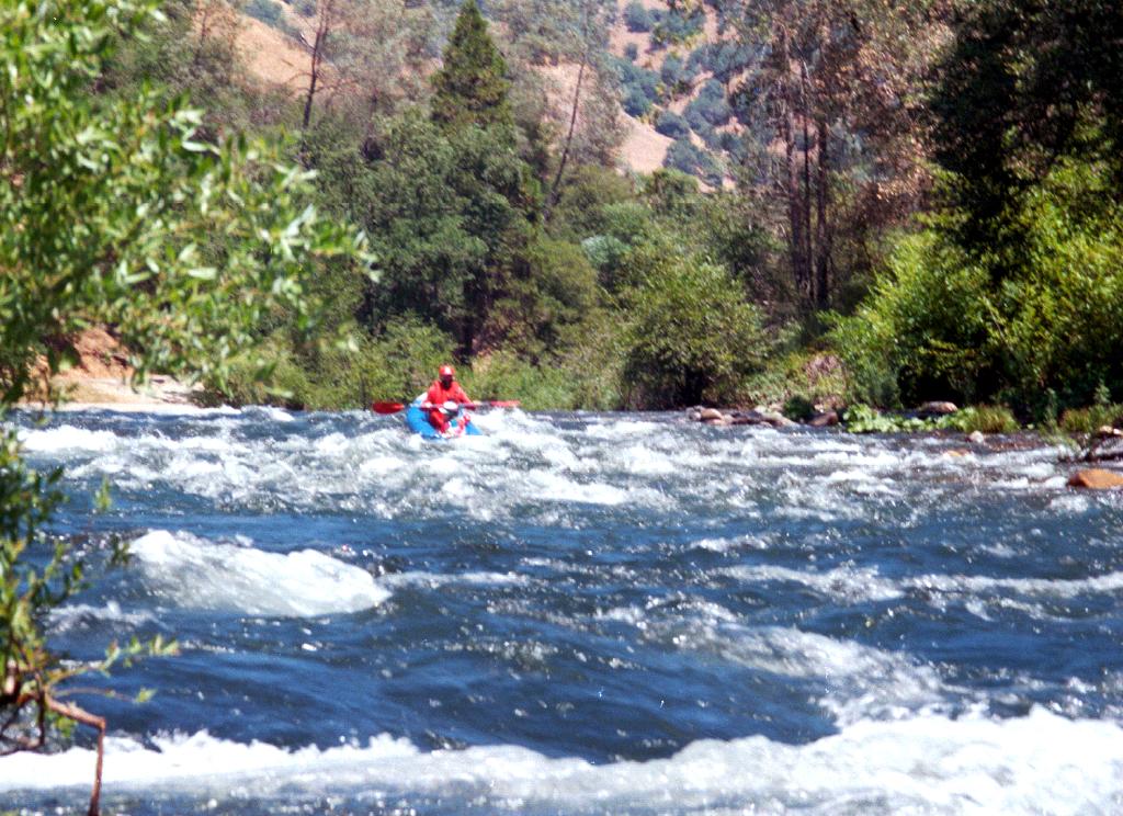
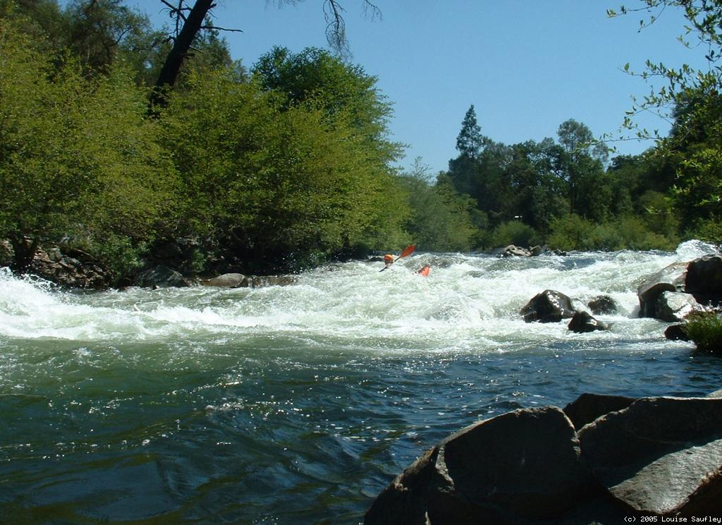
- 1.3
- The Slot, AKA The Chute, class II
The river funnels into a narrow chute with swift current
and big waves at the bottom.
-
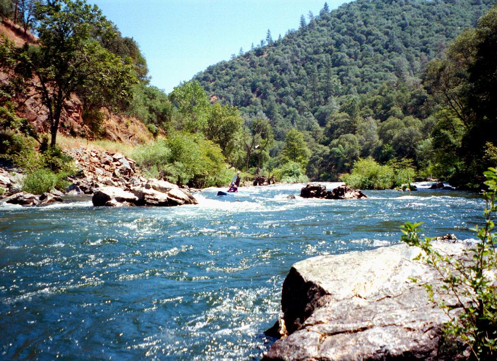
- 2.6
- S Turn, class II+
The river drops over a gravel bar, collects to the left, passes
several rocks (or holes at higher flows), then turns sharp right
against a rock outcropping. Good surfing waves below. Some people
take out right below to simplify their multi-run shuttles.
-
- 2.7
- Bridge Piling, class II+
Almost immediately the river turns right and flows past an old
concrete bridge piling, which creates lots of turbulence that is
easily avoidable, although you may not think so initially, on the
right. Swift water in a narrow channel continues to the bridge.
- 2.9
- River crosses under highway 49 bridge. Possible take-out below.
- Finally there is a good legal take-out for Electra Run: a new,
paved BLM river access point (the Big Bar River Access Facility)
with pit toilet on river left just below the Highway 49 bridge,
The whitewater action soon increases.
- 3.0
- Sweeping Left Turn, class II+
The river turns left among big rocks, past a cliff on the right,
and into some big waves.
- 3.1
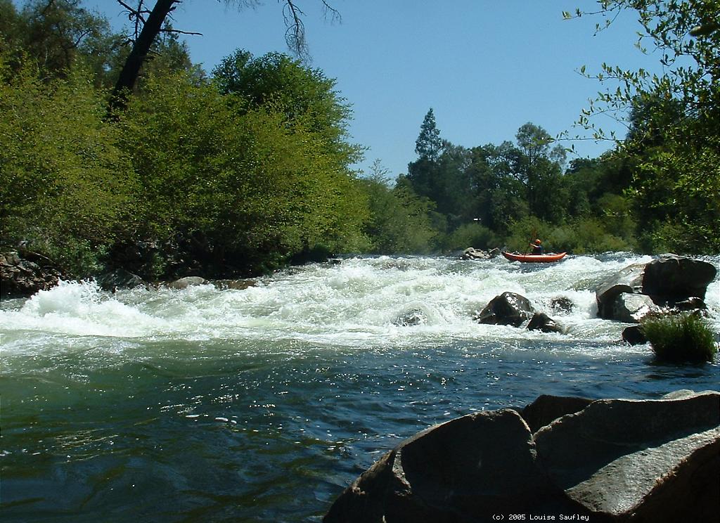
- Pin the Hardshell, AKA Devil's Toiletbowl, class III-, scout left
This is rated class III- because the drop is at least 1 meter high,
the international standard for making a class II/III distinction.
In a hardshell kayak at low flows, this rapid could be quite painful
if you struck the underwater rock. But in an inflatable the drop is
quite safe and straightforward. At lower flows, you might want to
slant a bit towards the right. At higher flows, waves get big, and
there is not much of a recovery pool before the next rapid.
-
- 3.2
- If you want, eddy out immediately to the left and carry your boats
back up a trail on the left bank to highway 49. A sign formerly
warned you that boating below this point was illegal, but no longer.
- 3.5
- After several rapids of decreasing difficulty, the river tapers off
to class I-II with superb scenery and abundant wildlife. Typically
boaters encounter at least one blue heron.
- 5.1
- Take out on the right above Middle Bar bridge, noting swank new
facilities. In April 2000, the Calaveras county District Attorney
declined to prosecute kayakers Andrew McKinsey and Keith Franklin
despite EBMUD efforts to have them arrested for trespassing.
In December 1999, Amador county authorities dismissed charges
(for lack of evidence) against McKinsey and a larger group of kayakers
who took out on the right side under the bridge. These events
represented a legal turning-point. Previously, kayakers had been
cited and fined up to $500.
To reach take-out on highway 49,
drive south almost 5 miles from Jackson,
or north more than 3 miles from Mokelumne Hill,
until you reach the bridge at the bottom of the hill.
From Jackson, Electra Road is a sharp left turn just before the bridge.
Access to Big Bar River Access Facility
when heading south is uphill above the bridge;
access when heading north is just south of the bridge.
To reach the lower Middle Bar take-out,
turn west then south on Middle Bar Road
just outside of Jackson where highway 49 starts going downhill,
or 2.5 miles uphill of the river if you came from Mokelumne Hill.
After a long and winding descent of about 3 miles,
Middle Bar Road reaches a new parking lot near the bridge.
To reach put-in from the highway 49 bridge,
drive up the river on one-lane Electra Road,
paying close attention to oncoming traffic.
The Electra picnic area, with parking, outhouses,
and many non-boaters, is about 3 miles away.
There have been frequent reports of vehicle break-ins
and stolen materials (especially beer).
One good idea is to designate rotating shuttle drivers.
|
|
Creeks Navigation
Home
Recommended Runs
Map of Rivers
Alphabetic Index
Alphabetic Table
Text Search
Sponsored Links
|