|
Mokelumne North Fork to Tiger Creek |
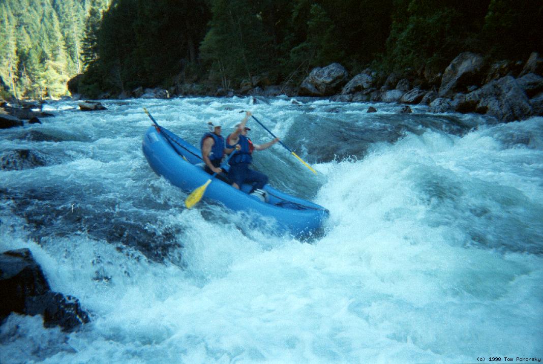
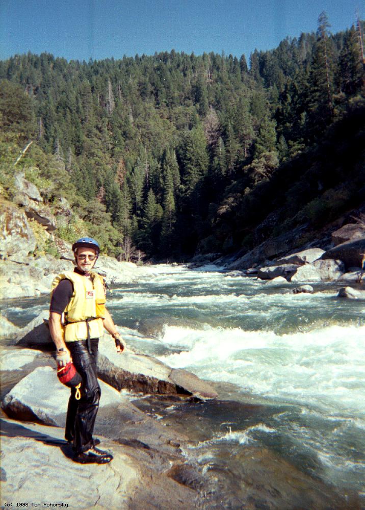
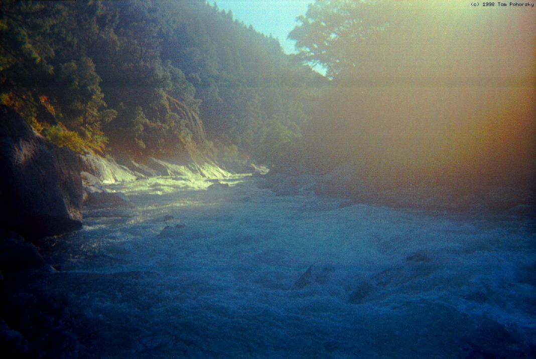
This is an excellent run that, after a steep initial section, gradually builds in difficulty until it culminates in a steep granite gorge containing nearly continuous rapids and class V Mokelumne Falls, considered “unrunnable and unscoutable” in the early days of boating. Nowadays this should become a popular advanced run. After FERC relicensing in 2002, PG&E is required to release water according to schedule in non-drought years. For flows, check the AWA website. Excellent camping, seldom crowded, is available at and near put-in. Trip Report from 1998by Tom Pohorsky Kosa said flow had been 420 cfs. As we parked by the take-out, a PG&E staffer said inflow that day was 700 cfs. Our gut feel was 600 at put-in (the old Kosa standard of “just-14'-raftable if the riverbed is not too wide”). Side creeks, mostly the Bear River, added about 200 cfs, for a total of 800 cfs. The smaller guys took my miniPuma, while the bigger guys paddled a standard Puma. This flow seemed like IK maximum, Puma optimal. Plenty of boulders were exposed, but there were few ankle biters or hard-to-negotiate sieves. [Flow tests indicate that 500-1000 cfs is acceptable, 1000-2000 cfs optimal for hardshell kayaks.] Most notably, the first .75 miles are high-ish gradient, maybe even 75 fpm, with continuous class III+ or IV. It came as a real surprise, as we were groggy from the drive, and because none of the guidebooks mentioned it, we were lulled is into complacency. But we handled it OK, and had no swims the whole day. This fun first section, combined with the section below Salt Springs reservoir, could make an interesting excursion in itself, or perhaps for the day before. The river quickly settles down to class II for about 9 miles, punctuated by the occasional short class III-IV boulder garden. This to me was the only downside. Solitude and scenery are excellent, though. The pools moved OK, but with a late put-in we paddled most the way. I'd guess 400 cfs would be the optimum IK flow, but the class II section could be pretty time-consuming at that flow. Scenery was always forested canyon and overall very good. No big drama like Giant Gap though. We encountered lots of driftwood, but no log hazards. Some snags scraped open an old patch on Scott's boat, though. We rushed thru a patch job, which only barely held; I guess we should have been more patient but we were concerned about doing the hard stuff in the dark. Holbek notes that the last 2 miles are 100 fpm, which seems right. We were pretty wary, and this certainly didn't catch us by surprise. We read and ran most of it, but at higher flows, that would be difficult. At IK flows, boat scouting would be fine; land-scout only what you don't like. The following distances are vague estimates. Hopefully these can be corrected by the next run or two. Maybe around mile 10, boaters encounter some occasional small gorge walls, like 10' of rock. Taller (20-30') rock sides indicated the tough stuff. First thing was a moderate right bend into long dropping straightaway. Right side is runnable with steady gradient. Left side had a large drop half way down. Class IV+, perhaps V with more water. Maybe .3 miles later is the first solid class V: the river is straight, dropping thru a boulder field and then over a ledge into a big reversal. The gorge wall closes in on the bottom left, forming an undercut vibe, so only the right seemed safe. We stayed close to the right shore and did fine. The gut may be runnable at some flows. Definitely worth a scout. The second class V is maybe .2 miles later. There is a left bend that we ran on the inside, into a right bend with a workable route through the middle. Our boat was back-ferrying left and didn't seize on this route. The other boaters scouted and found that clean middle line.
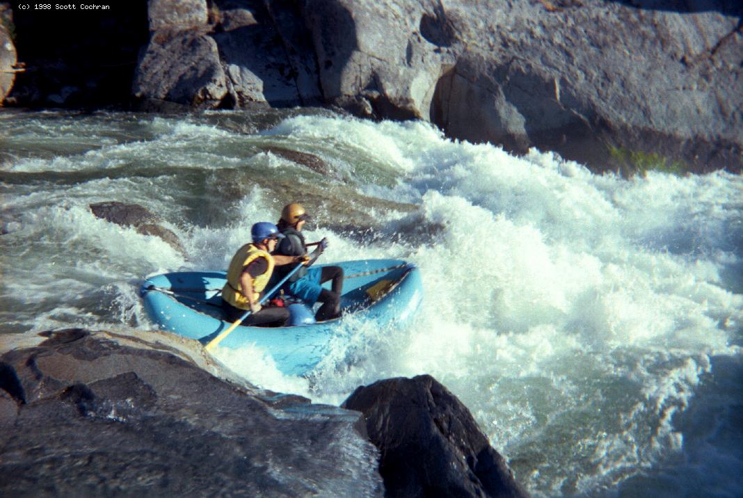
After maybe .3 miles of read-and-run, you start getting the sense of some serious gradient ahead. Again the gorge wall closes in on the bottom left. This is Mokelumne Falls. There is some mixed class IV leading to a horizon line, with a solid sense of foreboding. Kind of like a mini Granite Dome Falls, where there's just enough in the approach that there's a slight but real chance of a swim. We couldn't fully scout the big drop on the right. It seemed like the left scout wasn't as good but it may be worth a shot. The left shore seemed hard to work with. So we opted to line down the right shore until we could see the main drop. This was a Class IV lining. By putting in immediately above the falls, we were able to run the right side, dropping from cushion to cushion. Big, bouncy, but no more than a V, and a swim would not have been that bad. So at the time we assumed this was just another V. The other parts of the falls were generally unrunnable, but Holbek could probably make it. However when you take the IV+ entrance rapid into account, it's very unlikely you could string a complete run together. It seems almost impossible to get into the tiny rock-guarded pool for a right side run. Scott got a photo of us, but the lens might have been misty.
From the bottom, we looked down a long calm stretch and saw mist rising. So at the time we thought that was the falls. Only as we approached did we realize that this was the diversion dam, and that what we had just lined and run was Mokelumne Falls. Although Holbek wrote that the dam required a carry, Cassady wrote that the left side is runnable after inspection. This was correct: the far left side formed a very coarse “ramp” and was not very hard. In classic dam fashion, the middle had a deep reversal. Tiger Creek reservoir is just around the bend. There is a day-use area right at the bend were the reservoir begins, but access closes at 6:30 PM. It's posted No Boating because of powerhouse outflow danger, so this would be the best take-out if you arrive in time. We parked along a low spot (Tiger Creek inflow bridge, actually a 10' culvert) near the water, which required a .6 mile paddle out. Start early so you can float (rather than paddle) the Class II middle, and it'll be a great run! Medium-Highwater NotesBy Rorie Gotham The run starts out with a good stiff class IV+. Then there is a long section of class II with some IIIs. Keep paddling during the slow water because you want to have time to scout. On 1500 cfs, we put on at 9:30 and took out at 2:30 but we know the run. Another group put on a bit later and took out at 7:30 just before dark! In the last couple of miles, the canyon changes character and you are in the meat of it pretty quickly. Be careful. In this part of the canyon it is obvious that the gradient just changed abruptly and dramatically. First class V (Of Note): there is a wicked left wall that is cut out and undercut on the left where the river-canyon bends left to right. Do not take the left, left center, or center route. There is a small little eddy on river right to scout. Start out right in the slower flow, stay right and find the depression between an exposed boulder which will be on your left, and a pour-over mound on your right, which is near the right bank. Get between these two features and drop right to left. This is the right side run. Do not go further left. You can see the wall and the cut-out but you have to be quick to make the next eddy and scout the following class V rapids. Next class V (Pre Falls) is an important scout: scout left to best see your move. Again the river-canyon is bending left to right. The move is from center-right moving aggressively towards the center, to line up into a small depression (which is a big drop) driving left-center. Please make this move! Immediately and I mean immediately following this is Mokelumne Falls. If you cannot land on the right bank to portage, then run down the far right side of the falls. Mokelumne Falls is a very steep dramatic drop. You do not want to be left or center when running it. At higher flows, these two rapids seem to merge. You cannot scout Mokelumne Falls from river left. To scout both rapids, long-distance scout on the right. But scouting right makes it difficult to see the driving-left-center move. You could scout all the way right to see Mokelumne Falls, then cross over to scout left for the prelude class V. Difficult ferry, but at least you get to see the left-center move, and the line-up move to be made for Mokelumne Falls. At lower flows, most people portage the Falls. But at higher flow, the two drops merge so it is difficult to get to shore. We ran both because we knew where we were, but the group that was (by now) several hours behind us had a lot of trouble upstream. At a couple of huge holes, and at the undercut, they had 2 flips and one dump-truck, so everybody in all three boats swam. By the time they got to Mokelumne Falls they were beat up, tired, and cold. So they ended up portaging the Falls and the dam just downstream. Run the dam all the way over on far left, where an eroded channel has circumvented the dam structure.
|
Creeks NavigationHomeRecommended Runs Map of Rivers Alphabetic Index Alphabetic Table Text Search
Sponsored Links
|