Pauley Creek near Downieville


Stretch: Third and Second Divides to Downieville
Difficulty: Class IV+ with one portage
Distance: 4 miles on Lavezzola plus 4 miles on Pauley, 1 day
Flows: kayaks 300 - 600 cfs, IK minimum 150
Gauge: about 20% of N Yuba at Goodyear Bar (USGS site)
Gradient: 100 fpm, pool and drop
Put-in: downhill from Second Divide, 3330'
Take-out: confluence of Downieville and Pauley creeks, 2930'
Shuttle: 5 miles (10 minutes) one-way, twice
Maps: USFS Tahoe NF, AAA Feather and Yuba, Topo
Season: April into June, from snowmelt
Agency: USFS, private
Notes: © 1998 Bill Tuthill, CreeksYahoo

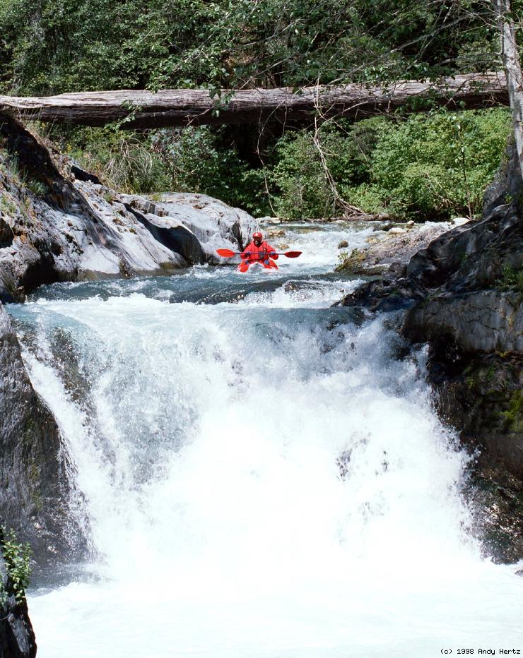
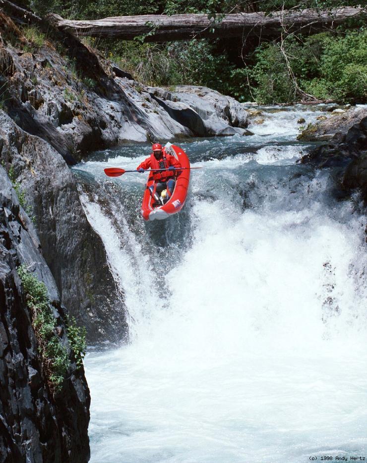
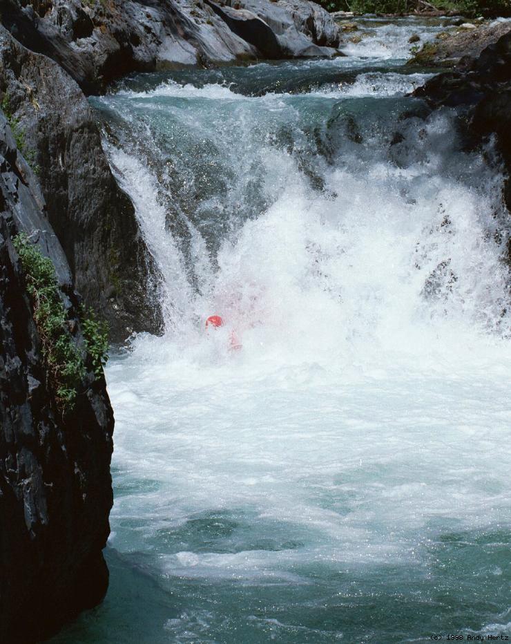
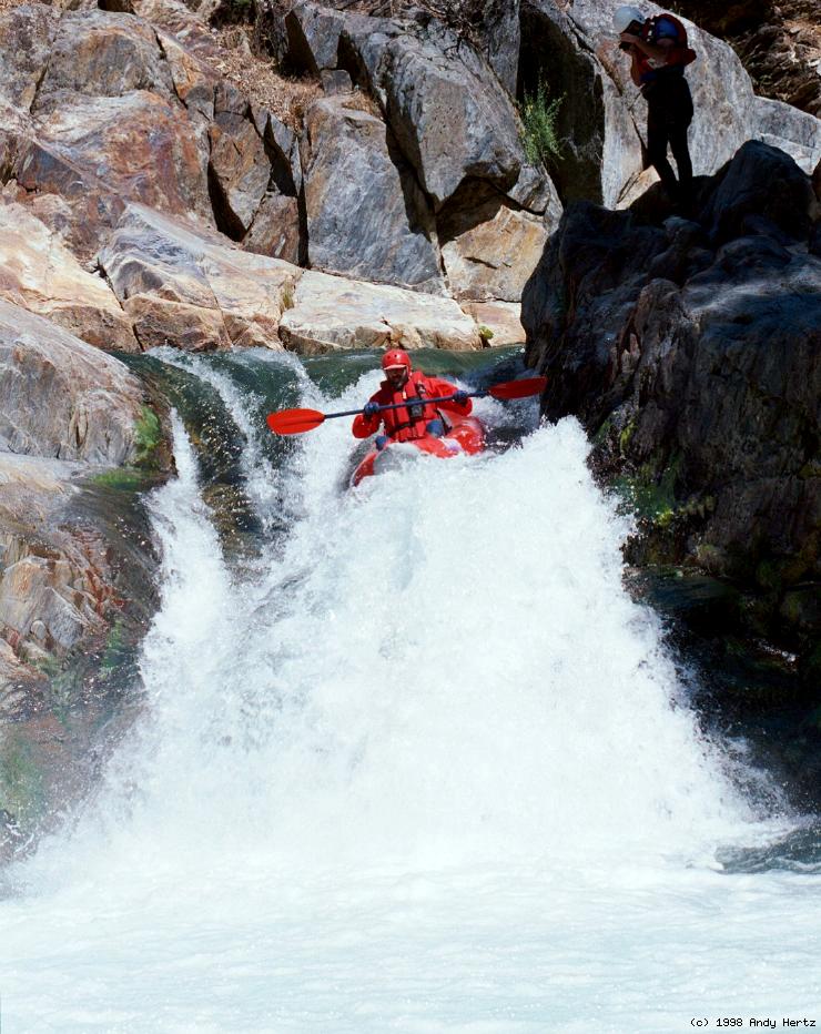
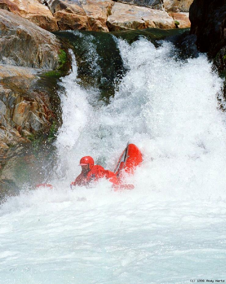
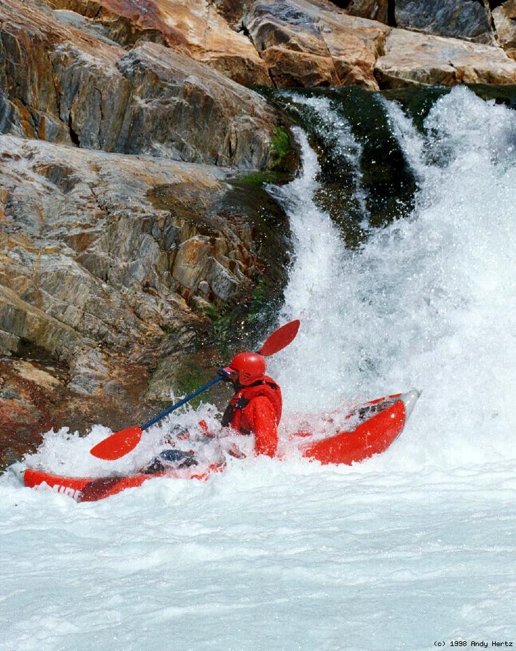
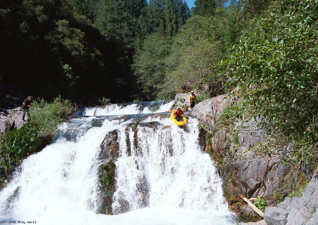
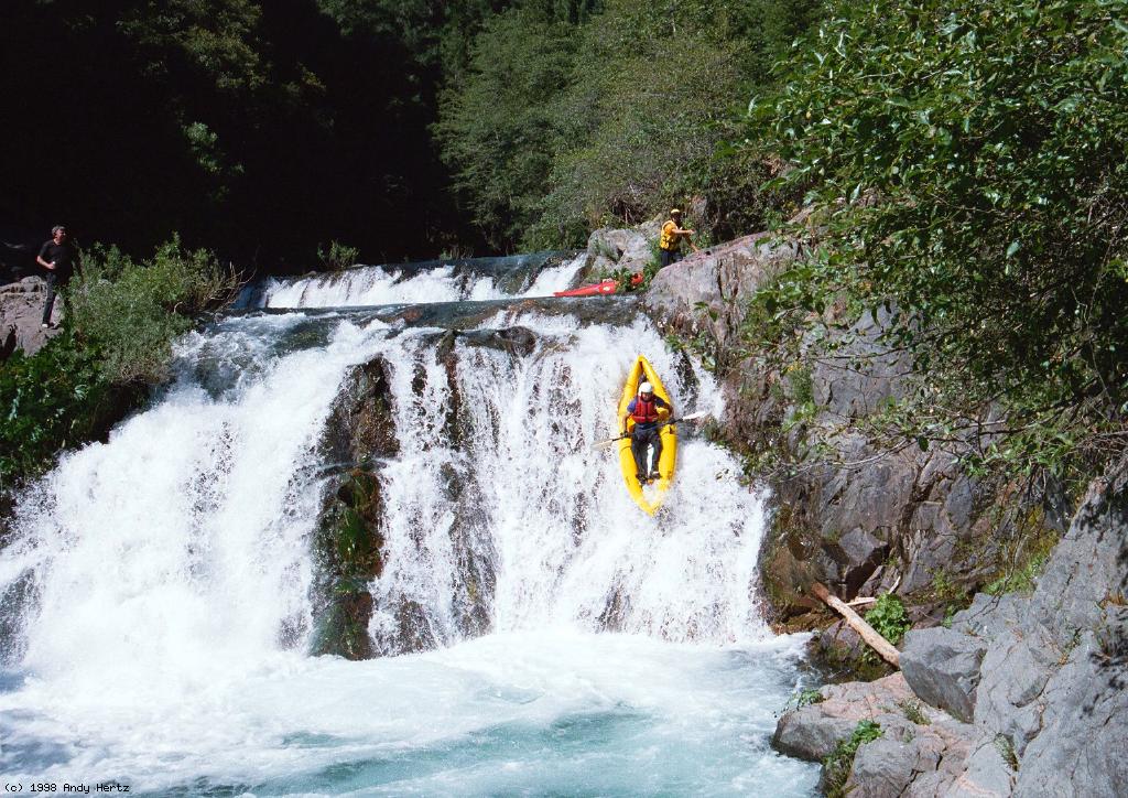
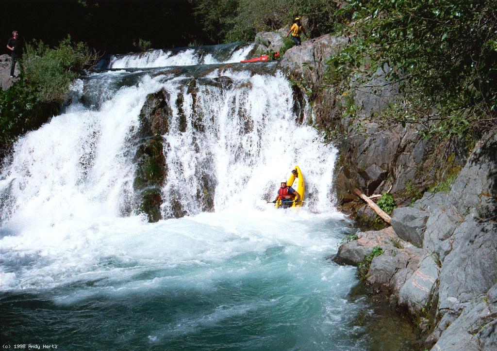
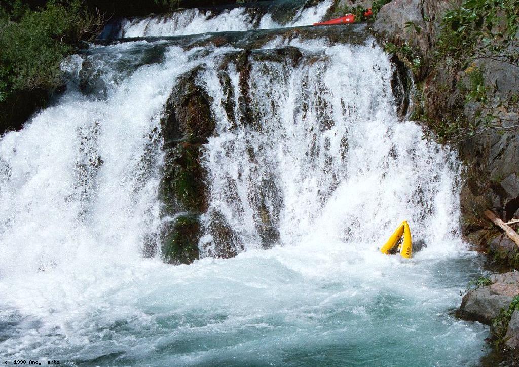
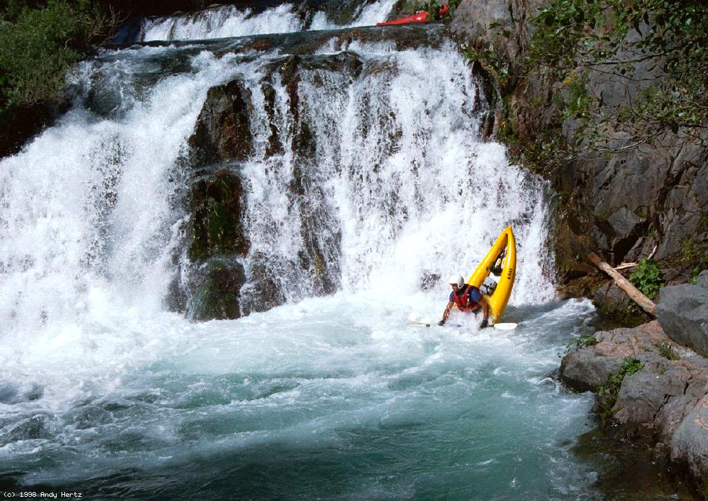
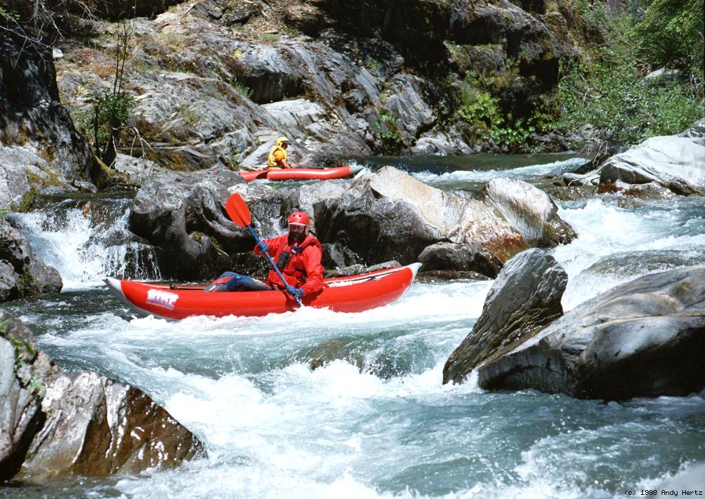
These two creeks, both tributaries of Downieville Creek (called a river on most maps) have nearly identical flows, and are separated by a narrow ridge with convenient dirt road for shuttling. Most people run both in the same day, usually Lavezzola first so Pauley Falls can serve as a climax. Lavezzola contains a class IV granite gorge and two harder rapids, one normally portaged, near the end. Pauley is basically a bunch of waterfalls connected by class II rapids. But what amazing waterfalls they are! The tallest ones are 25' and 15' high, yet it would be hard to rate either class V except at high flow. Wood is the principal hazard on both runs.

For a mile-by-mile description and pictures of Lavezzola Creek, click here. In spring of 1999, Pauley Creek had 2 mandatory tree portages, the first about 1 mile down, the second about 1.5 mile below put-in. The first may be portaged on the right with an eddy big enough for a couple of boats. The second may be portaged on the left with an eddy big enough for 3-4 boats.

mile
0
Put in where the single track approaches the river.
Pauley Creek near Downieville CA Class IV rapid immediately below put-in
1
Federal Falls, class IV+ (class V at high water)
Pauley Creek near Downieville CA Pauley Creek near Downieville CA Pauley Creek near Downieville CA Pauley Creek near Downieville CA
Easy approach The better side On the spout Almost buried!
1.2
Hazard! A distance below Federal Falls, the canyon opens up a bit and the creek splits around a rock jumble. From above it looks like the left channel is runnable, but it is not, owing to some logs jammed in between rocks (1998). The safer but unfortunately not obvious run is to the right of the rock jumble.
2
Slip & Slide, AKA Slip & Flip, class IV
Pauley Creek near Downieville CA Pauley Creek near Downieville CA Pauley Creek near Downieville CA Pauley Creek near Downieville CA
Staying high The Slide The Slip What, no Flip?
This sequence shows why this falls got its alternate name.
Pauley Creek near Downieville CA Pauley Creek near Downieville CA
The Slip The Flip
3
Pauley Falls, class IV+ (class V on river right)
Pauley Creek near Downieville CA Pauley Creek near Downieville CA Pauley Creek near Downieville CA
Starting from a sleeper Over the kicker rock near shore Into the deep pool below
Pauley Creek near Downieville CA Pauley Creek near Downieville CA
The Sotak's needlenose buries! Unintentional but photogenic nosestand

Shuttle directions can be found in the new Holbek book, the one with red trim and awful graphic on the front cover.


 Creeks Navigation

 Home
 Recommended Runs
 Map of Rivers
 Alphabetic Index
 Alphabetic Table
 Text Search

 Sponsored Links