| |
| Stretch: |
Grandjean Idaho to Banks Idaho |
| Difficulty: |
Class II to IV+ with one portage |
| Distance: |
66.1 miles, 4 days minimum |
| Flows: |
upper section: rafts and kayaks 600 - 5000 cfs, IK minimum 500 |
| Gauge: |
measured half-way at Lowman
(USGS site)
|
| Gradient: |
34 fpm overall, varies by section, 45 fpm in the Canyon |
| Put-in: |
Sacajawea hot springs near Grandjean, 5000' |
| Take-out: |
Banks access across the main Payette, 2775' |
| Shuttle: |
61.9 miles (1.5 hours) one-way |
| Maps: |
USFS Payette map, AAA Idaho,
Topo
|
| Season: |
usually runnable all year, from springs and snowmelt |
| Agency: |
USFS (Boise NF) and private |
| Notes: |
© 2015 Bill Tuthill, photos © Shaun Riedinger and David Elliott |
The South Fork Payette makes an excellent multi-day excursion,
especially in early July when rivers are drying up further south.
Boatable for over 66 miles with only one mandatory portage,
it offers five great runs (omitting flatwater) totaling almost 52 miles.
From the top:
- Wapiti bridge near Grandjean to near Sourdough Lodge, class II-III+, 13.5 miles
- Helende campground to Deadwood River access, class II-III+, 14 miles
- The Canyon, Deadwood River to Danskin access, class IV with one portage, 12 miles
- Swirly Canyon, Danskin access to Garden Valley, class II+, 7.7 miles
- Staircase run, Deer Creek access to Banks access, class IV+, 4.7 miles
Additionally you can continue from the Staircase run
or from Banks on the Main Payette, class III, 7 miles.
The Main is a really fun section with huge standing waves.
You can also add a day trip by driving upstream past Smith Ferry
for the North Fork Payette Cabarton run, class I-III, 10 miles.
The Cabarton section contains the famous rapids Trestle and Howard's Plunge.
Both the Main and Cabarton are popular runs that get crowded on weekends and holidays.
Distances given below are miles from the Snake river confluence, starting
above the highest put-in, with numbers (in parentheses) for each recommended run.
See shuttle directions for put-ins and take-outs.
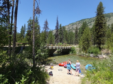
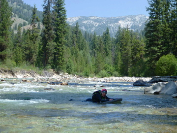
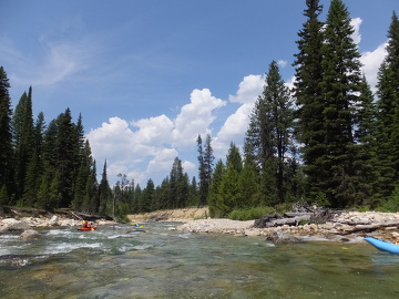
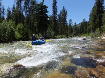
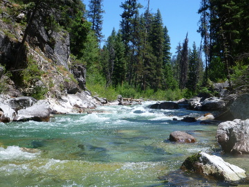
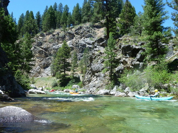
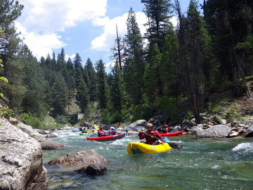
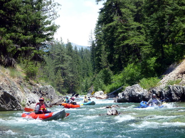
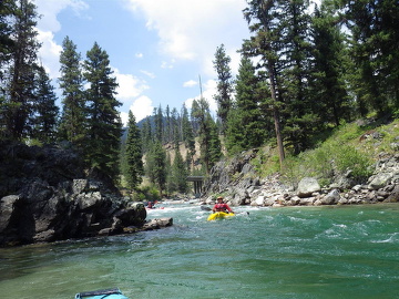
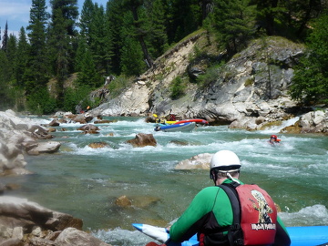
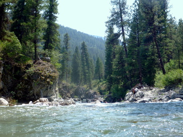
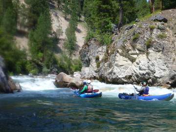
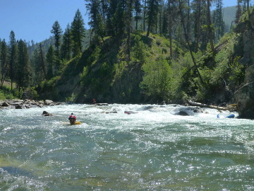
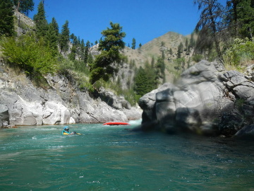
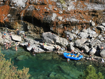
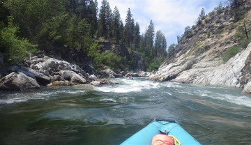
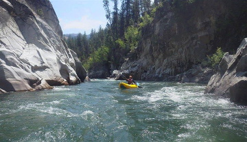
Photos were taken with the Lowman gauge around 700 cfs.
- 139
- Above Sacajawea hot springs, many trails lead down to beaches
that are good for put-in. Upstream the gradient is meager,
with many logs across the river that require portaging (2015).
- 137.3 (0)
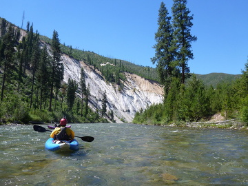
- Grandjean run.
The bridge to Wapiti summer homes makes a convenient put-in.
Above the first noticeable rapid .1 mile below, Bear Creek enters
on the right and Wapiti Creek on the left, adding welcome flow.
-
- The river in this section is continuous but not difficult.
-
- 134.4 (2.9)
- Canyon Creek Rapid, class III
Recognition: your shuttle road becomes visible on the right bank.
At a rock outcropping on the right, the canyon narrows and
the river makes several S-turns over bedrock drops.
Canyon Creek then enters on the right, adding significant flow.
Fun rapids continue below.
-
- 132.6 (4.7)
- Fox Creek enters on the right near a primitive campground,
an access point reachable from the dirt road to Grandjean.
- 131.5 (5.8)
- Access point on the right bank, reachable by rough dirt road,
recognizable from Highway 21 by a large pile of rock debris just downhill.
This put-in is frequently used but misses the scenic upper river.
-
- 130.2 (7.1)
- Warm Springs drop, class III
Recognition: after turning away from the road, the river enters
a small canyon. At low flows, a bedrock drop on river left.
- 130.1 (7.2)
- Warm Springs slalom, class III-
Merges at high flows. At low flows, several curving drops.
Immediately below, Warm Springs Creek enters on the right.
Bonneville Hot Springs and campground are upstream on that creek.
- 129.3 (8.0)
- Highway 21 bridge overhead. The road is now on the left bank.
-
- 129.1 (8.2)
- Chapman Creek rapid, class III+
Recognition: below the bridge, the river turns left twice, then right.
Big at high flows. At low flows, a tricky drop on river left
followed by a boulder garden. Chapman Creek enters on the left.
A dirt road on the right comes close to the river .3 mile below.
- 128.4 (8.9)
- Little Surprise, class III+
Recognition: after the second left curve an horizon line appears.
At low flows, a steep rock-infested drop. The right side has pin
or wrap potential. The left side seems safer but is harder to enter.
Cleans up at higher flows, but remains a significant rapid.
-
- 125.7 (11.6)
- Highway 21 bridge overhead. The road is back on the right bank.
- 123.8 (13.5)
- Recommended take-out beach on the right bank below a small campsite.
To reach this spot by vehicle, see shuttle directions
for the small campsite near 10 Mile Creek.
- 123.4
- Small bridge for access to local homes and up 10 Mile Creek.
Soon the riverbed widens, rapids flatten, and houses become visible.
Whitewater boaters do not greatly enjoy this 4.4 mile section.
- 119.0 (0)
- Kirkham run.
Upper Helende access, reachable by taking the right fork, then the
left fork, of a dirt road past Helende Campground for about .5 mile.
- 118.3 (.7)
- Lower Helende access, reachable by taking the right fork, twice,
of a dirt road past Helende Campground for about .7 mile.
-
- 118.1 (.9)
- Fence Creek Rapid, class III
After a left bend, Fence Creek enters on the right and the river
pours over a bedrock drop into the left wall.
At moderate flows the right side can be used as a sneak route.
Jackson Creek enters on the left below.
- 115.2 (3.8)
- The Slot, class III-IV
Recognition: below the first bridge on the run, Archie Creek Road 542,
the river makes a long left bend and the pace of rapids picks up,
culminating in a steep slot, with miniature Room of Doom on the right.
-
- 113.0 (6.0)
- Kirkham rapid, class III
Recognition: just before the bridge to Kirkham Campground,
rapids begin. A long lead-in is followed by a turbulent left curve.
Kirkham hot springs are below on the left.
- 109.4 (9.6)
- Mountain View campground, where you can take out near river level.
If you have time, consider boating past the village of Lowman and
thru the scenic canyon below.
- 105.0 (14.0 | 0)
- Canyon run.
Deadwood River access. Easy take-out but no afternoon shade.
Commercial raft trips use this put-in when running the Canyon.
For pictures and description of this run, see
Oregon Kayaking
or AW River Info.
- 101.7 (3.3)
- Pine Flat campground, alternate put-in for the Canyon run.
Many class III rapids ensue, but only the class IV rapids and portage are noted.
- 99.5 (5.5)
- S-Turn, class IV. A big drop after a left bend. The usual line traces an S
from bottom to top.
- 98.9 (6.1)
- Big Falls, class V+, portage left.
Marked by many signs, the portage trail starts near the lip of the falls.
- 98.6 (6.4)
- Blackadar Rapid, class IV. Enter left and work right.
A plaque commemorating Walt Blackadar is on the right wall below,
but underwater at higher flows.
- 97.1 (7.9)
- Lone Pine, class IV. Enter on the right and work to the middle.
Afterwards rapids continue with a big class III at a left bend
not far above Little Falls.
- 96.5 (8.5)
- Little Falls, class IV. Center is bad, but it can be run on the right.
Most boaters make a boof move off the far left. Shortly below is
a large rapid with rooster tail in the middle, apparently unnamed.
- 96 (9.1)
- Surprise, class IV. After coming close to Highway 21, the river enters
another canyon with rapids. This big rapid appears after a straight-away.
A large rock or hole lurks on bottom right.
- 95.6 (9.4)
- Kayaker take-out, a steep trail on river right leading to a small turn-out.
- 93.8 (11.2)
- River-wide ledge on the right, with a sneak route on far left.
- 92.8 (12.2 | 0)
- Swirly Canyon.
Danskin access, take-out for Canyon run, put-in for Swirly Canyon.
Somewhere below (not visible by satellite image) is a broken-down diversion dam,
which the AWA writeup calls the Ultimate Play Wave (UPW), mile 2.0.
- 90.7 (2.1)
- After the current quickens and you pass some houses on the right,
the river makes a horseshoe bend around a gravel and boulder bar,
and enters the largest and longest of the Swirly canyons.
-
- 87.8 (5.0)
- At a bend away from Highway 21, the river turns sharp right
and enters another canyon with some class II rapids.
- 86.7 (6.1)
- Large surfing ledge on river right. Hot springs on the left bank.
Alternate access below: you can take out by carrying up the right bank
to a parking area across the road from USFS Hot Springs campground.
No significant rapids from here to Alder Creek take-out.
- 84.1 (8.7)
- Alder Creek bridge on road 615, take-out for Swirly Canyon,
just downstream of the Garden Valley airstrip.
Current slows down even more until the Middle Fork confluence.
- 80.1
- Confluence access, .25 mile below the Middle Fork confluence.
You can put in here to run Staircase, adding 2.7 miles of class I-II.
- 77.7
- Upper Deer Creek access, intended as a takeout for fishermen.
- 77.4 (0)
- Staircase run.
Lower Deer Creek access, with a sliding boat ramp for rafts or kayaks.
The Staircase run has many significant rapids. All are visible from the road.
For pictures and description, see
AW River Info.
- 77.0 (.4)
- Soon after the rapid just below put-in comes Bronco Billy, a long class III.
After a right curve comes Tight and Right, where a log blocks the left channel (2015).
Shortly below comes Dog Leg, although its name better fits the rapid above.
After the first mile, rapids ease a bit.
- 75.1 (2.2)
- Staircase rapid, class IV+. A long steep rapid with entrapment hazards.
During this rapid the river makes a 90° left bend, northwest to southwest.
Scout from the turnout during your shuttle.
- 73.4 (4.0)
- Slalom rapid, class IV. The first part is steep and fast.
After a brief lull, the second part is rocky.
- 72.7 (4.7)
- Confluence with the North Fork Payette, forming the Main Payette.
Take out across the river at the Banks (fee) access ramp.
Shuttle Directions
To reach Banks, drive 42 miles north from Meridian Idaho on Highway 55.
For all runs, turn right onto county Highway 17.
Garden Valley has gasoline, motels, and cabin rentals.
Crouch has restaurants, laundromat, and a well-stocked grocery store.
Many excellent campsites are situated further upstream near Lowman,
where Highway 21 from Boise meets Highway 17 and continues upriver.
To reach the bridge to Wapiti summer homes, drive upstream (east)
from Lowman 21.3 miles, turn right (southeast) onto Grandjean Road,
continue another 4.7 miles on this dirt road,
and turn right at the sign for Wapiti summer homes.
To reach the small campsite near 10 Mile Creek,
thereby avoiding Sourdough area flatwater,
drive 1.5 miles upstream (northeast) of Sourdough Lodge
and find the right turnoff (south) to 10 Mile Creek Road.
This turnoff follows the river .1 mile to a small bridge.
After the turnoff proceed on Highway 21 another .6 mile upstream (east)
and turn right (south) at a campground (tent) sign on a short paved spur.
Park and walk down to the river (west) to note the take-out beach.
To reach put-in for the Kirkham run, drive upstream from Lowman 9.1 miles,
and turn right (south) at the signs for Helende Campground.
After passing the camp area to your left, turn right on a dirt road.
At the next fork, take the left for a quicker path to the river.
Though longer, the right fork also works and the put-in is shadier.
Deadwood access is at a paved turn-out along county Highway 17,
3.5 miles downstream (west) of Lowman,
or 17.8 miles upstream (east) of the Garden Valley airstrip.
Danskin access is right along county Highway 17,
16.8 miles downstream (west) of Lowman,
or 4.5 miles upstream (east) of the Garden Valley airstrip.
The Alder Creek Road bridge is just downstream from the airstrip,
or 1.3 miles upstream (southeast) from the Chevron station in Garden Valley.
Take-out is on river left below the bridge.
Deer Creek access is 3.6 miles downstream (southwest)
on county Highway 17 from the Middlefork Road turnoff into Crouch,
or 4.7 miles upstream from the junction with Highway 55 in Banks.
|
|
Creeks Navigation
Home
Recommended Runs
Map of Rivers
Alphabetic Index
Alphabetic Table
Text Search
Sponsored Links
|
