| |
| Stretch: |
Monticello Dam to Fishing Access #3 |
| Difficulty: |
Class II with strainer hazards |
| Distance: |
2.5 miles, 2-3 runs per day |
| Flows: |
kayaks 450 - 900 cfs
|
| Gauge: |
measured along this run near Fishing Access #1
(PUT) |
| Gradient: |
12 fpm average, higher at beginning and end |
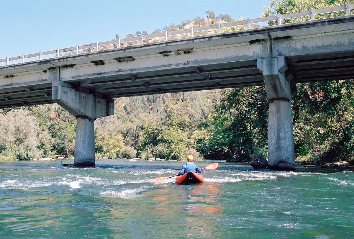
| Put-in: |
just upstream of highway 128 bridge, 180' |
| Take-out: |
Fishing Access #3, 150' |
| Shuttle: |
2.3 miles (10 minutes) one-way, bicycle OK (narrow shoulder) |
| Maps: |
AAA San Francisco Bay Region,
Topo
|
| Season: |
summer, from dam release |
| Agency: |
private, BLM |
| Notes: |
© 2007, 2009, 2013 Bill Tuthill,
CreeksYahoo |
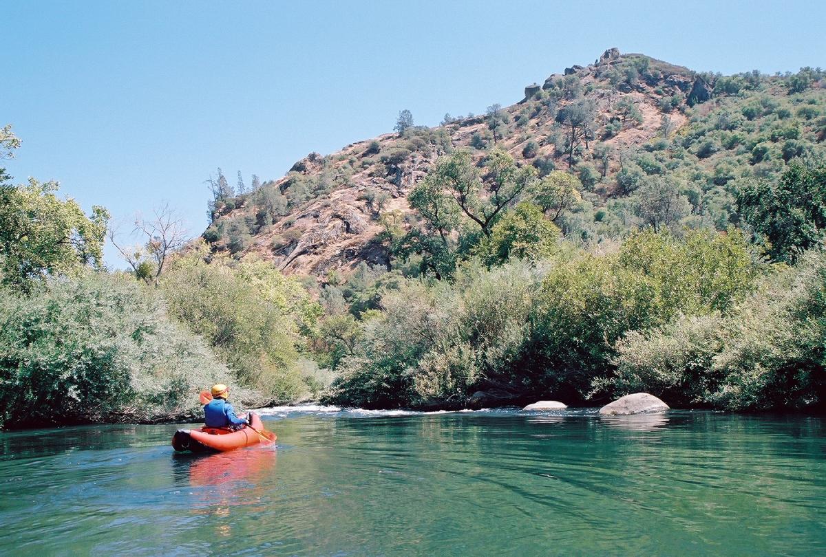
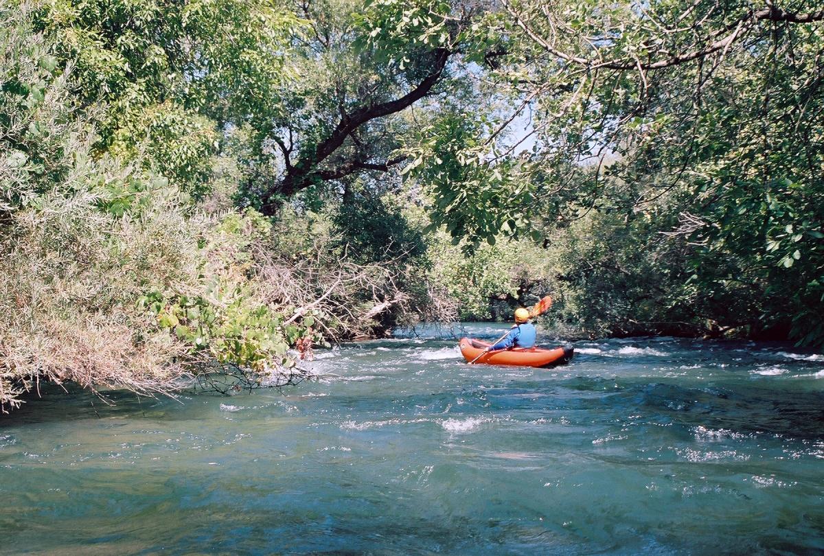
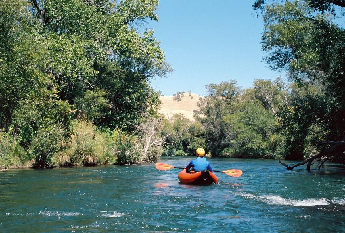
This is a beautiful run with reliable summer-long flows,
less than 100 miles from San Jose.
Rapids are not as exciting as on Cache Creek,
but water quality is better, and there are many good play spots.
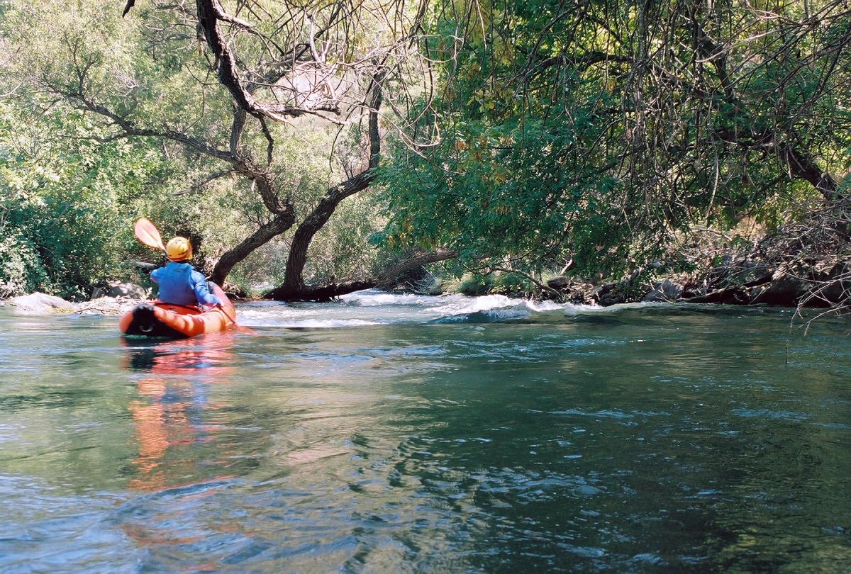
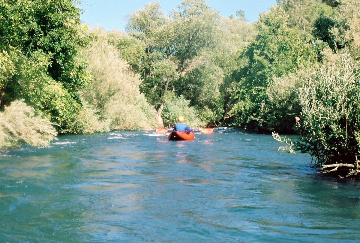
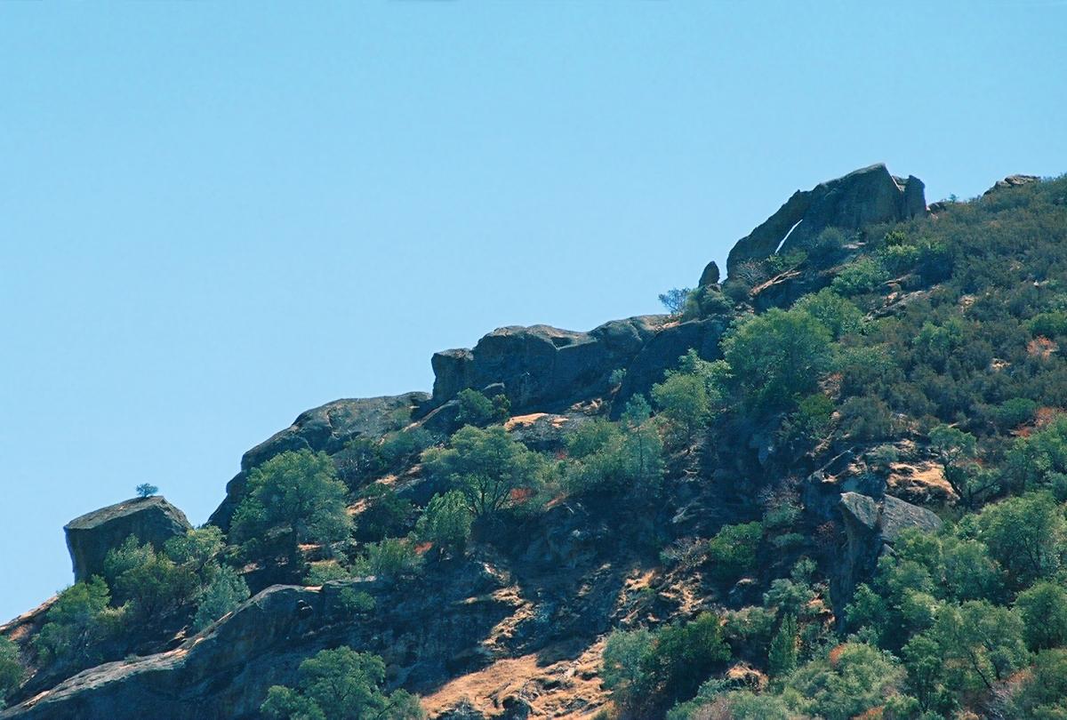
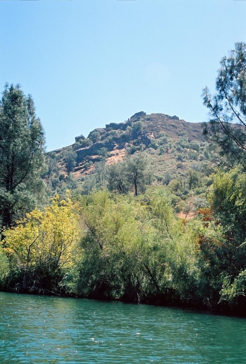
The scenery is remarkable, with rocky crags towering above the creek,
and lush vegetation along the water (mostly) obscuring highway 128.
On a weekday, we had the creek all to ourselves,
after greeting about a dozen anglers just downstream of put-in.
You don't need to visit Utah to see a natural stone arch!
See Arch Pool below.
For a guide to Putah Creek above Berryessa Reservoir, see the
Upper Putah writeup on this website.
Hazard:
Tree branches obstruct the top of the rapid Long Arm of the Law,
and a fallen willow tree blocks the channel further down.
Until forces of nature clear the channel, this run is not recommended.
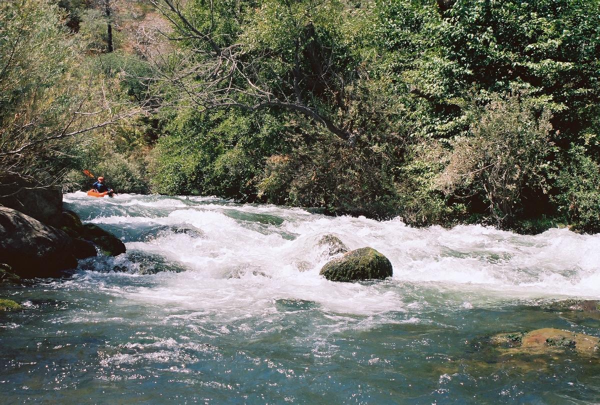
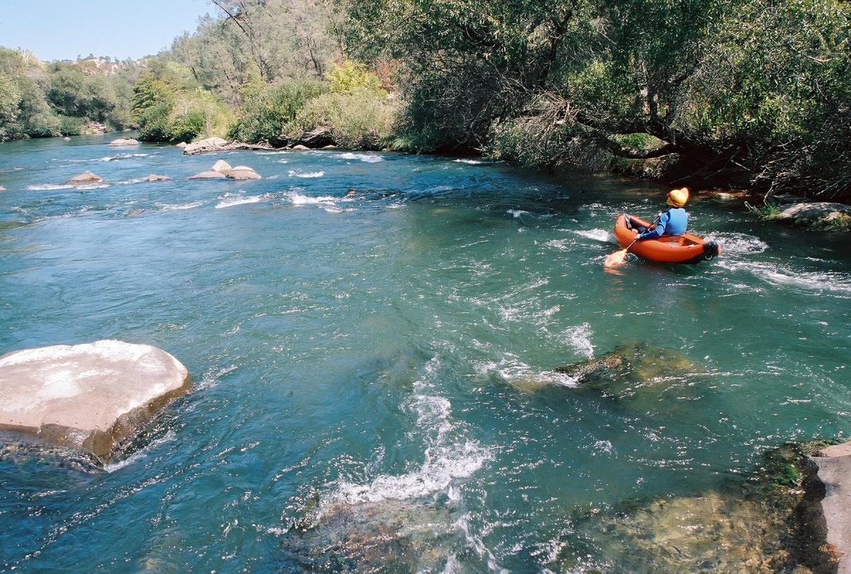
These pictures were taken at 480 cfs.
At higher flows, the waves get bigger and (for some people) more fun.
In drought years, the flow might drop below 450 by late summer.
- mile
- 0
- Put in on river right upstream of the highway 128 bridge.
There is a large dirt parking lot with a few shade trees
(no access fee in summer 2009) and a trail down to the creek.
On the other side of the creek is a members-only campground.
Friendly non-fly fishermen usually line the bank.
- .1
- Fly Fishing, class II+
The first riffles start under the bridge, feed towards the right bank,
then intensify as you round a leftward curve. The rapid culminates
in a steep drop with large holes and/or rocks. Surf spots abound.
-
- .2
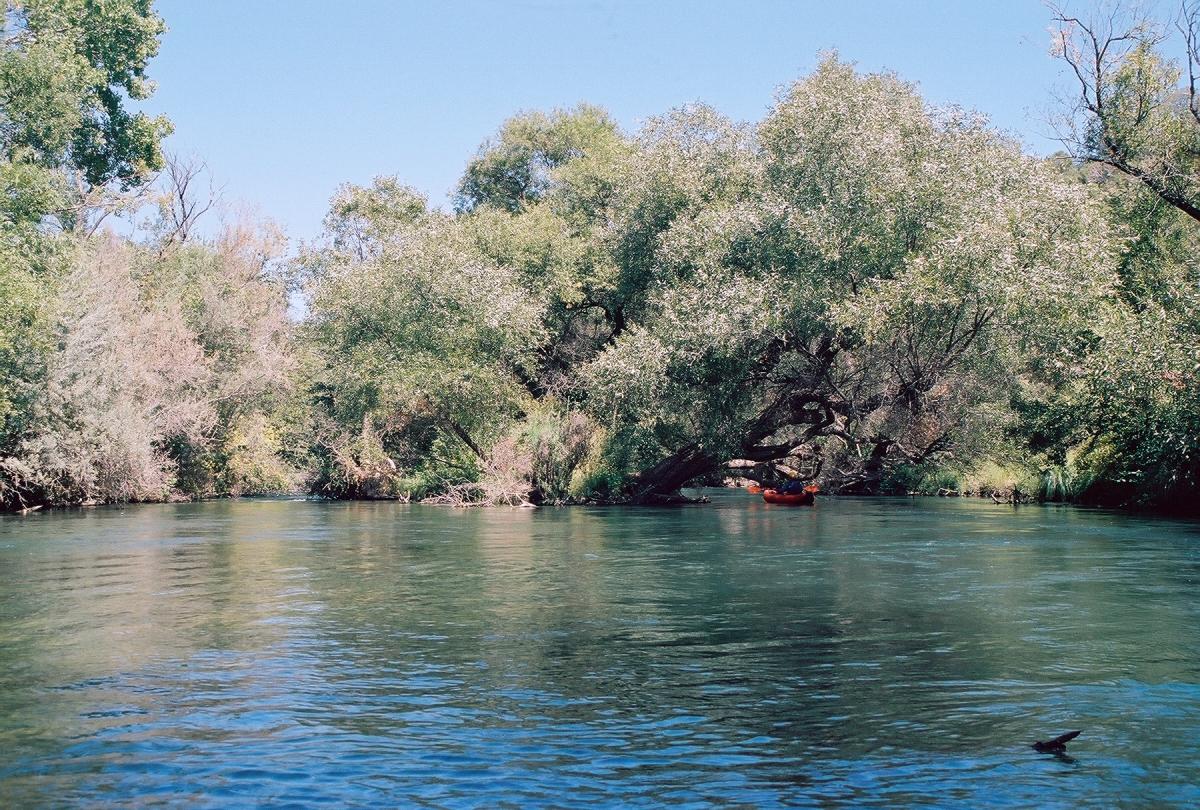
- Otter Pool, a long flat stretch near the resort and campground.
Otters like to hang out when fish stocking occurs.
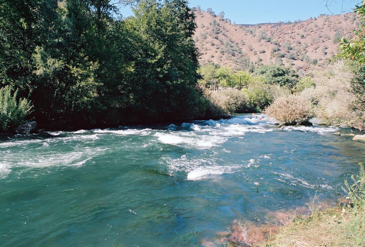
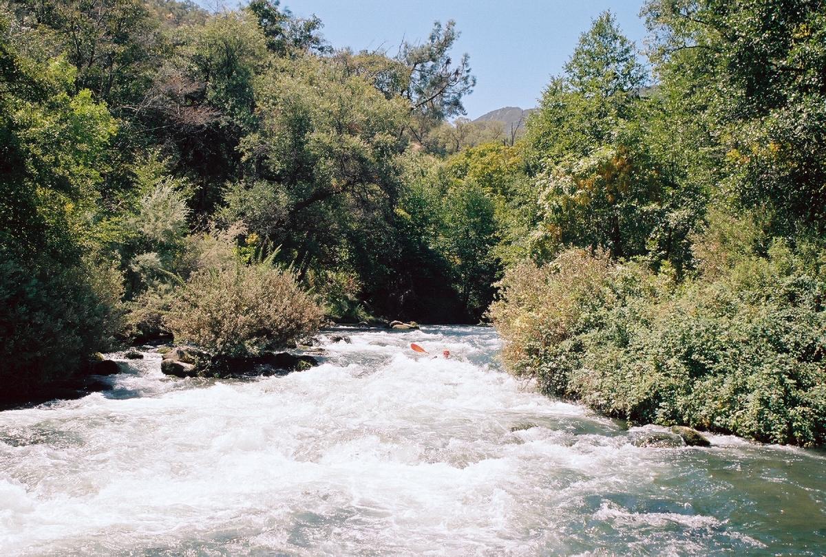
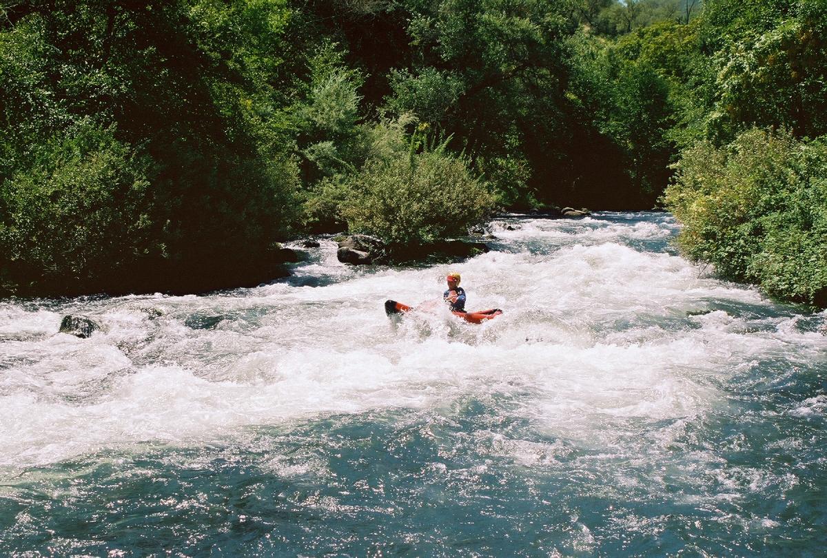
- .5
- Long Arm of the Law, class II+
Enter to the right of an apparent island, and mostly stay right.
The rapid curves left, then sharp left, then immediately right,
then gradually left, before the whitewater finally tapers off.
This is a very long rapid for class I-II boaters! Class III-IV
boaters can enjoy the many surf spots partway down, especially
at the first bend.
-
- .7
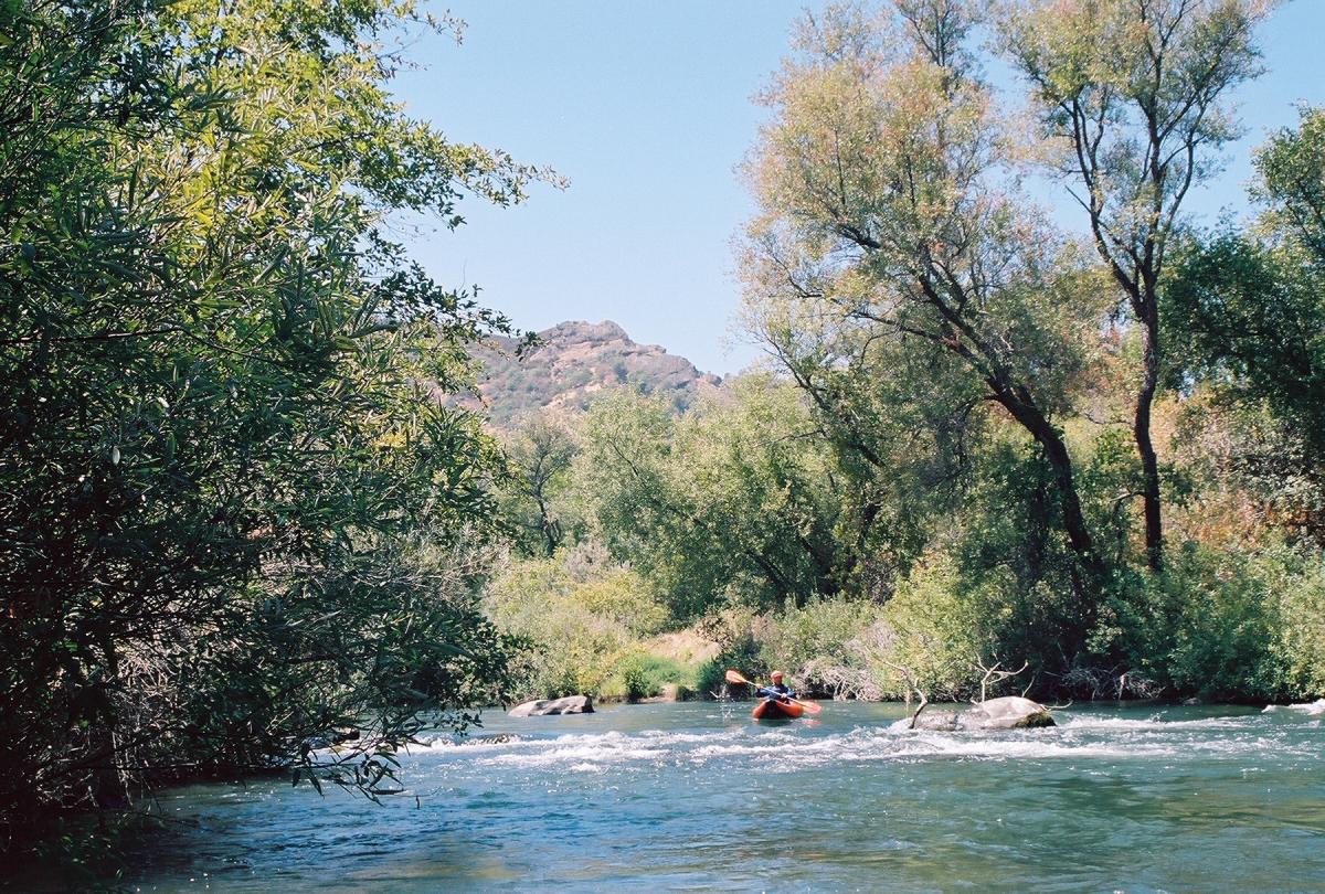
- Arch Pool, a long flat stretch with great semi-wilderness scenery.
High up on the right, especially in morning light, you can see
a beautiful natural stone arch on Pleasants Ridge. A table rock
with small tree sits lower on the ridge.
-
- 1.0
- Gauging station (PUT) on the left.
- 1.1
- Short Arm, AKA Bumper Car, class II
The entrance looks like Long Arm, but this rapid ends quickly.
-
- 1.2
- Interesting rock formation with spherical geodes near water level.
Looking back, you can see the arch and table rock on Pleasants Ridge.
- 1.3
- Dead Ducky, AKA Strainer, class II
A wave train leads directly towards strainers on the left bank.
Many torn vinyl rafts collect here, hence the name.
-
- 1.5
- Turtle Island, class II-
The right channel has more water; the left is marginally runnable.
Moderate waves and some maneuvering around trees.
- 1.7
- Overhang, class II-
Two overhanging willow trees (2009) and many blackberry bushes,
with small waves. Precise boat control is required to avoid trees.
-
- 1.8
- Boulder Baby, class II-
A minor drop in sight of its big brother downstream.
- 1.9
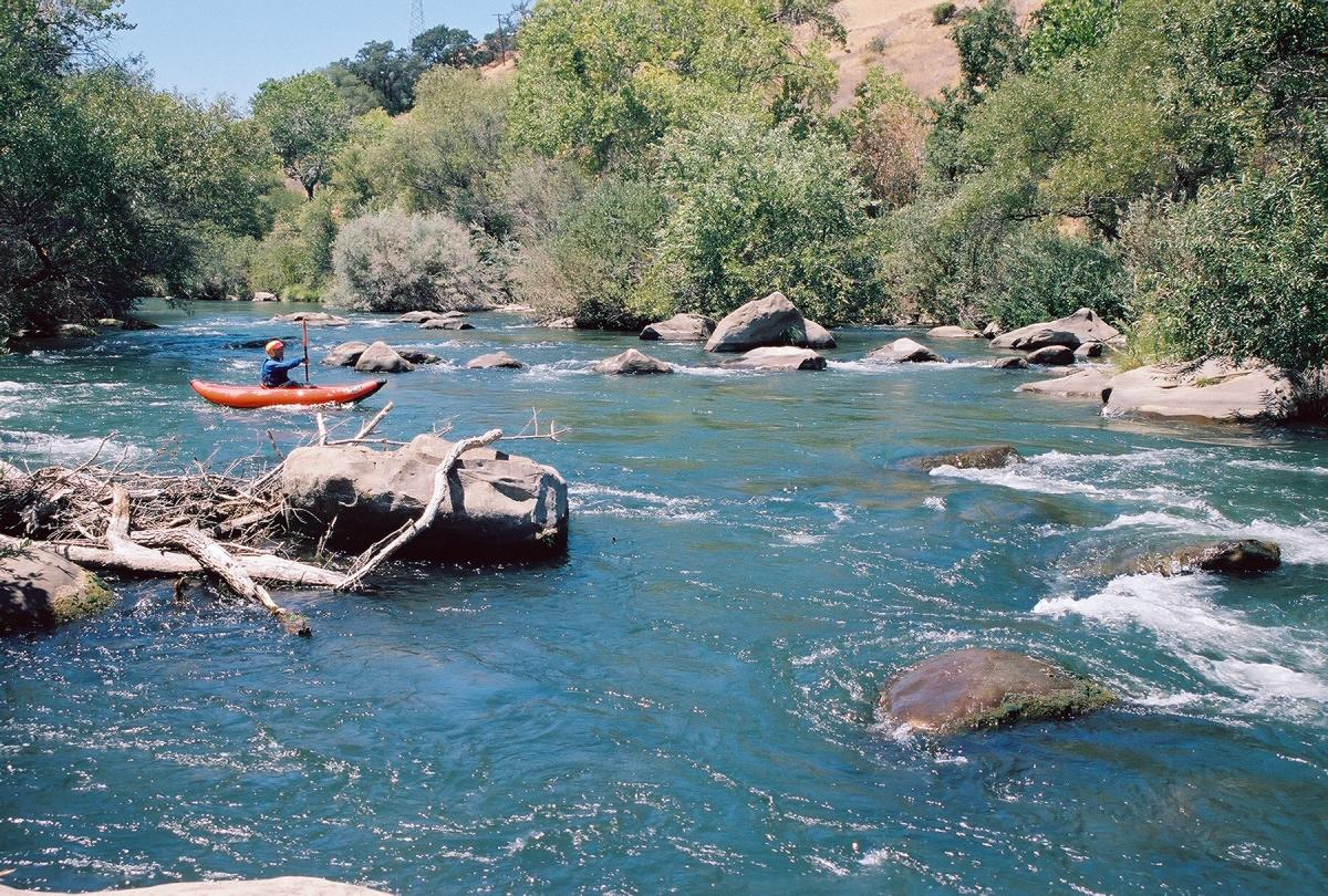
- Bolder Brother, class II
A boulder bar that seems easy to navigate, but underwater rocks
show many colors where plastic kayak hulls have been scraped off.
Quietwater surfing: nothing to increase your heart rate.
Tawny Meadows on the right.
-
- 2.1
- Alarmist's Surprise, class II
A good sized hole at the top can be avoided, boofed, or surfed,
depending on your preference. Aside from the first three rapids,
you encounter this run's biggest hydraulics here, so you might
want to surf a while.
-
- 2.3
- This Is Not a Rapid, class I+
Moving water with surface disturbances, put into this guide
only to boost the rapid count into double digits.
- 2.5
- The creek splits into three channels, the right being deadwater,
while the center and left channels move gently at first.
For the easiest take-out, choose the left channel, avoid some
strainers, and park your boat on the roots of a large tree.
This is the recommended take-out. Below in the left channel
is an impassible strainer (2009).
- 2.6
- Fishing Access #3 accessible from the leftmost channel.
The middle channel turns left and leads to a class II rapid,
which might have a logjam at the top and bottom (2011).
If you run this 11th rapid, take out in swift water on the left bank
and carry your boats up a paved fishing trail to the parking lot.
- 3.2
- Fishing Access #4 and shortly thereafter, #5.
You could continue an additional 1.5 miles to a bridge across small
Solano Reservoir, but one would have to ask why.
- 3.3
- Column Drop, class II, a nice little chute to a decent wave train.
- 3.4
- Skin Deep, class II, where you want to take the farthest right channel.
This rapid is actually quite good with a nice rock boof into a pool
then down a fast chute to a big bouncy wave train that arcs left.
This takes you on the right side channel of the island and finally
dumps you out at the slackwater of Lake Solano.
To reach take-out, drive north from I-80 on Pleasants Valley Road
(east of Fairfield, west of Vacaville, near Lagoon Valley park)
or west from I-505 thru Winters on highway 128.
At the intersection of these two routes,
near a bridge across Solano reservoir,
continue (north) west on highway 128.
After you see sun-drenched Fishing Access #5 and soon #4,
keep an eye out for Fishing Access #3 on the left.
Parking fee is $4 (2009) but leaving a bicycle might be free.
To reach put-in from there, continue uphill 2.3 miles on highway 128.
Eventually you pass a general store and members-only campground on the left.
Just after the bridge across Putah Creek, turn right and downhill
into a large dirt parking lot. The trail to the creek starts
on the far side near a large oak tree. No access fee (2009).
|
|
Creeks Navigation
Home
Recommended Runs
Map of Rivers
Alphabetic Index
Alphabetic Table
Text Search
Sponsored Links
|