| |
| Stretch: |
Fish Hatchery below dam to Shady Cove and below |
| Difficulty: |
Class I with some class II |
| Distance: |
10.5 miles, or up to 31.4 miles, 1 day or more |
| Flows: |
rafts and kayaks 700 - 3500 cfs or higher |
| Gauge: |
measured two miles below put-in
(USGS
site) |
| Gradient: |
15 fpm overall, good current |
| Put-in: |
McGregor Park boat ramp across from fish hatchery, 1540' |
| Take-out: |
Shady Cove Park boat ramp for day trips, 1400' |
| Shuttle: |
9.5 miles (15 minutes) one-way |
| Maps: |
Rogue River, AAA Oregon,
Topo
|
| Season: |
Year round, from reservoir release |
| Agency: |
County parks, but mostly private |
| Notes: |
© 2022 Bill Tuthill,
CreeksYahoo |
This section of the Rogue is a popular do-it-yourself commercial run,
and makes a relaxing day for private boaters.
Above lies a large reservoir, but all dams below to the ocean have been removed.
Scenery is good, especially in the forested upper half.
The lower half of the run passes many houses in town near the end.
The water moves quickly, and you encounter several class II rapids,
so you can splash and surf to your heart's content.
Outfitters tout this as "a three hour tour" (without Gilligan).
Shuttles are available from Rapid Pleasure Rafting
across the road from the take-out at Shady Cove Park,
and from other raft rental companies and fishing guide services
along highway 62 in Shady Cove.
Distances are in cumulative miles, and (in parentheses) miles above the ocean.
Satellite photos were apparently taken at low flows.
In spring and early summer, fewer rocks are visible.
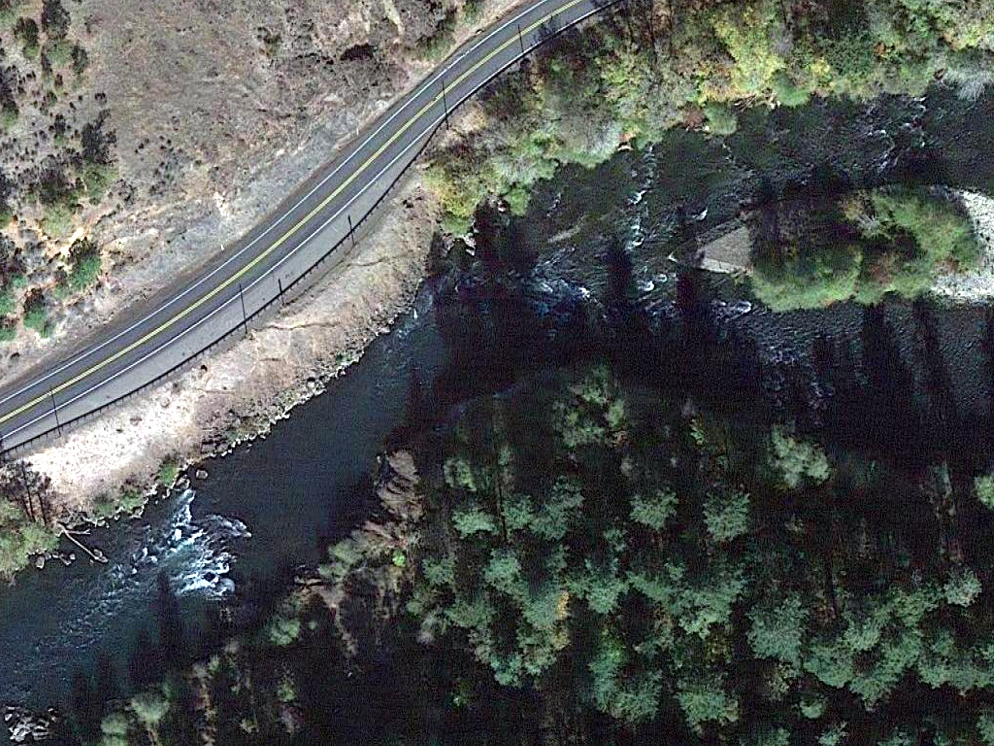
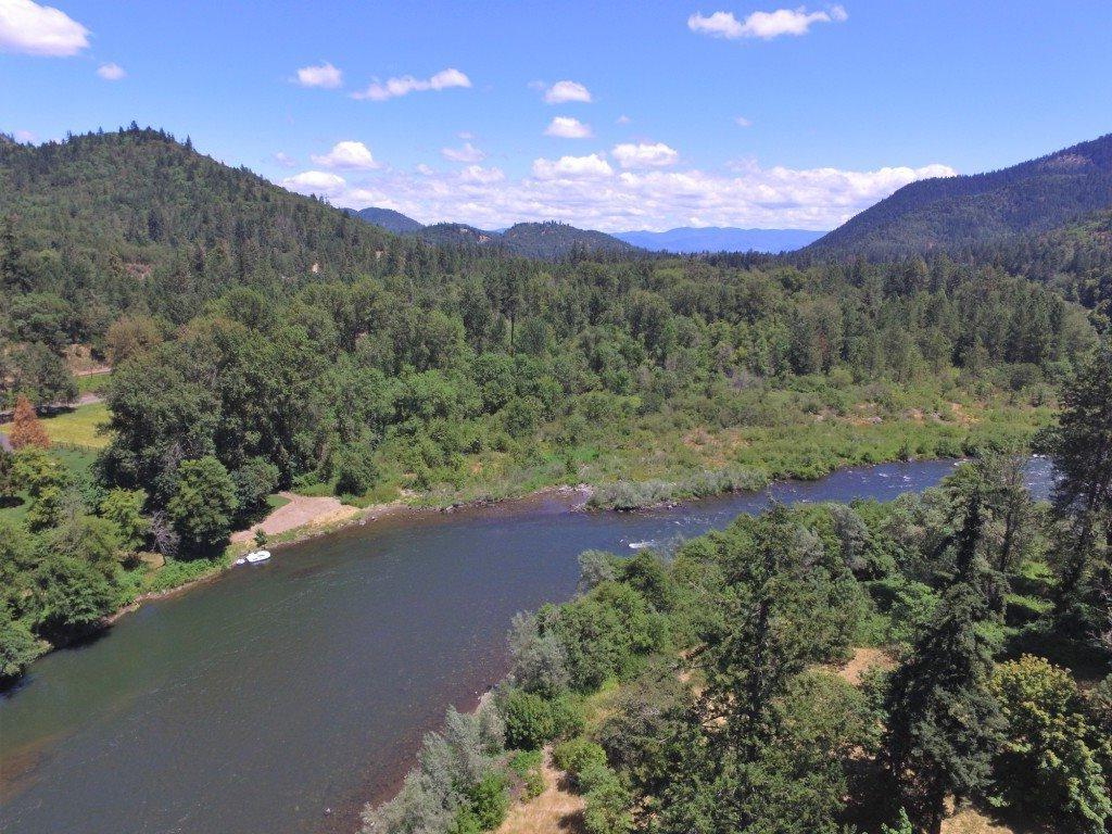
- 0 (156.5)
- Put in at McGregor Park boat ramp on river right,
across the river from the fish hatchery.
A diversion dam with scary looking reversal lies in between.
- 1 (155.5)
- After bending left around McGregor Park fishing access,
the river goes under the first highway 62 bridge,
and Big Butte Creek enters on the left.
Until you pass Elk Creek,
the left channels offer the easiest routes away from brush.
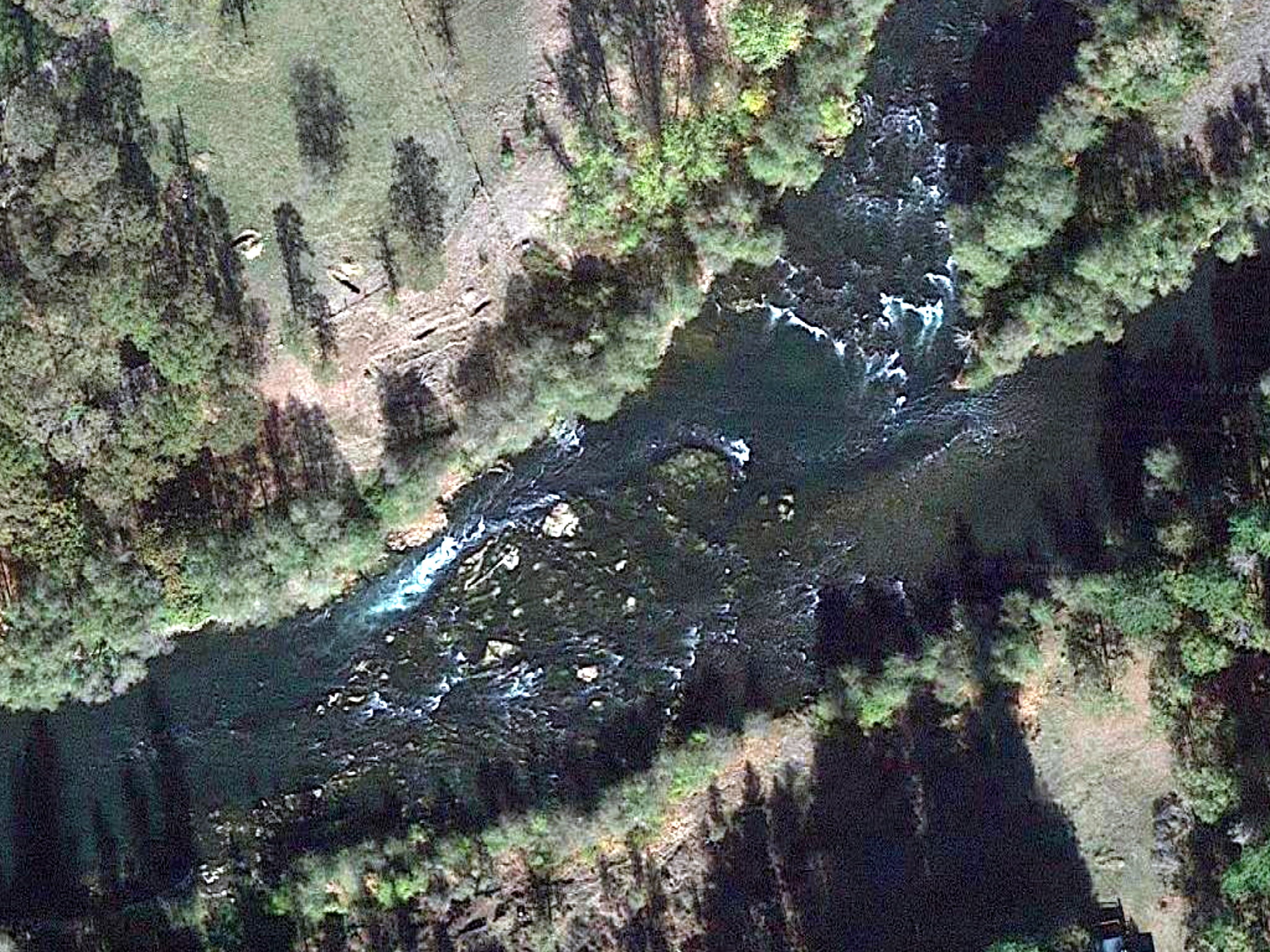
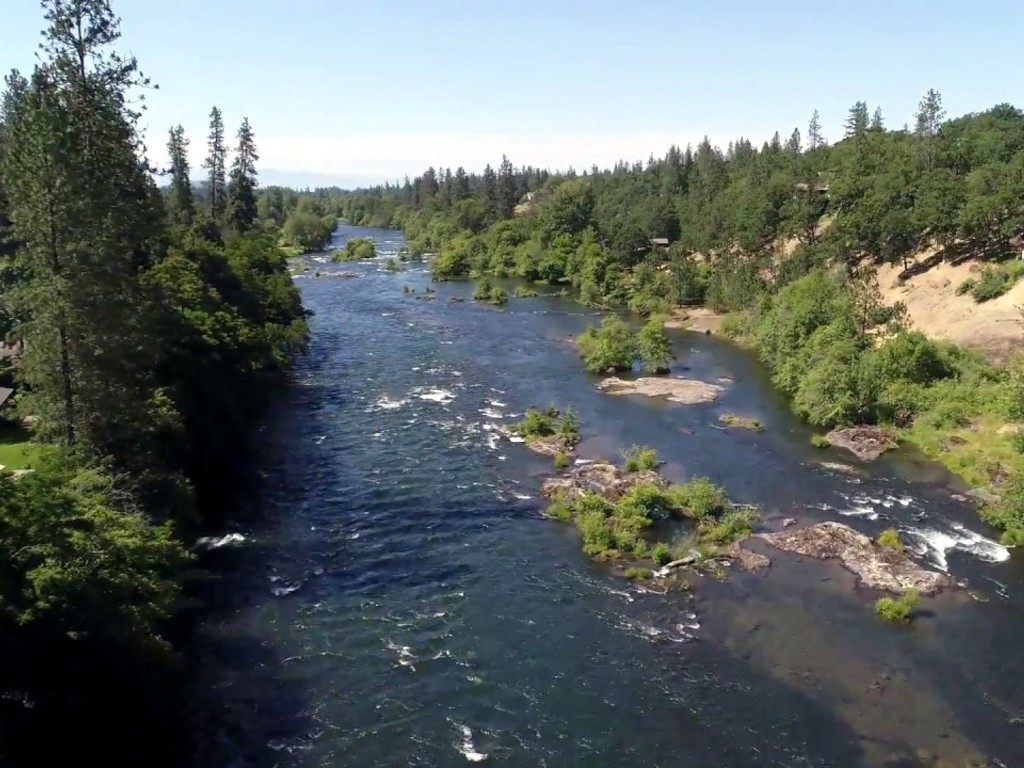
- 1.7 (154.8)
- After a small island, Highway Hole rapid, class II.
-
- 2 (154.5)
- After a large island comes so-called Island rapid,
a relatively long class II. At 3000 cfs it was the biggest rapid.
The narrow right channel misses some of the action.
- 2.3 (154.2)
- A small creek comes in on the right, in the midst of an island,
the end of which you might mistake for Elk Creek.
- 3.9 (152.6)
- Footbridge. Shortly after, Rogue Elk park on the right bank,
mostly fishing access with small boat ramp.
- 4.6 (151.9)
- Elk Creek enters on the right.
-
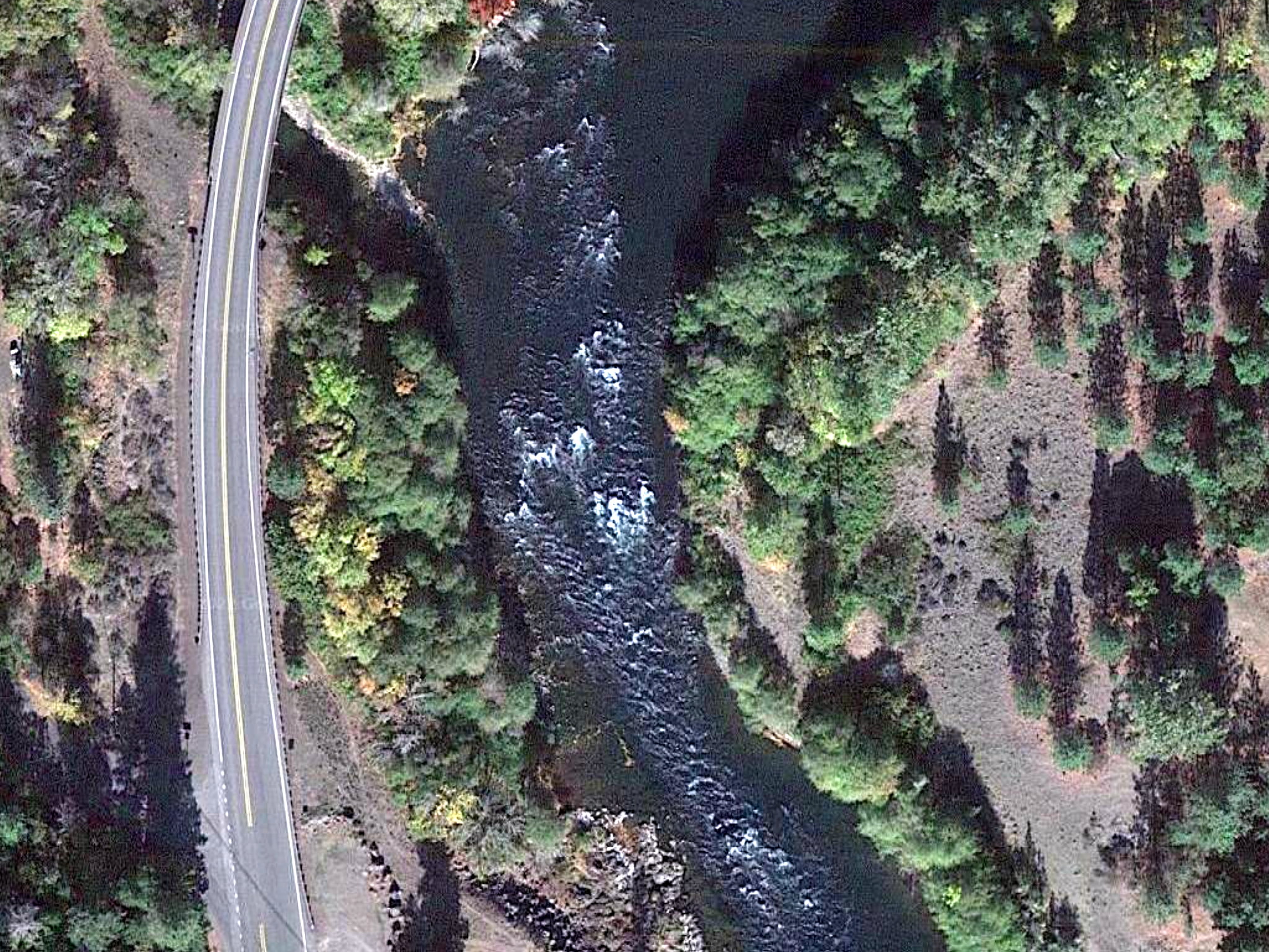
- 5.6 (150.9)
- Cable Hole, followed at a left bend by Cable Hole rapid, class II.
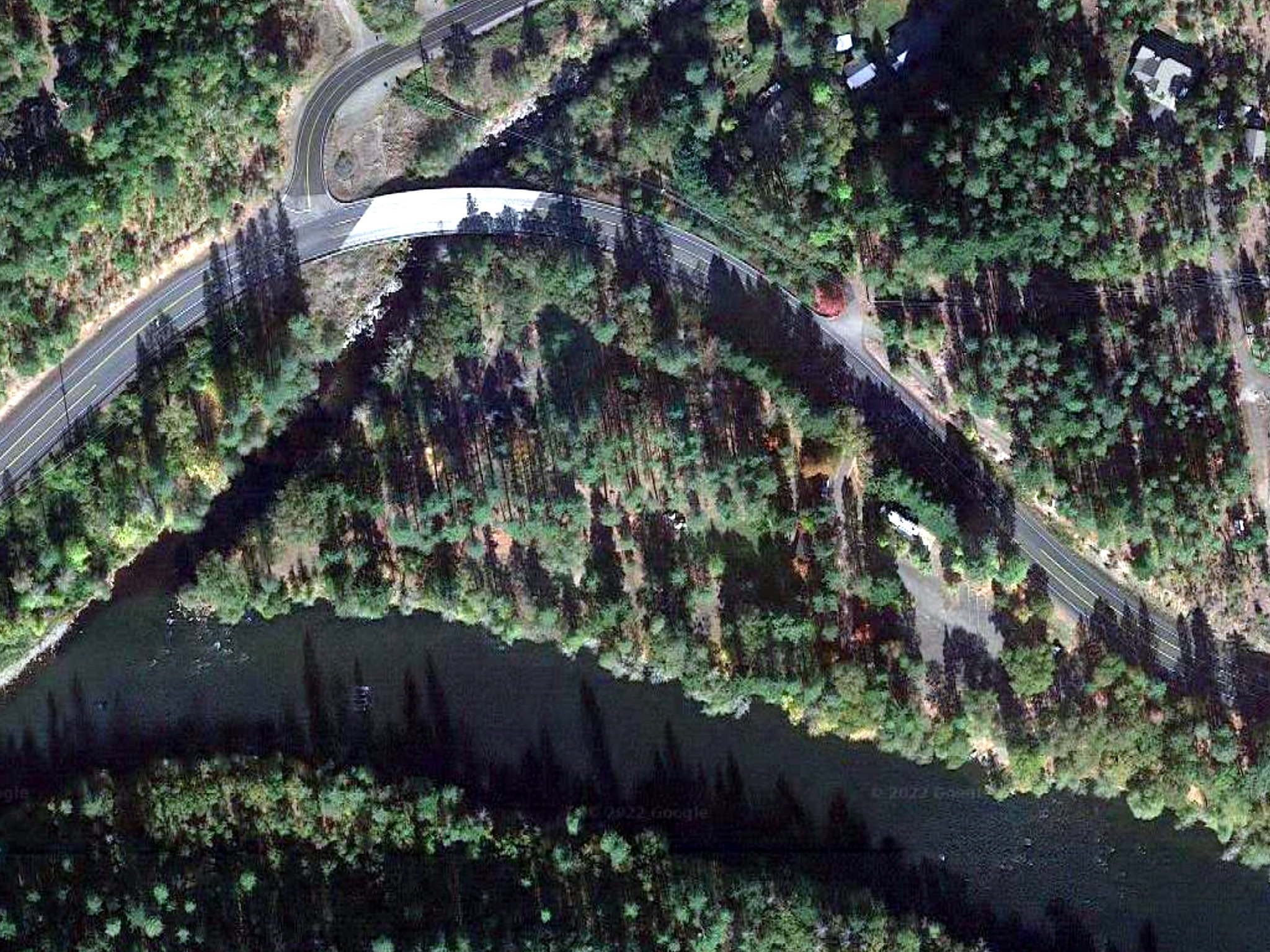
- 7.7 (148.8)
- Highway 62 bridge over Trail Creek makes you think the river goes under,
but instead it bends left into Trail Creek rapid, class II.
- 9.3 (147.2)
- More houses appear on the left bank. On the right bank,
some homeowners maintain beautiful gardens sloping down to the river.
- 10.4 (146.1)
- Highway 62 bridge splits the town of Shady Cove.
Take-out at Shady Cove park is .1 mile below on the right.
-
- 13.6 (142.9)
- River access at Takelma Park on river right,
named after a Native American tribe who lived in the Rogue valley.
- 17.9 (138.6)
- River access at Dodge Bridge Park on river left.
- 19 (137.5)
- Jackson Falls, class II. Starts before a left bend and continues.
- 20.4 (136.1)
- Rattlesnake Rapids, class II.
A series of rapids through cross-river bedrock fences.
- 25.4 (131.1)
- River access at TouVelle Park on river right,
named after orchard entrepreneur Frank TouVelle.
- 28.5 (128)
- After passing through numerous islands,
the river approaches massive Lower Table Rock on the right.
- 30.6 (125.9)
- Former site of Gold Ray dam, now a rapid.
Videos of the dam removal are available on YouTube.
- 31.4 (125.1)
- Fishers Ferry park, with boat ramp.
Downstream is a more difficult class III-IV run.
To reach Shady Cove, drive north 22 miles on highway 62 from Medford,
or southwest 63 miles on highway 62 from Crater Lake.
The town has several motels and many good restaurants.
|
|
Creeks Navigation
Home
Recommended Runs
Map of Rivers
Alphabetic Index
Alphabetic Table
Text Search
Sponsored Links
|