| |
| Stretch: |
Cedar Flat bridge to Hawkins Bar bridge |
| Difficulty: |
Class IV+ (with 4 class V rapids) |
| Distance: |
10 miles, 1 day |
| Flows: |
rafts (500) 800 - 2000, kayaks 500 - 5000 [sic], IK minimum 300
|
| Gauge: |
measured at Cedar Flat
(USGS site)
|
| Gradient: |
46 fpm average, 90/110 fpm at steepest |
| Put-in: |
Cedar Flat river access near highway 299 bridge, 980' |
| Take-out: |
bridge connecting Salyer with Hawkins Bar, 590' |
| Shuttle: |
10 miles (15 minutes) one-way |
| Maps: |
USFS Trinity NF, AAA North California,
PDF map,
Topo
|
| Season: |
late summer, from dam release and snowmelt |
| Agency: |
USFS, municipal |
| Notes: |
© 1998, 2001 Bill Tuthill,
CreeksYahoo |
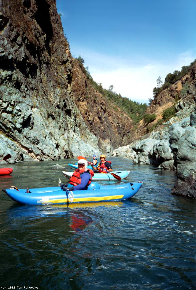
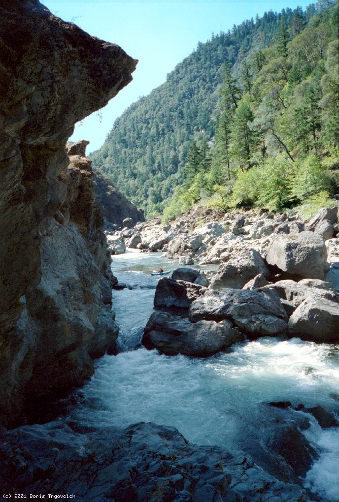
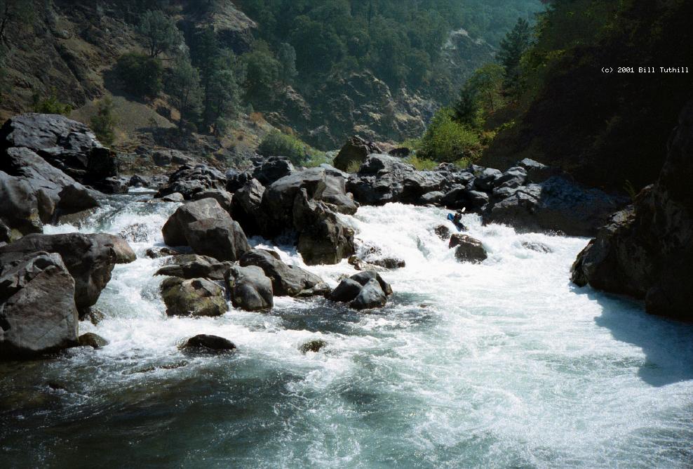
At low flows in late summer, Burnt Ranch Gorge makes an excellent kayak run.
Although this is an expert run, there aren't all that many tough rapids,
because the gorge itself is rather short.
Below 450 cfs many of the undercuts and tunnels are out of play,
and you can run this stretch with minimal hazard to life and limb,
provided you can execute a seal launch below Lower Burnt Ranch Falls.
However the river seldom falls below 450 cfs,
now that dam operations are being managed to enhance fish populations.
Perhaps 500 to 600 cfs is the best you can do.
Be sure to scout carefully and set safety where needed.
In September 1971, after the first successful kayak run of Burnt Ranch Gorge
by Mike Schneller, his father Mel Schneller, and guidebook author Dick Schwind,
Mel suffered a heart attack and died near take-out,
no doubt as a result of all the strenuous portages.
Although this gave the stretch a bad reputation,
expert kayakers soon learned to minimize portaging.
By 1982 even rafters had run all the rapids,
and Whitewater Voyages initiated commercial rafting in 1983.
-
mile
0
- Put in the Cedar Flat river access upriver from where highway 299
crosses a bridge from river right to left. Fun rapids begin under
the highway bridge.
- 1.5
- China Slide municipal dump, an alternate but not recommended put-in.
- 1.8
- China Slide rapid, class IV-
Just after a left bend comes this shallow and rocky drop, usually
run on the right at high flows, or on the left at low flows.
- 1.9
- False Pearly Gates, just class III.
- 2
- Pearly Gates, AKA Auto End-on, class IV+, scout right
The river drops more than 2 meters over rocks and boulders. Below
1000 cfs this one is dangerous for hardshells, which can hit the
underwater rocks end-on; broken ankle evacuations are common here.
Beneath the big boulder blocking the right side, there are some
dangerous-looking underwater tunnels, seemingly avoidable.
-
- Afterwards, the river mellows out considerably for about a mile
as it flows thru Box Canyon.
- 3
- Tight Squeeze, class IV, scout left
The river drops several meters in stages between large boulders, and
the gradient steepens to 90 fpm, then 110 fpm at Burnt Ranch Falls.
This rapid is more feared by rafters than by kayakers because at
low flows only the very-narrow right side is runnable.
-
- 3.3
- Unnamed class IV rapid, probably scout left
- 3.9
- Unnamed class IV rapid, probably scout right
- 4.2
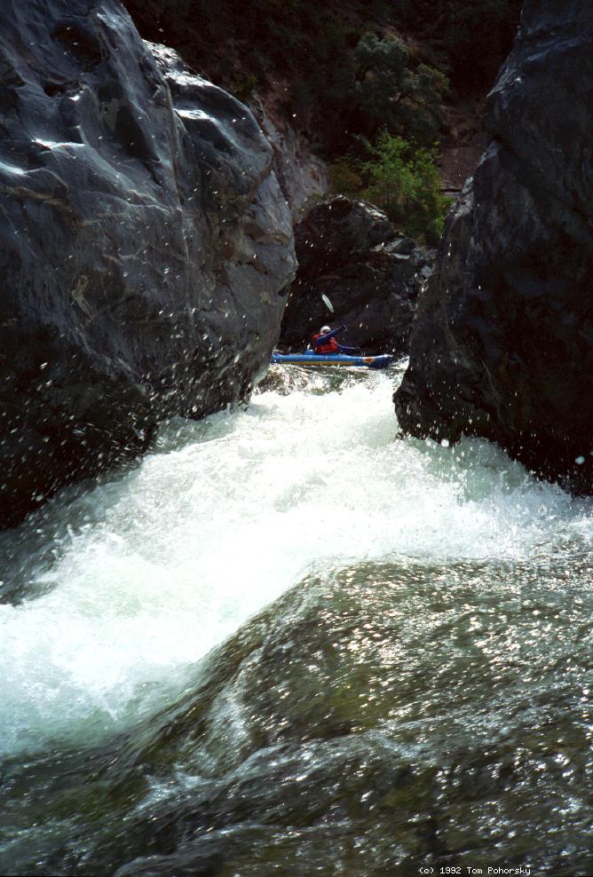
- Upper Burnt Ranch Falls, class V-, scout left
The river drops over several small falls, then over a taller falls,
below which some of the flow goes thru a tunnel along the right bank.
When this tunnel is in play, be sure to set safety here. Assuming
you stay upright in the taller falls, you must ferry left and make a
precise entry into The Jaws, a steep foamy drop between big boulders.
-
- 4.5
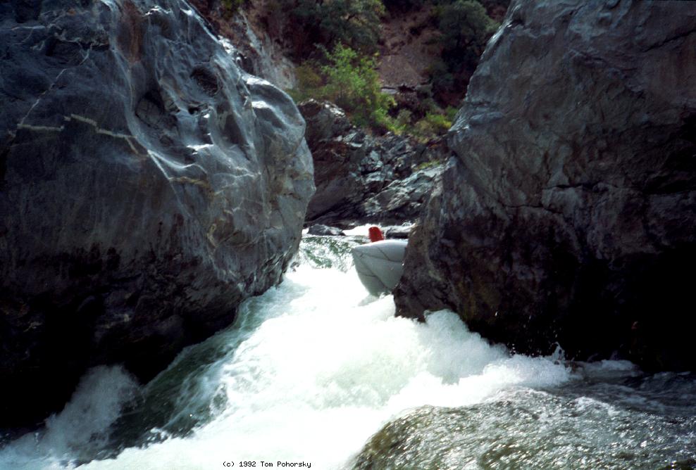
- Middle Burnt Ranch Falls, class V, scout left
The river drops over several meter-high falls, surges against a cliff
on the right, and drops steeply into a huge falls. Although this drop
is probably not any more dangerous than Upper Burnt Ranch, many boaters
choose to drag their boats over the shallow boulder garden drop on the
left, because it is hard to set safety for a run on far river right.
-
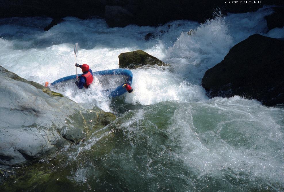
- 4.7
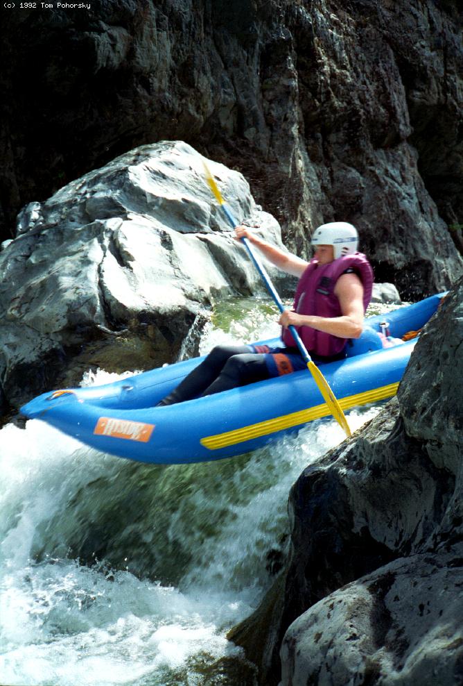
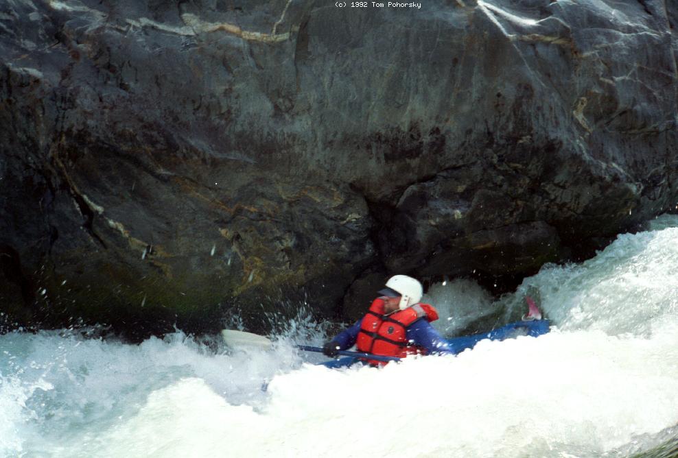
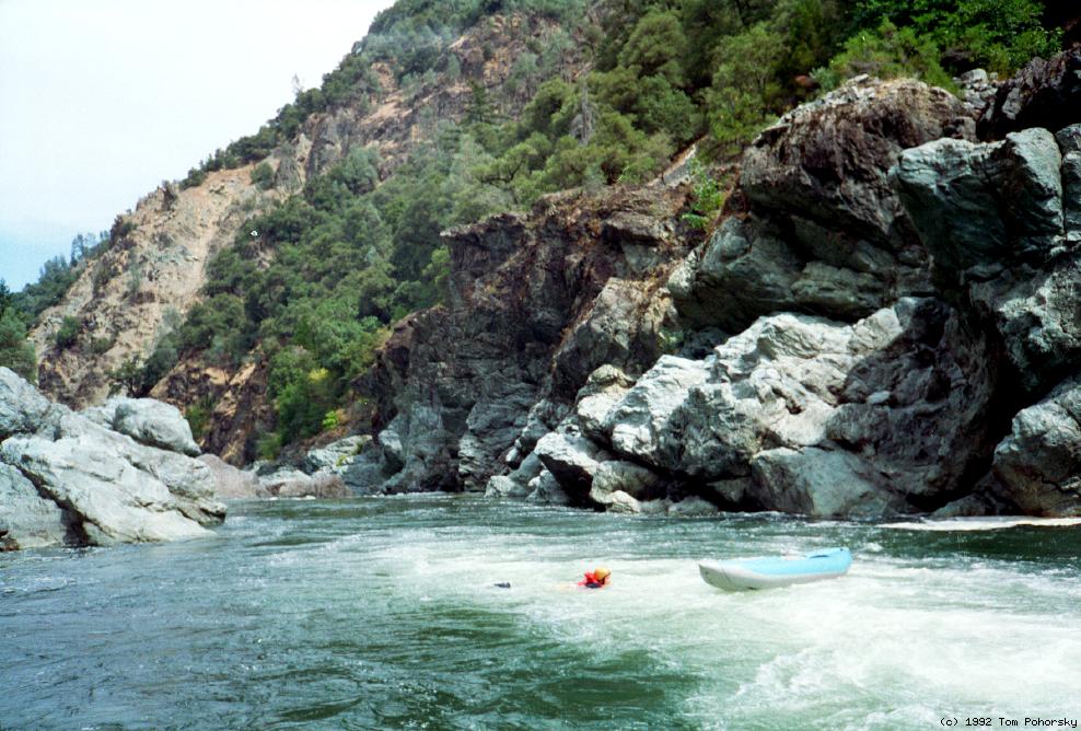
- Lower Burnt Ranch Falls, class V, scout or line left
A curling right turn followed by a long and turbulent drop over many
underwater boulders. It is very difficult to keep an IK upright here,
and the bruising swim is made more dangerous by the possibility of
foot entrapment. Kayakers could hit their heads while Eskimo rolling.
After a rockslide in the early 1980s this one became easier to run
(class V instead of V+) but more difficult to portage (there used to
be an easy portage on the right). Currently the best portage method
(2001) is to execute a seal launch from the left cliff below the rapid.
-
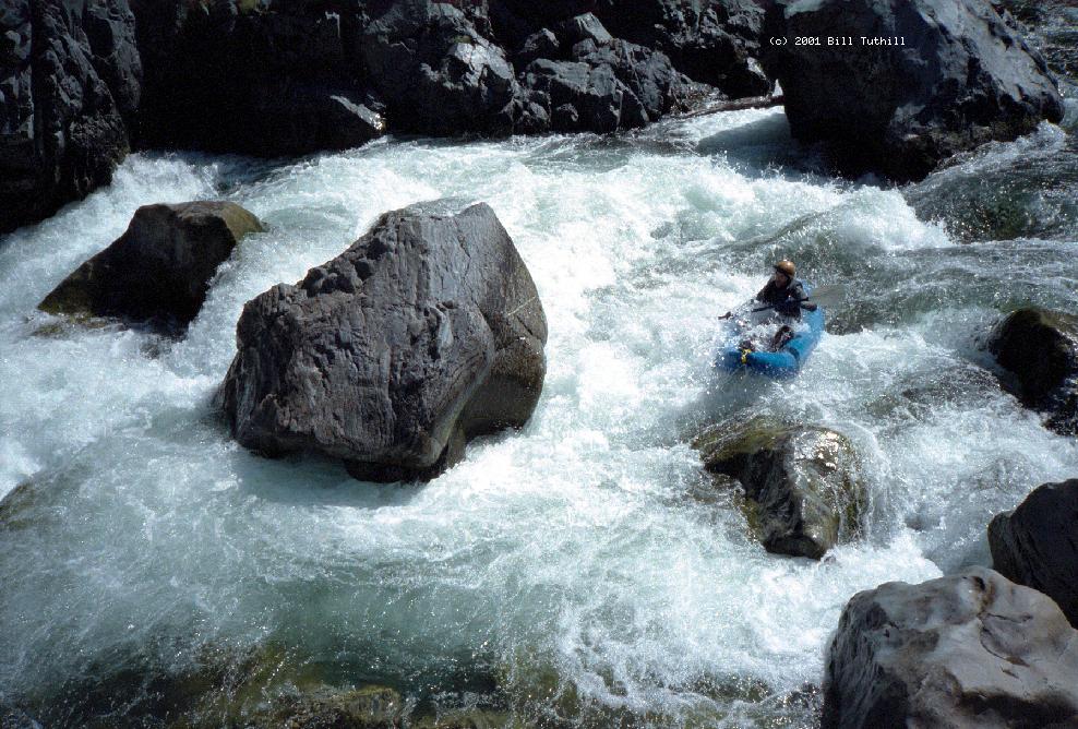
- 4.9
- Hennessy Falls, class IV, scout left
After a long pool, a boulder garden maze contains a right-left zigzag
that is difficult to discern without scouting.
- 5.1
- Origami, class IV+, scout or portage left
A long and complicated boulder slalom leads to a crux at the end.
At high flows some large holes lurk in the crux of this rapid,
and at low flows all good routes are obstructed by holes or rocks.
An advisable sneak route on the left side is usually available at
all but lowest flows. Although this one doesn't seem like a class V,
it often causes carnage because of its technical difficulty.
You might want to run the long lead-in and portage just the crux.
- 5.4
- Table Rock, class IV-, class V above 1000 cfs
A chute feeds into an undercut flat rock. Slower current at low water
makes the ferry move easy, but at higher flows you should consider
portaging on the left.
- 6.5
- New River enters thru a very narrow gorge on the right, making an
excellent side hike or lunch stop.
-
- 7.5
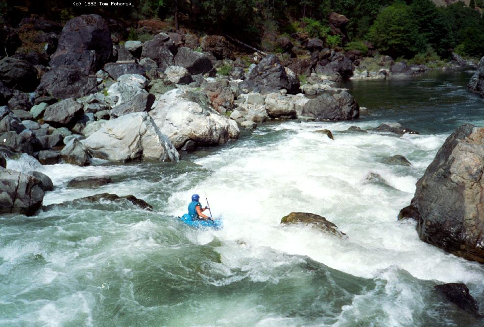
- Gray's Falls, class V-, scout left
Most of the the current moves left thru a rock and boulder maze,
before turning sharp left and tumbling over a steep boulder bar,
then turning right against a partially undercut cliff on the left.
Except at high flows, the boulder bar could cause kayak pins, or
possibly body entrapment for swimmers. At low flows, the far-far
left offers a relatively unobstructed kayak route (autumn 2001).
At high flows, you should choose the rightmost exit to avoid
getting slammed into the somewhat-undercut cliff on the left bank.
If you don't like the looks of the exposed boulders, consider
running the initial section (class III) and dragging your boats
over rocks in the final drop to reduce risk.
- 7.6
- Class II rapids to take-out.
It is possible to carry your boats up the hiking trail to
Gray's Falls campground, although you would probably expend
fewer calories floating three miles to take-out.
Sometimes people carry inflatables down this trail for a
short easy float to Hawkins Bar.
- 10
- Salyer bridge high overhead; a trail climbs the right bank.
- 10.4
- Take out at the large and scenic gravel bar on river left, where
4WD vehicles can drive right down to the river. A well-graded
dirt road leads down to this designated river access point
starting across highway 299 from the Hawkins Bar general store.
To reach put-in, drive west from Redding on highway 299 about 89 miles
to the Cedar Flat river access. If you cross a bridge to the left bank of
the Trinity river and start climbing uphill, you have gone too far.
To reach take-out from there, continue west on highway 299
to the Hawkins Bar general store.
Just across the highway, a dirt road starts along a line of trees
and descends to the river over USFS land.
|
|
Creeks Navigation
Home
Recommended Runs
Map of Rivers
Alphabetic Index
Alphabetic Table
Text Search
Sponsored Links
|