| |
| Stretch: |
Hoopa to Weitchpec |
| Difficulty: |
Class II (one III) |
| Distance: |
9 miles, 1 day |
| Flows: |
rafts 800 - 8000, kayaks 500 - 8000
|
| Gauge: |
flow measured just upstream at Hoopa
(HPA) |
| Gradient: |
9 fpm average, slow at times |
| Put-in: |
mouth of Mill Creek below Hoopa, 280' |
| Take-out: |
Klamath confluence at Weitchpec, 200' |
| Shuttle: |
11 miles (15 minutes) one-way |
| Maps: |
USFS Lassen NF, AAA North California,
Topo
|
| Season: |
year round, might be too high after rainstorms |
| Agency: |
Hoopa Indian, private |
| Notes: |
© 1997 Bill Tuthill,
CreeksYahoo |
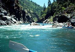
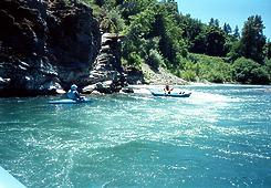
This is a good run thru a dramatic canyon with some class II rapids,
plus a bigger rapid that you might need to portage.
The rapids are not as consistent as on the upstream Salyer run,
but scenery makes the trip worthwhile.
Here is the latest
Flow Schedule
for Lewiston Dam releases.
There are two good USFS campgrounds nearby:
Tish Tang between Willow Creek and Hoopa,
and Gray's Falls just east of Hawkins Bar.
There are nice motels and Indian casinos in the town of Hoopa.
- mile
- 0
- Put in along the gravel bar on either side of Mill Creek.
The gorge deepens ahead, creating some tricky hydraulics.
- 1.5
- Entrance to Weitchpec Gorge.
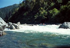
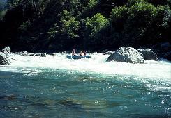
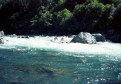
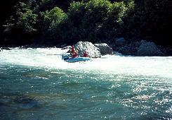
Aside from the class III downstream, there is only one rapid
that might require scouting, shown below.
-
- Power poles along highway 196 are occasionally visible high
on the right bank. The left bank is total wilderness.
- 7.5
- Bull Creek enters on the right. Class II rapid just below.
- 8.2
- Smoker's (or Weitchpec) Falls, class III. Scout or portage right.
This rapid can change during flood years, but in the mid 1990s
it was best run by starting on the left and working right of a
big hole and boulder fence on the bottom left. The hole is not
a keeper, but can easily tip kayaks over. The principal hazard
is the boulder fence, which might trap swimmers. There is an easy
portage on the right, at river level. Named after a local family.
-
-
- 8.4
- Alternate take-out if you decide the Klamath is too high.
This take-out involves a long climb up the right bank to
Pearson's Grocery, the Weitchpec general store.
- 8.6
- Confluence with the Klamath. Potentially big eddy fence as
the water becomes brown and the flow increases dramatically.
You need to work across to river right. It might be easiest
to cross the eddy fence at the top, or it might be better to
continue downstream to where the flows merge.
- 9
- Gravel bar on right, with trail leading up to parking area.
To reach put-in, follow highway 299 until the town of Willow Creek,
and turn north onto highway 96.
Past the town of Hoopa, there is a rusty old sawmill near Mill Creek,
just before the highway starts climbing out the the valley.
To reach take-out, continue on highway 96 to the town of Weitchpec.
Turn left onto highway 169. Shortly after crossing the Klamath river,
turn left and drive down a dirt road towards the river.
You'll need to carry boats uphill from the Klamath to the parking area.
While you're in the area,
consider combining this run with other ones on the Trinity.
If you're short on time,
try the run from Riverdale Park to Tish Tang campground,
which is mostly class I-II with one good class II+ rapid.
If you haven't done it already,
try the run near Salyer, which offers more rapids.
If you found this run too easy,
go upstream and try the run from White's Bar to Cedar Flat,
which offers several good class III- rapids.
|
|
Creeks Navigation
Home
Recommended Runs
Map of Rivers
Alphabetic Index
Alphabetic Table
Text Search
Sponsored Links
|
