| |
| Stretch: |
Lumsden Campground to Don Pedro Reservoir |
| Difficulty: |
class IV (one class V-), IV+ above 4000 cfs, V above 8000 cfs |
| Distance: |
18 miles, 1 or 2 days |
| Flows: |
rafts 1000 - 5000 cfs, kayaks 600 - 8000, IK minimum 500
|
| Gauge: |
a bit less than Don Pedro daily average inflow
(DNP) |
| Gradient: |
35 fpm average, much steeper at beginning |
| Put-in: |
upper Lumsden campground or (rafts) above Rock Garden, 1440' |
| Take-out: |
Ward's Ferry Bridge high above the reservoir, 850' |
| Shuttle: |
30 miles, including 5 miles on dirt (over an hour) one-way |
| Maps: |
Stanislaus NF, AAA Yosemite,
Topo
|
| Season: |
summer into early autumn, from dam release |
| Agency: |
USFS, permit required May - September,
guided Whitewater Rafting |
| Notes: |
© 1998, 2000, 2014, 2015, 2016 Bill Tuthill,
CreeksYahoo |
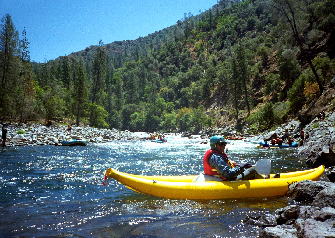
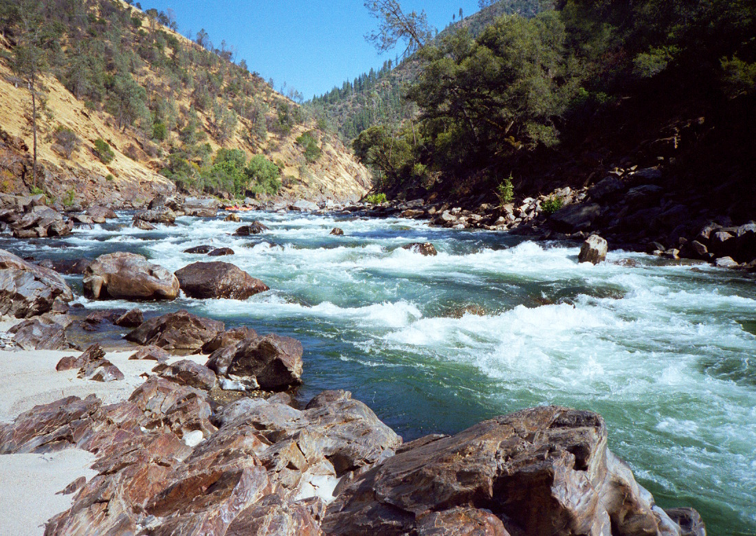
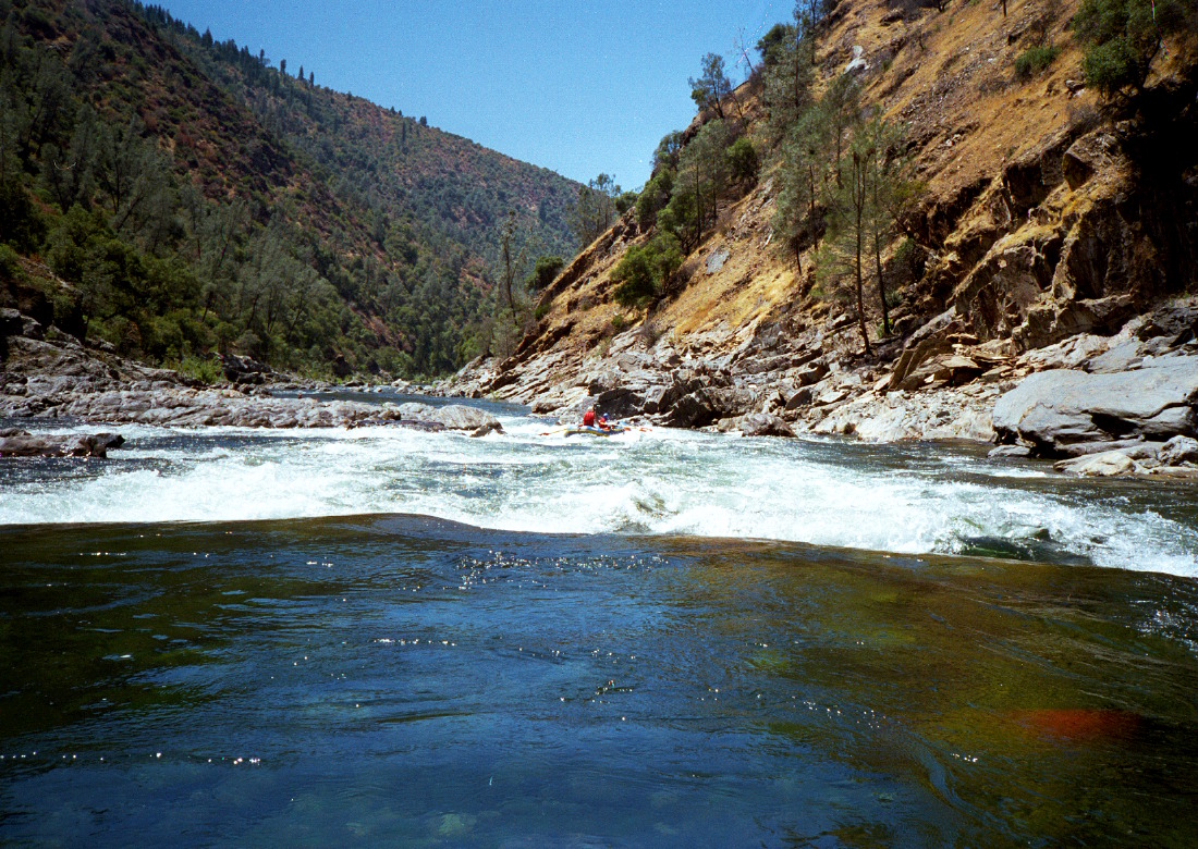
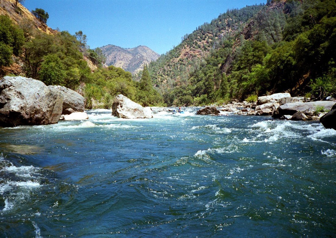
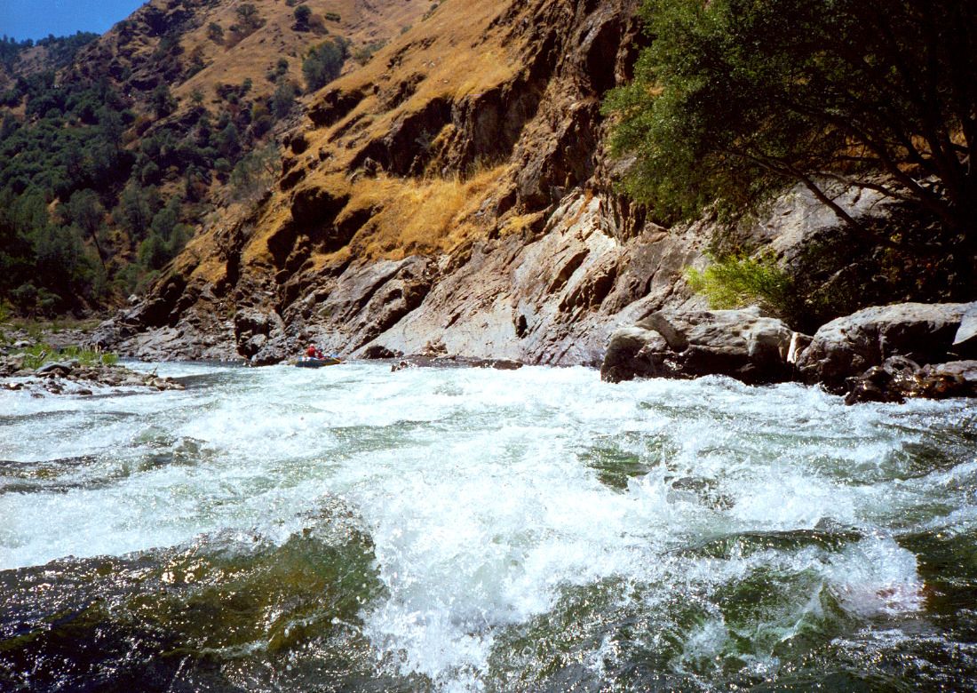
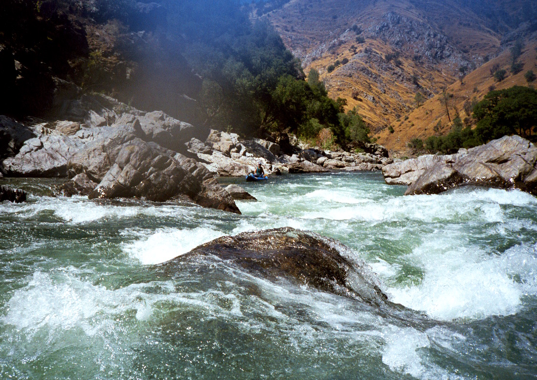
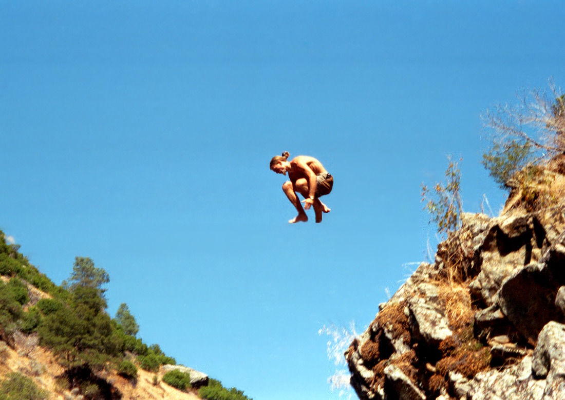
This total classic is one of the finest whitewater runs in California.
The rapids are exhilarating without being very dangerous,
camping is excellent, geology is interesting, and scenery is good.
This is one of the best overnight rafting trips in California.
Forests especially on the south side had regenerated after wildfires of the early 1980s.
Then the devastating Rim Fire, started in August 2014,
crossed the river from the Clavey river towards Groveland,
but left very little damage visible from river level.
The road to put-in was greatly improved during fire fighting efforts.
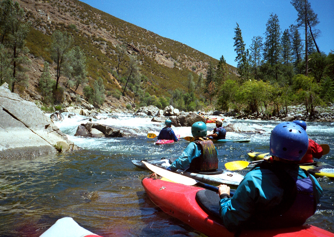
Although the Tuolumne is runnable in springtime,
there are usually many other rivers running at that time,
so many boaters save this run for summertime when little else is running.
In May and June, snowmelt can create flows well above 8000 cfs.
By July, dam releases create a more moderate 900-1300 cfs,
and fish flow (200-500 cfs) sometimes on Wednesdays.
Permits
are required from May 1st thru September 31st,
selected by fee payment and lottery during the off-season.
High water permits are the most sought-after.
Kayakers can often pick up cancellations
almost any weekend in August or September.
Note the port-a-potty requirement,
which encourages kayakers to make the run in a single day.
Rafters have a hard time making a one-day run at summer flows.
The shuttle is long and arduous.
One cost-effective alternative is to drive your vehicles uphill
early in the morning, pick up your permit at 8 AM,
pay for a half shuttle at Casa Loma Store,
then hitch-hike down to put-in.
That way, your vehicles will be at take-out when you get there,
and you can exit the easy way towards Sonora.
Later in the season, when hydropower releases reach Lumsden around 11 AM,
if you have a vehicle suitable for consolidation,
you can meet early at take-out and be ready by the time flows come up.
Full shuttles from Lumsden campground to Ward's Ferry are available (2014),
a convenient but more costly option.
Kayakers running Cherry Creek are often willing to bring a vehicle
uphill from Lumsden to Casa Loma Store in late afternoon.
A mnemonic for remembering the first letter of major rapids thru Clavey is:
“Rabbits never sleep having rested in pizza sauce, except after Clavey.”
Dan Dunlap suggested this mnemonic for the entire run:
“Rocky never slows his raft in large swirling eddies be-cuz ...
going thru slowly confounds his manic paddlers.”
- mile
0
- Put in on the left bank at Meral's Pool, near the river flow gauge.
- .1
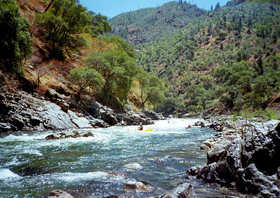
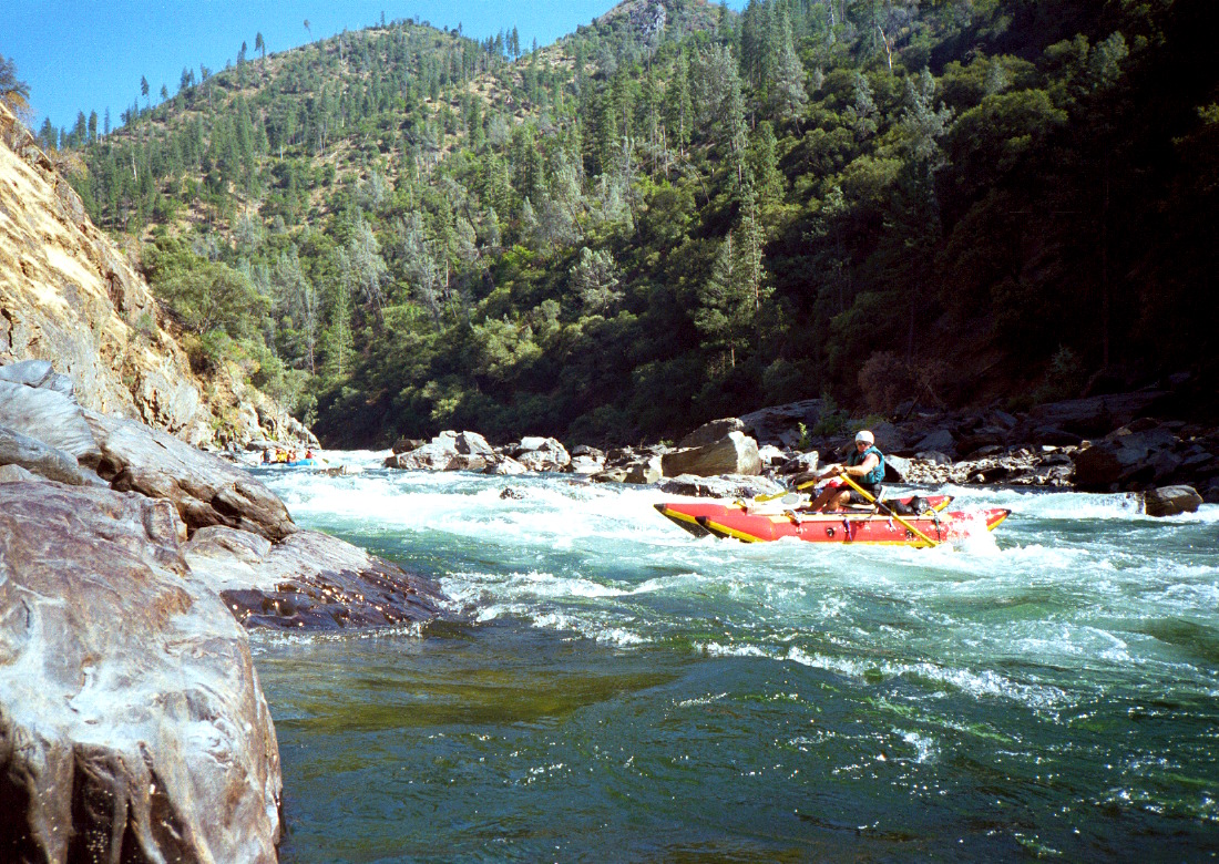
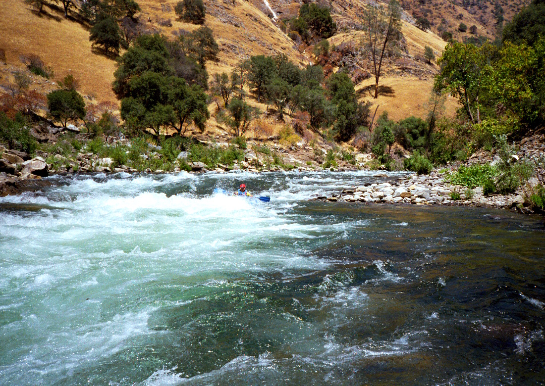
- Rock Garden, class IV, scout right
Runnable almost anywhere in a kayak, and great fun too.
At low water, a real pain for rafts; wraps and wedges are commonplace.
At low flows, rafts must enter right and make a yo-yo move
sharp left behind a large rock outcropping. At moderate flows, boats
can run far left all the way. At high flows, the sneak route is down
the right side, and another rock outcropping near the bottom creates
a huge reversal about the size of a suburban swimming pool.
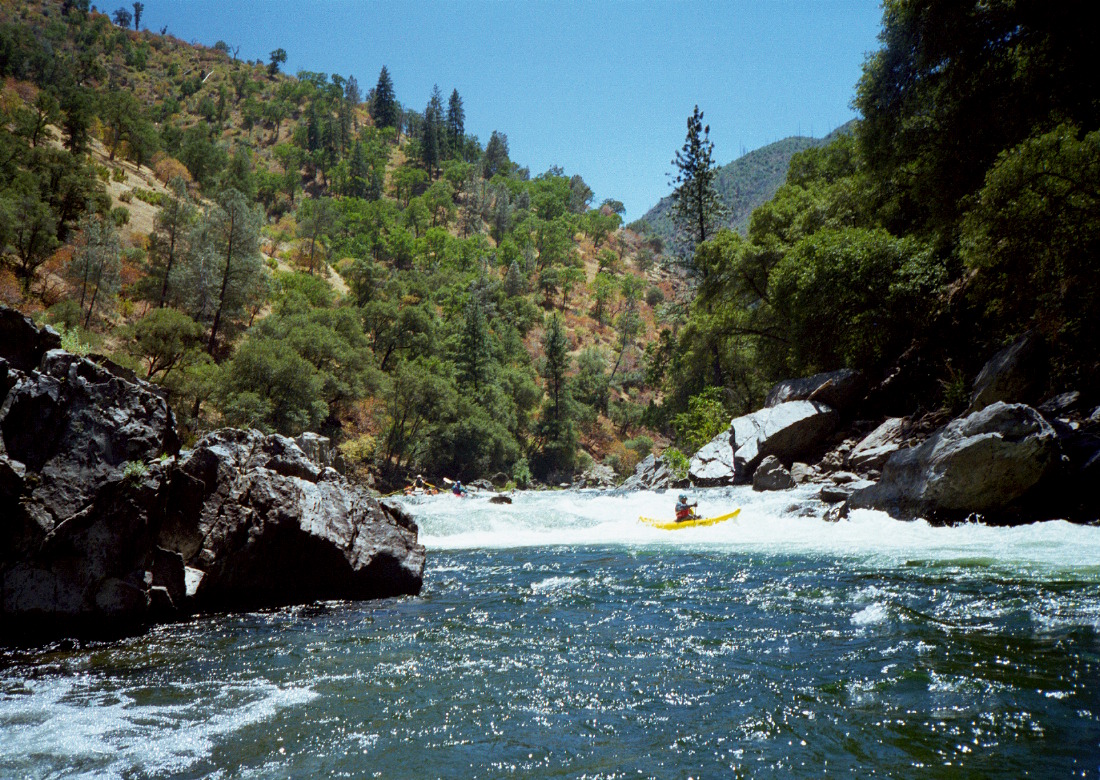
- .4
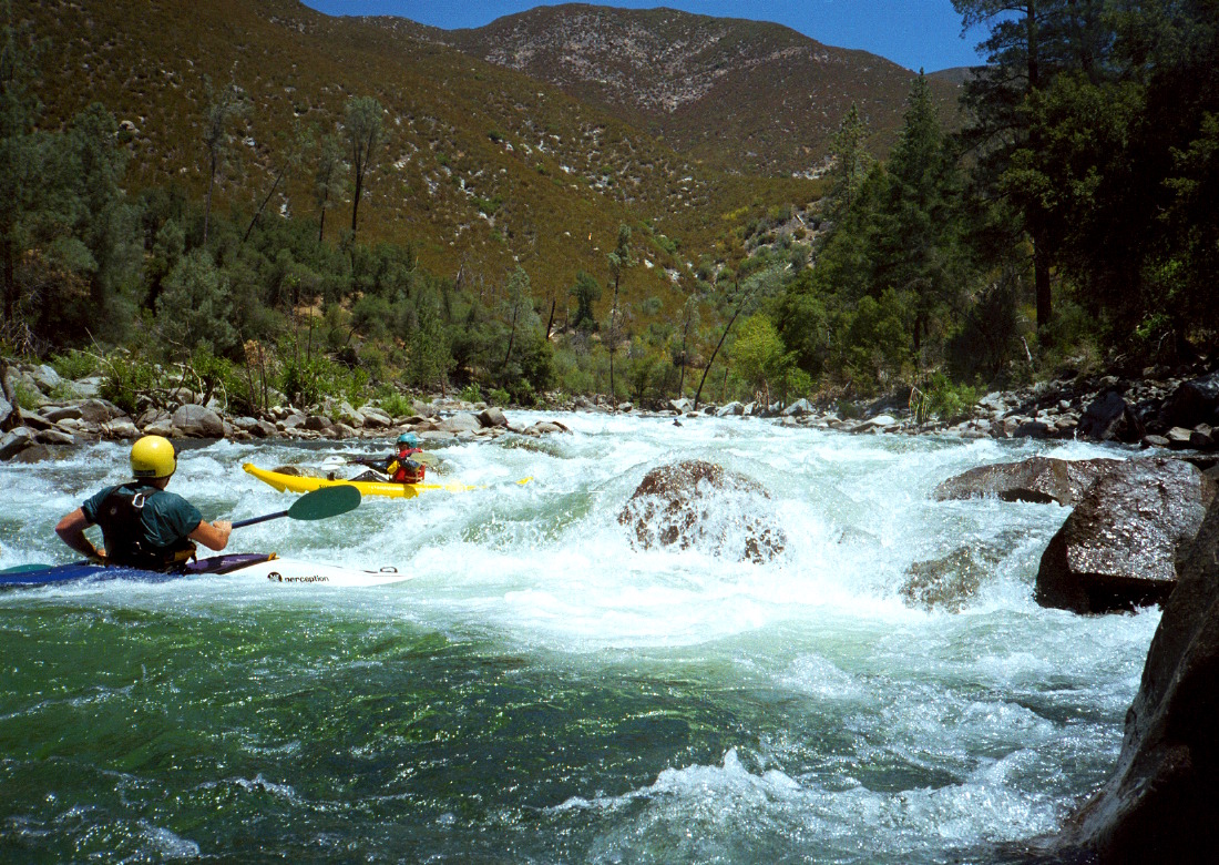
- Nemesis, class IV-, hard to scout
This rapid starts with a boulder field of moderate gradient, continues
into some bigger drops, then piles into a rock cluster, the Nemesis
itself. Although the rock cluster might change with future floods,
the current route is center, diagonally left to right. At high water
the sneak route is on the left. Some additional drops and slaloms
present themselves below.
-
- .8
- Sunderland's Chute, class IV+, scout left
The river turns right and drops over a gravel bar on the left and a
series of rocks against a small cliff on the right. You can scout
this rapid by walking over the gravel bar among willow trees. At low
and moderate flows, you probably want to enter on the right to avoid
right-tending currents. Find a good opportunity to ferry left and
avoid the huge holes at the bottom right.
- 1
- Hackamack's Hole, class IV-, boat scout
Contains two rocks near the center. It's easy to navigate between
them at low flows, but at high flows they create a single reversal.
Named after Bob Hackamack, a longtime Sierra Club river activist.
-
- 1.5
- Ram's Head, class IV, scout right
After a short respite, the river bends left, drops over a gravel bar
on the right, and piles into a cliff on the left (a smaller mirror
image of Sunderland's Chute). There are rocks to avoid and drops to
punch in the upper section, but the main problem is a large rock
(class V hole above 3500 cfs) smack dab in the middle near the bottom.
You can go either right or left of the Ram, but you must decide.
- 1.9
- India, class IV-, boat scout
After another short respite, the river narrows and curves sharply
left against the right wall, into a hole. Named after an early
femal kayaker, young India Fleming.
- 2.1
- Lower India, AKA Phil's Folly, class IV-, boat scout
Swift water continues over some drops leading into several rocks
with blind exits. Kayaks have no problem here, but at low flows
rafts are restricted to one or two channels between the rocks.
After this, relatively easy rapids follow for about two miles.
- 3.3
- Tin Can Cabin camp on the left bank, connected by hiking trail
to Lumsden Road.
-
- 4.2
- Ugly-Easy, class III, a long curving rapid into bedrock, ending
with in a big hole on the left and an easy tongue on the right.
Shortly below, just above Stern, is Zach's Falls: not remarkable
at low flows, but big waves and a huge hole at high flows.
- 4.4
- Stern, class IV, possibly scout left
Big boulders block the river. For rafts at low summer flows, this
is one of the most feared rapids on the river. At higher flows
many routes appear, so this rapid becomes easier. The low water
route is a boat-width channel between the leftmost boulder and the
cliff on the left. The drop just before the narrow channel contains
a diagonal wave that turns boats rightward, so be sure to counteract
that tendency with the appropriate strokes.
- 4.7
- Evangelist, class IV, possibly scout left
The river veers right and enters a series of drops. The second
or third drop contains a large rock (hole at high flows) right of
center, and the best low-water route is to the left of that rock.
Rafts sometimes get wrapped there, in which case, this one will
make a believer out of you! It's holey (groan).
- 5.2
- Airborne, AKA Bent Thole Pin, class IV-, possibly scout right
An innocent-looking series of drops leads into a steep falls over
some rocks that plug the exit. The left side drops more gradually,
with thr best route in the shape of a 2 (Z from below).
A large rock wall lurking on the left below has jammed rafters' oars,
hence the old name of this rapid. Clavey follows almost immediately.
-
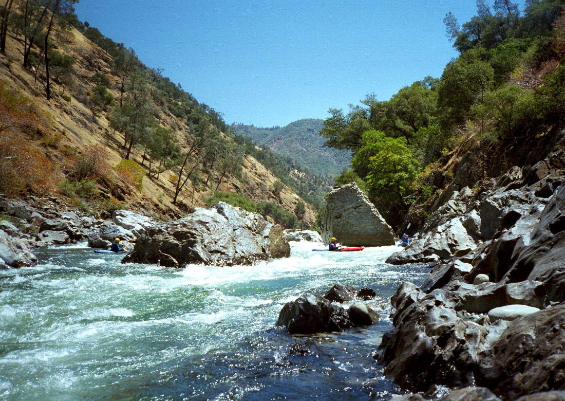
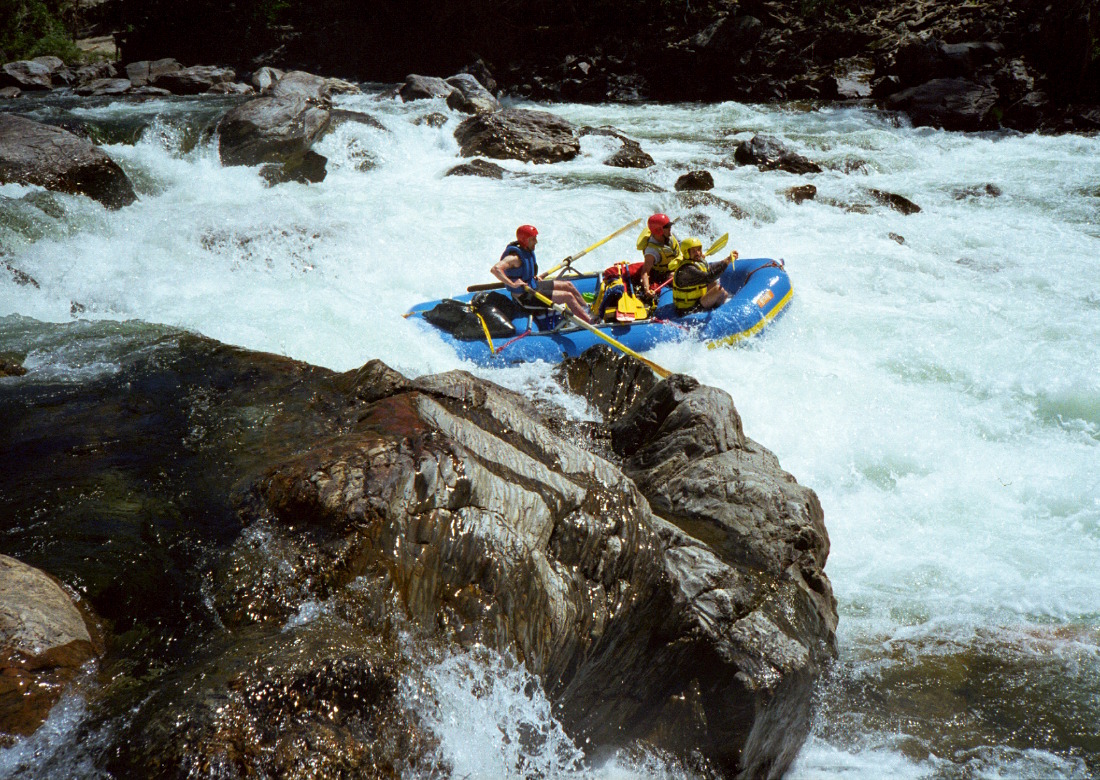
- 5.4
- Clavey Falls, class V- or IV+, scout right or left
On river right just past the Clavey confluence, the Tuolumne drops
over a 3 meter falls into rock-strewn turbulence, surges into a
cliff on river left, then crashes into a large holes downstream,
and finally collects to the left past Dinosaur rock before reaching
somewhat calm water.
- The route on the right is rated class V- for injuries it has caused,
such as kayak pins and broken bones. An alternate class IV+ route
on the left is available for kayaks, but is too narrow for rafts
below about 1500 cfs (depending on raft size and boater skill).
This semi-sneak route starts left of a low island, drops steeply
thru some rocks, then drops again between two underwater boulders
forming a goalpost, and joins the raft route well above the large
holes. Using either route, the holes can be avoided by paddling to
river right, but avoidance is easier when you start from the left side,
because this eliminates right-to-left momentum caused by the steep falls.
At flows above 3000 cfs most rafts choose the left-side semi-sneak route.
- Scout right if you are in a raft, except at higher flows. Scout left
otherwise. A narrow trail follows the left bank under tree cover,
stopping just short of the aforementioned cliff. First timers
might also want to scout the hole and lower rapid from the right,
then scout the entrance from the left before running it. Portage on
the right if you decide not to run the kayak route, which really isn't
much harder than Sunderland's Chute, and is less turbulent if you
take the correct route. For emergencies, a trail starts on the left
upstream of Clavey, leading downstream and then uphill out of the canyon.
- Kayaker Brent Bradley died after being pinned on the lower left side
of Dinosaur rock in mid June 2005 at about 10000 cfs. This was the
second fatality at that spot: kayaker Will Haygood pinned in the same
undercut in 1998, also at high flows.
-
- 5.6
- Son of Clavey, class III+ or IV-
Just around the corner from calm water at the bottom of Clavey Falls,
the river drops steeply over rocks. The left side drops more gradually.
It is difficult to see a good route from above; at moderate flows
one good route starts left of center and finishes right of center.
Afterwards, rapids taper off to mostly class II. Except for...
- 6.7
- Wrap King, AKA Little Niagara, class III+ or IV+
The river drops steeply alongside big boulders, a wrap hazard at
lower flows, then plunges over a final drop. Interesting Disneyland
kayak move on bottom left.
- 7.5
- Powerhouse from the gold mining days, destroyed by flood in 1937.
This sandy beach makes a common lunch stop or a good campsite.
- 7.9
- Grapevine Creek enters on the right. Ironically, Grapevine campsite
is on the left bank just downstream. About .2 mile downstream,
near the bottom of the flat gravel bar, is an abandoned hard rock
mine shaft that makes an interesting exploration, with flashlights.
- 8.3
- Indian Creek enters on the left. Ironically, Indian Creek campsite
is on the right bank just downstream. This formerly offered a huge
sandy beach, somewhat diminished by the flood of 1997.
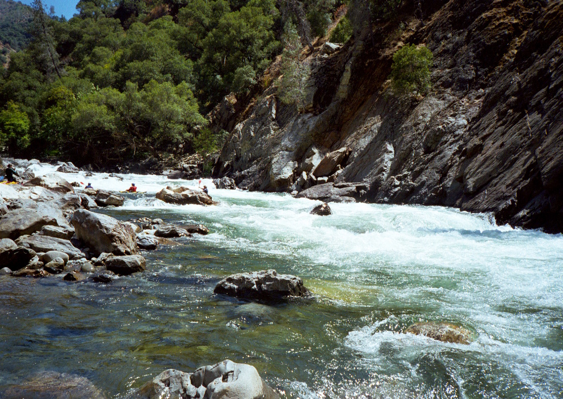
- 9.5
- Gray's Grindstone, class IV, scout center (top only)
This fine rapid is about one kilometer long, perhaps longer if
you count the class II rapid that follows a short break after a
typical Tuolumne rock-cluster-at-the-bottom. The first sequence
contains a series of holes and/or rocks, and should be scouted
if you are not familiar with the rapid, so as to avoid a long swim.
After the first sequence comes a long (but fortunately not very steep)
rock garden with many possible routes. This leads to a rock cluster,
best navigated with a left-to-right angle.
- During high water of 1998, the first death on this stretch of the
Tuolumne occurred when a commercial guide drowned after his oar raft
flipped in the first sequence of Gray's Grindstone. Another rafter,
Michael Wallace Eckert, drowned there in 2005.
-
- 10.5?
- Surf City, class III+, big waves and lots of fun.
- 11
- Thread the Needle, class IV or II+
A huge fractured boulder blocks the center of the river, offering
bold boaters a chance to thread the needle. You can also choose
the much easier Chicken Shot on far left.
-
- 11.4
- Driftwood, two excellent camps on the left bank with sandy beaches
and afternoon shade from old oak trees. Just below is a class III
rapid that is very bony on low-water Wednesdays (go left then right).
- 11.9?
- Steamboat, class IV-
A long boulder bar rapid leads into a big hole that often flips rafts
at high water. Usually sneakable on the left side.
- 12.2
- Mine shafts on both banks. Trail out of the canyon on the left.
A rusty old steam engine litters the right bank.
- 12.6
- Cabin, class IV, scout left
Big Humbug Creek enters on the left, probably causing this rapid.
The river drops over a boulder bar and curves left around big boulders
and over some big drops. For best results, ferry left after the
boulder bar and stay mostly left. Large rafts will get stuck on
low-water Wednesdays, but kayaks should have no problem.
-
- 12.8
- Big Creek enters on the left, creating a large but unshaded
campsite. Indian mortar holes nearby, and waterfalls upstream.
For heavily loaded rafts, this is a good choice of campsite for
Saturday night: you can run the first section of Hell's Kitchen
with water, tie up your boats, then run the remaining river at
low flows with no hang-ups.
- 12.9
- Hell's Kitchen, class IV, perhaps scout left
This starts with class III drops over a shallow boulder bar,
then turns into a slalom among huge rocks. The 2nd or 3rd slalom
often causes wraps, especially for paddle boats, because a tricky
underwater rock necessitates a precise maneuver. Make sure the
rapid is clear before entering.
-
- 14.4
- Mohican mine, an abandoned quartz mine and rusty old stamp mill
on the left. A trail (4WD in some years) leads up to Groveland on
the left bank. A defunct suspension bridge hanging down into the
river was pasted to the banks during the flood of 1997.
- 15.1
- North Fork Tuolumne enters on the right. Many good campsites
are nearby, some usually reserved for commercial outfitters.
Downstream on the right, fine campsites continue, all sunny and hot
in the afternoon. The 1 mile upstream hike to a waterfalls is
highly recommended if you have time.
-
- 15.8
- High water mark of New Don Pedro reservoir.
- 16.5
- Turnback Creek enters on the right.
- 16.8?
- Matterhorn, class III sequence
When the reservoir is low, you find several significant rapids
in a row. Between the first and second is a rock in the river
that looks like a miniature Matterhorn.
- 17.6
- Pinball, class III to IV
Uncovers when Don Pedro reservoir is < 770' above sea level.
Because this is under the reservoir most of the time, it gets
mighty silted up, so when it first uncovers, it is only class III.
But after several drought years, the river washes away the silt
and it gradually returns to its former class IV+ state (originally
considered harder than anything but Clavey). In the 7 year drought
of the early 1980s, it briefly reached class IV.
- 18
- Wards Ferry bridge, take out by climbing the right bank.
- 21?
- An easier take-out is at Moccasin Marina, 2 hours by motorboat pull
from Wards Ferry bridge. Contact Dave Friedman at 209-962-4965.
He works Don Pedro reservoir from the end of May through August.
Dave can pull up to 8 rafts simultaneously. His fee is $200
for 4 rafts (minimum) and $50 for each additional raft.
Dave can also help you move vehicles.
Shuttle Directions
To reach Casa Loma Store (usually closed),
drive east from Oakdale on highway 108/120.
Just before highway 108 starts climbing steeply,
turn right where highway 120 splits off.
Wind along New Don Pedro reservoir, then climb the steep hill to Groveland
(near the bottom of the hill past Moccasin,
a right turn onto Old Priest Grade makes a good uphill shortcut.)
Once past Groveland, continue east another 7.5 miles,
and turn left onto Ferretti Road, marked with a glow-in-the-dark green sign.
The parking area for Casa Loma Store is an immediate left turn.
There are some flat spots for sleeping along Ferretti Road,
and two USFS campsites at the bottom of Lumsden Road.
If you must reach take-out from Groveland,
drive west just past the outskirts of town and turn right
onto Deer Flat road, a shortcut.
After more than a mile, turn right onto Wards Ferry Road and continue north.
Past the final settlements,
Wards Ferry Road becomes one lane as it winds steeply downhill.
Parking at the bridge is limited,
and vandalism at night has been reported.
To reach put-in from Casa Loma Store,
continue north on Ferretti Road for almost a mile,
then turn right across a cattle grate (near power lines) onto Lumsden Road.
The put-in is about five miles down this bumpy one-lane dirt road.
If you opt to have all your vehicles shuttled,
you can avoid the steep uphill drive to Groveland
by exiting towards Sonora.
Continue north and uphill on Wards Ferry road about 2 miles.
Just over the crest of a hill at a left curve,
bear sharply left onto Algerine-Wards Ferry road
(Wards Ferry road continues uphill to the right).
After about 4 miles, turn left onto Algerine road,
which leads into historic downtown Jamestown,
with several excellent restaurants.
To find nearby food and lodging, type Groveland into the box and click Search.
|
|
Creeks Navigation
Home
Recommended Runs
Map of Rivers
Alphabetic Index
Alphabetic Table
Text Search
Sponsored Links
|