| |
| Stretch: |
at or above Outlet Creek confluence to near Dos Rios |
| Difficulty: |
Class III, harder at high flows |
| Distance: |
6 miles, more optional, can be run twice in a day |
| Flows: |
rafts 500 - 20000 cfs, kayaks 300 - 20000
|
| Gauge: |
see below for how to estimate flow
(FSW -
DOS / 2) |
| Gradient: |
20 fpm average, but seems steeper |
| Put-in: |
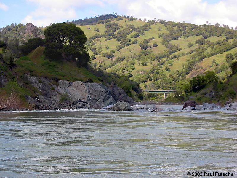
Highway 162 bridge over the Eel, 8.5 miles from 101, 975' |
| Take-out: |
Highway 162 milepost 14.5 just above Middle Fork, 850' |
| Shuttle: |
6 miles (15 minutes) one-way |
| Maps: |
AAA Sonoma and Mendocino,
Topo
|
| Season: |
winter and spring, from recent rain |
| Agency: |
BLM, private |
| Notes: |
© 2003 Paul Futscher |
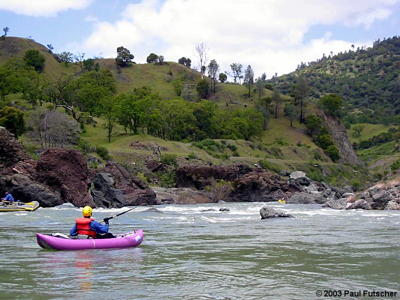
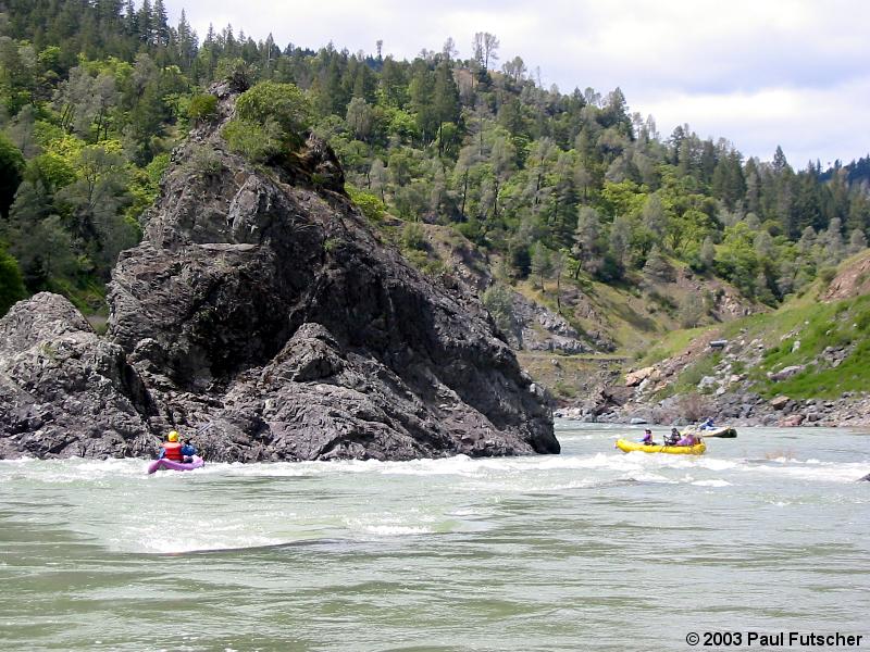
This is one of the best Class III runs on the Eel river, but it does
not see much use, except from locals, due to unpredictability of flow.
During winter the Eel at the confluence of Outlet Creek can be flowing
one day at 300 cfs and the next day after 2 inches of rain be flowing
at 20000 cfs, and then four days later back down to 1000 cfs,
and finally a week after that 300 cfs again. At a few thousand CFS
this run takes around 2 hours of float time and the shuttle takes
about half an hour round trip. At high flows the float time can be
reduced to little over an hour.
Those looking for a mini-Grand Canyon type experience can come out and
play on this stretch when the river is flowing at 12000 cfs and up,
usually within 12 hours of a good rain. Rafts and IKs do fine at these
flows, as there is usually plenty of recovery time, while hardshells
get worked pretty hard by hydraulics. Please scout the last rapid.
Some boaters put in on Outlet Creek to extend this run, but when the
Eel below Outlet Creek is at moderate levels, Outlet Creek is bony,
and when Outlet Creek has plenty of water, the Eel is big. There is
a possible put-in on 3 or 4 miles upstream on Outlet Creek, where a
railroad bridge crosses a brushy section before the final minigorge.
Nearby Runs
The Eel is also runnable upstream of Outlet Creek. The stretch from
Cape Horn dam (Van Arsdale reservoir) to the confluence of Tomki Creek
is seldom boated, and not recommended due to brush.
The stretch from Tomki Creek to Hearst is almost always combined with
Tomki Creek for a super-short vehicle shuttle.
The 17.3 mile stretch from Hearst to Outlet Creek starts out class II.
At mile 1.8 appears a class III rapid caused by a large outcropping of
dark rock, where a huge prow rock entirely blocks your view, causing
most boaters to scout on the right. Below there, scenic class II rapids
continue, with wilderness camping opportunities. At about the halfway
point scenery worsens, as do the increasingly class I rapids.
A great class III run on the main Eel from Dos Rios to Alderpoint
or Fort Seward is described here.
A class II then IV run (with long portage) on the Middle Fork Eel
is described here.
Estimating Flow
If the North Coast has not seen significant rain in the last 48 hours,
then the flow can be estimated by subtracting the Middle Fork Eel flow
from the main Eel flow at Fort Seward, and dividing by two.
If the ground is saturated (the normal condition in winter and spring)
and there has been significant rain in the last 24 hours, then the flow
can be estimated as a range by how much rainfall has occurred.
- 0.5" of rain produces 2500 - 5000 cfs
- 1.0" of rain produces 5000 - 10000 cfs
- 2.0" of rain produces 10000 - 20000 cfs
Note: 1-2 inches of rain is typical of North Coast storms.
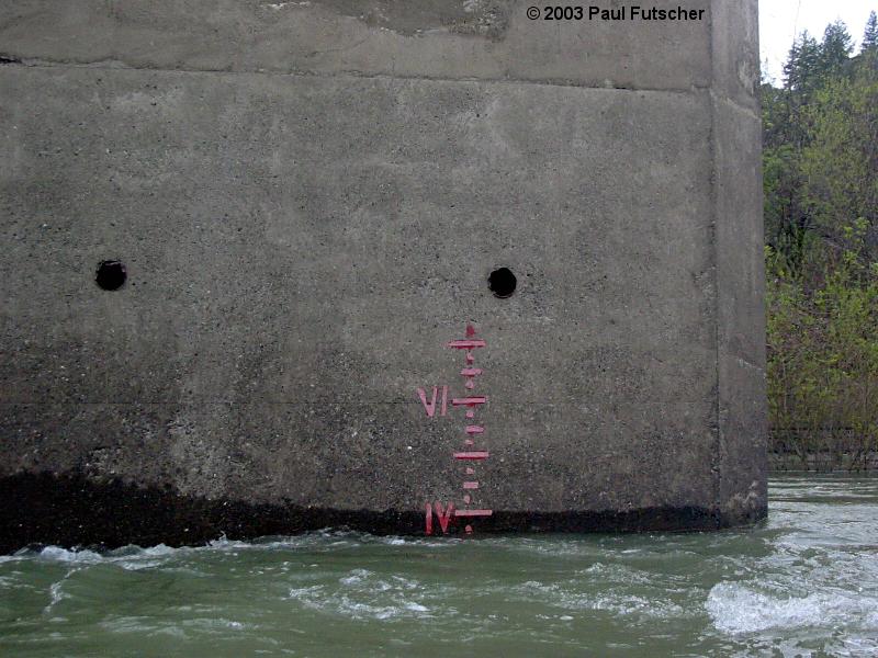
The Gauge
There is a water level gauge at the put-in bridge (mile marker 8.5).
Look on the second bridge pillar. The markings are in feet (roman numerals)
with ½ foot lines and ¼ foot dots.
| O | ~ 8' |
Drain hole in bridge means about 12000 cfs: huge hydraulics. |
| VI | 6.0' |
Hydraulics very significant: kayaks are worked, rafts will flip. |
| V | 5.0' |
Big water, hydraulics are now starting to bite. |
| IV | 4.0' |
Big waves, paddle to punch, like 2000 cfs in the South Fork American gorge. |
| III | 3.0' |
Intermediate kayak, easy raft, like 1200 cfs in the South Fork American gorge. |
| -- | 2.5' |
Just Class III- rapids. |
| II | 2.0' |
No significant flow. |
Mile by Mile
[ Thanks to Paul Futscher for this entire writeup. ]
- mile 0
- Put-in under the bridge on river right at the confluence of the
Eel River and Outlet Creek. A trail leads from the road down to
a small beach. Gauge is painted on second bridge pillar.
-
- 1.2
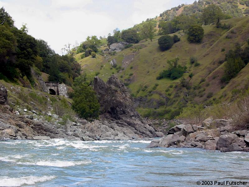
- Tunnel 1.
A railroad tunnel appears above the river on the left side.
The river narrows and makes a slow turn to the right with
a right curling wave-train on it. A boulder appears near
the bottom of the rapid in the center of the channel. The
run is to the right of the boulder except at higher flows.
At higher flows (4000 cfs and up), run down the middle until
you lose your nerve. At 12000-20000 cfs huge standing waves
grace the channel though no holes develop, just breaking waves.
There is a recovery pool at the bottom of the rapid.
- 1.4
- Tunnel 2.
There is a pool after Tunnel 1 that continues until you see
the horn rock on river right, which signals this rapid.
Just below the horn is a nasty half-submerged rock lurking
just to the right of center, and at the bottom of the rapid
a large hole forms on the left. The run starts enough
left-of-center to avoid the rock at the top, and pulls hard
towards center to avoid the hole at the bottom on the left.
-
- 2.0
- As the river makes a turn to the left, a large riffle forms,
which at certain flows hides a surprisingly large hole.
- 2.5
- No Name.
The river turns to the left as it drops between large
boulders and ends with most of the flow hitting a massive
split boulder. This rapid is clearly visible from the road
and can be identified by the massive boulder that is split
in four or more pieces. The run starts from the far left
and aims for the massive split boulder by missing large
holes on the right (upper hole) and left (lower hole). After
clearing the left hole, pull hard to the left around the
massive split boulder.
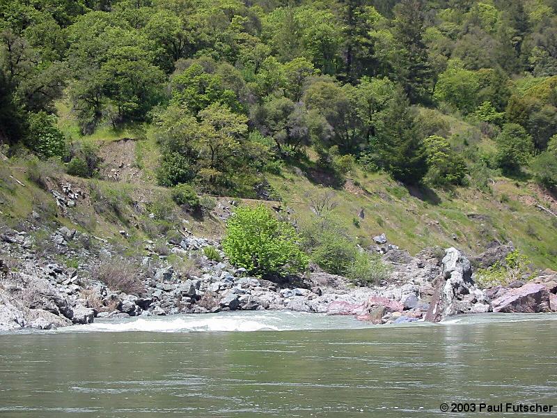
- 2.7
- Rock Garden.
This rapid starts with a small pour-over and then the river
makes a gentle turn to the right through a rock garden,
which ends in a large swirling eddy and pool.
-
- 3.1
- Boundary Creek, a nice lunch spot.
Recommended walk up the creek to a nice pool.
- 3.6
- Rapid 12.47.
Named after highway marker. The river is split in two by
a small island and boulder. Can be run starting from either
side. Watch for lurking pour-overs and hidden rocks. Near
the end of the rapid the river is forced between two rock
walls where some nice standing waves form.
- 3.8
- 12.47 Beach, good river access though the actual parking is
shortly upstream at mile marker 12.30(?).
- 4.2
- Pinnacle Rock, AKA House Rock.
Run to the right of Pinnacle Rock, which is just left of center.
If the right side of Pinnacle Rock looks too bony then the
left side can be run, though there is not much of a rapid there.
-
- 5.2
- The Wall.
The river makes a quick left turn through a boulder field
and ends along a large cement retaining wall, which protects
the railway. This rapid is fairly technical with numerous
rocks and holes to be avoided. At low water (around 1000 cfs)
the path is tight for rafts. At higher flows (4000 cfs) the
holes get big. At 10000 cfs the paths open up.
- 5.5
- Unnamed.
The river swings to left through a number of boulders and
standing waves, ending in a large hole or, at low flows, a rock.
Break the eddy line on the bottom right to avoid the hole.
-
- 5.9
- Last Rapid, scout left, right at high flows
A boulder field with a small slot on the far river left.
This is the only rapid that should be scouted, as it is a
little dangerous if approached blind. Run the extreme left
under 3000 cfs, as six feet from the left bank there is a
powerful hole that can flip rafts. At higher flows a right
side run opens up and the left side flows into a tree below
the drop which must be avoided. At very high flows (15000 cfs)
the center can be run. This rapid can be seen from the take-out.
- 6.0
- The take-out is on river right at the beach just below Last Rapid,
about half a mile upstream of the Dos Rios Bridge.
To reach put-in, drive north from Willits or south from
Leggett. After the road finishes its descent to Outlet Creek, turn
east on highway 162 towards Covelo. After 8.5 miles, cross the Eel
river bridge and park.
To reach take-out from there, continue
north on highway 162. If you cross the Middle Fork of the Eel, you have
gone too far. About half a mile before the Middle Fork bridge, there is
a small parking area and an old gated road leading down to a beach.
|
|
Creeks Navigation
Home
Recommended Runs
Map of Rivers
Alphabetic Index
Alphabetic Table
Text Search
Sponsored Links
|